September, 1983

Sunday |
Monday |
Tuesday |
Wednesday |
Thursday |
Friday |
Saturday |
28 |
29 |
30 |
31 |
1 |
2 |
3 September
|
4St.
Louis
|
5Mammoth
|
6
|
7Bluefield
|
8Monticello
|
9Gettysburg
|
10
|
11Ticonderoga
|
12
|
13
|
14Detroit
|
15Wright-Patt
|
16
|
17 |
18 |
19 |
20 |
21 |
22 |
23 |
24 |
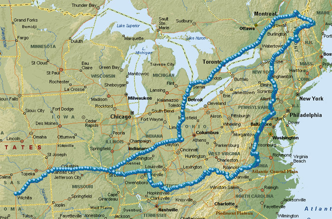
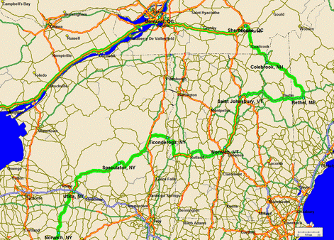
This was a full two-week trip down and across to Kentucky and then following the Appalachian and Adirondack mountains to Maine, into Canada, and then back across the top of the lakes, through Detroit, and then back to Wichita. Except for nights in Port Huron, Dayton and Saint Louis (on the way back) every night was spent outdoors.
Please note that this account is being written in 2004--some 21 years after the fact. So, I should be excused for not remembering all the unnecessary details that I usually include in these things (not to worry, I've still included plenty of other unnecessary details).
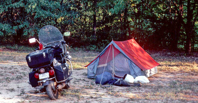
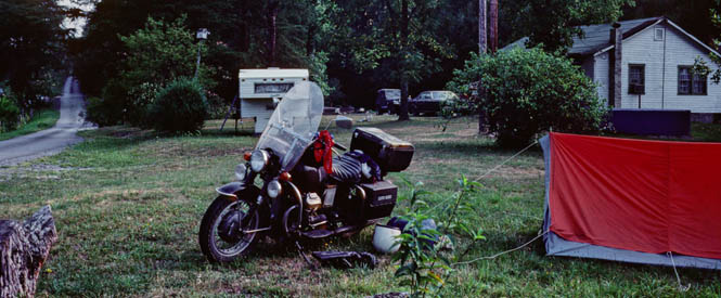
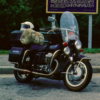
I packed motorcycle (Moto Guzzi Eldorado Police) to the rim for this trip. The saddlebags were devoted to clothing, while the rear trunk was used for food, tools, and equipment. The tent and sleeping bag were tied just behind the seat (between me and the rear trunk). This motorcycle had a solo seat, which made this sort of arrangement work quite well--the sleeping bag serving as a good back rest. I strapped a tank bag to the gas tank, and this is where I kept the maps, tour books, and extra pairs of gloves. I carried most of the food that I ate along the trip (not the whole two week supply, of course) so I had a small cook stove along as well. Thinking back, I have rarely been on longer trips where I was more self-sufficient than this one. Generally I wore a highway patrol style leather jacket along with California CHP boots. When the temperature got too hot (as happened), I strapped the jacket behind me.
 Kansas
I started out late Saturday morning. It had been raining all morning, but there seemed no point in waiting any longer. The rain lasted to just about the Missouri state line (Kansas City), by which time the clouds broke up and the sun came out.
 Missouri
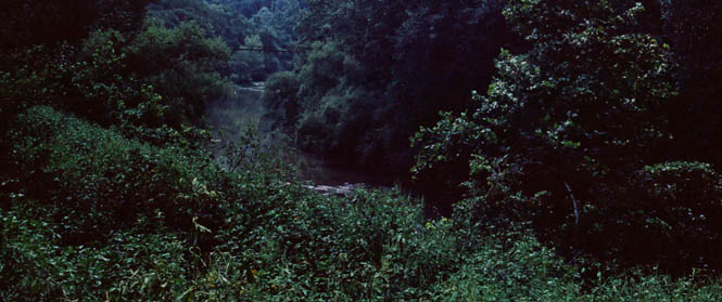
The first stop of any length was at Boonville, Missouri (at the old bridge that crosses the Missouri River), for a rest break. By now, it was quite hot--about 105. A little rain, now that it had stopped, would have been more than welcome.
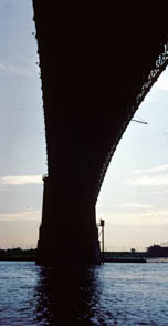
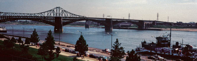
I spent the night at a campground in central Missouri--just north of the Interstate--and then hit Saint Louis around noon the next day. I rode through a bit of downtown before parking the bike just under the Eads Bridge. I would stay in this area for a few hours.
That's one leg (the north one) of the Gateway Arch in the photograph. There's quite a large (and worthwhile) museum underneath, devoted to the entire westward movement. By the way, the copper-dome building in the background is the old courthouse.
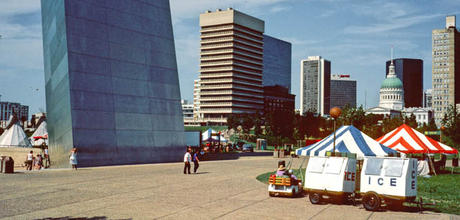
These next two photographs were taken from the top of the arch.
There's a segmented train/elevator conveyance (think of a
beaded necklace) that takes you to the top where there are several fairly small windows
on each side that give
a great view. Because of the triangular shape of the arch cross-section,
 the walls
slant outwards
from the floor, so you have to lean outward to press your nose against the
glass. This is a shot looking towards Illinois
the walls
slant outwards
from the floor, so you have to lean outward to press your nose against the
glass. This is a shot looking towards Illinois
 and the Mississippi river.
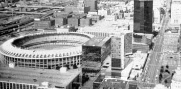
The photograph on the right is a particularly bad image of Busch Stadium and downtown St Louis (the 20 year old slide seems
to have been in the process of dissolving). Incidentally, I used a rather
low-cost Minolta 35mm camera, shooting slide film. Turned out to be
a poor camera for the job.
and the Mississippi river.
The photograph on the right is a particularly bad image of Busch Stadium and downtown St Louis (the 20 year old slide seems
to have been in the process of dissolving). Incidentally, I used a rather
low-cost Minolta 35mm camera, shooting slide film. Turned out to be
a poor camera for the job.
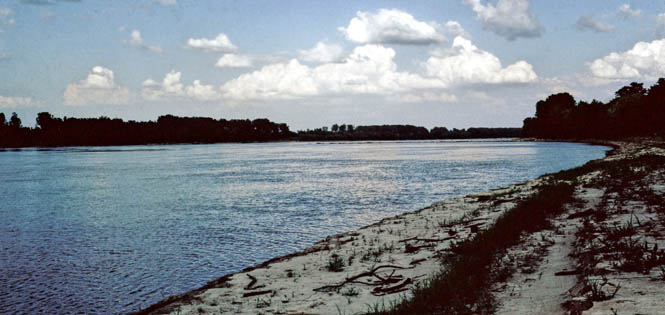
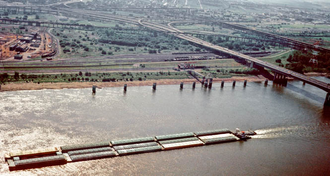
The Eads bridge was one of the first bridges ever built across the Mississippi River.
 Illinois
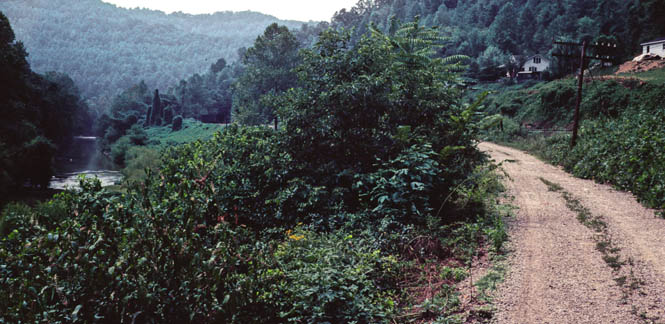
Once the river was crossed, I had my first real decision to make. I had intended, all along, for the trip to be a large loop around the great lakes (or at least a couple of them) and, then down the east coast (in some fashion) towards Virginia, before circling back to Wichita through Kentucky. But, although I just described the trip as being clockwise, I hadn't really decided even on that part. So, just outside St. Louis, I decided (at the last moment, while at the intersection) to take Interstate 64, which would commit me to making the trip a counterclockwise loop.
I had no desire to make this an Interstate ride, so soon enough, I was off I-64 and riding a number of secondary roads that parallel it to the north.
One of many back roads I took in Illinois.
A non-descript rest area in Illinois where I pulled off to take a nap and wait out the worst of the heat.
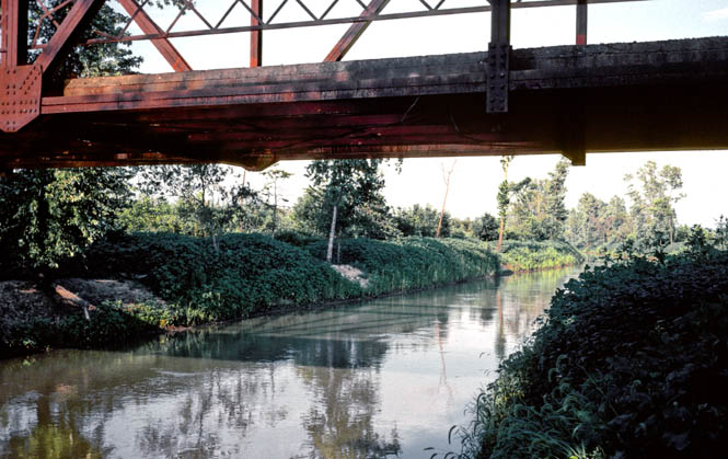
Along this particular back road I stopped at a creek (with an interesting iron bridge) in order to soak my red bandana--a system which worked pretty well against the heat. A leather jacket (with a conventional fold-down collar) exposes your neck to the sun, so some sort of neck protection is required (the Aerostich one-piece riding suit that I've worn for over 10 years, now, has a short, standup collar that protects the neck nicely.
 Indiana
At Mt. Vernon, I kept on state highway 15 to the east, and crossed over the Wabash River into Indiana near Mt. Carmel.
At Huntingburg, I turned south on 231 towards Kentucky. I spent the night at Lincoln State Park, which is adjacent to Lincoln Boyhood Home National memorial park. Lincoln, as we all know, was born in Kentucky, but he grew up in a number of places, and seemingly, they're all state parks, now.
The tent I used on this trip (and, many others before and since) was a rather cheap nylon pup tent that wasn't exactly waterproof. It had the advantage, though, of packing tightly, and being very quick to setup and take down.
 Kentucky
 I crossed the Ohio River into
Owensboro, and then made my way in a more-or-less southeast direction along
several smaller roads. At the Rough River Lake, I stopped at the heat of
the
day and stayed in the water for hours (it seemed). With the temperature near
hundred, and the humidity at the same point, it felt awfully, awfully good.
I crossed the Ohio River into
Owensboro, and then made my way in a more-or-less southeast direction along
several smaller roads. At the Rough River Lake, I stopped at the heat of
the
day and stayed in the water for hours (it seemed). With the temperature near
hundred, and the humidity at the same point, it felt awfully, awfully good.
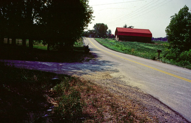
This is quite a hilly area. The roads have lots of turns to them, but never anything tight. It's generally a gentle up and down and left and right that is very pleasant.
This, however, was not a pleasant road. I had just crested the top of the hill and was heading down the grade, when I saw, well ahead, a highway service dump truck waiting on a side street (on the right-hand side) to turn onto the highway. There could be no doubt that the driver could see me, as the road was clear, and I could easily see the driver.
Just as I approached the waiting truck--but, still with plenty of time to react to anything he might do--the truck pulled out, turned right, and started to slowly accelerate. I was annoyed that he didn't wait for me to ride past before turning into my lane, but it wasn't that big a deal. At this point, there was no problem. He was moving very slowly, the road was clear ahead, so I moved into the other lane to pass around him.
Here's where it gets interesting. The driver, apparently just now seeing me in his mirror, decided to be "courteous" (I give him the benefit of the doubt) by steering left into the oncoming lane to allow me to pass him on the right.
But, what I saw was a heavy dump-truck moving to the left at the same time that I was moving to the left to pass him. So, now my lane was about to be blocked, but I didn't trust him not to move back to the right, and in any case, he was actually straddling the centerline (wide truck, narrow road), so I couldn't be sure just what he was up to.
So, I elected to go all the way to the left, and ended up on the left shoulder because the truck just kept on moving to the left leaving me no space at all.
Things happened pretty quickly, but I rode down into the drainage ditch on the side of the road, avoided the steel culvert, and then up the bank of a driveway (see picture), where I went airborne completely across the driveway, and landing on the other side. At that point I pulled in all the brakes and came to a skidding halt. Even though I bottomed out both the front and rear suspension on the (very hard) landing, nothing came loose, and nothing happened to the motorcycle (you can see it in the photograph, just beyond the driveway, at the side of the road).
The truck driver came to a stop, and the driver was all apologetic about the whole thing. He said that I looked like Evel Knievel as I jumped over the driveway. There wasn't much I could tell him. I stayed there at least half an hour waiting for the adrenaline to flush through my system.
I have thought often about this incident over the years and have wondered if I could have done anything differently. Can't think of anything, though. When a truck pulls right in front of you, and then closes off your escape route, you're just out of good options. What I should have done was to brake hard when the truck first pulled out in front of me--still, the lane was well clear for passing...
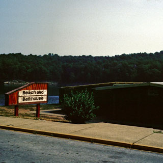
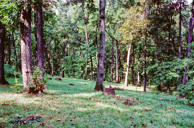
From highway 259, I picked up highway 70 and rode around the southern border of Mammoth Cave National Park before turning into the main entrance. As would be expected, there are quite a large number of tours available--from the "easy and crowded" to the "hard and dirty".
 I elected to take the "easy and crowded" tour. That's
the ranger preparing us for the tour of the caves in front of us. Those
people with light jackets are the smart ones. Those people without;
aren't. It was pretty nippy in there. Having been to both Mammoth
and Carlsbad, I conclude that they're both amazing; you really need to see both.
I elected to take the "easy and crowded" tour. That's
the ranger preparing us for the tour of the caves in front of us. Those
people with light jackets are the smart ones. Those people without;
aren't. It was pretty nippy in there. Having been to both Mammoth
and Carlsbad, I conclude that they're both amazing; you really need to see both.
I spent that night just southeast of the Park off in the woods from the road.
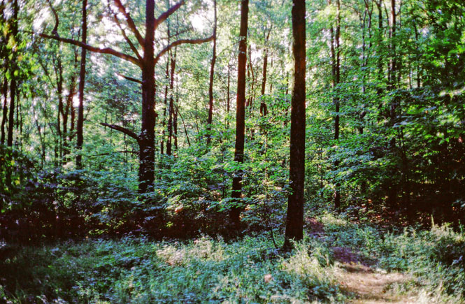
Next morning I picked up the Cumberland Parkway and the Daniel Boone Parkway through some gorgeous wooded hills. Usually I stayed on the Parkway, but not always.
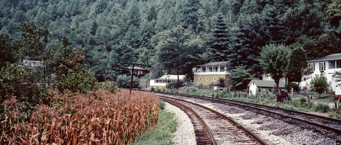
One time I found myself on a narrow (sort of) paved road that followed a river and railroad far into the hills.
Eventually, the pavement became more and more broken until it was more gravel than asphalt.
I have not a clue where this place is. I know I could never find it again. The town was clearly built on the railroad, as the main highway through town was little more than a two-track gravel road (that's it in the photograph, below).
Not wanting to find myself deep into some Kentucky Holler on a dirt road, I turned back--the only time I did so on this trip. I suspect that the road would follow the river to its source, and then end--probably in somebody's yard (and likely guarded by a big dog).
Coal trucks in Kentucky are above the law. The empty ones run around 85 mph, while the fully loaded ones run about 60 mph. I found it best to just get out of their way.
 West Virginia
After traveling till fairly late at night--these back roads in Kentucky are narrow and twisty and you don't get too far--I spent the night in the front yard of a West Virginia coal miner near the town of Welch.
He and his family lived on the top of the hill. It turns out that he had to have his water trucked in every few days. If he were to sink a well, the drill bit would end up hanging in open air. All of these hills are full of mines. I was intending to spend the night at the airport. I had seen the sign indicating an airport, so turned off onto the road and climbed up to the top of the mountain only to find that there was a locked chain-link fence around the airport. At that point, the owner of the house near the airport came out to find out what I was up to. He quickly agreed to letting me set up camp in his yard (but, I imagine that they all kept an eye on me through their window).
 Virginia
The next morning I rode down the
mountain to state highway 52 and then crossed into Virginia at Bluefield.
This photograph was taken at a highway rest stop in Virginia.
From Roanoke, Virginia I turned east on highway 460 through Lynchburg (where I inadvertently blew through--without slowing one bit--a red light at a terribly confusing intersection) and then to Appomattox Courthouse National Historic Park (where Lee surrendered, effectively ending the Civil War).
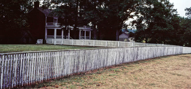
The town has been preserved to be as close to the way it was at the end of the war as possible. I arrived fairly late in the day, and had the whole place pretty much to myself. The house where Grant met Lee is still there (having been rebuilt after being dismantled, just after the war), and the interior was just as it was. I spent perhaps 2 hours walking through the town and the nearby site of the final battle. Perfect time to be there.
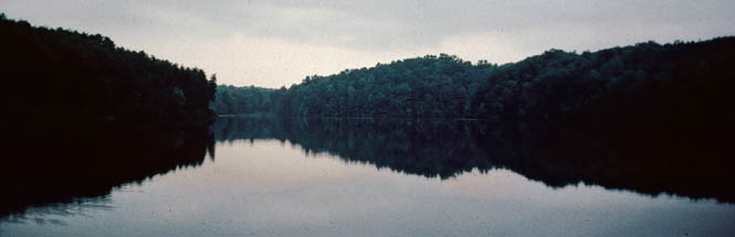
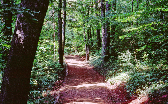
About 20 miles north of Appomattox Courthouse is Holiday Lake State Park (above), where I spent the night. This campground was similar to some of the campgrounds that I stayed at during the trip, in that it cost around $8.00 to enter, and was highly developed: showers, sometimes tennis courts, running hot and cold water, flush toilets, small restaurants. Certainly everything is paved. Quite different from what I was used to in my travels west. I wouldn't really call it a campground anymore; more of a resort. Anyway, it was a beautiful place, and I walked along a nice single-track trail partway around the lake before catching the park road and walking back to my camp spot.
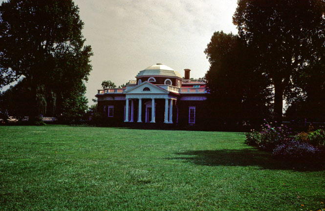
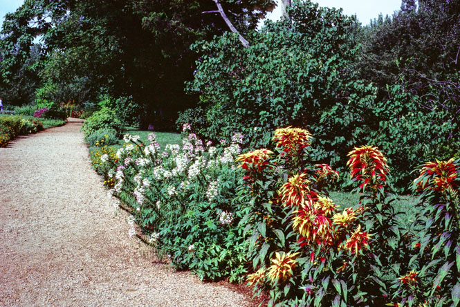
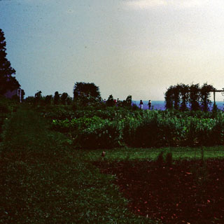
The next morning I picked up several smaller roads and made my way to Thomas Jefferson's Monticello, just east of Charlottesville. The house sits on top of a flattened mountain--something Jefferson had done as it was more pleasing.
I took a couple of tours here. One was of the house itself, and the other was of the gardens. All parking was well down the hill, away from the house. A nice touch, as the grounds are not then blemished by the view of a parking lot (and the sound of cars). The house is not part of the National Park service, so the tours were a bit more fawning towards Mr. Jefferson than you might otherwise expect. Quite a nice little house.
The photo was taken during the tour of the grounds and gardens. The woman holding the plant was our tour guide.
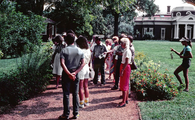
Most of the times she is simply a gardener, but because so many people had asked about the gardens, they had recently started offering on-purpose tours.
They are attempting to keep the grounds as close to what Jefferson had in mind as possible. This is an example. Jefferson was much taken by English forests and tried to repeat the look here by thinning selectively in order to produce an artificial meadow. He also imported the right sort of deer to produce the right look. Presumably "looking English" was the effect he was after.
 The view
east from Monticello and Jefferson's hanging gardens. He tried to grow
grapes here, and in fact, he tried to grow many different things. Some
were successful, and some were not. He was certainly not afraid to try
most anything, once.
The view
east from Monticello and Jefferson's hanging gardens. He tried to grow
grapes here, and in fact, he tried to grow many different things. Some
were successful, and some were not. He was certainly not afraid to try
most anything, once.
From Monticello, I took a quick swing west to Waynesboro. North is the Skyline Drive and Shenandoah National Park. South is the Blue Ridge Parkway, which extends all the way to the Great Smokey Mountains National Park in North Carolina. I turned north.
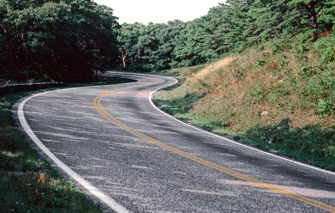
The parkway is a well-developed road, built particularly to be a scenic road meant for only gentle driving. At one time (before the 20s) the area of the Shenandoah mountains had been stripped almost entirely of trees for use by the railroads (wooden ties) and had become a desolate and pretty hopeless place. Then, in the 1930's the Roosevelt administration bought quite a bit of land and kicked all the (sometimes rather irate and unhappy) people out. Over time it has returned to what it used to be. Except for the 35 mph limit, it is a perfect road for a motorcycle. Even with that speed limit, it's a perfect road.
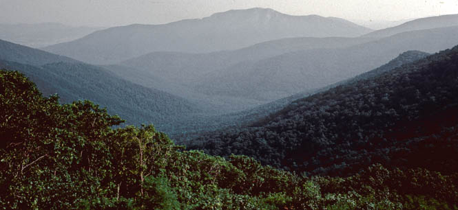
The Skyline Drive eventually ends at Front Royal. Some day I'd like to go back and run along the Shenandoah River (just to the west of the Drive), which has quit a bit of Civil War History associated with it.
West Virginia
Not wanting to pick up the Interstate, I stayed to the
east on 340 as it crossed into West Virginia.
I had some idea that I'd spend the night at Harper's Ferry National Historical Park (at the apex of West Virginia, Maryland, and Virginia. I was minding my own business sitting on the bike (looking through a AAA tour book) in the parking lot just outside the restored village of Harper's Ferry, when a sheriff's car pulled up to me and the sheriff started in on a hundred questions about who I was and what I was planning to do. I started to be concerned that he really wanted to haul me in for something (if he could only figure out what that something was), so I told him that I had no intention of staying there, and was only planning on moving on north. This sort of thing is really very unusual, but on the rare occasion I've some unexpectedly rude treatment by police officers. (note: I am convinced that this is attributable to the look of this particular motorcycle (police bike, all black with no trim)--I've had no problems of this sort with other bikes)
 Maryland
 This
is another case of being lost but, not really. I always knew where north
was and that was the general direction I was headed. So, what I happened to come
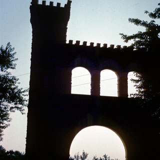
across was more by chance than design. Anyway, this is in at Gathland
State Park in Maryland. It's a battlefield site that might be more famous
were it not for the fact that Antietam is just up the road. The gothic
structure is a monument to war correspondents killed while reporting, and it
continues to record names up to the present time.
This
is another case of being lost but, not really. I always knew where north
was and that was the general direction I was headed. So, what I happened to come
across was more by chance than design. Anyway, this is in at Gathland
State Park in Maryland. It's a battlefield site that might be more famous
were it not for the fact that Antietam is just up the road. The gothic
structure is a monument to war correspondents killed while reporting, and it
continues to record names up to the present time.I arrived in time to be able to set up camp and still have plenty of daylight to walk the battlefield and to hike just a bit of the Appalachian Trail. As it happened, my camp site was just off the trail.
The next morning I had a really nice ride in the early coolness as the sun was coming up, riding through some very nice Maryland countryside. I'm not sure of all the roads I was on--most were not even numbered highways, but eventually, I crossed into Pennsylvania, and found myself on the road to Gettysburg. Without meaning to, I had been following the path of Lee's army.
 Pennsylvania
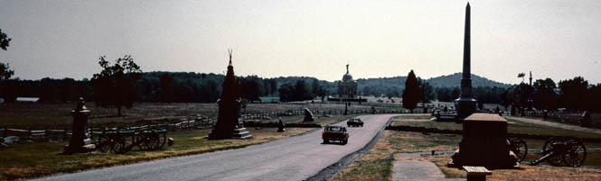
Gettysburg Pennsylvania. It
hadn't been on my list of things to see (even if I had kept such a list), but it was
the place that I remember most.I entered the park along the old Emmitsburg road, which put me between the Seminary Ridge and Cemetery Hill (Confederate and Union) and parked the bike at the Visitor's Center.
The first order of business was to walk across the street to a Burger King, which I am happy to hear, has been removed. On this same subject, I am happy to report that the horrible observation tower--which looked like some sort of a cross between a gigantic dandelion and the Eiffel Tower--has been demolished, too. I made a decided point to have nothing to do with the tower when I was there, so you will see no birds-eye photographs of the battle site.
The visitor's center had a particularly helpful large 3d relief map, that was lit with various colored lights--representing the troop locations as the three-day battle progressed. This presentation took about 30 minutes. The museum was quite worthwhile, too, although I could have done without the various "art works" made from bullets and cannon balls. Admittedly, these were made by locals soon after the battle, but in context, they're all in very poor taste.
I didn't think I had enough time to see everything, so after walking through the museum and visitor's center, I walked through the cemetery, and than along the path at the crest of cemetery hill. There are monuments everywhere. Ordinarily I might think that there are too many monuments, but in this case, perhaps not. Each one was erected by the state or town from where that particular company was from.
I believe the very large one off in
the distance was Pennsylvania. I stopped for some time at the point where
Pickets charge had just broken into the Union lines, and they had began to turn
the canons. In spite of all the monuments, and people, and roads, this
remains a very moving place. The whole charge is inconceivable when you
look out across the fields to the trees on the opposite side and realize that
soldiers had marched in the face of heavy fire, out in
 the open, to this very
point.
the open, to this very
point.
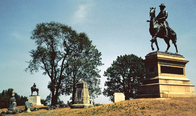
The horse with its right leg raised means something as opposed to the horse in the distance with all 4 legs on the pedestal, but I don't recall what. In any event, I do recall that not all the statues conformed to the 'rules'.
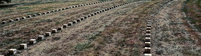
Those square, low, headstones (above) show the way the Gettysburg battlefield cemetery was originally planned after the battle. Simple, not flashy, monuments. In time nearly all of the southern solders were removed. Now, it's almost entirely Union. The cemetery in the background, with the conventional upright headstones, existed before the battle.
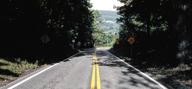
It was quite hot when I eventually mounted up and left Gettysburg. I didn't have any particular destination, and my lack of any progress showed that. I followed old highway 30 to Lancaster, before I became concerned that things were getting much too congested as I rode further east. And, at any rate, I was getting out of the Allegheny Mountains. So, at Lancaster, I turned north and eventually linked up with I-81. If I traveled only on back roads, I wasn't going to make enough progress to complete the trip in the two weeks that I had.
Before the sun set, I turned off the interstate to Lackawanna State park in northern Pennsylvania. This was another highly developed park which was really quite a nice resort.
 New York
Next
morning I continued
north. I believe this is Binghamton New York. I was stopped at a
drive-in when I took the photograph.
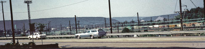
This was the first time I'd seen electric trains on a large scale. It's rather common in this area. A train that is not self sufficient, and depends on being plugged into an overhead wire somehow doesn't have the same romantic feel of a real train.
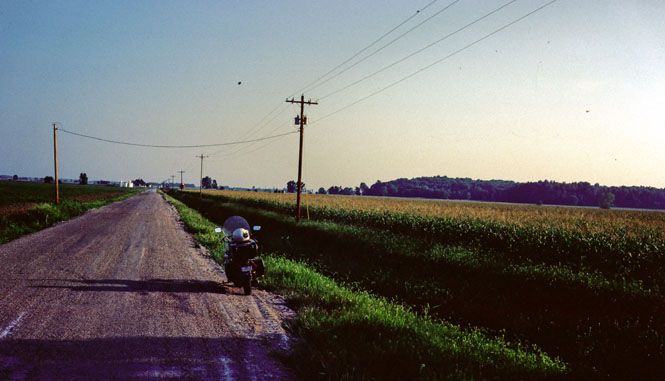
Unfortunately
this single photograph of the motorcycle is the only picture
 I took in the Adirondacks of New York. But, this
is an area worth repeating, some day. It's fairly devoid of all towns except for a few
small ones. Quite a few creeks and rivers, lots of trees. Hardly any
traffic. Swoopy roads, a beautiful area, and a wonderful place for a
motorcycle.
I took in the Adirondacks of New York. But, this
is an area worth repeating, some day. It's fairly devoid of all towns except for a few
small ones. Quite a few creeks and rivers, lots of trees. Hardly any
traffic. Swoopy roads, a beautiful area, and a wonderful place for a
motorcycle.
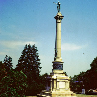
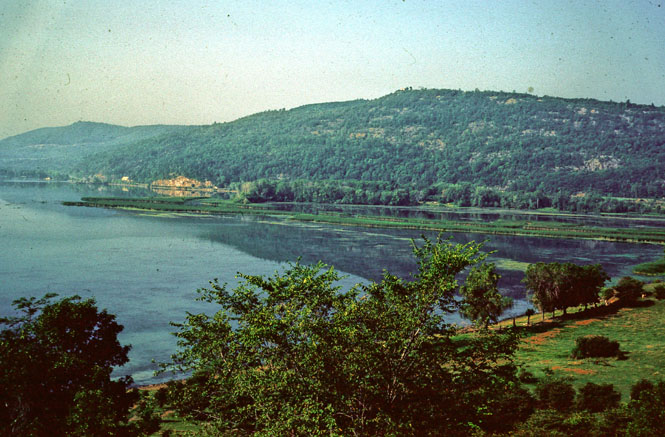
I spent that night at a campground about 10 miles south of Ticonderoga. In fact, I arrived at night, which is something that I tried always to avoid. Makes it tough to find a camping place and to erect the tent.
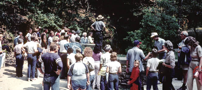
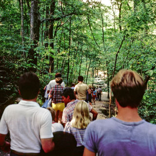
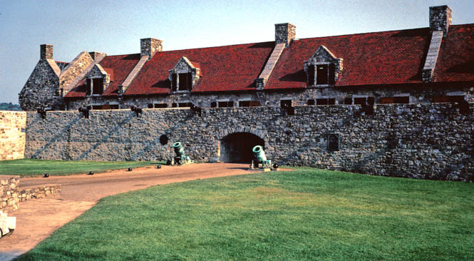
Fort Ticonderoga guards the entrance to Lake Champlain, and therefore controls the route to Canada from the Hudson (at least it did when all trade was by water). It has been extensively rebuilt from the time of Ethan Allan and his Green Mountain Boys. It's quite an interesting place, and made a good switch from after all the Civil War sites of the days before. Walking through a large Civil War battlefield leaves me feeling melancholy.
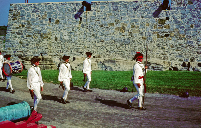
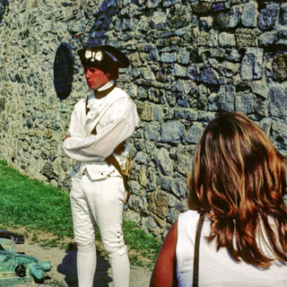 The
soldier dressed in white was the guide for the tour. Like all the guides
at the fort,
he was a college student from the area. In addition, he's also part of the marching
band, and is somewhere in the other photograph. I was told that
earlier in the summer the band was quite
large, but one by one they left for school (like a certain Haydn symphony where
the players leave one-by-one). This fort has the largest
cannon collection outside England. Certainly, collecting cannons is something that is
reserved only for very serious military collectors. I found it quite
interesting.
The
soldier dressed in white was the guide for the tour. Like all the guides
at the fort,
he was a college student from the area. In addition, he's also part of the marching
band, and is somewhere in the other photograph. I was told that
earlier in the summer the band was quite
large, but one by one they left for school (like a certain Haydn symphony where
the players leave one-by-one). This fort has the largest
cannon collection outside England. Certainly, collecting cannons is something that is
reserved only for very serious military collectors. I found it quite
interesting.
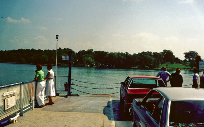
 Vermont
Just east of Ticonderoga is a
ferry that takes traffic from New York, across the lake, to Vermont. It
reminded me of the ferries of the Sacramento river delta many years
ago.
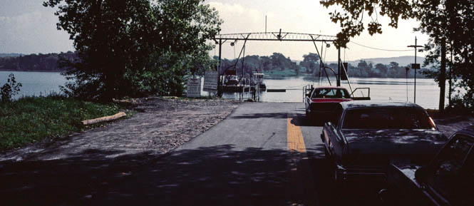
The crossing was leisurely, and a woman was selling apples and oranges out of a basket.
And, on through Vermont--which may have been the nicest state I visited. Heavily wooded hills, small clean towns, all with small white churches with tall steeples, narrow bridges across streams, nicely winding roads. Definitely worth going back for more.
 New Hampshire
I crossed into New Hampshire at Lancaster, and stayed on
highway 2 all the way across. These are small states, and it didn't take
long. Beautiful area.
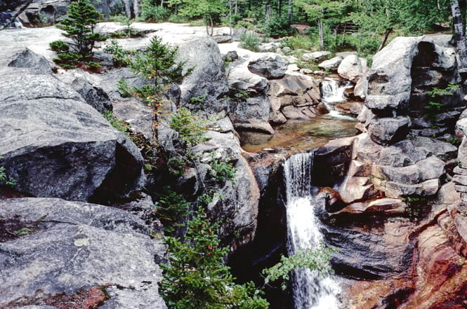
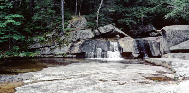
 Maine
Maine
And, then into Maine. The morning was quite chilly
with a heavy mist as I rode along the Androscoggin river towards Bethel. I
had been thinking that it would be nice to continue east, to at least see the
Atlantic ocean before turning back. But, by this time, I was already well
past the halfway mark (as measured by the calendar) and it was beginning to
look questionable if I'd be able to continue riding 'out' much longer. At
some point I really had to start the loop back to Wichita--at least if don't want to
have to do some long-range Interstate riding. I chose to make Bethel my
turning point, and headed north.The photograph is at Maine's Grafton Notch State Park (Screw Auger Falls).
Starting from about the time I crossed into Vermont, the bike started running awful, and it was getting worse as I rode through the morning mist in Maine.
New Hampshire
I finally limped into Colebrook, New Hampshire, determined to stay there until I figured out just what the problem was. Eventually I found that the points-plate in the distributor had come loose (one of the screws had backed out) which was causing the points to close up. It's always a very nice feeling to be able to solve an engine problem when the solution is so simple and you know the problem will not come back. Anyway, I set the points gap to the width of a credit card and buttoned everything back together.
 Québec
I crossed into Canada at Stanope without
any real destination. Basically, though, I wanted to ride down the north
side of the lake. At Sherbrooke, I took took highway 10 towards Montréal.
At this point, but especially as I neared Montréal, I was trying to sort out as
much French as I could. There was nothing bilingual about any of the road
signs. It didn't help a bit that I didn't know the names of any of the
smaller cities beyond Montréal, or that I was not even sure of the word for
"West" (occidental) or for "South" (sud).Somehow I got through Montréal by reading the French signs. I spent the night, just west of the city at an RV campground. I believe that I had the only tent there.
I really didn't have much choice of route but to stay on the freeway and continue along the north shore of Lake Ontario towards Toronto.
About halfway to Toronto, just as I had shifted into 5th gear, the clutch cable broke. Oh. On most motorcycles, shifting without the use of the clutch is pretty easy, and is done routinely (if ill-advisedly) by many people. Not so with a Guzzi transmission, where down shifting without a clutch is about like trying the trick in a pickup truck. Anyway, for now, I just kept on riding keeping a sharp eye out for a perfectly situated service station at on off ramp. Eventually, I found what I was looking for, and managed to ride the bike to the station and shut it down without looking too incompetent. As it happened, I was carrying a spare clutch cable with me, so changing it out was easy--well, it would have been easier if my spare cable had the right sized barrel fittings, but a bit of crude work with an even cruder file solved that problem.
 Michigan
Toronto is big. Really big. It seemed as if I spent hours just riding through that city.
It looked, on a map, as if the freeway I was riding eventually dumped into downtown Windsor, from where I'd be on surface streets in downtown Detroit. Something that didn't sound fun. Therefore, at London I turned west (occidental?) and rode towards Port Huron. This turned out to be a good choice. Port Huron is not a big place, and the crossing was easy. All the way from London it had been raining quite heavily, and since I don't like setting up a tent in the rain, I opted for a motel--the first one of the trip. Up to this point, I had spent eleven days out in the weather; the occasional museum or store being the only time I'd be out of the sun or rain or wind or whatever was happening. It had become such a normal thing, that even the heavy rain I'd been riding in wasn't of much concern. But, setting up camp in the pouring rain is to be avoided.
 Ohio
Ohio
Homeward stretch now. It was Wednesday, and I wanted to get back by Friday, so my days of winding on the back roads were over. South through Detroit, Toledo, into Ohio and Dayton.
I thought that I'd stop at the Wright-Patterson museum for a couple of hours, and then continue down I-70. I pulled into the museum parking lot around 4:00, and did a quick run-through of the museum before they closed at 5:00. This would not do. So, I rode across the street and checked into a motel. I spent the entire next day (from the time it opened until it closed at 5:00) at the museum and all the adjoining exhibits and buildings. I figured that I'd just have to ride a bit longer the next day. As it turned out, this was easy enough, anyway.
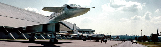
That's an XB70 Valkarie (below), which was mainly a research plane to investigate a lifting phenomena available at high mach cruise. The wing tips fold down at very high high speeds as the airplane rides on its own shock wave. As an airplane, it's spectacularly exotic looking, but as a bomber it really wouldn't have worked so well.
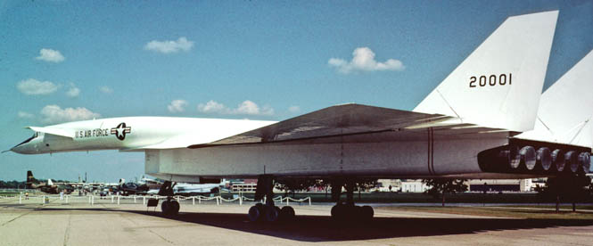
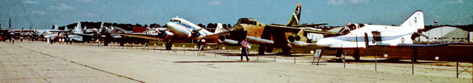
View of the flight line (above). The F4 (on the right) was the first fly-by-wire fighter.
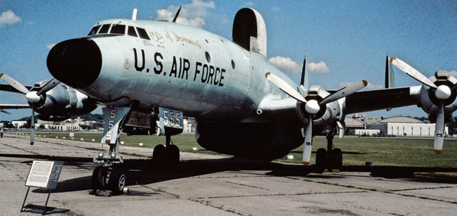
This plane (Lockheed EC-121D, Constellation) is noteworthy for being from Sacramento. It is in fairly ratty shape although they have hopes of moving all the outdoor planes indoors when they get money.
Indiana
Illinois
Missouri
I left the museum as they were closing the door, and got on the bike and
just figured to ride into the evening, and stay wherever I ended up. That
turned out to be St Louis.
Kansas
The next morning was a fairly ordinary ride from St. Louis to
Wichita.Good trip. About 4,200 miles.