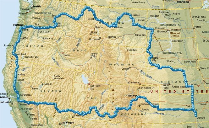
August, 1988

Sunday |
Monday |
Tuesday |
Wednesday |
Thursday |
Friday |
Saturday |
7 August |
8 |
9 |
10 |
11 |
12
|
13
|
14
|
15
|
16
|
17
|
18
|
19
|
20
|
21
|
22
|
23
|
24
|
25
|
26
|
27
|
28 |
29 |
30 |
31 |
1 September |
2 |
3 |
I had been talking with a friend at work about the fact that I had never been to North Dakota and that it wasn't likely that I would ever get to that state unless a concerted effort was made to ride up there. After all, North Dakota isn't on the way to much of anything. Shortly after this conversation another engineer, having heard us talking about it, dropped by to ask us if one of us was planning on going there. I replied that I might be going there on a motorcycle trip sometime in the future.
Well, it turned out that he had been born and reared in North Dakota and was more that willing to talk all about it. We all agreed that a special trip to North Dakota just to say you had been there was rather ridiculous, but, nevertheless, I was committed...
This would be "The Trip to North Dakota."
There really wasn't much for me to do to prepare for the trip. I've been on enough of these things to know pretty much what I need to take. My tank bag was still packed from the previous trips (first aid kit and the like) and most everything else was all together, ready to be tossed into the saddle bags. There was one problem, however: my tent poles were still in Ely, Nevada. I spent about three days in Ely last year for the most part waiting for a part to arrive (that's a whole other story). When I finally left that town I neglected to take my sleeping bag and tent out of the garage that I had been using before I locked it shut. The people that lived there were nice enough to send me the bag and the tent, but they apparently didn't see the tent poles. Anyway, I forgot all about it myself until I started getting ready for this trip.
I immediately ordered a replacement set of tent poles from Sears, but, since I didn't think that they would arrive in time (which they didn't) I went ahead and just bought a new tent as well. As it turned out, the new tent was made quite a bit better than my old one and, as such, took up much more room when packed. Therefore, I left the new tent behind and took only the new poles to use with my old tent (they were only slightly longer which wasn't a problem).
The two week period in August was chosen pretty much at random. However, it did help that Becky and my mother would be able to take a few days off during that time to drive to Walla Walla. The plan was for us to all arrive in Walla Walla at about the same time.
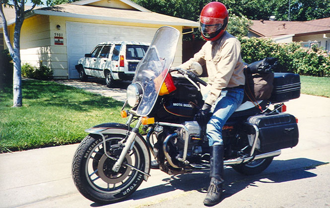
In the days before leaving I spent some time preparing the bike. There wasn't really all that much to do as it has been running quite well for some time. I did, though, replace both front and rear tires. This was my second new rear tire this year, alone. The night before leaving I replaced the high tension (spark plug) wires as well as the spark plugs. This was to cause me some trouble the next day.
 Kansas
I had intended to leave Wichita directly after work. But, as I hadn't quite packed all the clothes and completed all the little tasks that needed to be done, I didn't head out until around 6:45. When I started the bike up it was only running on one cylinder (of two). I foolishly hoped it would clear itself up and headed out, anyway. But, about two blocks away the engine wasn't getting any better so I brought it back. Sigh...
I very quickly established that I wasn't getting a spark on the left cylinder, but I couldn't for the life of me figure out why! I was just about to go through all the wiring, link, by link, looking for a loose connection when I remembered that I had installed new spark plug wires the night before. I had never heard of bad (new) spark plug wires before so I simply cut off the connectors at the coil side and attached new ones. It worked! I'm still not sure what was wrong with the old connectors, but Guzzis do have a deserved reputation for having a weak spark.
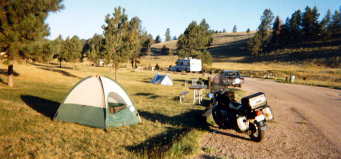
In any case, I finally rode off for good around 8:00 PM in the evening. I had intended to ride well into Nebraska this first evening, but my very late start meant that I could only make it as far as Salina, Kansas--not far, at all. I spent the night in a KOA campground ($11.50 !). This was to be the only night that I would be rained on. As luck would have it, this was also the only time I didn’t put my rain fly on the tent. Even so, the tent didn't leak beyond a slight spray of moisture when the drops hit the canvas.
 Nebraska
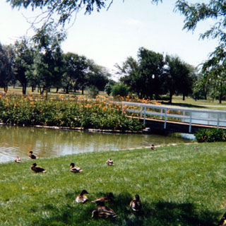
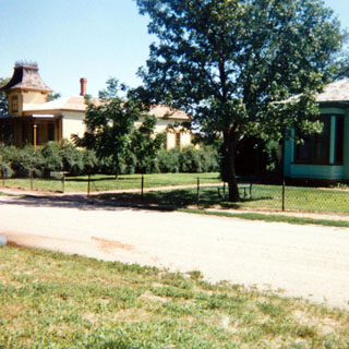
After sleeping about as well as I ever do the first night camping out, I packed up and returned to I-135 after back-tracking about a mile on a terrible washboard road that led from the KOA campground. Since I had such a long journey ahead of me, I had no intention of stopping too much this close to home. Still, it takes a couple of days before I'm able to ride extra long distances without any stops at all. So after reaching I-80 I turned west on the freeway until I came to the Grand Island exit and the Stuhr Museum.
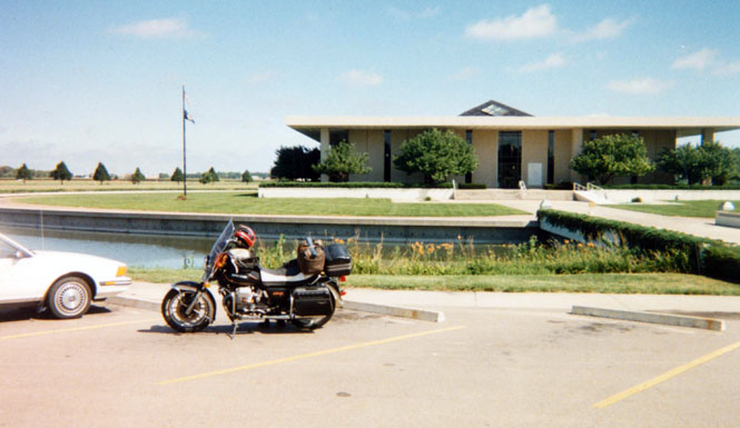
The museum seems to suffer from the same problem that many museums have. They undoubtedly received a great deal of money. However, I think that they spent far too much money on the grounds, buildings, and displays at the expense of any real content.
Perhaps I am too critical. The surroundings really were something! A prairie town had been rebuilt within walking distance of where I parked the bike. This town was intended to show what Grand Island looked like around 1870. Incidentally, the small green house is the house where Henry Fonda was born and reared.
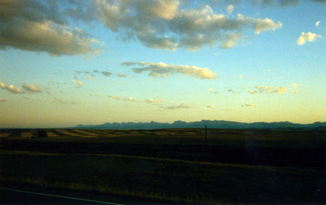
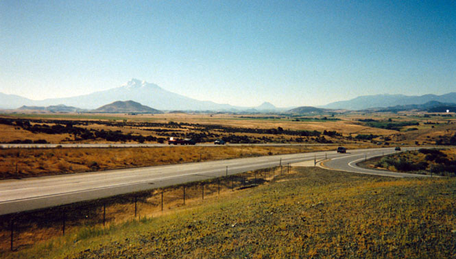
From Grand Island I headed north on highway 281. I stopped for gas at Greeley, the county seat of Greeley county. I suspect that the entire population of the county, such as it is, lives in this town. This is the only county seat I've been to without paved roads. The town looked as if it hadn't changed in 80 years. I continued on north to O'Neal where I stopped for lunch at a small cafe. I took a 30 minute nap on a hospital lawn under a nice shade tree. From O'Neal I turned West on highway 20 following the Elkhorn River.
While riding along this fairly desolate two-lane black-top I passed a large number of motorcycles heading the opposite directing. It wasn't until I stopped for gas and asked, that I found out that a major motorcycle rally was just finishing in the Black Hills town of Sturgis.
While stopped here I wrote a post card to Mom and Grandma. However I neglected to address the one to Sacramento. As it happened some quick thinking postal clerk (the advantage of a small town) must have noticed that the handwriting was the same on both cards and sent them both on to Walla Walla - perfect!
I stopped for a spell at the small town of Cody, Nebraska and drank four cans of soft drinks (not the recommended fluid). The day had turned into something of a scorcher and I was still wearing my leather jacket. At the (relatively) large town of Gordon I turned north on highway 27. I had intended to ride through Wounded Knee and then on to the South Dakota Bad lands where I expected to spend the night.
However, after reaching highway 18, and riding the few miles to the turn-off to Wounded Knee, I was disappointed to see that the road was not paved. I had no way of knowing how far that road was not paved, but, I could only assume that it would be that way clear to the town of Scenic on the other side of the Pine Indian Reservation. So I didn't go. The town of Pine Ridge is the center of government for the reservation and as is so often the case was a very depressing town.It's such a shock to see people living in such miserable third-world conditions.
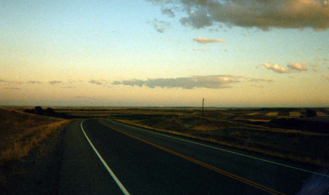
From Pine Ridge I continued on the really quite scenic road to Oelrichs on highway 385. By this time the sun had gone down and I would (once again) be looking for a camp site at night. I'd be putting in several long-mile days on this trip.
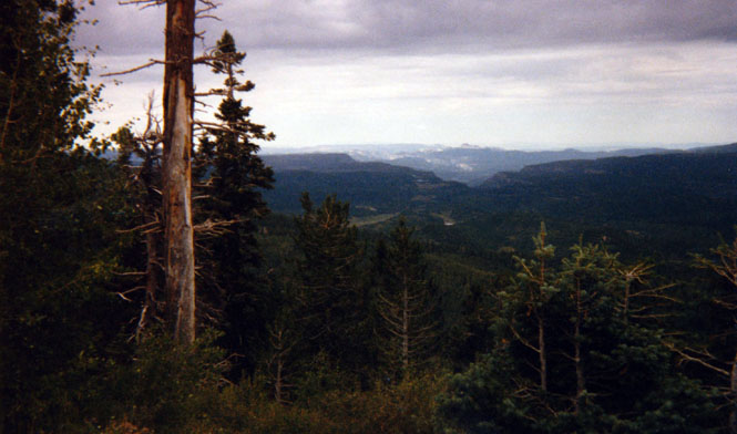
 South Dakota
I had seen a number of signs for KOAs in the Black Hills region, but after riding through Hot Springs I didn't see a one, so I just kept on riding. The roads through the Black Hills can be quite twisty, and combined with the darkness and the fact that I had been on the road all day, I gladly turned into the Wind Cave National Park Campground for the night. I carry a small flashlight with me so setting up the tent in the dark was no problem.
The next day I packed up as the sun rose above the nearby hills and studied my maps for a while to see just where it was that I was going.
While
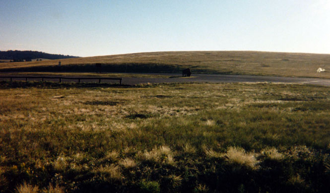
still in the park I stopped at a road-side rest area to photograph a Buffalo
that was parked there.
A sign said that the "Buffalo are dangerous" and to keep clear of them. So when
this particular animal started walking towards me I decided not to
stick around and rode on. From the Park I rode north to Custer (being careful to
avoid stopping for the Flint-Stones cartoon characters
 Bedrock City) and then
north to
the Crazy Horse Memorial.
Bedrock City) and then
north to
the Crazy Horse Memorial.
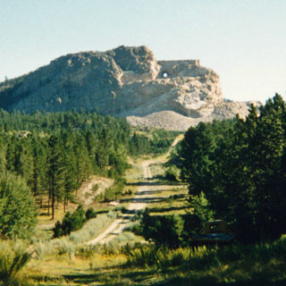
I had been vaguely aware for some time of the existence of some man trying to carve a gigantic statue of the Indian Crazy Horse. But, I never expected that anything would ever come of it nor that it would ever even come close to resembling anything like it was supposed to.
Well, I was wrong. I now believe that the statue will eventually be completed, if not by the sculptor's children then by his grandchildren. A really quite enormous amount of work has already been done in the past 30 years. I spent about an hour at the visitor center.
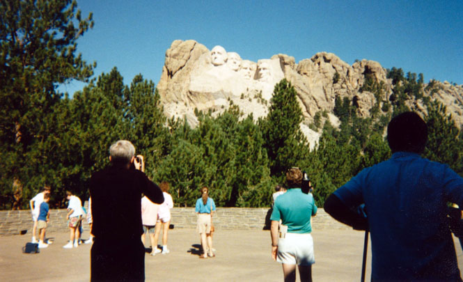
From the Crazy Horse Memorial it was only a short ride to Mount Rushmore. I had been here twice before, but being so close it seemed silly not to stop in for another look. I was getting quite used to the cool mountain air of the Black Hills so it came as a disappointment to have to ride down the long hill into Rapid City.
The Black Hills are really a fairly small area of mountains surrounded by prairie. The entire area was meant to be set aside for the Indians, but once gold was discovered that idea was quickly put aside. The existing Reservation is located on what appears to be very poor land.
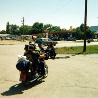 After fighting my way though the streets of (seemingly) enormous Rapid City
I traveled North on I-90 to Sturgis. By this time the rally
that had taken place
the last week was winding down. Even so, the roads were still thick with
motorcycles (mostly Harley Davidsons). At a service station I took a picture
of a couple that typify what was known years ago as the
"one-percenters". Actually
they're all pretty nice people, not withstanding their (quite conscious) projected
outlaw image (which in large part is entirely fictional).
After fighting my way though the streets of (seemingly) enormous Rapid City
I traveled North on I-90 to Sturgis. By this time the rally
that had taken place
the last week was winding down. Even so, the roads were still thick with
motorcycles (mostly Harley Davidsons). At a service station I took a picture
of a couple that typify what was known years ago as the
"one-percenters". Actually
they're all pretty nice people, not withstanding their (quite conscious) projected
outlaw image (which in large part is entirely fictional).
2004 note: The move towards Harley-Davidson as a fashion statement had not quite reached full bloom in 1988. Today, it'd be much harder to find a Harley rider who actually lived the lifestyle that they're dressed for.
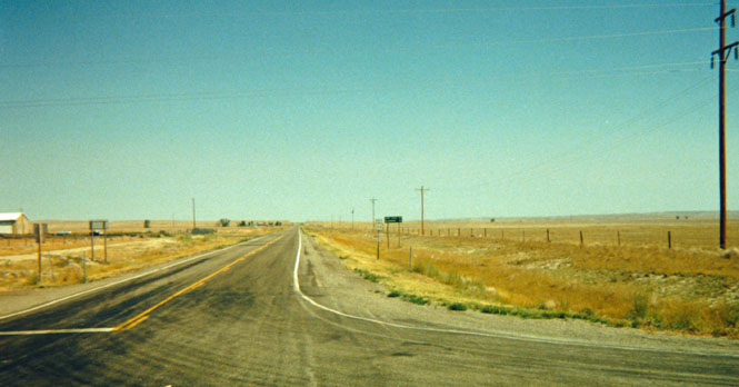
From Sturgis I rode on up the freeway to Spearfish where I stopped at a Dairy Queen to eat and (more importantly) to decide where to go next. Heading North on highway 85 I passed through some of the most desolate landscape I have ever seen (if you ignore the occasional missile silo).
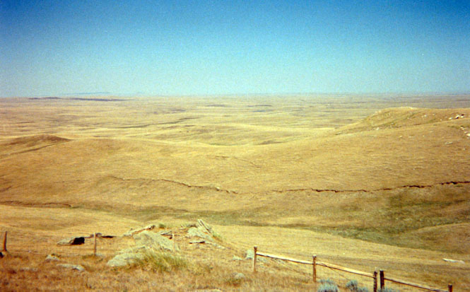
About 30 miles north I stopped at the geographical Center of the U.S. The Center of the "lower 48" is in Kansas. This is the center of all 50 states. Well, actually the real center is about 10 miles to the west. There may have been a dirt road leading to it, but I wasn't about to find out. The long view is looking to the South along the highway I just came on. Way off in the distance you can just make out the outline of the Black Hills.
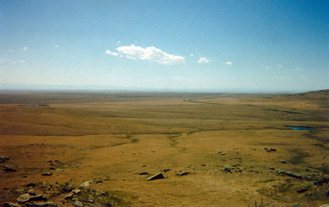
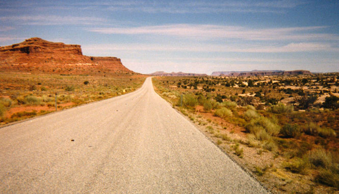
I had intended to continue north along highway 85 and then on up to Williston, North Dakota. However, I met a couple of motorcyclists at this stop who were from that area (and had just been down to the motorcycle rally in Strugis) and they told me that the road north of Belfield, North Dakota was almost entirely Chip Seal. Chip Seal is the process by which the highway crew pours hot tar on the road and then sprinkles gravel on top. I was to encounter quite a bit of this stuff throughout my trip, but there was no point in riding on it if I didn't have to. It's not fun stuff.
So, I decided to continue on to Belfield and Theodore Roosevelt National Park, but, to not continue any further in North Dakota. On my way up the road I stopped a couple of times in the small towns to drink some water. I haven't been able to figure out just why anyone lives in these small towns. Except for some sheep grazing and missiles there does not appear to be anything to support very many people. In fact, perhaps, that's why.
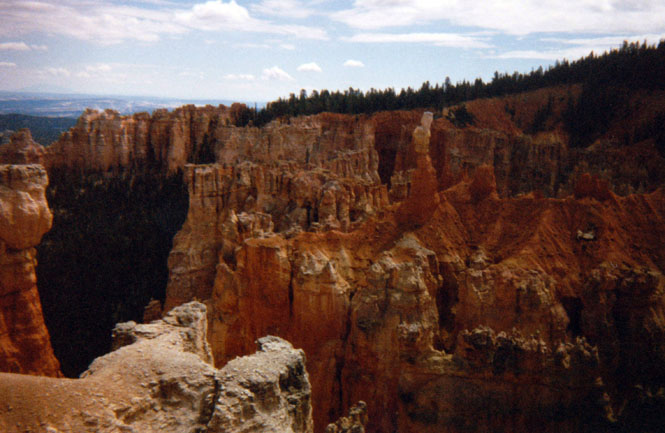
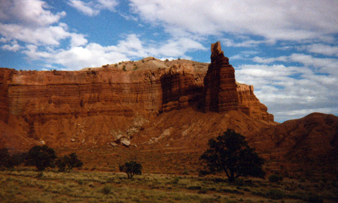
 North Dakota
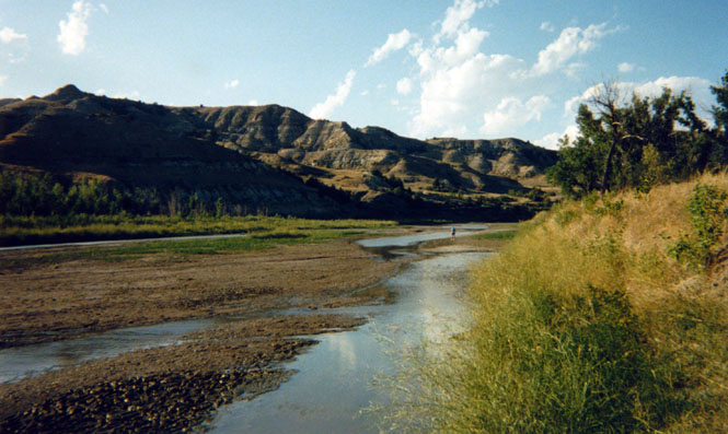
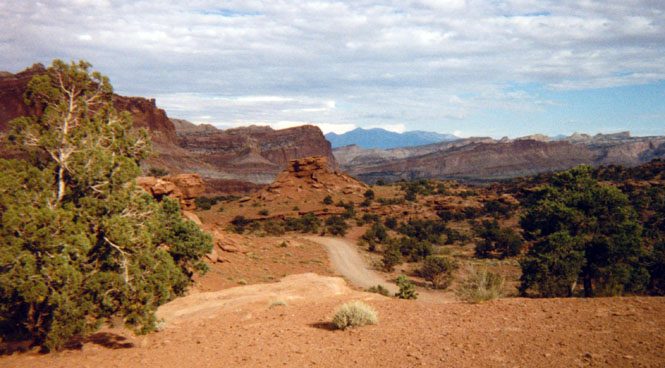
At Belfield, North Dakota I was once again on a freeway. I rode about 15 miles west before stopping a a rest area and overlook. This was my first look at the North Dakota Badlands.
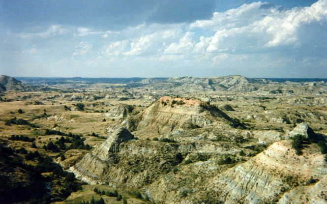
When the buffalo were nearly made extinct in the later part of the last century there remained only about 300 left, most of whom lived in this area. Most all the buffalo remaining in the rest of the country were placed there, but, only after all the native animals were all killed off In fact, it seems ironic, but the first buffalo now living in any of Kansas' three current herds were very likely originally from the New York Zoo, Since then, the animals have been moved from herd to herd in order to maintain a good breeding stock.
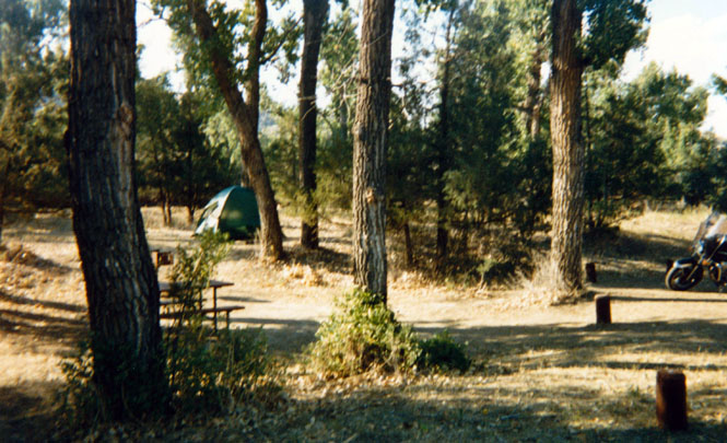
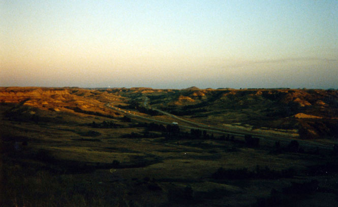
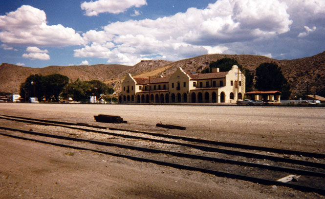
Entering T. R. National Park requires first driving through downtown Madora. The only point to this that I could tell was that the businesses of Madora had enough clout to force the Park Service to do it that way. I set up camp fairly early. I had reached my destination and saw no need to keep on riding. North Dakota was a done deal. I started to walk up the Little Missouri River to Medora, but then decided that it was just too far so I returned to my camp site and instead rode the bike there. On the way back from town I stopped at an overlook and took a photo of I-90 looking towards the Southeast.
There is a scenic drive around the park that I only traveled part way on. By the time the sun set there seemed no point in continuing. Back at the camp I attended an interesting campfire by one of the rangers who described the various large animals contained in the park.
 Montana
I continued on I-90, crossing into Montana to the city of Glendive where I turned West onto State Road 200S. This part of Montana is nearly devoid of trees, crops, or most anything else of note. I stopped at the town of Circle to get something more to drink and to re-supply my stock of juice that I carry with me.
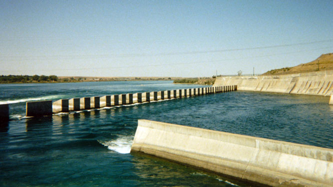
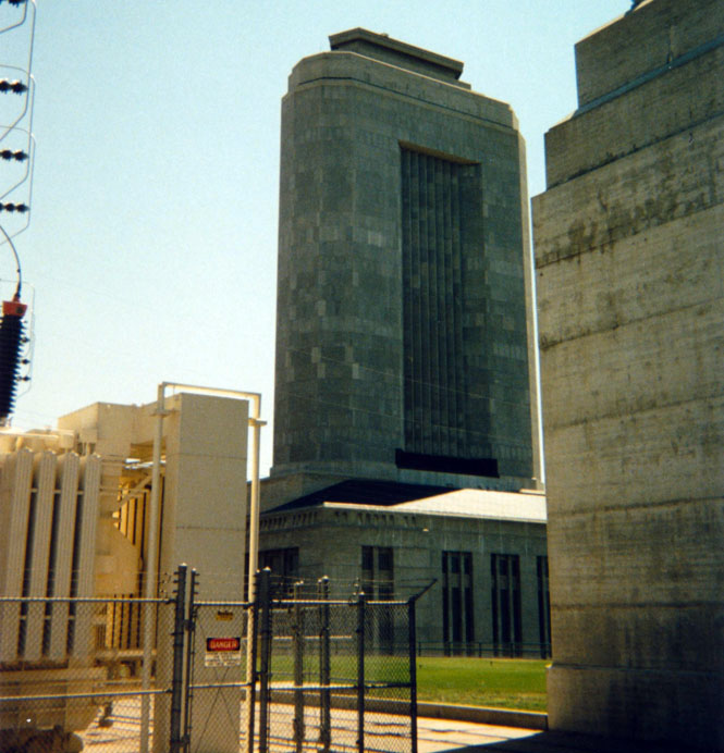
The Ft. Peck Dam is one of those huge civil engineering projects that were so popular during the depression. However, unlike Coulee, Hoover, and much of the rest, Ft. Peck Dam really had no reason to be built in the first place. The tour guide said it all when she said that the main reason for the Dam was simply to provide jobs. Even so, the Dam is very impressive. Crossing over the Dam I continued West on 2 through Glasgow (where I stopped at a Pizza Hut for lunch) and onto Malta.
I had every intention of staying on highway 2, all the way to Glacier National Park. But, being this close to a number of relatives I decided to turn South at Malta and take a look at Zortman.
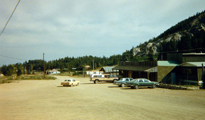
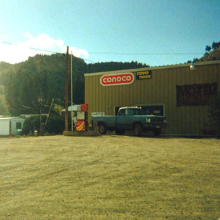
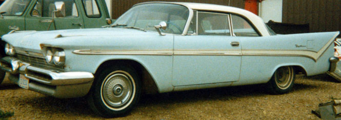
I took the gravel and dirt road to Zortman, not expecting the road to be quite as bad as it turned out to be. This was one of the worst roads I have ever been on. At Zortman I looked up John Kalal who is related to me as follows: His father is Dick Kalal. Dick's father is Edward Kalal. Edward is (was) the brother of Daniel S. Kalal my grandfather making John and me second cousins. The bar in photo was owned and operated for many years by Dick and his wife Lucy. John and his wife now run the Conoco service station and garage (and Hotel).
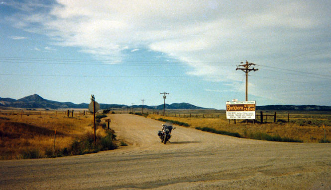
 I left Zortman by the southern route (also gravel) stopping at the end to
take a picture. Zortman is in the hills in the background of the
photograph. Turning to the north, I took a photo of highway 191, which
shows that no matter how heavy, or what color the line on the map is, the actual
road is little more than a country road with little or no striping (or traffic,
for that matter).
I left Zortman by the southern route (also gravel) stopping at the end to
take a picture. Zortman is in the hills in the background of the
photograph. Turning to the north, I took a photo of highway 191, which
shows that no matter how heavy, or what color the line on the map is, the actual
road is little more than a country road with little or no striping (or traffic,
for that matter).
Not far south of the Missouri River I stopped off at Perry Ed's house (brother of Dick) and saw Dan Kalal (his son) and Dan's wife Barbara. Perry Ed and his wife were in Lewistown with his brother at the time. Dan and Barbara fed me a dinner of elk meat which isn't something I've had before (and may not have the chance, again, for some time). I drove down to Dick and Lucy’s house and waited until after dusk for them to return and then headed west to find a campground. However when I was about 1/2 mile down the road I passed them in their car while they honked their horn at me so I did a quick U-turn.
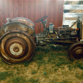
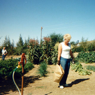
The next day I spent some time re-looking (I had been here before) at Dick's remarkable museum of cars and "things." Just before I rode off, I snapped a shot of both Dick and Lucy in their garden.
 I backtracked to Grassrange and then north to Roy to see if some other
relatives were home, but alas no one was, so I stayed on highway 191 back to Lewistown
in a frustratingly time-killing loop before finally heading west on highway 87
rather late in
the afternoon. At this point I wasn't making very good progress and I knew that
I was roughly scheduled to be in Walla Walla Wednesday night or Thursday morning and
here it was already Tuesday evening.
I backtracked to Grassrange and then north to Roy to see if some other
relatives were home, but alas no one was, so I stayed on highway 191 back to Lewistown
in a frustratingly time-killing loop before finally heading west on highway 87
rather late in
the afternoon. At this point I wasn't making very good progress and I knew that
I was roughly scheduled to be in Walla Walla Wednesday night or Thursday morning and
here it was already Tuesday evening.
Therefore, I made pretty good time riding to Great Falls where I had dinner and then North on highway 89 towards Glacier National Park.
You might have noticed that it would have been quicker to head North on I-15 to Shelby and then West to Glacier; and you would be right. But, I couldn't see spending all that time on a freeway that I had already been on before, anyway. Freeway riding--if you've been on that pavement, before--is awful.
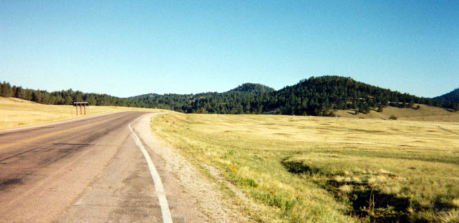
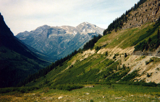
By the time I reached Choteau I could finally see the Rocky Mountains. In fact the mountains seemed to rise straight up out of the prairie. This highway is indicated as a heavy red line on my AAA maps; however the actual road was really a very narrow (sometimes single lane) farm road that had very little traffic. Clearly most traffic was 30 miles to the east on the Freeway. In places, however, this was one of the nicest roads I was to travel on the entire trip.
At the time I stopped to take the above photograph, I took the time to investigate a rather foul smell. It seems that the cartons of juice I was carrying in my rear trunk had leaked and had mixed with some Fig Newtons that had also escaped. The resultant mixture had then seeped out and dripped onto the rear fender. It took me some minutes to wash all the goop out. Nothing, nothing, can survive long hours packed in a motorcycle, without special care.
By the time I reached Browning (in the heart of the Blackfeet Indian Reservation) I had given up hope of camping that night and started looking for a motel. None of the motels in Browning looked too pleasant (and, my standards are really quite low) so I continued on towards East Glacier thinking the odds would be better there than in the equally close town of Kiowa (as indeed they were).
A note here: Montana, like some other states, places small white crosses along the road at places where auto fatalities have occurred. I got used to seeing these crosses along most roads at infrequent intervals. However within the reservation I must have passed at least 50 markers! In places where the road turned sharply there would be several markers from several different accidents. They made for rather macabre curve warnings.
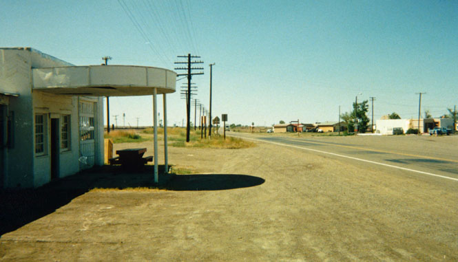
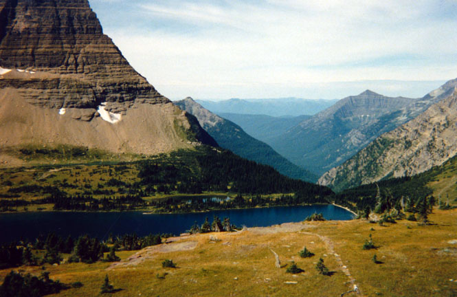
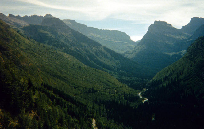
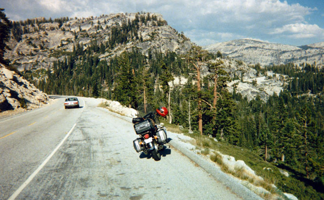
Early the next morning (after spending the night at a quite reasonable hotel in East Glacier Park I headed north on highway 49. This was actually my first exposure to mountain roads on the trip. East G. P. is right on the edge of the Rockies. After 12 very winding and scenic roads I crossed over a pass and descended to the town of Kiowa, which consisted of a Service station and not much else, which certainly made my decision the evening before look like the correct one.
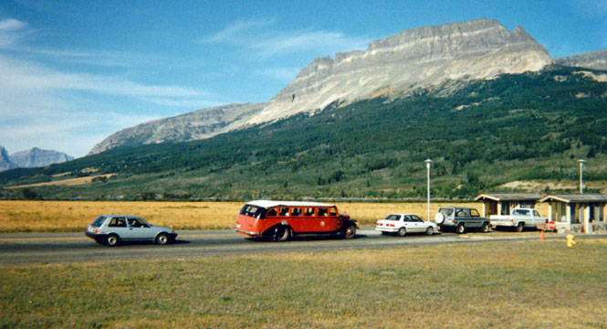
From Kiowa I again started to climb into the mountains and on into the town of St. Mary. I had been here before on a previous trip. However at that time I had come from Glacier Park and was headed North. At St Mary I stopped for gas and then drove about a block to the Visitor's Center. The Glacier lodge operates about 50 of these 1938 and 1939 White Company buses you see in the picture. They are all specially equipped to deal with the steep hills and because of that, rarely impede the traffic behind them. Unfortunately the same cannot be said for most of the motor homes I saw (from behind).
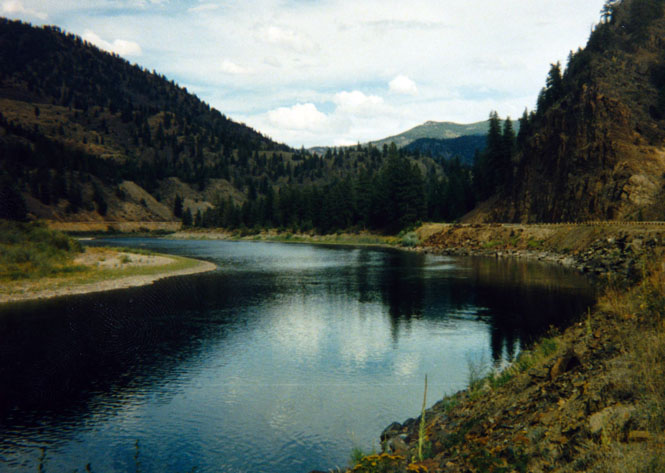
From St. Mary I rode along the North side of St. Mary Lake stopping several times to look around and to take pictures. If I had to pick a high point of the entire trip it was probably around here. The bike was running terrific, the weather was just perfect and all was well.
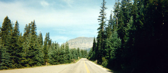

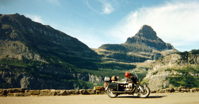
I might add here that the road I'm traveling on was built during the depression and was a major engineering accomplishment of the time. Much of the road clings to the side of the mountain and required a large amount of dangerous blasting to cut.
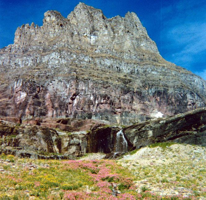
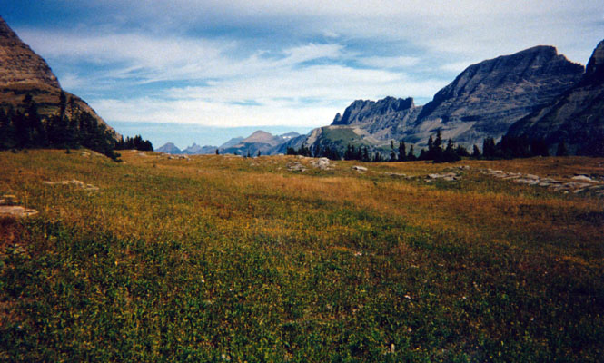
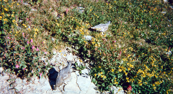
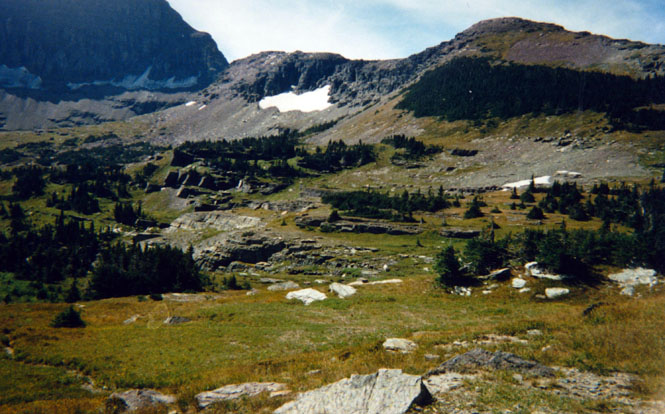
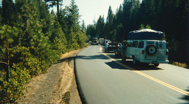
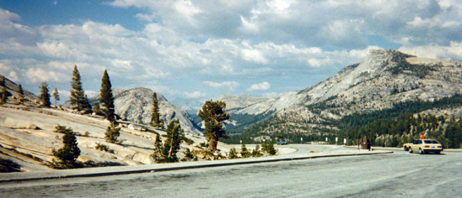
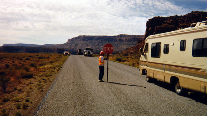
I stopped at the Visitors Center at the Continental Divide Pass. While there I spent perhaps 2 hours hiking along the trails. I apparently was there at the right time because the wild flowers were in full bloom. The trail I was on climbed about two miles up to a mountain ridge where it was possible to see both side of the Divide. There was some construction taking place along the road (more chip seal). While waiting for the green flag I would shut the engine off. When the the flagman (actually woman) gave the 'go' sign I often didn't bother starting the engine and simply coasted on down the hill.
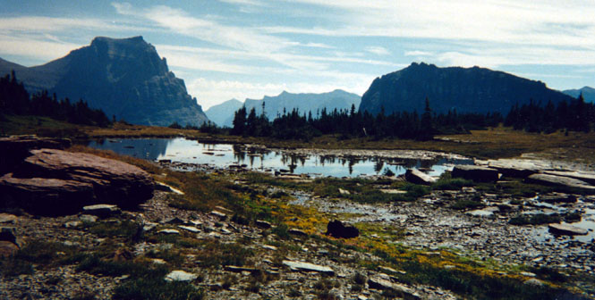
If you look carefully (at the photograph, below) you'll notice the road down by the river as well as much further up the slope as it climbs towards the gap at the top of the picture.
I continued on through the Park exiting at the town of West Glacier. From this town, I rode the next few miles on to Hungry Horse. I had been carrying around a number of cans of food but hadn't really used any yet. So, I took this opportunity to cook some clam chowder on the butane stove that I carry. On motorcycle trips of past years, I would often cook most all of my meals. It seems that on my more recent trips I eat far more often in restaurants. In any event, after eating my lunch I again headed west on Highway 2.
At the town of Kalispel I had a number of decisions to make. My goal was to reach Walla Walla, of course. However, this was complicated by the fact that it isn't easy to get from Kalispell to Walla Walla by any direct route. To add further constraints, I am very reluctant to travel on any road I've been on before.
One option was to stay on highway 2 to Bonners Ferry, Idaho. Another, and possibly the fastest, was to head south to Missoula and on to Lewiston on highway 12 over Lolo Pass. But, I've already been on that road (three times) so instead, I decided to head south to I-90 and then west across to Spokane.
At the small town of Elmo I mailed some post cards and then headed west on some very minor roads to Niarada and then south to Plains. I stopped here for a light dinner and a rest. From here I was very tempted to head west to Thompson Falls and Gliddens Pass, but my map showed that some of this road was unpaved and I didn't feel like doing that sort of thing on this day. So, I headed South to Paradise and then on to St. Regis where I had a fresh gooseberry milk shake.
 Idaho
Idaho
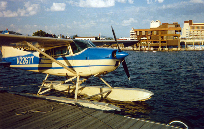
I was quite pleasantly surprised at how scenic the freeway route (I-90) was. I stopped at the top of a pass to take a photograph. At Coeur d'Alene it took me a bit of maneuvering (including riding on pedestrian sidewalks through a park) to reach lake side. I walked up to have a look at a nicely maintained Cessna 180 on floats. A sister-plane was on the dock being fitting with a new fuel tank. The mechanics were having a terrible time putting it in so I didn't think it prudent to mention who I worked for...
There were some really clever water tricycles up on the docks. They had large plastic hollow wheels whose treads resemble something off of a John Deere. And because of these large wheels it is possible to pedal down the beach and on into the water where the turning wheels act as a (rather inefficient) paddle wheel.
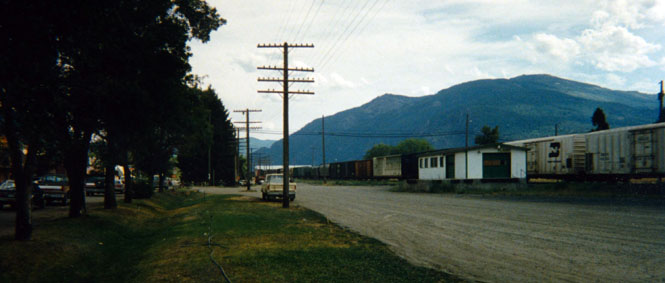
 Washington
By the time I reached Spokane, the sun was nearly down. I had thought, earlier in the day, that I might make it into Walla Walla by today, but clearly I wouldn't be doing that. My intent, then, was to keep riding down I-90 until I came to a campground or a hotel; whichever appealed to me the most.
As I passed by Sprague Lake I ran through an enormous swarm of flying insects. There were so many of them that my face shield quickly became covered with them, and I had to ride crouched behind my windshield for about 8 miles. At Ritzville I had to make some choices about just how I was going to get to Walla Walla so it seemed as good a place as any to spend the night (in a motel).
In the morning I headed south on highway 261 through Washtucna and then east on highway 261 through Starbuck and on to highway 12 where I turned right and rode on into Walla Walla.
Becky and my mother had, of course, both arrived together the day before. It was nice to be able to visit everybody for this short time. ...Played the organ, played cribbage with Grandma (lost several times), read 5 books, changed the oil in the bike, toured the Ft. Walla Walla Pioneer Village, helped Becky buy new tires, and bought a detailed map of the Roy, Montana area.
There was some thought given to riding with Becky and my mother to Yamhill (obviously, not all with the same vehicle), but we eventually decided to simply leave Walla Walla and go our own ways. Still, as I left Walla Walla, I considered that we might meet anyway. After filling up at the Standard station across from the Whitman Hotel, I again headed west on highway 12 and on to Umatilla and I-84. I stopped for a period at the Arlington city park (long tradition) to eat some of the food I had bought in Walla Walla before heading west again.

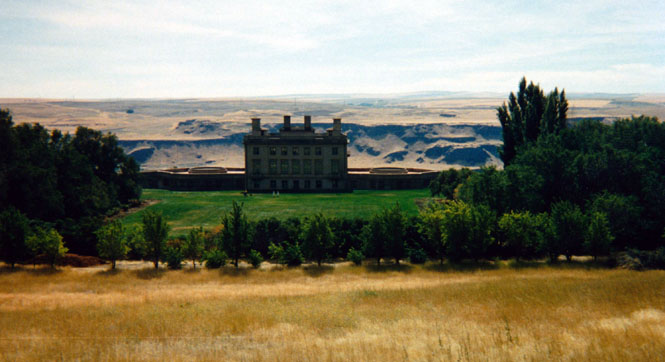
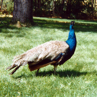 At Biggs Junction I nearly kept on riding until I saw the Maryhill museum
across the river. The last time I was there I think I was probably around five
years old and remembered little about it except for a dress made out of gold
thread. So I crossed over the bridge and drove the five miles, or
so, to the museum. After parking the bike I walked on back to the
main road to take the photograph (below) and then returned by walking straight down
the hill through the grounds where I took a picture of one of the
many peacocks there. All together, I spent around an hour at Maryhill before
heading west again.
At Biggs Junction I nearly kept on riding until I saw the Maryhill museum
across the river. The last time I was there I think I was probably around five
years old and remembered little about it except for a dress made out of gold
thread. So I crossed over the bridge and drove the five miles, or
so, to the museum. After parking the bike I walked on back to the
main road to take the photograph (below) and then returned by walking straight down
the hill through the grounds where I took a picture of one of the
many peacocks there. All together, I spent around an hour at Maryhill before
heading west again.
 Oregon
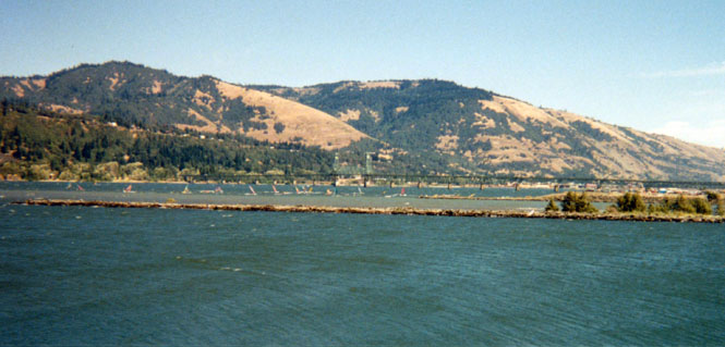
I stopped again at a pier in Hood River to watch and take some pictures of the wind surfers on the Columbia River. It's difficult to tell from the pictures, but there were perhaps 75 sailboards on the river. The wind blows continually up the river through the gorge so the boats spent most of their time traveling from one side of the river to the next sailing across the wind.
Perhaps it was their size, but they seemed to be sailing at incredible rates of speeds. While I was watching, a grain barge went through the area traveling upriver. They didn't seem to give it much notice as they sailed directly in front and to the rear of it.
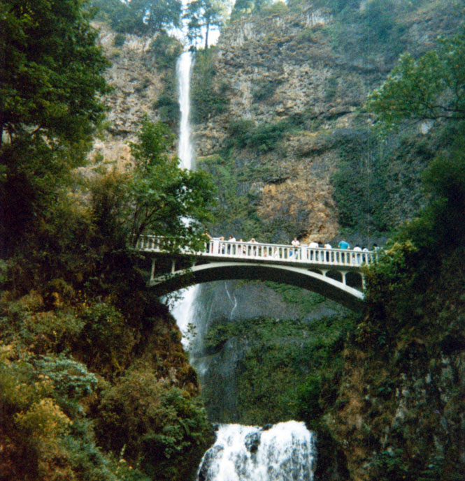
I stopped at Multnomah Falls for about 40 minutes. The (paved) grounds near the bass of the falls were taken up by numerous artists and their paintings. In addition there were dozens (perhaps hundreds) of tourists walking about. I have never yet been on the bridge in the photograph even though I've been here several times.
When I reached the boundary of Portland I turned south on I-205 and then drove on to Oregon City following the signs to the Oregon Trail Visitor Center. I was surprised (but not greatly so) to see Becky and my mother in the Center. In spite of my slow pace (and tour of Maryhill) they had matched it by taking the longer Government Camp route around Mount Hood.
After looking at the displays in the center and watching a 15 minute movie on the Oregon Trail we walked to the (claimed worlds only) Civic Elevator and descended (at least two of us) to the older part of Oregon City. After ascending we walked to the McLaughlin house and took the guided tour along with six other people. For reasons that weren't completely clear to me, this house had been moved up a rather steep hill (the same one the elevator travels) to its present location.
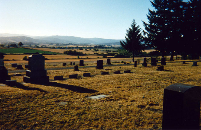
 Here we decided to travel together to Yamhill just as we had spoken of doing
earlier that morning. From Oregon City we rode (or drove) to Wilsonville and then on
to Newberg. After a couple of false starts (I thought Becky was leading, she
thought I was leading) we finally found the right road to
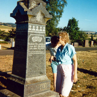
Yamhill. At Yamhill we followed a map that Grandpa had made so that we could
find the cemetery, the prune drier and the train
depot. Of course there really is no train depot, nor are there any
tracks, but it's still possible to see where the tracks used to be in the last
photograph. I had parked my bike in front of a house while we did all the
running around in this area.
Here we decided to travel together to Yamhill just as we had spoken of doing
earlier that morning. From Oregon City we rode (or drove) to Wilsonville and then on
to Newberg. After a couple of false starts (I thought Becky was leading, she
thought I was leading) we finally found the right road to
Yamhill. At Yamhill we followed a map that Grandpa had made so that we could
find the cemetery, the prune drier and the train
depot. Of course there really is no train depot, nor are there any
tracks, but it's still possible to see where the tracks used to be in the last
photograph. I had parked my bike in front of a house while we did all the
running around in this area.
As you can tell by the photographs the sun had nearly set so we drove (or rode) to McMinnville to eat dinner. After eating our fill of a terrific salad bar we headed south and stayed together as far as Rickreall where we separated and I headed east to Salem and they headed south to Corvallis.
When I reached Salem it was quite dark, but as I wasn't feeling at all tired, I just kept on riding south on I-5. By the time I decided to stop for the night I found that all the motels were full. It wasn't until I was well past Roseburg (nearly clear through Oregon) that I gave up and pulled into a rest area and went to sleep on the ground (I've done this, before, and have no fear that anybody will ever bother me. They're more likely more worried about me).
 California
Early morning I was on my way to Grants Pass to get gasoline and then on south to Sacramento. Up to this point I wasn't really sure that I'd even be going through Sacramento.
But, because I wanted to cross the Sierra's on a pass I hadn't been on before, I didn't really have much choice. North of Weed I stopped and took a distant photograph of Mt. Shasta. The weather was just about perfect.
Between Red Bluff and Redding I stopped at a rest area to try and make up for some of the sleep I missed that night. Rest stops (such as I stayed that night) are not the best places to sleep. It's remarkable just how many cars come through at all hours of the night. I was not prepared for the high temperatures in the valley and spent about 40 minutes at an A&W in Williams to cool off. I arrived at my father’s house some time around 4:00. Here I changed the oil in the bike again (always take the opportunities when you find them) and did a little minor maintenance on the engine.
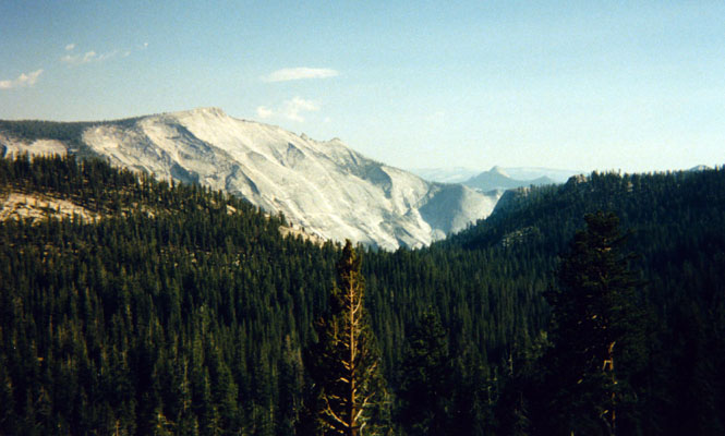
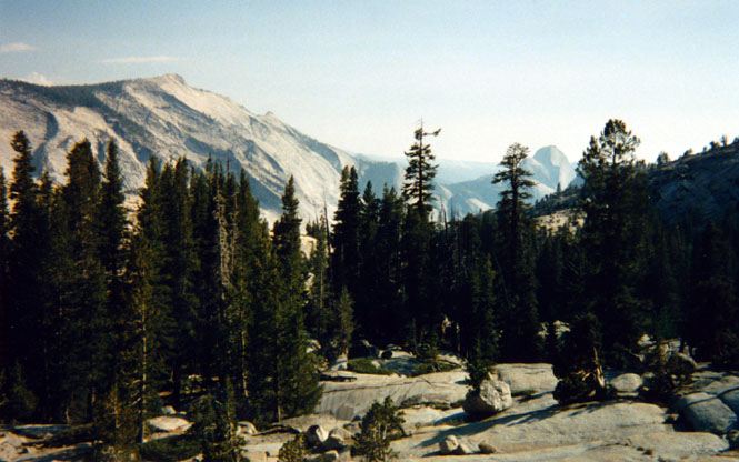
After having lunch with my father at a local Denny's (He was on a break from classes) I again hit the road. I stayed on highway 99 to Manteca where I got gas and then headed east on 120. The road to Chinese Camp is fairly flat, but just as soon as I took the turn-off to Yosemite at Big Oak Flat it just starts climbing like crazy up into the Sierra Nevada Mountains. Once in the park traffic halted for about 30 minutes for road repair which gave me a good opportunity to get off the bike and take some pictures. Further down (or rather, up) the road I stopped to take some pictures of Yosemite Valley from a vantage point I have never seen before. In one photograph it is possible to see Half Dome in the right-center portion of the picture. Most of the Yosemite tourists are way down there in the valley.
In an odd turn of events, I lost my rear brake near Tioga Pass and I didn't recover it until I had descended to lower altitudes and warmer climates (if that was the reason). It wasn't a major problem since most of my braking power comes from the front brakes which remained unaffected. I have since then flushed out all my brake fluid with a newer type, which I feel has cured any problem.
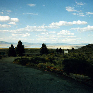 When I reached highway 395 and Mono
Lake I turned north to the small town
of Lee Vining for gasoline and then headed south and west on highway 120 to Benton. The
landscape was such a strange mixture of long flat roads and high mountains that
I stopped for a picture. Traffic was such that I really did just
that. I simply stopped on the road and got off. Anyway the sand on the side off
the road was so soft I was hesitant about getting into it.
When I reached highway 395 and Mono
Lake I turned north to the small town
of Lee Vining for gasoline and then headed south and west on highway 120 to Benton. The
landscape was such a strange mixture of long flat roads and high mountains that
I stopped for a picture. Traffic was such that I really did just
that. I simply stopped on the road and got off. Anyway the sand on the side off
the road was so soft I was hesitant about getting into it.
 Nevada
It was night when I reached Coaldale Junction, so as soon as I reached Tonopah I found a hotel and stayed for the night.
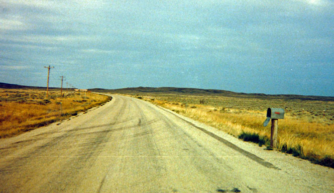
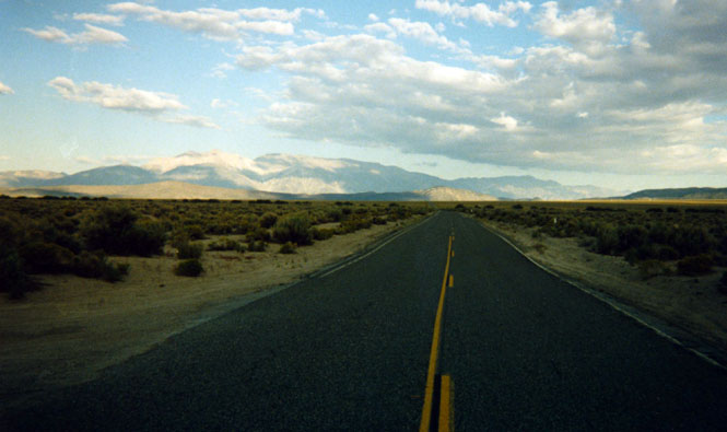
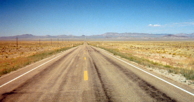
Not so early that morning I headed west on highway 6. The section of road from Tonopah to Caliente is perhaps the emptiest stretch of highway I have ever been on. In those 185 miles there are two service stations, one of which (Warm Springs) is not to be counted on and the other (Rachel) is hardly a guarantee either. My bike has a possible range of around 300 miles, if I take it easy, so as long as I made sure to get gas before heading out I had no worries.
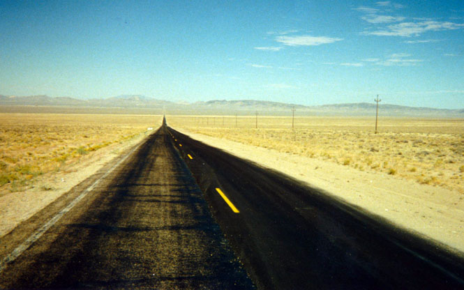
I took a couple of shots of the road, but they don't really capture the vastness of the desert (never does). You'll just have to trust me on this. The mountains you see in the distance are about 30 miles away. You'll not see any cars in the photographs and you could probably eat lunch on the pavement without any fear of being interrupted. The wind that day was completely still. When I shut off my engine and took off my helmet the only sound I could hear was the slight ringing in my ears from the ride. There are not even any birds to make a sound.
I stopped at Caliente and had a really terrible hamburger before riding north to Panaca and napping under a tree at a High School. The distance from Panaca to Cedar City, Utah is about 80 miles but I just reeled them right in. Sometimes the miles seem to take forever to pass by and at other times (such as this) they just evaporate.
 Utah
Utah
I arrived in Cedar City late in the afternoon. I really wasn't tired, and fully expected to keep on riding over the pass to Bryce Canyon National Park. But, when I was only 10 miles east of Cedar City I ran into some rain and it was clear that if I rode any more I'd be riding in heavy rain all the way to the park. Since I saw no need for that, I turned around and rode back to Cedar City (where it was not raining). This gave me time to tour the Iron Mission Museum in town. The Mormon settlers to this area had established an iron mine and smelter, which was the basis for the museum. Since I was the only person in the museum at the time I was given a personal tour of about an hour by the museum director. I then walked around the town before eating and checking into a motel just as the rain clouds that had sprinkled on me earlier started watering me again.
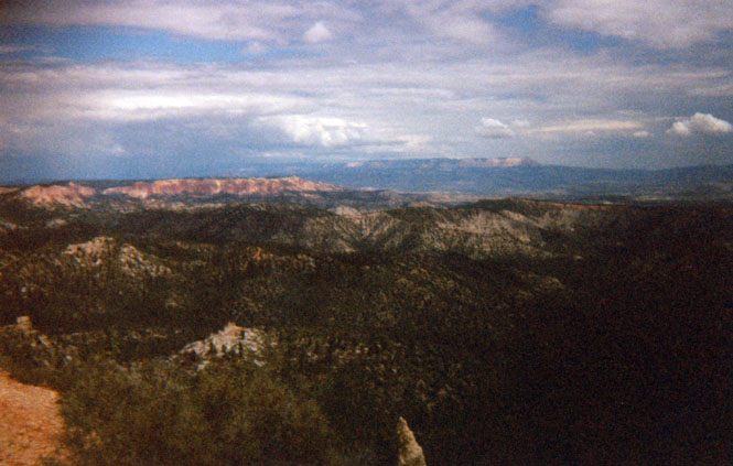
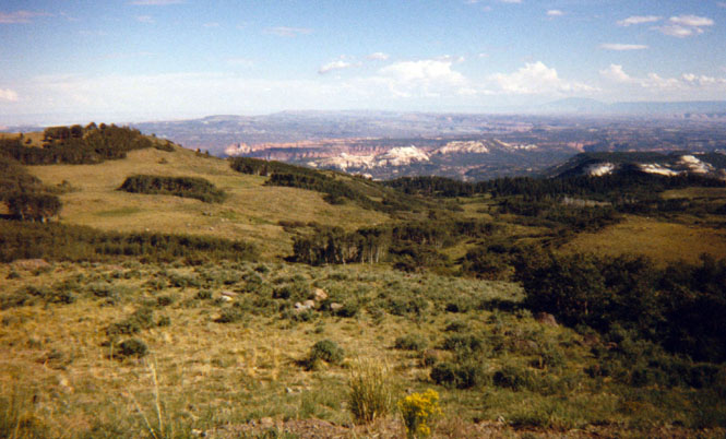
The next morning the clouds were still there, but they were now spent. I headed up highway 14 over Midway Summit towards Bryce Canyon. Near the summit I stopped for a V8 juice break and to take a picture of Zion National Park off in the distance. I visited Zion a few years ago, so wouldn't be doing it, again, on this trip.
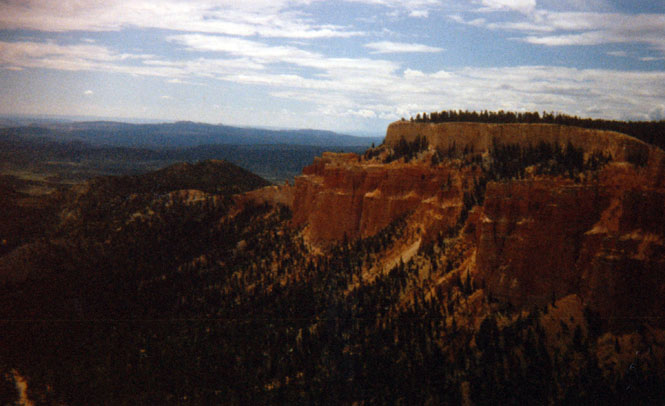
From Long Valley Junction I turned north on highway 89 through Hatch and then east on highway 12 to Bryce Canyon National Park. At the park Visitor's Center I couldn't help but notice that I was one of the few English speakers there. Most of the visitors seemed to be German. While there I met a Swiss rider on a new Harley-Davidson Motorcycle. It seems that in Switzerland he rides a Moto Guzzi motorcycle, but had purchased the Harley for this trip. I'm not sure why, but I receive many more comments from Europeans about my motorcycle (which is Italian, and more common in Europe) than I do from Americans.
For the vast majority of visitors to Bryce Canyon National Park (including me) the visit consists of driving south along the rim road for about 20 miles and then driving back north along the same road. The pictures I took were all taken from roadside turnoffs along that rim drive. While at one of these turnoffs I overheard a small boy pleading to his mother that he wanted a chipmunk. His mother told him that they were wild creatures, but the boy continued to insist that they should buy one.
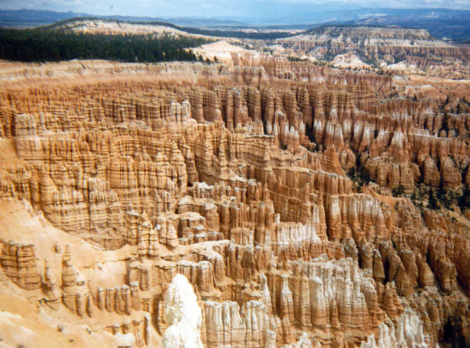
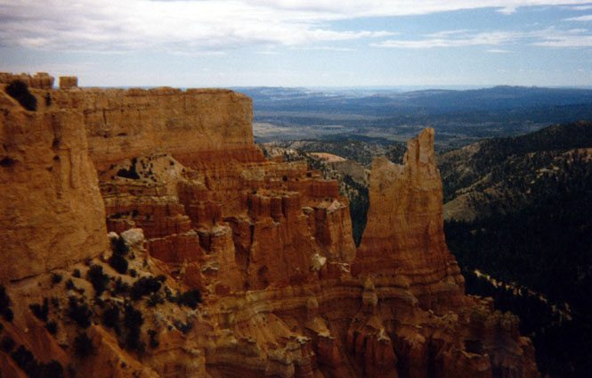
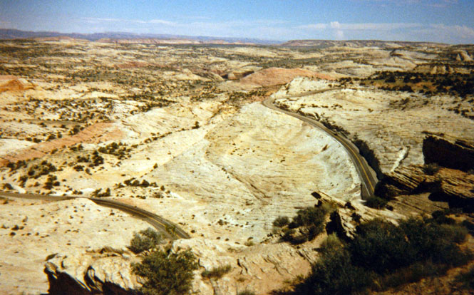
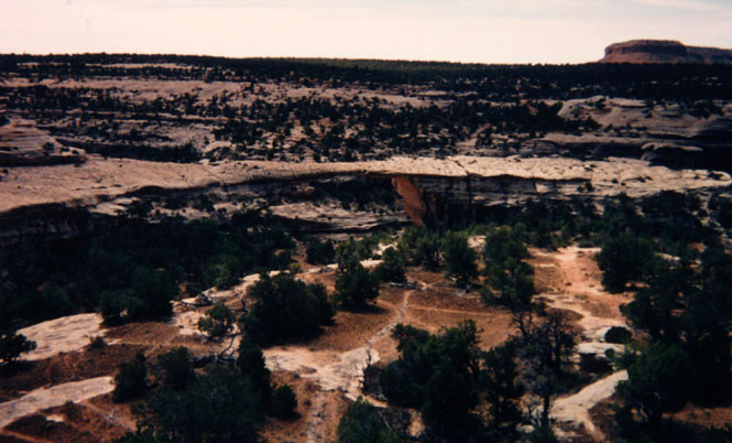
At Ruby’s Inn (that's the name of the town) I filled up the tank before heading east on highway 12. This would be very difficult country to walk across. The photograph (below) shows some of the complex road construction necessary.
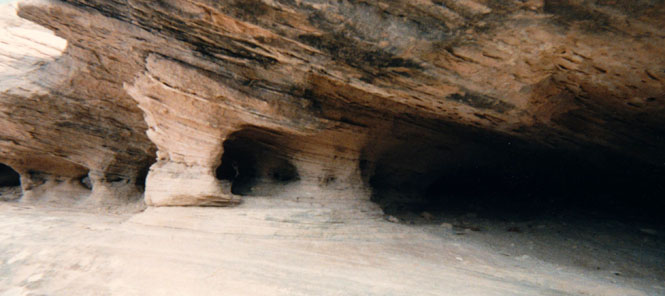
I stopped at Anasazai Indian Village State Park for about 30 minutes. One of the great mysteries of these people is why, after 300 years or so in the area, did they suddenly leave? While at the museum I met a couple on a motorcycle. This would not be so unusual except for the fact that we kept running in to each other (so to speak) throughout the day and the next day. I stopped quite often to take pictures along this road. A unique feature of the highway was that for a time there was a long drop-off on both sides of the road. It felt as if I were on a very high and narrow bridge without any guard rails.
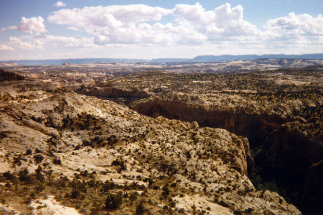
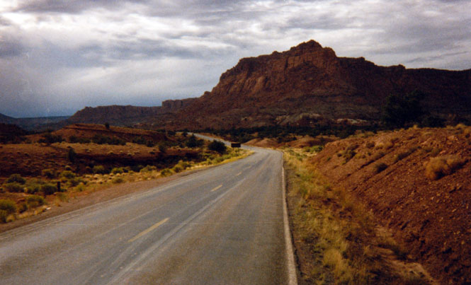
I rode on into Torrey and then turned right on highway 24. The formation shown in the photograph is called (not too originally) chimney rock. I reached the Park Headquarters late that evening and spent perhaps 45 minutes looking at the exhibits and watching a film of the area. When you don’t have time to see the whole thing, these park films are terrific. After setting up camp (about 3 miles from the Visitor Center) in a very nice area, I rode back to Torrey where I had the best dinner (fresh trout) of the entire trip. When I returned I found that the couple I mentioned earlier had set up camp next to my tent without knowing that it was mine (since I was on the motorcycle).
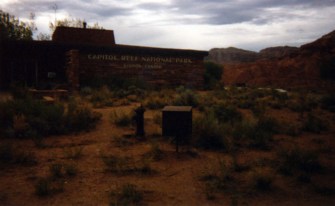
I had fully intended to head north on highway 24 to I-70 and then on to Arches National Park. However, I never made it.
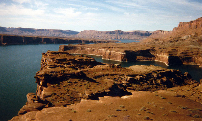
After stopping for gas at Hanksville I rode south instead of north. I can't really explain why I did; I just did. I just as nearly took the turnoff to Ticaboo and Halls Crossing on the Colorado River. But, I wasn't sure how often the ferry operated so I stayed the course. Lots of decisions to make; none of them wrong.
I stopped for a time at an overlook of Lake Powell (where the Colorado River passes through Glen Canyon). Once on the other side of the river (lake) I had about 30 not-so-wonderful more miles of chip seal to contend with. Just beneath that benign looking roadway is gooey slippery tar. After about 5 miles, however, I got used to the numb-feeling steering as I slid sideways through the gravel and pretty soon was able to (almost) ignore it completely.
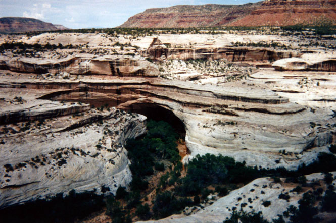
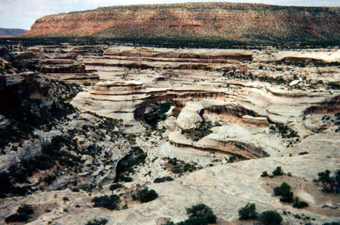
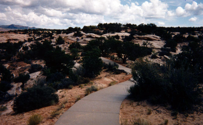
I didn't know it, but, this day was National Park Day and as such, all park entrance fees were being waived. Therefore when I entered Natural Bridges National Monument later that day the ranger simply wished me good day and waved me on. Nice.
As with Bryce Canyon, the Park people have given people like me a way to see the park without having to work up much of a sweat. There is a one-way fairly narrow road of about 25 miles that circles the park allowing you to see most all of the major bridges. Some of these bridges are quite fantastic. The photograph (below) shows a sample of the paved trails throughout the park. Nearly the entire park looked wheelchair accessible. As I was leaving the park I passed (coming from the other direction) the same couple I had met the previous day! Lots of waving.
 Colorado
When I reached highway 191 I turned north to Monticello where I had an acceptably good dinner at a Mexican restaurant. I then turned east on highway 666 to Dove Creek for fuel before heading north on highway 141 through Slick Rock. I dodged thunderstorms much of the way but I managed to avoid getting anything except a few drops. And for that, I was very, very glad. About 20 miles of highway before Ridgway was all dirt, due to construction. As it was, it was still fairly slippery going, but if it had been raining I would have had no choice but to park the bike and wait for things to dry out; A prospect that might have kept me there until the next day.
At Montrose I stopped at a Dairy Queen that has become something of a habit for me each of the four times I've been through here.
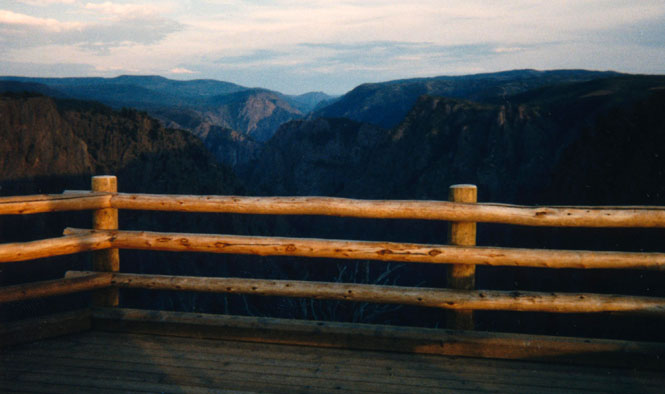
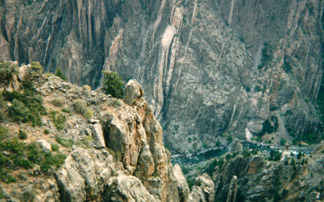
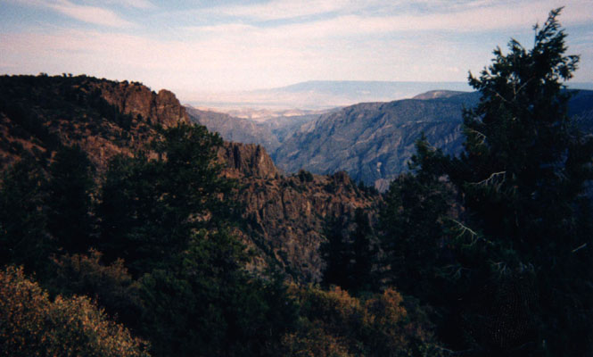
From here I rode up to the top of a plateau to Black Canyon of the Gunnison National Monument. After setting up camp I walked along the canyon trail for about 2 miles until I reached an overlook. Later that evening, I attended a ranger program about the wildlife of the park. There are trails to the bottom of the canyon, but people are warned that these are very steep trails and that if you have any doubts at all about your abilities you should not attempt them. A better, if longer, way might be to hike either down or up the river bed.
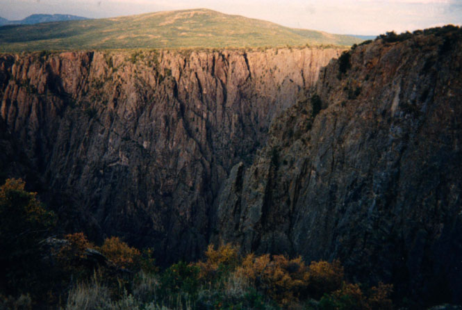
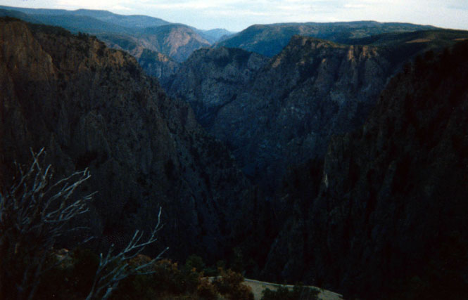
The next morning, I rode the 20 mile canyon road stopping often to take pictures
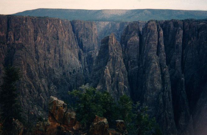
You can see the river, way down there (this is an exceptionally deep canyon):
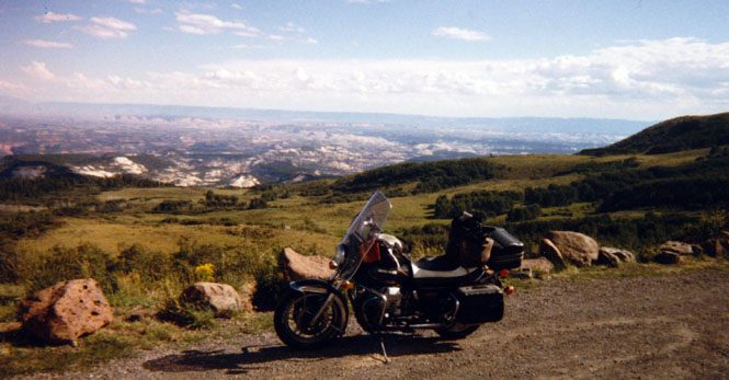
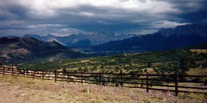
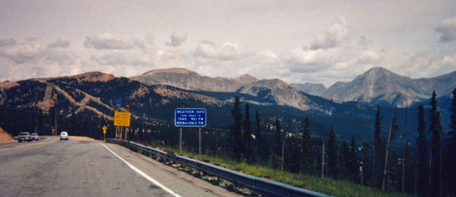
I've been on highway 50 through Colorado quite a few times, so I was anxious to travel on a new road. So, after crossing 11,312 ft Monarch Pass (which, is always nice) I turned north on highway 285 all the way to Denver. Just south of Nathrop some major road construction was taking place, which meant sitting on the bike for half an hour until we were allowed to proceed.
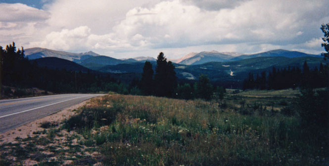
Even though highway 285 is at a fairly high elevation (9,000 - 10,000 ft), the road actually skirts around the taller range to the west. Much of the road travels through high mountain meadows. From Cenosha Pass to the base of the Rockies I hit more rain than the entire trip put together. But, since it wasn't too cold it didn't bother me all that much.
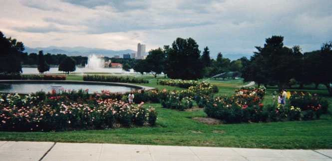
I had every intention of visiting the Denver Museum of Natural History. Unfortunately, when I arrived they were closed, so all I was able to do was walk through the park and watch a dog have fun chasing geese that were only trying to sleep.
Kansas
The ride from Denver to Wichita is one that I've done so often that it is hardly worth a mention.
So I won't.
I arrived in Wichita around 6:00 Saturday. I really didn't feel too fatigued after miles of riding, but I was still glad that I didn't have to go to work the next day.
About 5,400 miles