July, 1996

Sunday |
Monday |
Tuesday |
Wednesday |
Thursday |
Friday |
Saturday |
30 |
1 July |
2 |
3 |
4
|
5
|
6
|
7
|
8
|
9
|
10
|
11
|
12
|
13
|
14
|
15
|
16
|
17
|
18
|
19
|
20
|
21 |
22 |
23 |
24 |
25 |
26 |
27 |
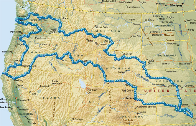
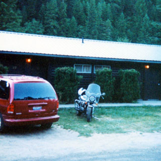
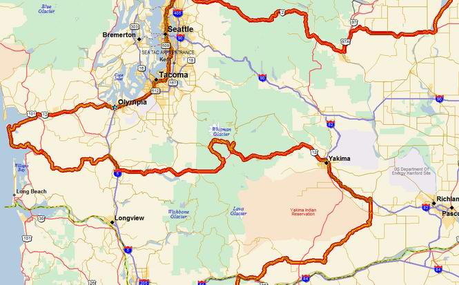
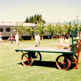
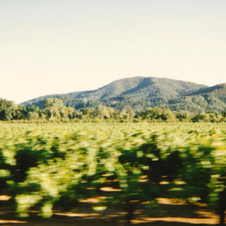
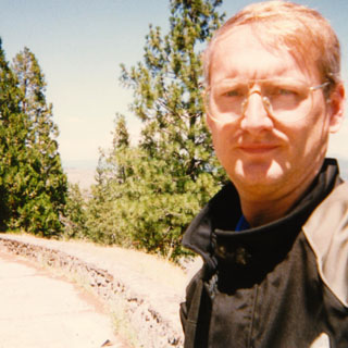
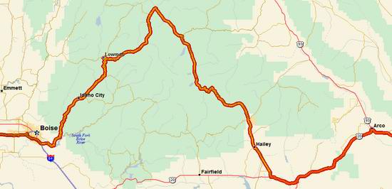
This time, instead of two weeks off, I took two weeks and three days making it one of my longer trips. My basic plan was to head north from Wichita through the Black Hills and then on to Seattle, down to Eureka, and then back to Wichita. And, in a general sense, that's just what I did. But, what really stands out from this trip is that I crossed the Cascades six times and I finally made it to Stanley, Idaho!
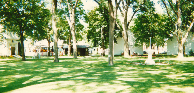
 Kansas
From Wichita I took the two-lanes up toward Russell (you’re in Bob Dole country), Kansas, and then up to the Harold Warp Museum in Minden, Nebraska.
 Nebraska
As you might remember, I’ve been through this museum many times in the past, but there’s always so much more to see with each visit.
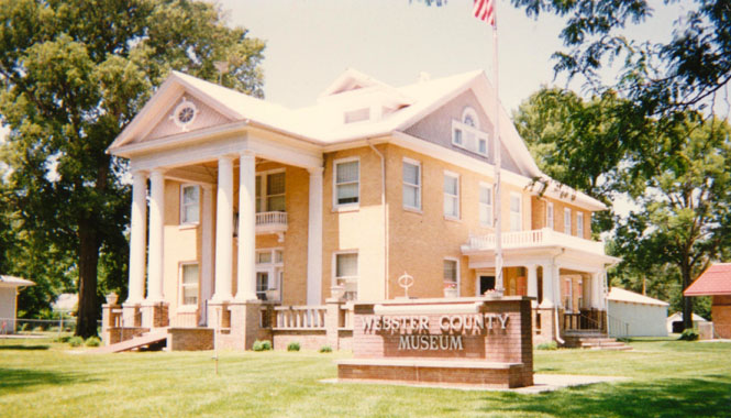
But I think I’m ahead of myself. I first stopped in Red Cloud (you’re in Willa Cather country) and went through the Webster County Museum.
From Minden I crossed I-80 (always to be avoided—the freeway, not the crossing of it) at Kearney and caught up with Nebraska state Highway 2. This road has been called one of top scenic highways in the United States (by Charles Kuralt, I think--although I suspect he was being intentionally contrary). It passes through much of the Sand Hills region.
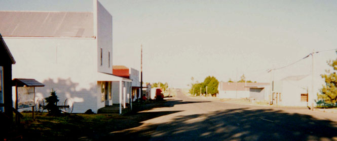
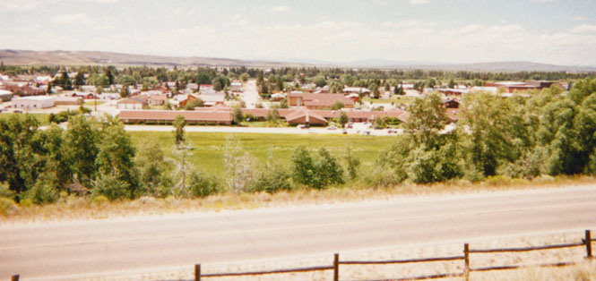
I stopped for the night in Broken Bow. This
isn’t a very large town, so I was able to walk the full length of Main street before
returning along the side streets and the residential areas. I thought that there might be
some organized fireworks somewhere, but apparently not.
 Most every house had people
sitting out on the porch and I think just about all of them called out a "hello"
to me as I walked by. A pleasant place.
Most every house had people
sitting out on the porch and I think just about all of them called out a "hello"
to me as I walked by. A pleasant place.
Somewhere in the Sand Hills I stopped at a historical marker that explained about the Potash refining that was done in Nebraska during the first World War (when the normal suppliers weren’t too friendly with us, or were too busy with other things). After the War ended the industry collapsed leaving only the shells of several towns.
Riding through Alliance I passed the Woolrich shirt factory, which I believe is part of the Pendleton company. Anyway, I do remember from touring the plant in Pendleton Oregon that while blankets were made in Pendleton, shirts were made in Alliance Nebraska. Somewhere around here is also Carhenge, which is a Stonehenge concept made with old cars. Someday I’ll have to look that up--but, not this trip.
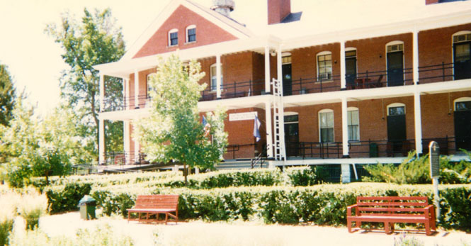
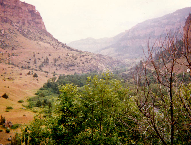
Fort Robinson is just south of the South Dakota state line and North of
the Piney Ridge mountains of Nebraska (yes, that’s right; Nebraska does really have
mountains). The fort is perhaps best remembered these days as the place where some
over-nervous private bayoneted and killed Crazy Horse at the time when Crazy
Horse was held there.
There’s now a large monument to Crazy Horse on the grounds along with an
 identical
one for the soldier for whom the fort was named, who was killed by Indians. The fort
served many functions throughout its long life (it closed around 1950). For some time, it
was the training ground for much of the mounted cavalry. In fact, the Olympic equestrian
team regularly trained here, since most of the equine expertise already worked here. During WW II, with
the horses no longer needed, the fort trained guard-dogs for all the services. The museum
didn’t play it up too much (but, couldn't entirely avoid it), but you can guess what the primary source of meat was for
the dogs…
identical
one for the soldier for whom the fort was named, who was killed by Indians. The fort
served many functions throughout its long life (it closed around 1950). For some time, it
was the training ground for much of the mounted cavalry. In fact, the Olympic equestrian
team regularly trained here, since most of the equine expertise already worked here. During WW II, with
the horses no longer needed, the fort trained guard-dogs for all the services. The museum
didn’t play it up too much (but, couldn't entirely avoid it), but you can guess what the primary source of meat was for
the dogs…
Also during the war, German prisoners were held there. They apparently complained of all the noise from the dogs. The photo (above) shows the parade grounds. The previous photo is of the old base barracks; now a working hotel.
From Robinson I headed North on an official Nebraska state highway.
 South Dakota
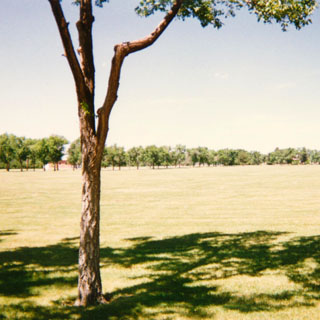
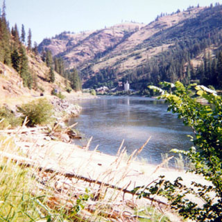
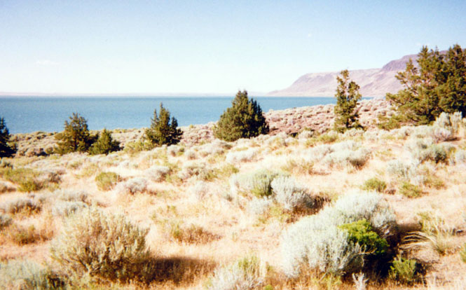
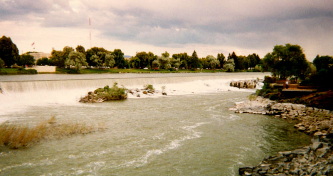
I was irritated (but amused) to find perhaps 30 miles of the road unpaved starting at the South Dakota line. I was wondering why there was absolutely no traffic. Not too far south of Hot Springs (still on the unpaved road) was a very nice swimming hole that seemed to be used by locals and not tourists (judging only by the license plates on the cars) .
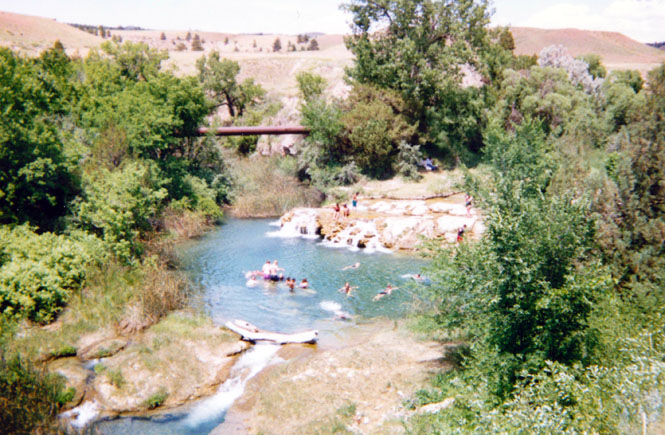
It occurred to me that if I were to break down out there, I’d have to walk out, since it’s unlikely any cars would show up for some time. The photo below is taken from the swimming hole, looking north towards the Black Hills.
About this time my speedometer broke.
For some reason this made me irked with the Black Hills in general, and anyway there were just way too many people here (July 4th holiday after all). So I turned west to Mule Creek and then North.
 Wyoming
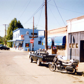
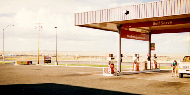
I had considered dropping down to Laramie, where I thought there might be a Guzzi dealer. Good thing I didn’t, since he had dropped the dealership some years back (in favor of KTM) and no longer had parts. At Upton I stopped at a drug store for a root beer float as well as some tape for my helmet face shield. Looking into sun was getting to me. The drug store was right out of the 30’s, and was so far off the beaten path that they were making no attempt to be some quaint tourist stop. It’s just that they never changed.
Once on I-90 I cruised to Buffalo. I don’t remember a whole lot of what the scenery was from the freeway; I never do. I spent the night here. From Buffalo I took the road to Ten Sleep. I’d been on this road before but that was 19 years ago, so I can be forgiven for retracing old ground. There are three roads that cross the Big Horn Mountains, and they’re all great. At Cody I stopped at the Buffalo Bill Museum. This is a world-class museum, rather unexpected in the middle of Wyoming. I only went through the Remington exhibit and a bit of the rest as I’ve been here more than once before.

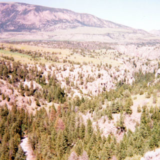
From Cody I was able to ride a new road; one that I’ve looked forward to for a long time. The Chief Joseph road across Dead-Indian pass had been unpaved until just last year (no, Chief Joseph isn’t the dead Indian for which it’s named. I have no idea what the origin of the name is. The photo (below) is from the top of the pass looking West. The road was in really great shape (as you might guess) and was just terrific on a motorcycle.
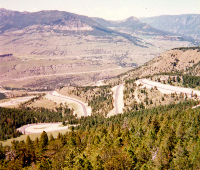
Once I made the crossing of the divide, I decided to cross back, again over Bear Tooth Pass into Red Lodge instead of passing through Yellowstone. I’ve been through Yellowstone too many times during the July 4th holiday weekend to make that mistake again.
 Montana
The Bear Tooth Pass road is noteworthy for having the steepest ascent up a canyon wall of any road in the U.S. (at least that’s what the literature said at the motel). It’s one of those roads that probably wouldn’t be built today.

The photo (above) is of the city of Red Lodge, looking South. There’s another Indian carving in Idaho Falls that I think looks just like this one. Unfortunately, I didn’t take a picture of that one for a comparison. One imagines a traveling Big-Indian-Carving salesman going from town-to-town.
I spent the night at Laurel, just South of Billings. From Billings I headed
north on
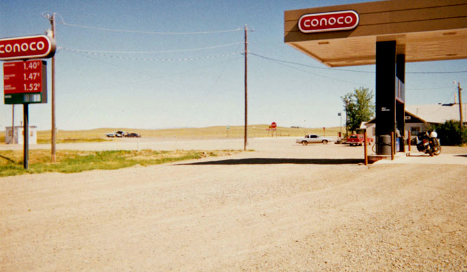
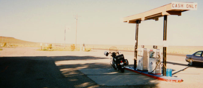
Montana Highway 3 to Lavina. This was my first exposure to GAS PRICES. Even the
cheap-gas price of 1.40 would come to look pretty good later on. I’m used to paying
1.09 here in Wichita, which has been the price for some time now. In
Wyoming, the price was 1.12. But, the further West I went, the prices were just plain
out of control. At this point I wasn’t really all that far from Lewistown and the Kalal
reunion—except that the reunion wasn’t scheduled until the next weekend. Oh
well.
 The photo was taken at Harlowton.
Traveling through Helena was rather unpleasant. The country is full of towns that grew
larger than the local officials had ever planned (Madison, Wisconsin comes to mind).
This city should have had an East-West freeway bypass years ago; but no--you have to drive
through seemingly endless traffic lights until you get to open road again. Just to spite
the local merchants (who I’m sure were behind the whole thing), I refused to buy even
so much as gas in Helena. When I did stop for gas after crossing over the pass, I talked
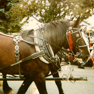
for a time with a man who was bicycling up to Glacier for his summer vacation .
The photo shows his dog who, most of the time, stayed in the trailer. When the hills
become steep, the dog
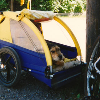 knows to jump out and trot along side the bike so as to make the
ride easier. However, his master (didn’t get his name) miscalculated, and had his dog
do some running in the morning. So, when they came to the long grade outside Helena, the
man told the dog to get out, but the dog just stared back and stayed put in the trailer.
He’d already done his running for the day, and wasn’t going to do it again! So
the dog was towed all the way up the pass. Good for him.
knows to jump out and trot along side the bike so as to make the
ride easier. However, his master (didn’t get his name) miscalculated, and had his dog
do some running in the morning. So, when they came to the long grade outside Helena, the
man told the dog to get out, but the dog just stared back and stayed put in the trailer.
He’d already done his running for the day, and wasn’t going to do it again! So
the dog was towed all the way up the pass. Good for him.
I had intended to turn north on Highway 141 and then head up to Glacier and perhaps on into Canada. However, I missed the turn (Montana ties with Oklahoma for really lousy road signs), and since I hate turning around, I kept on to Missoula. At Missoula I expected to head South over Chief Joseph pass and then to (will I never get there?) Stanley, Idaho. But, road signs warned of long traffic delays at the summit due to construction, so I turned off to take the Lolo Pass road instead.
 Idaho
Idaho
Certainly, not a bad option. This is one really terrific road. I’d have to include it on my list of the top 5 roads. Nothing sharp, just long curves, good sight-lines, no off camber stuff, very little traffic, and apparently little patrolled. One of the highlights.
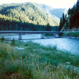
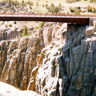
I spent the night in Lowell at a rather worn looking resort village. The rooms didn’t even have telephones. The TV had some really nice snow though—all the channels. The bridge (above, photo) takes you to an unpaved road that eventually leads to the Nez Perce Pass. It’d be worth taking with a 4WD but I’d be leery of taking the Guzzi on it. (By the way, the reason for all the Nez Perce and Chief Joseph roads is that I’d been following, in reverse, some of the route taken during the unsuccessful flight of the Nez Perce to Canada).

At Lewiston, I turned north on Highway 95 and climbed out of the (Salmon/Snake) rRver canyon . The road you see in the picture (below) is the old highway, and is much more curvy (though not as steep) than the new one. Modern cars have an easier time climbing steep grades than they did years ago. But I’d guess that modern trucks, therefore, are much more apt to go careening across the river into the city than they used to as well. Must be rather exciting when that happens.
I stayed in Idaho (really beautiful area) to Plummer, where I turned into Washington for what I thought would be the scenic back roads into Spokane.
 Washington
Ha! Maybe that was true 20 years ago, but Spokane has grown so large that all of the small country towns around it have become its suburban neighborhoods. Gads, just another big city to get through now.
I stopped at Coulee and went through the visitors center. I didn’t go on any of the dam tours, but I’ve been through here several times already, so there wasn’t a real need.
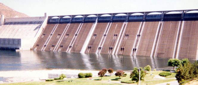
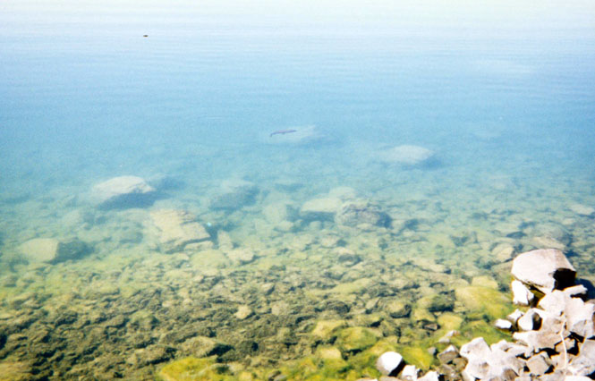
From Coulee I followed the South side of Banks Lake (photo, below) down to Coulee City.
I’m not sure how deep Banks Lake is. The dams on either side aren’t particularly high, but I’m not sure that it doesn’t get deeper towards the middle. It is a very clear lake though. If you look in the photo (below) you can see a rather large fish. The thing must have been nearly 2 feet long (we'll call it a trout).
From Coulee City I cut across some very empty farm land, dropped down to the Columbia River and into Wenatchee where I spent the night.
I’d never been on the Steven’s Pass road to Everett (at least on a motorcycle, and that’s all I count) before. Although I was to hit some more rain throughout the trip, this was the coldest rain I encountered.
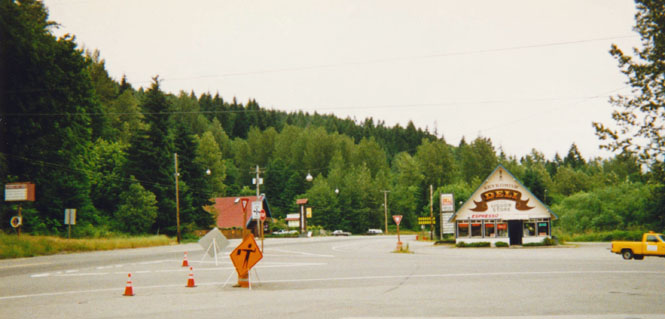
Actually, it might be more accurate to describe it as riding in the clouds. At the summit, the fog was so thick that I had to slow down to about 20 mph and still had a hard time seeing the stripes on the road. Once I was a few miles over the top the fog lifted though. The photo (above) isn’t of much except the scenery from the gas station. I ate breakfast at the restaurant with the red roof.
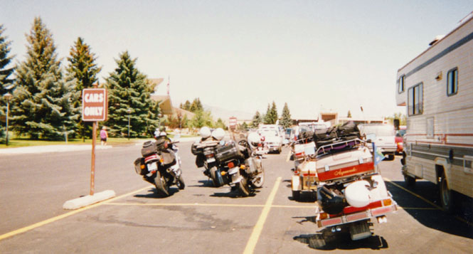
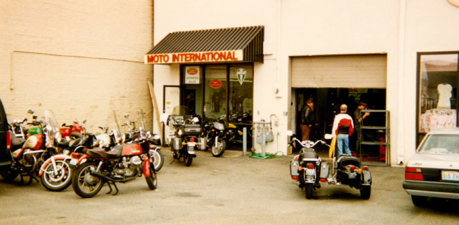
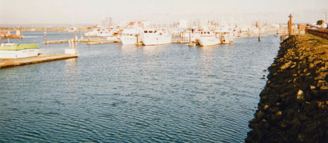
At Seattle I was able to stop at Moto International to change the oil and to buy and install a new speedometer cable. There were several folks there who were on their way to the National Guzzi Rally just up the road in Mount Vernon. I never did make it there.
The Boeing Museum is just down the road from the motorcycle shop. I spent perhaps 2 hours going through it. One of the best.
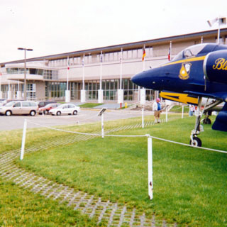
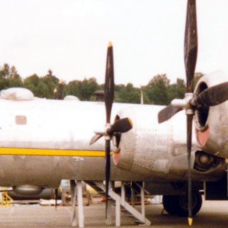
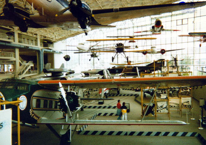
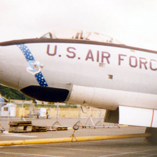
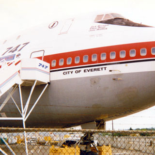
They still have plenty of room to add more aircraft—both indoors and out. I’m pleased to see how well the photo of the museum interior came out. One of the photos shows a B-29 (unless somebody convinces me that it’s a B-50) and might be just one of two left (I’m not real sure on the numbers). Chances are that the B-47 in the photo was built in Wichita, as most of them were. In fact, it’s quite likely that the B-29 was built in Wichita, too. The last photo is of the prototype 747. It used to be fairly common to see that airplane over Wichita, as Boeing used it for engine testing. I’m not sure if it's used any more, though. While at the museum, I bought a book on American aircraft production during the war—a good book.
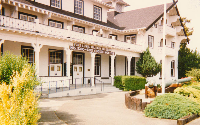
I stopped at the Fort Lewis Military Museum in Tacoma for the third time. And for the third time it either wasn’t open, or they wouldn’t let me in (which happened the first time—didn’t have a reflecting vest, and could not ride to the guard shack to get one without a reflecting vest…). I will keep trying, and some trip, I'll make it in.
At this point I was considering circling up the Olympic Peninsula and into Victoria again (I was there last year). But, since it looked like rain, I just rode on across to Aberdeen.
The photo (above) was taken someplace along this stretch while I was stopped for road construction. I think on every trip I’ve taken I’ve encountered road construction stoppages at least five times each. At Aberdeen I continued on to the coast and the town of Westport where I spent the night.
For reasons that were never clear, a Coast Guard helicopter spent a good two hours hovering over the bay. He’d stay over one spot for a while, and then move on to another. Sometimes a Coast Guard boat would trail along as well. Probably a training exercise, of some sort.
The next morning I cut back across the coastal range (above) through Pe El . I do really like this area.
 When I entered the restaurant on the corner, the waitress just about
screamed. I guess I have that effect on some people! It seems that my full riding suit and
helmet looks a little too alien for some folks to handle! I notice that this road is
Highway 12—a road that I’ve been on and off for much of the trip. Someday I may
make the effort to travel the full length of 12, or at least pick up the few portions of
the road I haven’t been on (it goes clear to Detroit).
When I entered the restaurant on the corner, the waitress just about
screamed. I guess I have that effect on some people! It seems that my full riding suit and
helmet looks a little too alien for some folks to handle! I notice that this road is
Highway 12—a road that I’ve been on and off for much of the trip. Someday I may
make the effort to travel the full length of 12, or at least pick up the few portions of
the road I haven’t been on (it goes clear to Detroit).
I stayed on 12 to Mt. Rainier, then drove up to the visitor center at the base of the mountain. The photo is looking across a valley at the road.


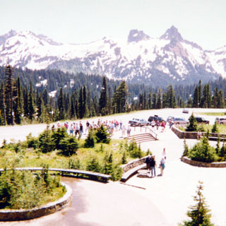
There wasn’t as much snow on the ground as there’s been on earlier trips. Still it was nice to be able to crunch through the stuff after enduring all the heat of Kansas.
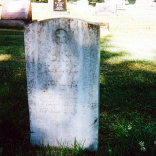
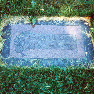
It was nice and cool at Rainier. It was horrible in Yakima. I stopped in Sunnyside (cemetery photographs, below) and then tried to track down the road to Bickleton.
The AAA map I was using indicated that the road started at Outlook—it was wrong. I finally found the right one, and climbed out of the Yakima Valley. You’ll probably be able to find Bickleton on most maps even though there really isn’t much to it.
Still, it’s about the
only thing even close to being a town in the whole area south of the Yakima Valley
(Horse Heaven Hills). The
town presents itself as the bluebird capital—come to
 think of it, I don’t think
that they claim to be any sort of world capital of blue birds just a
capital. I stayed the night at Goldendale, and used the time to wash my clothes.
I found during the trip that I really should have packed just one more complete
change of clothes (Remember; after the first day you’ll always be carrying dirty
clothes with you, unless you want to do your laundry while looking rather bare)
think of it, I don’t think
that they claim to be any sort of world capital of blue birds just a
capital. I stayed the night at Goldendale, and used the time to wash my clothes.
I found during the trip that I really should have packed just one more complete
change of clothes (Remember; after the first day you’ll always be carrying dirty
clothes with you, unless you want to do your laundry while looking rather bare)
I stayed on the Washington side of the river until White Salmon where I crossed into Hood River.
 Oregon
 The toll bridge here is just about as bad as the Bridge of the
Gods, not too far downstream. The roadway is made of uneven steel grating and makes for
rather haphazard directional control. This sort of road doesn’t usually bother me,
but there was something extra nasty about this one. I had to concentrate on relaxing my
arms, and to just let the front end wander wherever it wanted too; eventually it would
head in the right direction.
The toll bridge here is just about as bad as the Bridge of the
Gods, not too far downstream. The roadway is made of uneven steel grating and makes for
rather haphazard directional control. This sort of road doesn’t usually bother me,
but there was something extra nasty about this one. I had to concentrate on relaxing my
arms, and to just let the front end wander wherever it wanted too; eventually it would
head in the right direction.
At Hood I headed South and around the mountain. I stopped at Parkdale for a bit to tour their museum. This is also the endpoint of the Hood River Railroad (something I've never been on).
 Twenty years ago (when I took this route on another motorcycle), the road around the mountain was a twisting, narrow road. Now, much
of it, particularly on the west side, is a four-lane highway. No longer is the town of Zig-Zag a small, scruffy looking place. By the time I reached Sandy, I might just have
well been in Portland. It was time to turn south.
Twenty years ago (when I took this route on another motorcycle), the road around the mountain was a twisting, narrow road. Now, much
of it, particularly on the west side, is a four-lane highway. No longer is the town of Zig-Zag a small, scruffy looking place. By the time I reached Sandy, I might just have
well been in Portland. It was time to turn south.
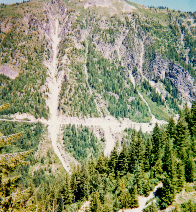
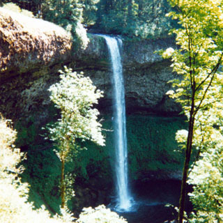
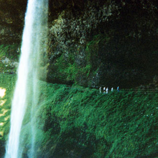
My intention was to follow several back roads (highway 224) across the Cascades. Unfortunately, I kept coming across "Road Closed" signs and was forced to stay on the major secondary roads . The photos were taken at Silver Falls State Park. Such a refreshing place.
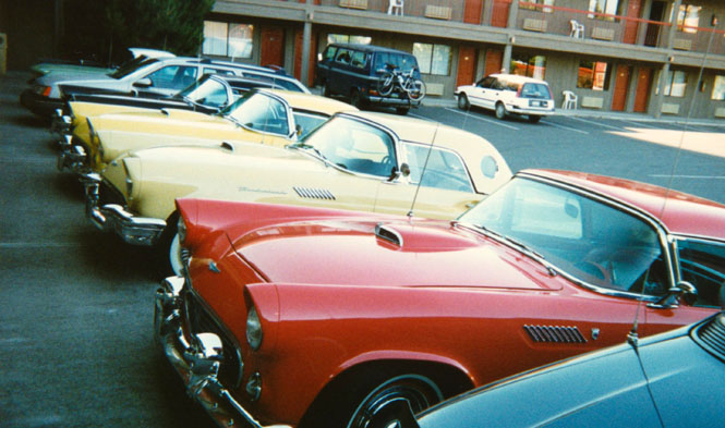
I’d never crossed the Cascades at Santiam Pass, before. I can’t say it’s very efficient, but it's a very nice road. At the motel in Bend were about fifteen 1955 - 1957 T-birds that were returning from a car show. Awfully nice cars.
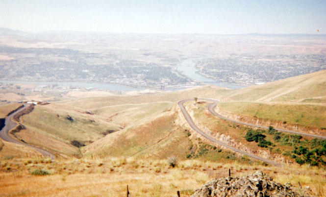
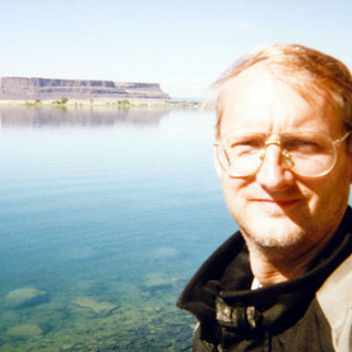
From Klamath Falls (below) I crossed over the mountains again to Ashland.
This is a deceptive road. From the map it looks like a fairly direct route connecting Highway 97 with I-5. In fact, its a very winding road that takes much longer that you’d first think.
I must have waited over 20 minutes at the agriculture checkpoint on I-5. I’m not sure what they were looking for, but several campers were receiving a thorough going-over. In the mean time I was dying on the motorcycle in my riding suit. I shut the engine off and "paddled" my way as the line slowly crept forward. It was hot. Of course, once I reached the check-point, I was waived on through. Not too far south I turned west on highway 96 toward Eureka, California.
 California
This stretch of road will surprise you. Just as with the road from Klamath to Ashland, it’s a lot farther than you’d think. In fact, from I-5 to Eureka is around 200 miles of continuously winding road, and very few towns of any size.
 It was along this road that I
totally miscalculated how much water I should be drinking. I was expecting the temperature
to start dropping, but that really doesn’t happen until you cross the last range—about
30 miles from the coast. When I pulled into Somes Bar I was surprised to find that the left side
of my face was completely numb. Not a good sign. I stayed there for some time drinking
quite a bit of fluids. I’m not sure what the initial signs of heat-related problems
are, but there didn’t seem much point in finding out.
It was along this road that I
totally miscalculated how much water I should be drinking. I was expecting the temperature
to start dropping, but that really doesn’t happen until you cross the last range—about
30 miles from the coast. When I pulled into Somes Bar I was surprised to find that the left side
of my face was completely numb. Not a good sign. I stayed there for some time drinking
quite a bit of fluids. I’m not sure what the initial signs of heat-related problems
are, but there didn’t seem much point in finding out.
By now I’ve had four occurrences of approaching hypothermia (only passed out once though—a long time ago), and I think I can tell the signs of that, pretty well. This was something else. After drinking probably over a gallon, I was feeling fine and continued on. Actually, except for the numbness, I never felt ill at all—just make a note to drink more when its hot (seems fairly basic).
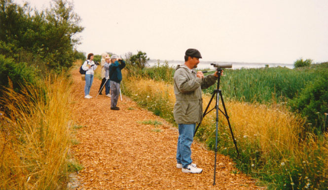
The next morning after I arrived in Eureka, Becky and Gil and I went to the Arcata Wildlife Refuge to see what new had shown up. Except for a kitten—not much. A very nice place.
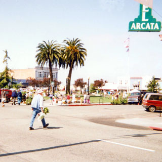
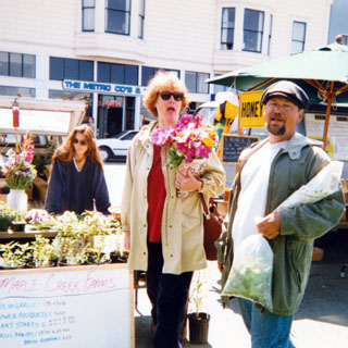
The above photos are of the Arcata farmers market. Incidentally, I stopped at the record store to get a CD of Hank Williams; primarily to find out the correct lyrics to one of his songs that had been running through my head for the better part of the trip, but I couldn’t quite get the words right:
Hear that lonesome whippoorwill
He sounds too blue to fly
The midnight train is whining low
I’m so lonesome I could cryI’ve never seen a night so long
when time goes crawling by
The moon just went behind a cloud
to hide its face and cryDid you ever see a robin weep
when leaves begin to die
That means he’s lost the will to live
I’m so lonesome I could cryThe silence of a falling star
lights up a purple sky
And as I wonder where you are
I’m so lonesome I could cry.(c) 1949, Hank Williams
 (the tune exactly matches the
rhythm of the Guzzi when it’s running at about 65 mph—sounds crazy, I know).
(the tune exactly matches the
rhythm of the Guzzi when it’s running at about 65 mph—sounds crazy, I know).
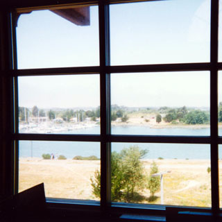
This photograph was taken from the second floor the Eureka library. What a place! Must be one of the best public buildings anywhere. Beautifully done.
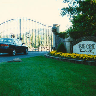
Becky and I left in the Mazdarati (Gil’s name for it) that evening for Sacramento. We took the Western route through Santa Rosa so that we could stop at the In-and-Out fast food place. Sounds goofy, but it really was good food.
These photos are of a really nice looking winery along the route. We spent the next day in Sacramento before returning the following morning.
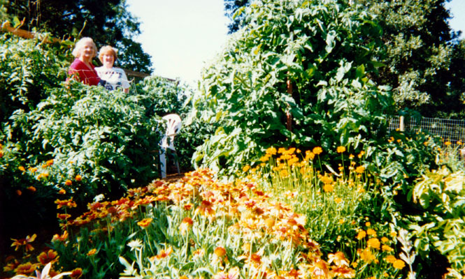
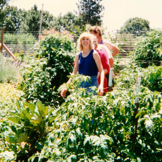
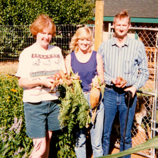
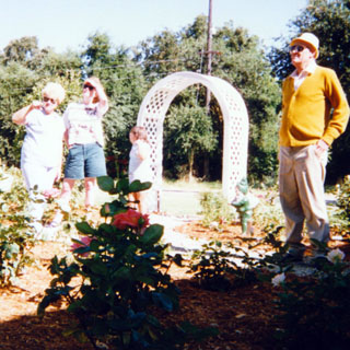
In Sandi and Larry’s incredible garden. Sandi’s holding her Super-Beet in the last shot.
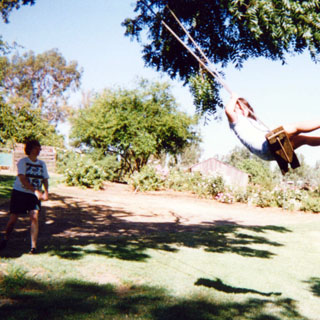
Sarah (daughter of Annette and Lewis) being pushed by Becky.
 The next morning I left Eureka (and remounted the motorcycle) and headed back
across Highway 299; except that this time I crossed the mountains into Redding (hot, as usual) and
back up the other side. Somewhere between Redding and Burney I stopped at a small café
for lunch. It turns out that I was the last customer. I don’t mean the
last customer of the day, I was the last customer of the business—for
ever, and I personally turned off the OPEN sign.
The next morning I left Eureka (and remounted the motorcycle) and headed back
across Highway 299; except that this time I crossed the mountains into Redding (hot, as usual) and
back up the other side. Somewhere between Redding and Burney I stopped at a small café
for lunch. It turns out that I was the last customer. I don’t mean the
last customer of the day, I was the last customer of the business—for
ever, and I personally turned off the OPEN sign.
Along the road to Alturas.
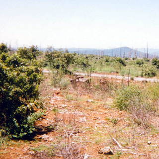
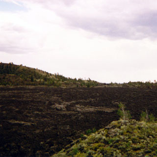
Just a few years ago there was a tremendous forest fire here.
Stopped for some road construction—somewhere near Goose Lake.
Oregon
Lake Abert; an area I found quite interesting. This is very barren land. There aren’t any towns, very little vegetation, and not too much traffic. The lake has no outlet so it’s quite salty. Even so, there are apparently some hardy brine shrimp living in it.
Wagontire, Oregon. There isn’t much more to the town than what you see in the above photograph. By the way, the town’s for sale if anybody wants it. There’s even an International airport (that's what it says) that goes along with it!
I really expected to spend the night in Burns, except that there was some sort of baseball tournament going on, so I continued on to Ontario.
Idaho
One of the main reasons for taking this route is that I thought I might finally be able to see Stanley and Sun Valley. After so many years of trying, things were looking good...
Rest stop just north of Boise, before I started climbing into the mountains.
I stopped for lunch at Idaho City (above photo) which didn’t impress me too much (the town, not the lunch).
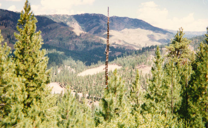
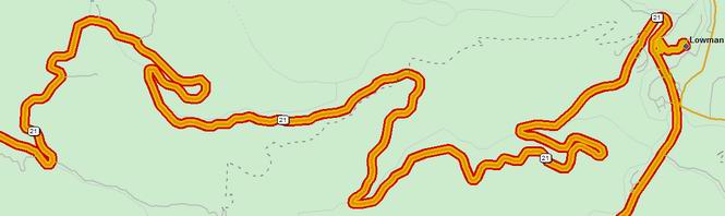
Near Lowman, Idaho. Once I got past the section of road used by the logging trucks, the quality of the road surface improved 100%. Spectacular views along here. An amazingly twisty road.
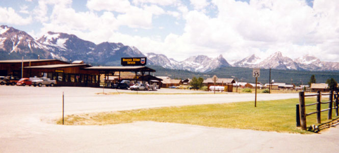
From Stanley looking back at the Sawtooth Mountains. Stanley. I finally made it.
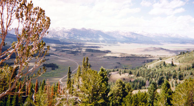
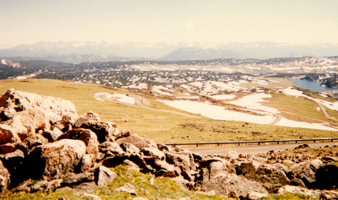
The above photo was taken from the Galena Summit looking back down the road and towards Stanley (which is to the right). The climb up to the summit was long and steep, but not very winding. The descent down the other side was quite curvy—a good road. For all of my efforts to see Sun Valley, I didn’t take any pictures. I should have; this is a very expensive looking place, BMW’s (cars not motorcycles) were quite common.
The road south from Sun Valley dropped quickly into the Snake River plateau—back to the heat again. I took a few shots at Craters of the Moon and went through the visitor’s center, but I didn’t spend too much time there. Several years ago I camped and spent more time hiking around.
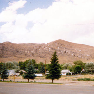
This last photograph (above) is of the bluffs behind the town of Arco. The earliest date I could find painted on the cliffs was from 1924. It looks like every graduating class since that time has painted their number on a rock.
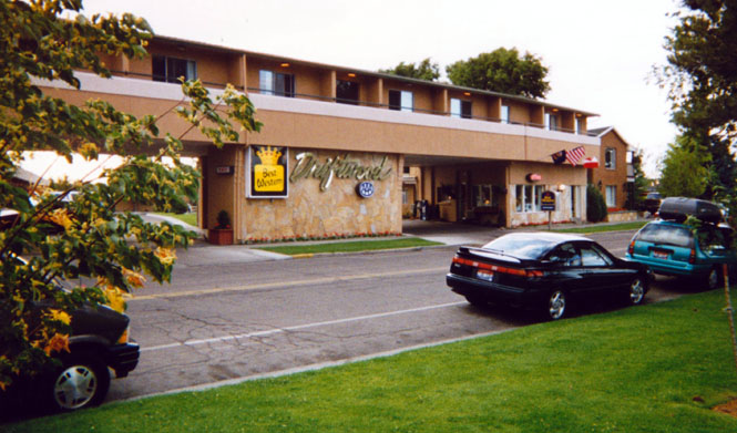
Because of a large range fire, I was diverted down to Blackfoot, and then north to Idaho Falls, where I spent the night. Photos below are all of the area near my hotel. A nice evening for a walk.
Wyoming
From Idaho Falls it’s a short ride along the river to Jackson, Wyoming (the town is called Jackson Hole by many people, although I don’t know why—nobody there calls it that) I think I’ve taken more than one shot that all look identical to this photograph—taken from the front of a Dairy Queen.
I had considered riding north to Togwotee pass and then down to Rawlins, but instead, I stayed on 191 through Pinedale and then Rock Springs. This gave me a chance to cover the 40 mile stretch of road from Farson to Rock Springs that I’ve never been on before (nothing special about it, I just hadn't been on it, before). I’ve about got Wyoming completely covered now—just a few minor state highways left to go and I'll have them all.
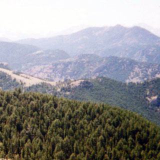
Pinedale has a lot of history related to the Fur Trappers Rendezvous. I went through their Mountain Man Museum on the outskirts of the town (above, taken from the museum, looking down on the town). Also had lunch—only noteworthy for being so bad.
Rawlins. Not a whole lot to see here, but you can sure see it for a long distance.
I spent the night at Laramie.
 Colorado
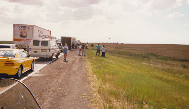
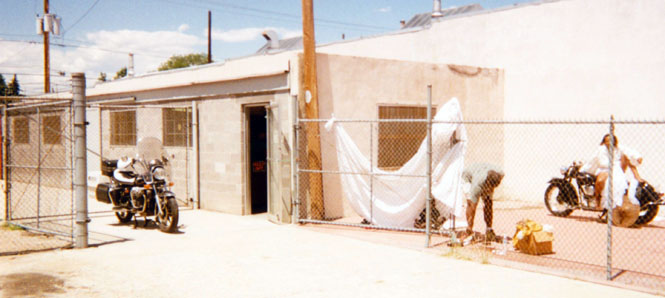
Nothing seemed to work out too well the next day (photo is of a Life-Watch helicopter leaving the scene of an accident along the freeway) and I didn’t get any farther than Denver before stopping for the night. This last photograph is of the Guzzi shop in downtown Denver. This is the side of the shop; the front looks a bit more presentable. There was a photographer taking pictures of a model sitting on an old Indian Chief (motorcycle) for a calendar designed along the theme of "Women of Color and Old Cars and Motorcycles."
After the late start out of Denver (you'll read more about that below) I spent the next night in La Crosse, Kansas (post rock capital, and barbed wire capital). That night I walked to a nearby dirt-track and watched some pretty good car races. I caught a ride (quite literally) back to the motel by hanging onto a trailered race car (at the invitation of the person driving the truck pulling the trailer).
Kansas
Really great trip. About 6,000 miles.
Notes:
Motorcycle Problems
I have to say that the bike really did just fine for the trip. I’m the one who let it down.
The broken speedometer In South Dakota. As it happens, I had a backup, auxiliary speedometer so the only thing I missed was the odometer and a record of the miles ridden between the Black Hills and Seattle (as well as a way of tracking the distance before the next fill-up).
Another incident happened in Wyoming. Rolling into a service station I heard an unpleasant mechanical sound. For an instant I thought of all sorts of awful things that could be wrong. Instead, it was the horn bracket that had fatigued in two, and the horn had fallen off, supported only by a single wire. The bike has two horns (a very fail-safe motorcycle!), so I just put the other horn in the trunk.
The last problem about drove me nuts. During much of the trip, the bike would intermittently run terrible, then great, then terrible again. It exhibited virtually every engine-problem symptom you could think of. Thinking bad-gas, I drained the carburetors (several times during the trip). I thought the jets might be plugged, so I took them all out and thoroughly cleaned them with carb-cleaner. Still no help. At higher rpm’s the bike would (sometimes) run awful. Sometimes it would fire right up, and other times it wouldn’t fire at all. Sometimes it would bark loudly during deceleration, and then it wouldn’t. About 40 miles this side of Denver, I was cruising along at about 65 (speed limit 75), when the engine just quit pulling, and wouldn’t run faster than 50. I pulled into the nearest small town and tried everything I could think off. I borrowed a strobe light to check the spark at all rpm’s—everything looked just fine! I didn’t see running that way all the way to Wichita, so I turned around (horrors!) and rode back to Denver. After the long wait for the Life-Watch helicopter (see text), the bike ran great! I could roll on the throttle, and it would respond with all the power I needed. Just when I was about to turn around again, it started acting up. At this point I thought I had confirmed a bad coil that was affected by heat. Well, to speed this up… At Harry’s Motorcycles (fourth generation run, since 1927) Greg did a quick check of the static timing and found it to be way too far advanced. When I told him that I always checked it dynamically at high rpm’s a light-bulb went off in our collective heads. The automatic advance was stuck! Had to be. And it was. After cleaning all the corrosion off of the mechanism and lubricating all the parts that I had forgotten about (sigh...), the bike ran like it hadn’t for some time. It was great! It now starts on the very first piston stroke every time, it runs cooler, smoother, and quieter. It’s very gratifying to find the one thing that will fix all of your problems.
Bugs
Why is it that bugs always aim for my left eye? Even though I ride behind a windshield, have a helmet face shield, and wear glasses, I still seemed to get a bug or other airborne stuff in my left eye at least every hour. The problem is that I just have to live with it—can’t even rub my eye. Once it was so bad that I had to stop to pull the remains of some creature out. At least two legs anyway.
What kind of bike is that?
I’m beginning to think that nobody knows what a Moto Guzzi motorcycle is. I was asked several times, even by people riding a motorcycle, what I was on. A typical session runs: "What’s that?" It’s a Moto Guzzi. "Who makes it?" Moto Guzzi. "Yes, but who makes it?" Clearly there is no end to this, but I find that if I say "It’s made in Italy" that they’re usually satisfied. I think that they expect to be told that it’s a Honda Moto Guzzi. My favorite was a Harley rider who, after admitting that he had never heard of Guzzi, still said that he was a real "bike buff".
Best Road on Trip
A toss-up between highway 12 across Idaho, and the Chief Joseph highway in Wyoming.
Best Area
Anyplace where the weather is good, the road is smooth, and the engine is running well.
Motel Prices
The most expensive was $95 in Denver. The least expensive was the very next night in Kansas at $22. There isn’t much correlation between price and quality—just whatever they can get away with...