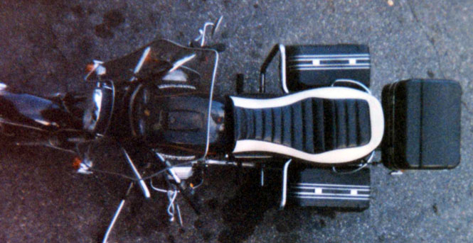
August 1997

Sunday |
Monday |
Tuesday |
Wednesday |
Thursday |
Friday |
Saturday |
17 August |
18 |
19 |
20 |
21 |
22 |
23
|
24
|
25
|
26
|
27
|
28
|
29
|
30
|
31
|
1 September
|
2
|
3
|
4
|
5
|
6
|
7
|
8 |
9 |
10 |
11 |
12 |
13 |
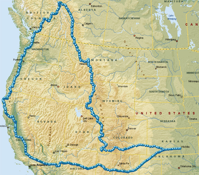
I managed to get off two good-sized trips this year; the first one took me to the southeast as far as South Carolina, and this, the longer one, took me in the opposite direction--well into British Columbia.
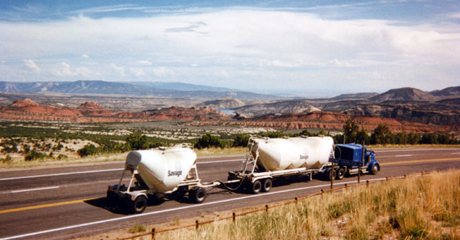
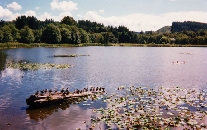
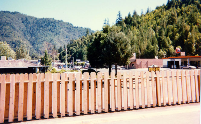
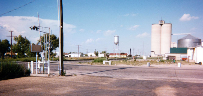
 Kansas
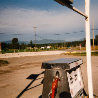
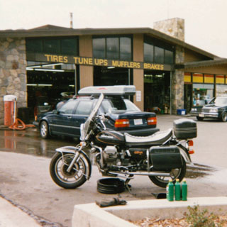
The initial stretch was straight west from Wichita on US 54 through to Dodge City on US 50 and then on into Colorado. The photograph was taken from a small restaurant in Holly, Colorado that I’ve stopped at several times in the past.
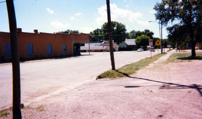
Poor Holly has seen better days. At one time this was a major sugar beet growing region (perhaps—I'm guessing here—Holly sugar comes from the town’s name—or perhaps it’s the other way around) but, that was many years ago. The temperature was somewhere near 95°.
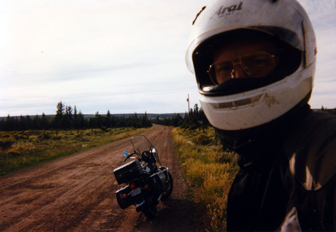
 Colorado
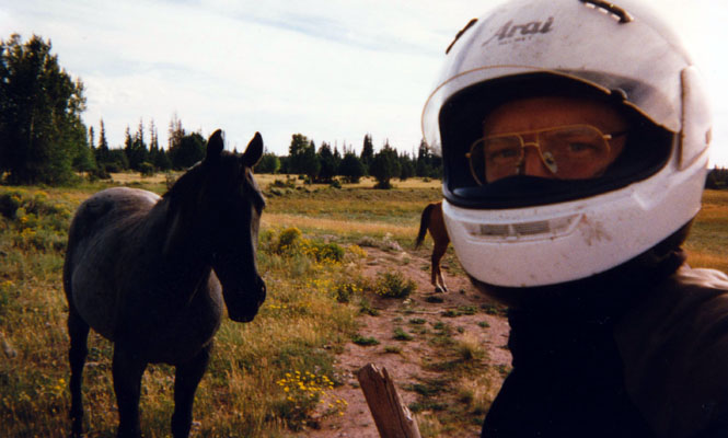
 At this point in the trip, I didn’t really have anything but a general goal
of where I was heading. I had considered Jasper (Alberta)
earlier,
but the weather didn’t look too promising in that direction at the time, so I
thought I’d just wander a bit to see what opened up.
At this point in the trip, I didn’t really have anything but a general goal
of where I was heading. I had considered Jasper (Alberta)
earlier,
but the weather didn’t look too promising in that direction at the time, so I
thought I’d just wander a bit to see what opened up.
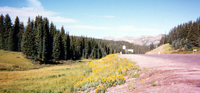
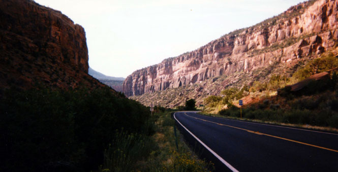
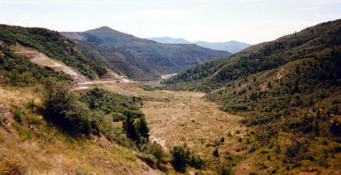
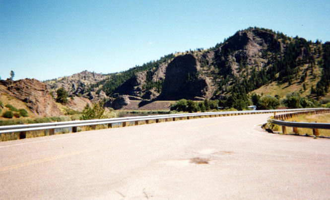
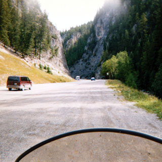
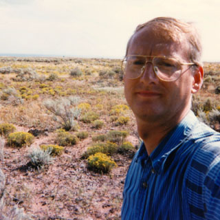
At La Junta I turned off the "major" highway, for something more interesting—state road 10. There’s a 100-mile wide strip of land that extends from New Mexico up through Canada along the eastern slope of the Rocky Mountains that remains one of my favorite regions. Within this huge region there are no towns of any size, and very few roads. In fact, I doubt that there are even very many fences. At the mid-point along Highway 10, at some of the rises, you can see for miles in all directions and not see so much as a telephone pole.
Once passed Walsenburg, it started getting quite cold as I approached the mountains.
Eventually, I had to pull over and replace my light gloves with the warm ones and add
another layer under my riding suit. When I reached La Veta Pass (9,300 ft.) it
was raining quite hard, but luckily not freezing. The sun was about 20 degrees
off the horizon when I descended down to Fort Garland, and behind me was the
most intense double-rainbow I’ve ever seen set against the black backdrop of the
thunderstorm I’d
 just
ridden through. Really spectacular (too cold to stop and take a picture--anyway,
those rarely turn out)
just
ridden through. Really spectacular (too cold to stop and take a picture--anyway,
those rarely turn out)
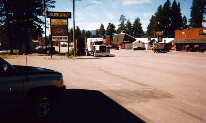
I stopped for the night in Alamosa, Colorado. This shot was taken the next morning when it was quite chilly out. I ate dinner at a nearby Subway where I was entertained by a very fussy man: he spent at least 15 minutes trying to sort out just what type of sub sandwich he wanted (I wasn’t going anywhere, so I didn’t mind waiting). Even after they finally prepared it exactly the way he wanted it, he would return to the counter several times and inquire about a particular item—"what kind of tomato is this? I think you put on too much lettuce." My favorite, was when he returned with his cash register receipt and went over with the poor server each line-item. Ordinarily I’d guess that he was a plant from the corporation doing a quality check except that his overall look suggested that he came about his eccentricities honestly.
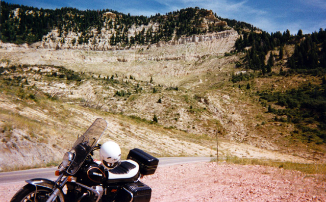
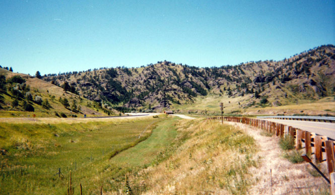
I stayed on Highway 160 and crossed the continental divide at Wolf Creek Pass (10,500 ft.). Somewhere along here I lost my key ring containing my house, car, and rear trunk keys. Luckily, I keep a spare set of motorcycle and trunk keys in my riding suit, so it wasn’t too inconvenient for the trip. Still a nuisance though. This photograph was taken right at the Pass. There’s a short series of nature paths leading off into the meadows to the left. Beautiful weather by this point.
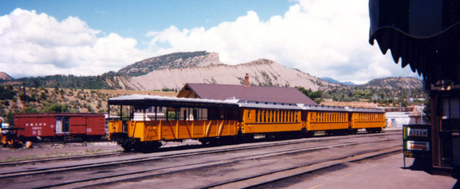
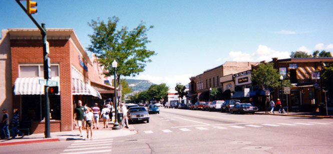
Continuing on highway 160 I rode through Pagosa Springs, and then into tourist destination of Durango. The next few shots are identical to some I've taken on previous trips—but here they are again.
The station for the Durango – Silverton Railroad. Someday I’ll take the trip, but I do need to plan ahead a bit so that I arrive on time. Trouble is, I’m terrible at that sort of long range planning.
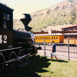
Even though they have a good collection, it still doesn’t appear to be nearly as extensive as what is in Chama, New Mexico. Both of these towns are the last remaining remnants of the Denver Rio Grande Railroad narrow gauge lines. In Chama, nobody cares if you snoop around the cars. Here, it’s all fenced off.
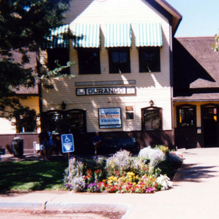
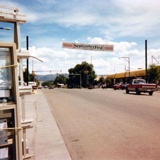
Downtown Durango. I ate lunch at a Mexican restaurant about halfway down the block on the left. It looked good from the outside, had fountains inside with trickling water, lots of painted tile, plants all over… Unfortunately, the food was terrible; should have gone to Subway.
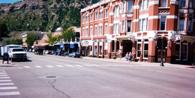
Shot looking back at the corner from which I took the previous picture. That’s still a working hotel.
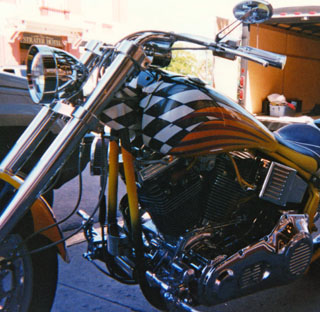 There was some sort
of Harley event planned for the weekend. I doubt that this particular bike has ever been
ridden on the highways, but it is a very good example of what it is and example
of. I overheard someone saying that they were expecting over 30,000 bikes. Oh,
my. Time to go.
There was some sort
of Harley event planned for the weekend. I doubt that this particular bike has ever been
ridden on the highways, but it is a very good example of what it is and example
of. I overheard someone saying that they were expecting over 30,000 bikes. Oh,
my. Time to go.
Along this point, I
had to come to some decision as to where I wanted to go. Since there were a few roads yet in western
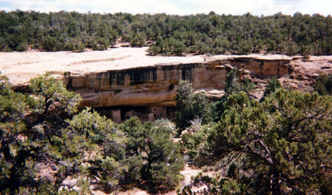
Colorado that I hadn’t been on yet, I aimed for them. But first, I dropped into Mesa
Verde National Park. I was last here several years ago, and spent the night in a tent. This
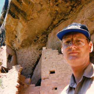
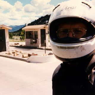 would be just a fairly quick pass-through. The photo is at the entry station to the park.
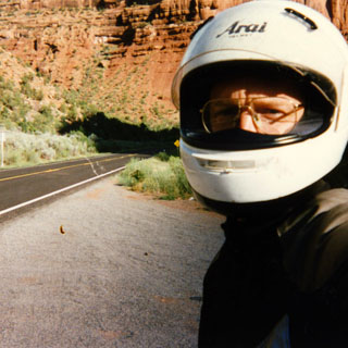
Really, I did clean (and wax) my helmet before I started this trip--as I always
do.
would be just a fairly quick pass-through. The photo is at the entry station to the park.
Really, I did clean (and wax) my helmet before I started this trip--as I always
do.
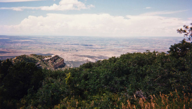
Look closely below the cliff and you can see the dwellings. Dwellings. I think that’s acceptable. The park is involved in renaming things from their old Euro-centric names to something that is more acceptable to people who didn’t accept the earlier names. One of the key items is the name "ruin." Apparently that word suggests bad things (about the people who were once here) to some people. So these are not ruins, they’re uninhabited dwellings (can’t call them abandoned either). Sigh…
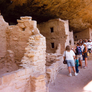
There’s a very nice semi-paved path that wends its way down to the site.
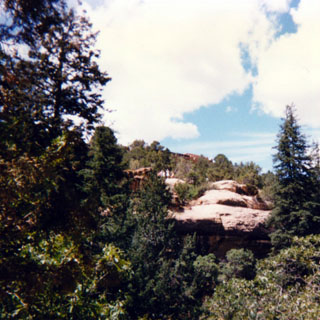
This was taken from the highest point on the Mesa. We’re looking northwest. At this time, I’m still trying to sort out where I want to go. Those clouds looked pretty dense to me (and they were).
I wish that this shot had turned out better (too much haze). In the scale of the shot, Shiprock rises about ¼" above the horizon pretty much in the center of the picture.
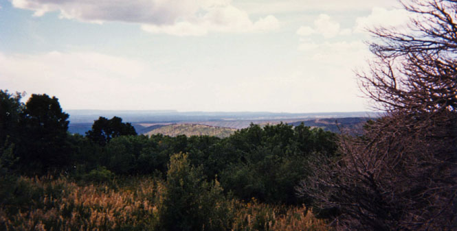
From this vantage, there’s no doubt how it got its name. The amazing thing is that it is at least 40 miles south. I seriously considered heading south, but since the temperature was now approaching 100 degrees, I decided to keep going northwest—the probable rain not withstanding.
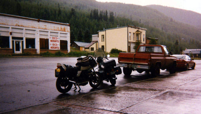
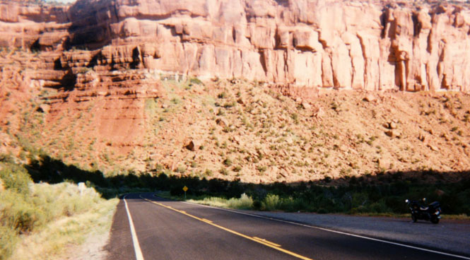
This was a fun part of the trip. This region of Colorado is rarely visited—mainly because it’s so inaccessible. Just shy of Cortez, I turned north on highway 145 to Dolores and then on up the river to Rico where this picture was taken. By the time I reached the town, the rain was coming down much too hard to even see adequately. So, I stopped at the local café for a light lunch (salad). The white bike next to mine with the yellow New Mexico plates is a Moto Guzzi Lemans. I never did see the owner, though.
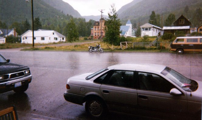
Looking across the street towards the old courthouse. Eventually, the rain lightened up enough so that I was able to ride on over Lizard Head Pass (10,200 ft.). It was snowing lightly at the top, so I didn’t bother to take any pictures.
Once down the other side, I rode on into Telluride. This is about as upscale a ski resort as you can find anywhere. The photo is looking east towards the San Juan Mountains. The pavement ends not far from here, but I know a person who has taken a trail bike up and over the hill. That’d be quite a trip.
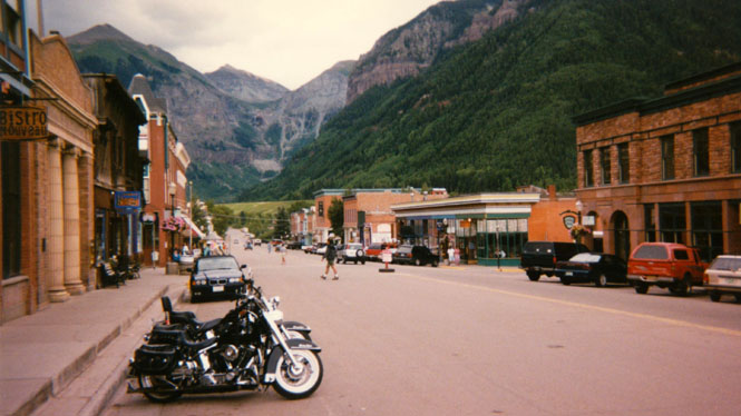
View from the same spot looking towards the west. To the right of the picture was a mountain-bike store (least expensive—$1,900). Conversation in store: What kind of bike is that? Moto Guzzi. Who makes it? Moto Guzzi. Yes, but who makes it? It’s Italian. Cool, but I want a Harley. Sigh…
 From Telluride I
stayed on highway 145 west towards Naturita, where I spent the night. This
photograph was taken
the next morning. As I was walking through the town that evening (which didn’t take too
long) I passed a couple of high school boys who were playing golf "catch." They
were facing each other (about 150 yards apart) and were hitting a golf ball back and
forth. Occasionally, one would hit it too far, and the ball would go bouncing down the
street. I asked one of them if they had broken any windows yet, and he said he didn’t
think so. Looked like fun though.
From Telluride I
stayed on highway 145 west towards Naturita, where I spent the night. This
photograph was taken
the next morning. As I was walking through the town that evening (which didn’t take too
long) I passed a couple of high school boys who were playing golf "catch." They
were facing each other (about 150 yards apart) and were hitting a golf ball back and
forth. Occasionally, one would hit it too far, and the ball would go bouncing down the
street. I asked one of them if they had broken any windows yet, and he said he didn’t
think so. Looked like fun though.
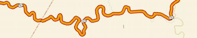
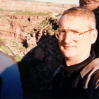
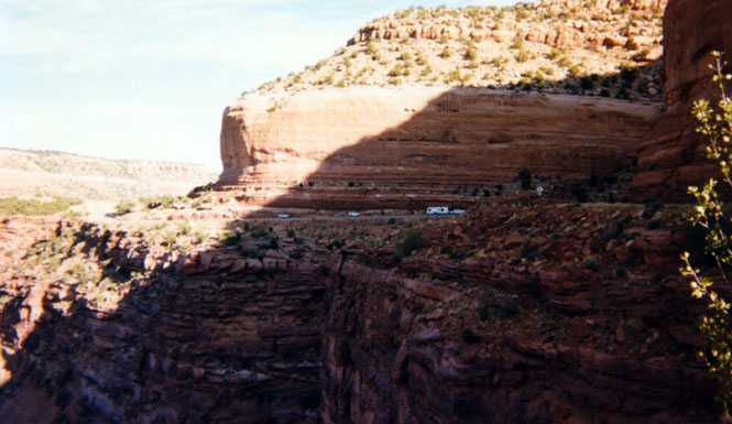
I really enjoyed this road: Naturina to Grand Juction along highway 141. That’s the Dolores River. One of the great motorcycle river roads.
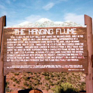
If you look closely on the side of the cliffs closest to me (in both pictures) you can see the remains of a flume that was built sometime in the 1890’s for gold mining.
You can see a few cars on the road. There was very little traffic, and I had to wait some time for these cars to show up and take their positions in the photograph.
This explains the flume that you probably weren’t able to see (and, I'm sure that you can't read the sign here either).
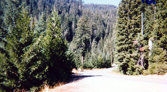
Many miles of the road followed the river within a narrow canyon. I wanted to stop and get a picture, but there weren’t any good places to stop, and besides I was having too much fun anyway. You can get some idea of the road from these photos.
The road surface was perfect. Not sure why they bothered really, since there was hardly any traffic at all.
 Sometimes what looks
spectacular in person looks quite ordinary in photographs. But, trust me. This
is spectacular country.
Sometimes what looks
spectacular in person looks quite ordinary in photographs. But, trust me. This
is spectacular country.
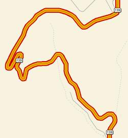
From Grand Junction I jogged over to Loma, and then north on highway 139 to Rangely. If you happen to have a Colorado map handy you might take a look at this stretch.
This shot was taken from just below Douglas Pass (8,300 ft.).
I think that in a previous trip I took a shot from near the top of the pass. You can see the road coming up the box canyon off in the distance.
It really is a box canyon. The long valley just ends suddenly, and the road makes several steep switchbacks to get over the pass. The area just below the tree line is all road-cut. It doesn’t look so steep in the picture, but trust me, it was.
 Things are looking up
in Rangely. The last time I was here (three years perhaps) the town was dying and dirty.
This time it looked quite good. Apparently Conoco is back in town working the oil fields.
The shot was taken from the front of a café where I had lunch. This time the
entertainment was provided by an old-timer and his waitress. The whole time that I was
there, they shot insults back and forth—even when she was back in the kitchen. Her
food, his looks, her dress, his manners, her hair, etc. They were both good at it. I
imagine that they’ve known each other a very long time.
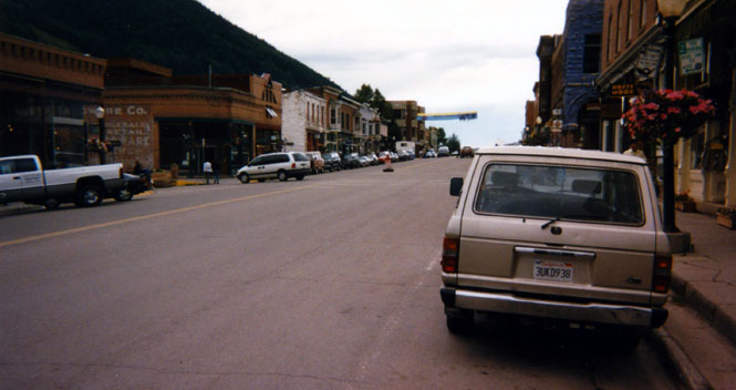
Things are looking up
in Rangely. The last time I was here (three years perhaps) the town was dying and dirty.
This time it looked quite good. Apparently Conoco is back in town working the oil fields.
The shot was taken from the front of a café where I had lunch. This time the
entertainment was provided by an old-timer and his waitress. The whole time that I was
there, they shot insults back and forth—even when she was back in the kitchen. Her
food, his looks, her dress, his manners, her hair, etc. They were both good at it. I
imagine that they’ve known each other a very long time.
 Utah
Utah
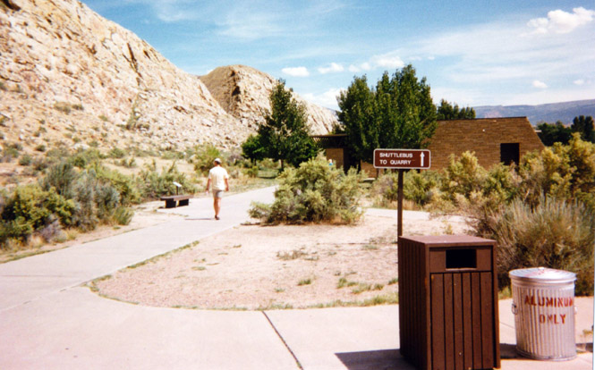
Since I’d revisited Mesa Verde, it seemed reasonable to revisit Dinosaur National Park as well. Things have changed quite a bit. The last time I was there (ten years perhaps) the parking area was right next to the visitor center. This time, there was a new parking area below the hills.
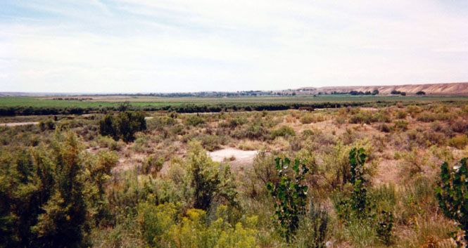
The shot on the right was taken from the parking lot, looking south across the valley.
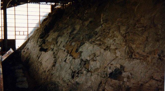
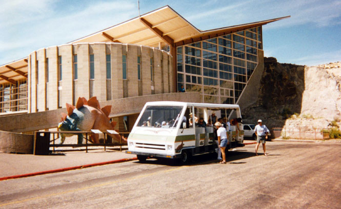
A tram left the parking lot every 20 minutes or so and climbed the hill up to the main excavation area. The last time I was here they were still taking bones (strictly, fossils) from the site. They’ve stopped that, and have frozen the site from any future diggings.
Cute little vehicle there. This happened to be National Park Day so everybody got in free.
A ranger gave a talk on the National Park System, which was appropriate for the day, but clearly morale isn’t what it should be. He went over a whole array of problems that the Park System had. Not the least was money. The money that is collected (from entrance fees) is (mostly) sent to the general fund, and not the park system. Further, when congress does appropriate money for the parks, they want to see something tangible for their money. So consequently they assign funds for new visitor centers (their favorite) but at the same time have taken money away from rangers. Which means that while Mesa Verde is building new exhibition centers, they no longer give evening campfire programs. They also don’t get paid anything close to what their education should warrant. None of the rangers at Dinosaur made over $10/hour.
 Wyoming
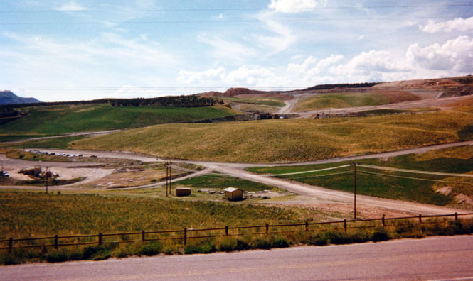
From Vernal I turned north on 191 towards Flaming Gorge. Chevron operates an enormous surface mine in this area. Trouble is, I can’t remember what it is that they mine. Phosphorus? I don’t recall any of this the last time I came through here on a motorcycle (eighteen years).
The colors in this area make for interesting photographs.
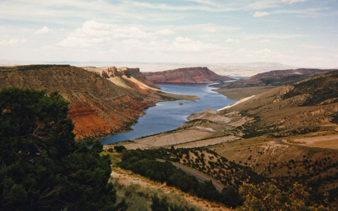
Flaming Gorge National Recreation Area.
Before I reached this point, I had to cross over the Uinta Mountains. This is a rather high range, and one that is unexpected. The first time I crossed these mountains was on the old Guzzi Eldorado. From the map I had, I thought it would be somewhat hilly, dessert-type terrain, so I didn’t bother filling up in Vernal. It turns out that the road distance is much farther than the crow distance--not to mention the hills. It got to the point where I was running out of gas on the down hill stretches (the fuel lines run from the back of the tank), and only getting fuel going up hill (which is certainly better than the opposite). No problems of that sort this time through.
Taken from the same point, except looking northwest—the direction I was heading.
Let me offer an excuse. The map I was using didn’t show any towns along highways 43/414 to the intersection with I-80 (take a look at any map you have). Combine that with the Wyoming sign system, which is as bad as anything Oklahoma has ever thought up. So when there was a sign in Mountain View (again not on my map) that said Robertson – nine miles, I figured that Robertson must be at I-80, so headed there. Well, this is Robertson. Population: 2 Horses.
And this is what the road looks like after Robertson. At this point I pulled out the official Wyoming state highway map to check where I was. I considered staying on the dirt road anyway, but I wasn’t certain that there would be a bridge a Muddy Creek, and I didn’t like the sound of Muddy Creek anyway. So, I turned around and headed back to Mountain View and turned north on 412 (or was it 414, or perhaps 410—never could tell). The road north to Kemmerer was great fun. The surface wasn’t too bad, and there was absolutely no traffic, so I had things wound up pretty good. When I came to the town of Carter, Wyoming, I didn’t slow down much at all, which is when I saw the railroad crossing. Wow; I didn’t think a fully loaded Moto Guzzi could jump so well (now don’t think that I was blasting through some defenseless town—Carter consists of four ancient false-front buildings right off a movie set, and no people). I spent the night in Kemmerer (proud home of John Cash Penney and the J. C. Penney Mother Store).
"Nice bike." Thanks; nice car.
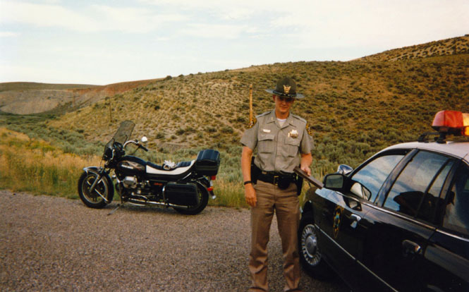
The officer was good humored, and only gave me a warning.
 Idaho
Idaho
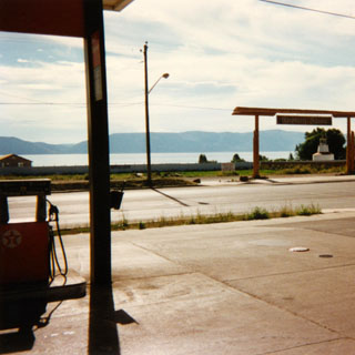
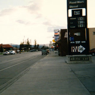
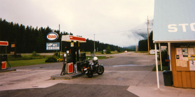
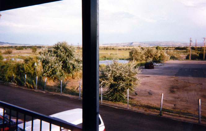
I thought about stopping at Fossile Butte National Monument, but it wasn’t real exciting the last time, so I just rode on past. The officer (see above) told me that there was construction on Highway 30 north of Sage, so I rode into Utah on Highway 30 (can’t these people get together and avoid labeling two highways, across the state line from each other, with the same number?). This shot was taken of Bear Lake from Garden City.
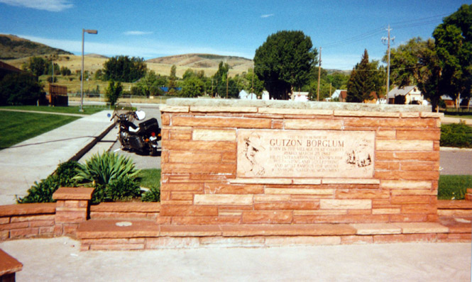
I believe this is Fish Haven (Idaho), but there were a number of similar small towns along the lake. This is a memorial to Gutzon Borglum, the builder of Mount Rushmore.
I’m standing in the middle of U.S. 89. No Fear. I stayed on 89 to Montpelier and then back over to Wyoming.
Wyoming
From about Garden City to near Afton Wyoming I played leap-frog with a Mercedes with California Tags (and a Los Angeles Dealer’s name on the license frame). Every chance they had, they’d roar by me only to be held up by traffic, or a light, or construction, at which point I would cruise right past. My favorite was when they came to a long stretch of single-lane highway/bridge that was controlled by a construction light. They had apparently run the red light, only to loose their nerve when they came to the one lane bridge under construction and couldn’t see if any traffic was coming their way. So they pulled onto the dirt and waited for someone to come along (someone who obeyed the traffic light) so that they would know it was clear. That someone was me, and when I passed them again it must have been for the fifth time.
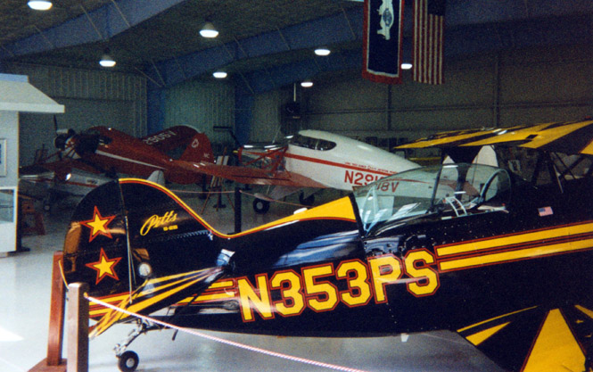
Afton Wyoming is the home of the Pitts Special (airplane), and, earlier, was the home of Call-Air. This photo shows a Pitts in the foreground, and a Call-Air in the background. Call-Air’s are ugly airplanes no matter how long you look at them.
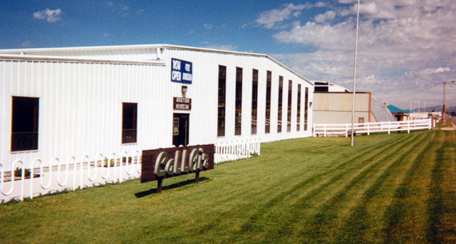
There is a very nice museum for the Call-Air. The people who built it (the museum) were very proud of their aviation history, and wanted to show it. I was the only one there.
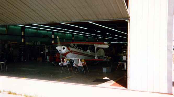
Another company--Aviat--is still making airplanes in the factory that once made Pitts, on the same airport that made Call-Air’s. An engineering intern gave me a tour of the factory. Not to confuse you, but that’s a new Pitts coming out the door. Aviat bought the rights to make Pitts.
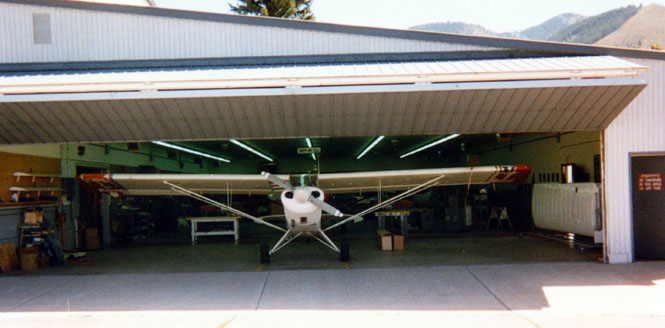
An Aviat Husky, which is a clone of another airplane (the Piper Cub).
After eating at a Pizza Hut in Afton, I rode through Alpine and then on into Jackson. Funny thing; without trying, I think I’ve been through Jackson each of the last four years.
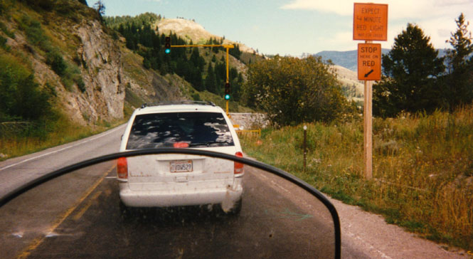
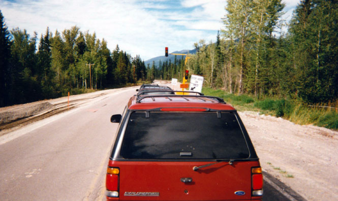
Road construction along the Snake River. The sign said to expect a four-minute wait. So, I pulled my gloves off and started to take a picture. Suddenly, the light turned green, and I wasn’t ready at all. I rolled to the side to let the other cars go by.
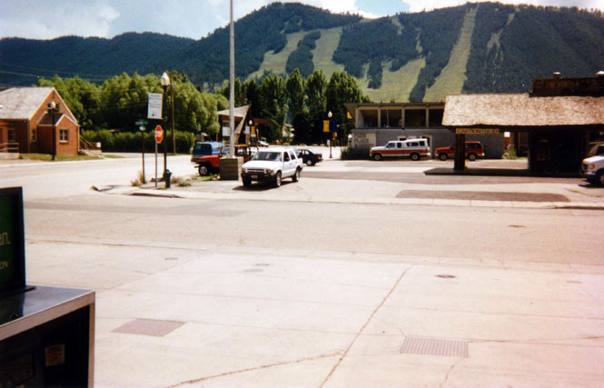
This is a traditional picture. Taken from Chevron Station just north of Jackson looking south onto the ski slopes. I should have a whole collection of just this shot. Next stop, the Dairy Queen just up the road.
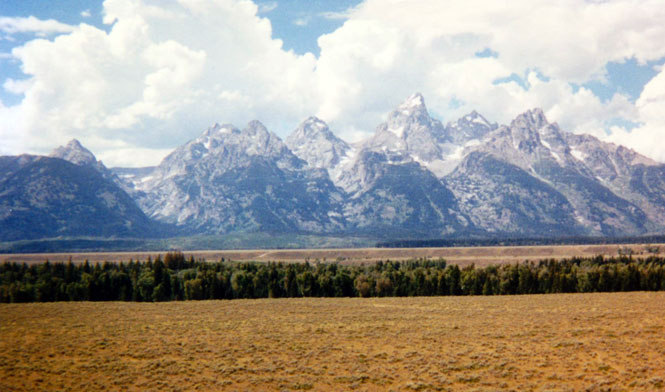
The Grand Tetons.
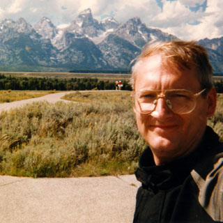
I’m sorry to say that the photograph that I really wanted didn’t come out. I took a picture of the mountains that are behind all the photographers when they’re shooting the Tetons. Felt sorry for them. The last shot of the roll (in the single-shot camera I used) often doesn’t come out, and this had been the last shot.
Entrance to Grand Teton National Park.
Entrance to Yellowstone National Park. I had planned on riding through Yellowstone and spending the night in Bozeman. That didn’t work out.
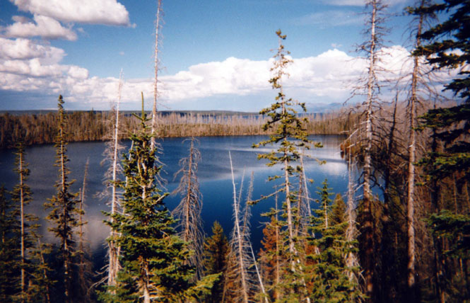
Not too far north of West Thumb, the park rangers had closed off the highway due to a bad car accident farther up the road. They couldn’t say how long it would be, but it would probably be less than the time it would take to drive all the way around the Yellowstone loop highway, so I just parked and waited. I couldn’t tell you what lake that is.
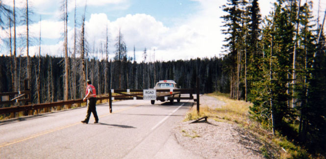
I spent much of the waiting time (2 ½ hours) talking with a man who was traveling with his wife around the country. He was close to 80 years old, and had been retired for some time. They were actually doing what many people set out to do, but don’t: they were living out of a motor home, and just touring the country. Sounded like he loved every bit of it. We had a great time talking over the places we each had been.
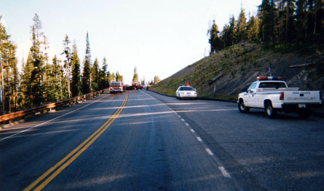
Once the road was opened, a ranger (I was at the front of the line) led us to the point of the accident. I only saw a single car, and couldn’t quite tell what had happened. There were four separate ambulances used, along with a life-watch helicopter.
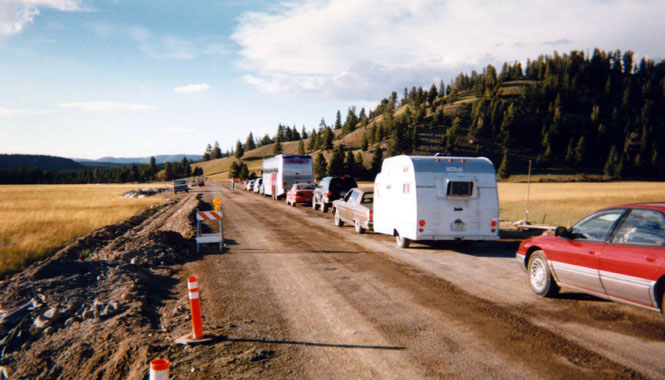
I saw my share of this sort of thing on the trip. The section of road from Old Faithful (no, I didn’t stop) to Madison was being replaced. These two pictures are the straight parts. I didn’t stop at the curvy, hilly portions, so there aren’t any pictures.
What made it even more of a challenge, was that they watered down the road in some areas with a water truck. I’m sure it kept the dust down, and I’m sure those folks in cars appreciated it, but I wasn’t at all thrilled. Miles and Miles of rough muddy road.
Between the accident and the road construction, I didn’t get as far as I thought I would. This is a shot of West Yellowstone where I spent the night. Just down the road a bit, and to the left is the old West Yellowstone depot.
It has been converted into a museum. I went through the museum and found it only so-so. However, afterwards, I talked with a man who was trimming the lawn out front, and found him much more interesting. He was in his mid-eighties, and had grown up in the area. He was able to tell me all about the depot and what it was like when the tour trains rolled into Yellowstone. He was still angry at the recent decision to tear up the rails. Now there’s no possibility that trains will ever return.
 Montana
From West Yellowstone I was finally able to pick up a road that I’ve never been on, and it’s always bugged me—191 north to Bozeman. With this last road I’ve now been on every road that leads into Yellowstone Park. The road follows the Gallatin River most of the way, which makes it a great swooping motorcycle road. Hence, no pictures. I’ve been through Bozeman off and on through the years, but the outskirts are becoming unrecognizable. Where are all these people coming from, and what do they do here? From Bozeman I jogged west a bit, and then north on 287 to Townsend, another new road.
I’m not a big fan of freeways, but I-15 out of Helena is beautiful. I had intended to pick up a small road north to intersect highway 200, but kept missing turns (nothing was labeled).
Taken at the small town of Wolf Creek. I missed yet another chance (my third!) to turn north.
Staying off the freeway, I kept on the old highway on the east side of the Missouri River. Turned out that there was no access to the same roads that hooked up to the freeway running on the west side. Eventually, 30 miles down the road, I was able to get back on the freeway and head back south so that I could catch highway 287 and head north again.
The view looking back down the freeway. I had been on the old highway.
I do wish I had taken a picture along here. Highway 287 intersects 200 which then angles back towards the southwest. This particular road is one I’ve wanted to ride on for some time, and it didn’t disappoint. For many miles it runs over steep, rolling treeless prairie lands (think Palouse Hills in Washington) when suddenly the Rocky Mountains loom up. It’s such a dramatic view that there was even a sign on the side of the road that said simply "Rocky Mountains." It reminded me of the way the lower Sierra’s look from the Nevada side—Enormous mountains rising out of a vast, empty land. Poetic.
And this is Ted's old hangout. Theodore Kaczynski that is. Having grown wary of small, homey restaurants for the time being, you’ll notice that I’m at a Subway again. There was nothing in Lincoln to suggest the Unabomber, and I certainly didn’t bring it up.
Turning north on highway 83 I headed towards Kalispell. There was quite a bit of construction on this stretch, and once again I got to fight the slippery work of the water truck.
I considered riding into Glacier National Park, but then I’d be on roads that I’ve already ridden. So I stayed the course, and spent the night in Eureka, Montana.
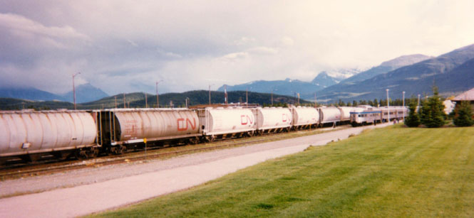
 Canada
 British Columbia
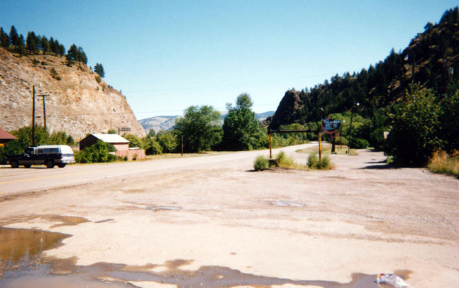
After an uneventful crossing into Canada I stopped in Jaffray to get fuel and the correct color of money. After paying a frightful amount of money for gas I pushed the starter button. Nothing. Hmm. I took my helmet off, and was able to hear the starter relay click, so I knew it wasn’t too serious. I removed each of the wires leading to the relay, cleaned the connectors, and put everything back in place and it started right up. That was the only motorcycle problem the entire trip. Too many muddy roads apparently had mucked things up (this problem was eventually fully solved by rewiring the starter switch solenoid with a direct connection to the battery, but it lasted for this trip with just the cleaning).
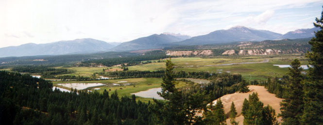
The Columbia River valley (take a look some time at a map and trace that river’s path in Canada. It runs all over the place—north and south)
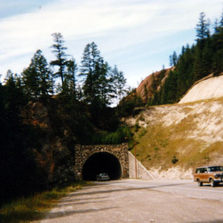
I had a perfectly awful breakfast in Radium Hot Springs (consequently, I do not recommend eating sausage when in Canada). This photo shows the road leading into Kootenay National Park. This park is connected to Banff and Jasper Parks (and perhaps others) to form one very large park, indeed. The entrance fee to one counts for the others.
Just beyond the entrance, the road went through a very tight canyon called "eye of the needle" or something similar. I didn’t get a picture of it (no place to park), but I did stop not to far up the road to get a shot of something similar to it.
 Alberta
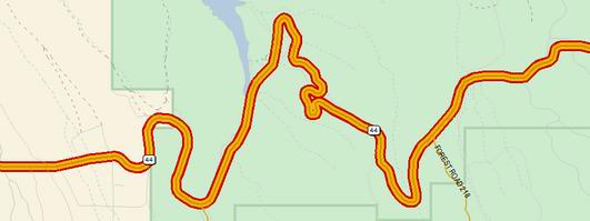
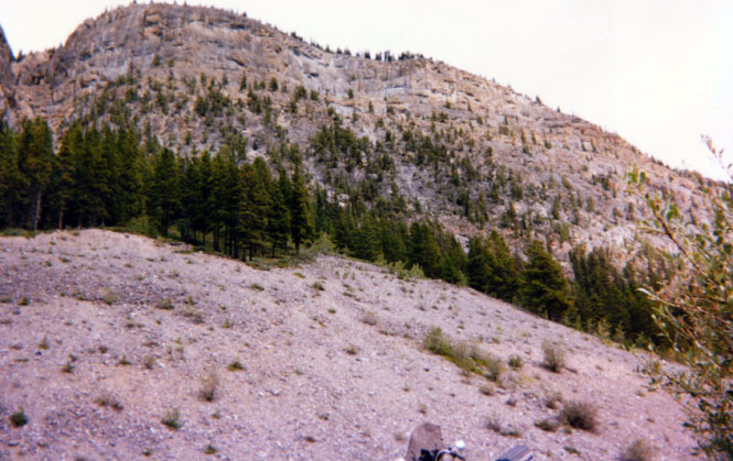
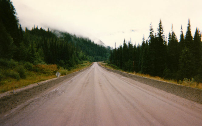
The road down into the valley--after crossing the divide again--was noteworthy for its steepness. I’ve mentioned that the Canadian roads are steep. Well, this was something else again. It was a very long, straight, downhill 10% grade. There was no need of a runaway truck ramp since there were no curves (but that stop at the bottom would be a problem). I could read the print on the tires of trucks coming up the hill, they were moving so slowly. I think you could walk up the hill faster than they were moving. No chance that this road would be built this way in the U.S.
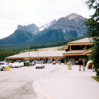
The Visitor Center and Mall at Lake Louise.
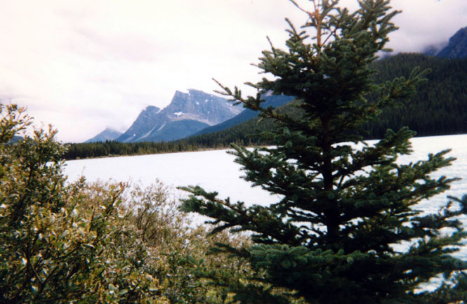
Somewhere along the Sunwapta River within Jasper National Park.
There were mountain goats up on the cliff according to other people around, but I never saw them.
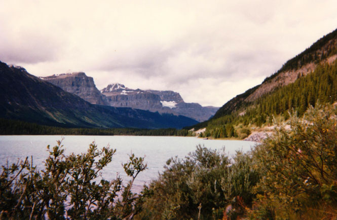
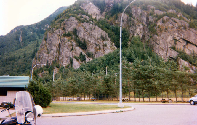
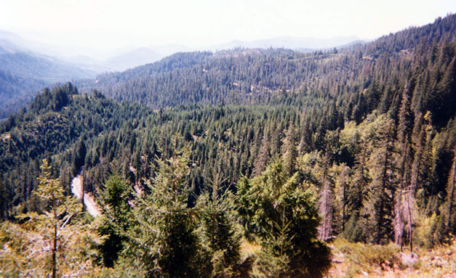
This is a spectacular valley. Imagine Yosemite Valley, and then make it 100 miles long. Both sides of the valley have long shear cliffs at all different angles. Behinds them are tall, snow-covered mountains.
View from the lookout looking back down the road.
A view looking east (the old pass road is someplace down there).
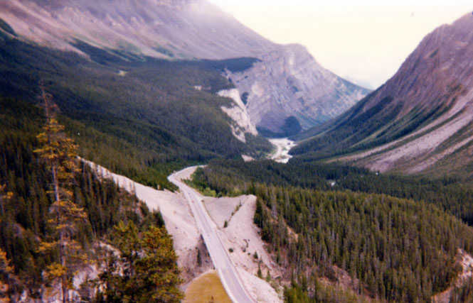
Another view looking down the valley from Sunwapta Pass. It’s not obvious from these pictures, but the building of this road took a huge effort. I don’t think it was fully completed until the late sixties.
Note the sky in these pictures. Although it didn’t rain too often, for part of the trip up the valley it did pour quite heavily. I was concerned some that it was going to turn to snow. As it was, I was wearing my full-warm outfit by this point--I had nothing more to put on.
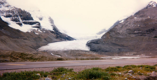
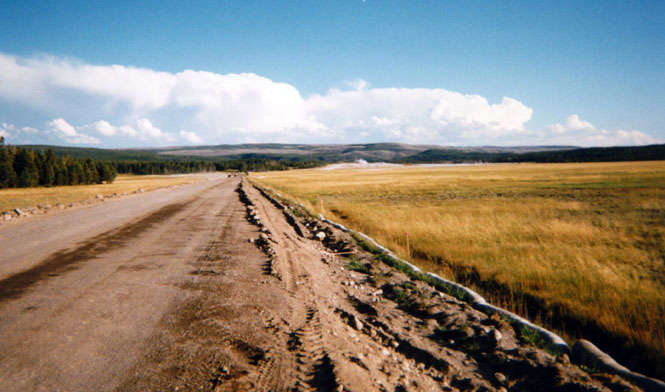
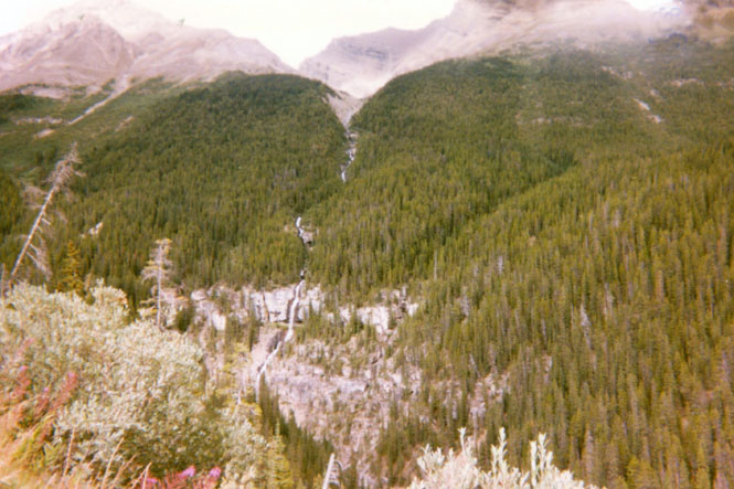
Part of the Columbia Ice Fields. I confess that I knew little of this ice field before coming up here. It is huge. It is also responsible for much of the water supply for the entire region.
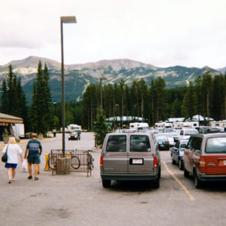
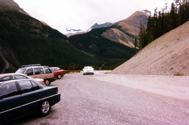
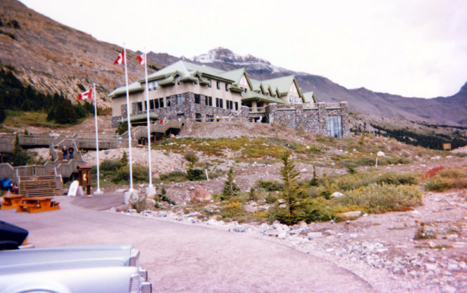
The visitor center/hotel near the ice fields.
If you study the photo long enough you can probably find my motorcycle down there.
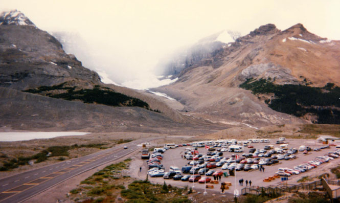
Between the parking lot and the highway is one of their ice-cats (not their real name). These are the latest in a long line of ice vehicles used to deliver tourists to the ice fields. They ride on very large, low-pressure tires, and can carry perhaps 30 people (I’m guessing). I thought about taking the trip out onto the ice, but considering the weather, I decided not to do it. As it turned out, the weather eventually cleared, and I actually could have. Ah well. Next time.
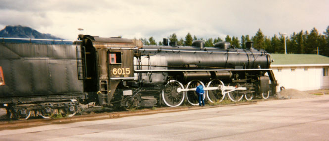
Jasper! It wasn’t really my original destination. But, it turned into it, and now I was here. I paid some crazy amount for that oil (well, it’s not real money anyway; it's much too colorful) but I thought the bike deserved it.
There wasn’t a rail museum here, it looked like they just parked the engine.
View from the motel room. Pricing the room was like buying a car. Little slips of paper passed silently over the counter. Since this was off-season (not sure when on-season is) the rate at this very nice motel was quite reasonable. Just don’t ask me to say it aloud or write it down!
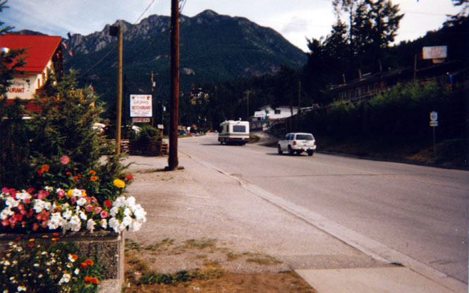
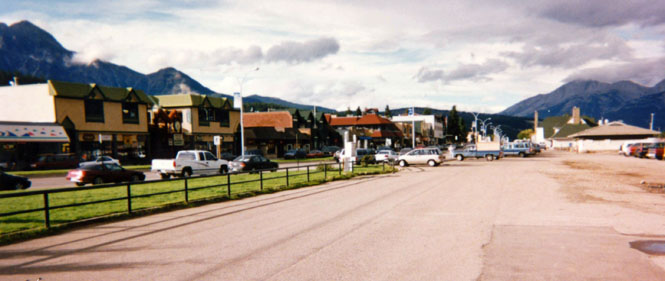
I like Jasper. I was struck by how the accents of the locals changed the further north I went (admittedly a limited sample). The residents of Jasper could just as well have been British for all I could tell. It’s a very clean town with many interesting (not too touristy) stores. I spent that evening walking around. A nice place.
British Columbia
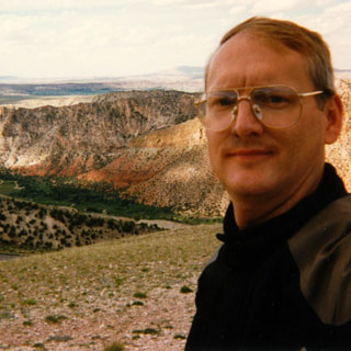
Mount Robson is a small town near Mount Robson—the highest point in the Canadian Rockies at 3,954 meters. I didn’t like the looks of that cloud bank one bit. (Yet again, I was told that I looked like a spaceman by a couple of tourists--the price of wearing an Aerostich riding suit)
This, I believe, is the town of Blue River. Once I cleared the pass, the road descended into the Thompson River Valley where the weather was good. I had breakfast here, and mistakenly had sausage again (hence the previous warning).
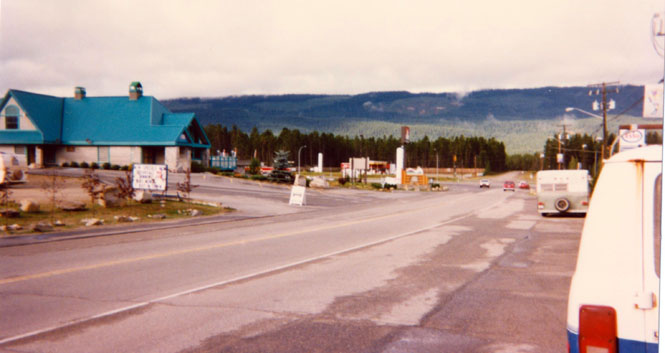
Two-for-two of the same greasy, undercooked (it seemed) sausage was my limit. The menu also listed Egg-McMuffin. Apparently McDonalds' lawyer’s don’t make it this far into the Great North.
Yikes! More slimy, slippery, dirt roads.
Miles and miles of it. By this time, I was used to it, and didn’t even slow down too much for them. A little slipping of the tires doesn’t hurt anything. Just go with it.
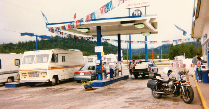
This could be Avola. I’ve laughed at others for doing it, but only because I’d never done it myself. I pulled up to the pumps, put my foot down, leaned the bike over… And then realized that I hadn’t put the sidestand down. Yee haw. Luckily it all happened in slow motion and a man next to me helped me right the thing. No harm (well hardly). But, it sure surprised me! I pushed the bike to the curb and walked around a bit. I figured I’d been riding too long, without a break. I may have thought that I was used to it, but riding many miles on slippery dirt takes far more concentration than normal, and can wear a person out. I was beat and didn't know it.
 A rest stop along the Thompson River. There was an interesting story about
this area. In the last century there were a number of plans to connect the United States
with Europe through a telegraph line. The technology for laying wire under the oceans
wasn’t developed yet so it was planned to run a wire from the U.S. up through Canada,
across Russia, and then into Europe. This location served as a cache for the wire that was
to be strung. As it happened, after huge amounts of money had been spent, and after the
negotiations with Russia had been initiated, somebody went ahead and put the wire under
the Ocean. Makes you wonder though, how different things might have been had that line
been strung.
A rest stop along the Thompson River. There was an interesting story about
this area. In the last century there were a number of plans to connect the United States
with Europe through a telegraph line. The technology for laying wire under the oceans
wasn’t developed yet so it was planned to run a wire from the U.S. up through Canada,
across Russia, and then into Europe. This location served as a cache for the wire that was
to be strung. As it happened, after huge amounts of money had been spent, and after the
negotiations with Russia had been initiated, somebody went ahead and put the wire under
the Ocean. Makes you wonder though, how different things might have been had that line
been strung.
Thompson River.
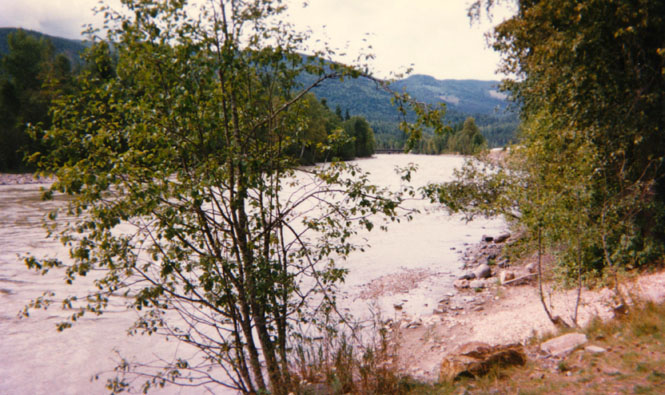
There was a short, ¼ mile trail around the rest stop.
Looking across the highway.
At Kamploops I had to decide if I would continue south or if I would cut across west on Canada 1. If I went west I planned to continue onto Vancouver, and then Victoria Island. The southern route would take me down to Hope and the Frazier River Valley. I would have preferred to go west, but the weather said to go south. So I did. By the time I reached Abbostford, I realized that Victoria was out of the question, so I dropped down into the U.S. at Sumas, Washington.
 Washington
Sumas. Looking north into Canada. Not wanting to ride the freeway just yet, I stayed on 9 all the way to Mt. Vernon before admitting defeat and catching the on-ramp. It’s amazing how built-up this area has become. Roads that were isolated country roads just 10 years ago now have developments with names like "Stone Brook Pines" (that’s not too bad—in Georgia you can find developments named Tara Acres).
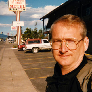
Hotel in Snohomish. Sometimes I don’t care that the motel I stay in doesn’t have a phone or even a bathroom door (see Eureka Montana. Other times, I just want a good room regardless.
I stayed in I-5 all the way to Longview (local connection--Mr. Long’s huge house in Kansas City is now the Kansas City Historical Museum. No doubt many locals even think the name has something to do with a long view of the Columbia River.).
 Oregon
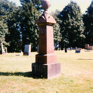
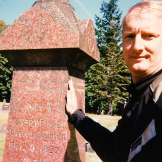
At Longview I turned south on 433 to Rainier. Photos below are of John Meserve’s stone in the Rainier cemetery.
Highway 47 from Clatskanie to Vernonia occasionally gets listed in various lists of great motorcycle roads. They’re right. It's a terrific motorcycle road. I stopped at the city lake in Vernonia.
A bit back I mentioned that there was hardly any damage when the bike was righted after I foolishly rested it on a sidestand that wasn’t there. Well, when my helper pushed the bike, he pushed the rear trunk, slightly bending things in the process. I stopped at the Vernonia Napa store and bought a small pack of cable-ties and a tube of RTV silicon and fixed things right up. Better even.
Gas station at Glenwood.
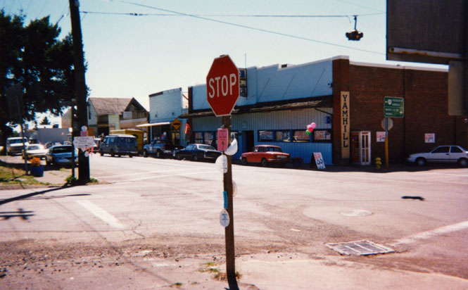
Yamhill, Oregon.
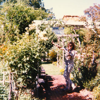
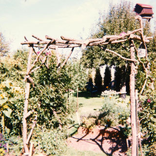
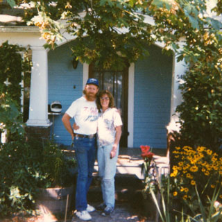
I stopped for a short time at Lorraine and Mike's house in Carlton and was able to see their gorgeous gardens as well as their pictures from their recent trip to England. Lorraine does a lot better job than I do at assembling these trip reports!

From Carlton I cut back across to I-5 at Salem and then sailed on down the freeway as far as Roseburg. Didn’t really see any point in taking a picture of any of this.
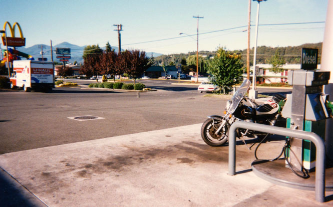
Grants Pass, Oregon. There really is more to this town than a gas station and a McDonalds.
 California
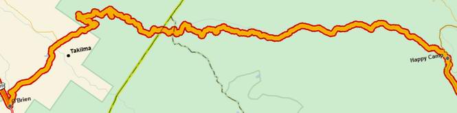
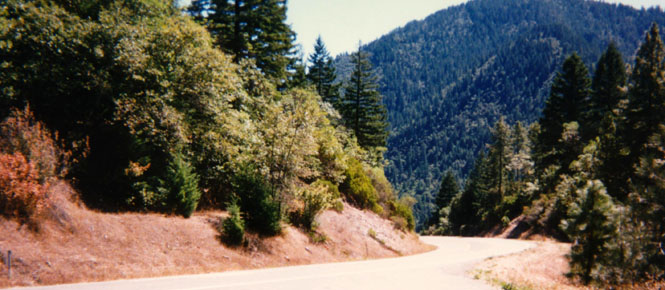
This was another chance to hit the O’Brien-to-Happy Camp road. There are some roads that I’ve been trying to get for years, but just haven’t been able to. This was one of them.
Near the summit. In places the road was quite narrow and winding. But, except for a few locations, the surface was just fine. There were, however, several places where one lane had washed down the mountain. Instead of fixing things, the highway department just put up a flashing light, a stop sign, and a sign that said "one lane road ahead." One assumes that the remaining lane had sufficient residual strength.
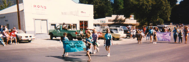
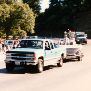
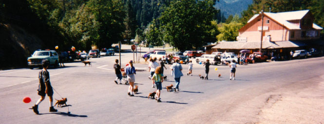
The big town of Happy Camp. I arrived just in time for their Big Foot Days parade. The lead entry was a fishing boat pulled by a pick-up truck followed by a Forestry truck staffed by people throwing candy at (to) the crowd. I got nothing (whimper).
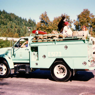
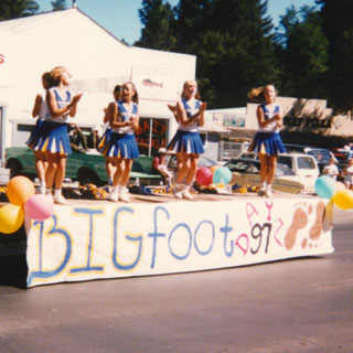
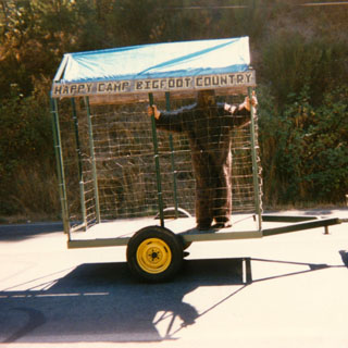
There he is. Big Foot. This guy had a lot of fun. He was able to rock that trailer at least a foot off the ground each side.
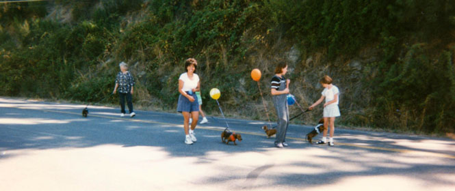
The march of the Dachshunds. Each dog had a balloon tied to his collar. Dachshunds apparently have a mind of their own.
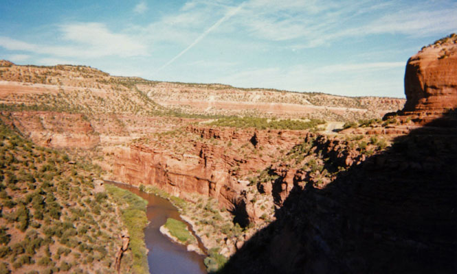
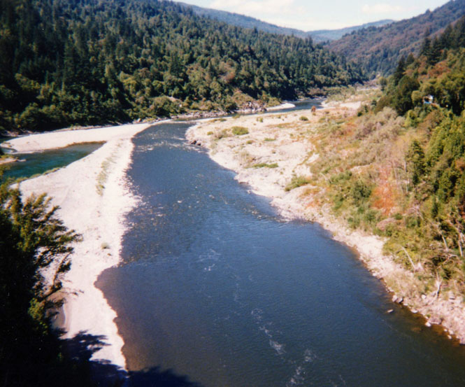
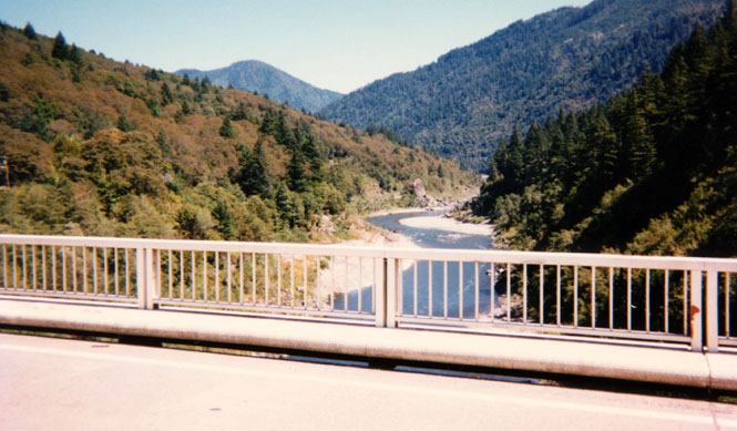
Just beyond Somes Bar.
Crossing the Klamath River.
View from Willow Creek hamburger stop. A Great hamburger.
Once again, no pictures in Eureka. Wasn’t intentional, just didn’t have the camera with me. We (Becky and Gil) did drive over to the island for breakfast. Becky was quite specific in ordering scrambled eggs—scrambled not beaten. Still didn’t work (beaten). Good food nonetheless. We also did the tourist thing and sailed on the Madacat. This is an old ferry that used to take the mill workers from Eureka to the Samoa Mills. The captain did a very good job describing the bay and its history. A worthwhile trip.
 The trip down to Sacramento was via the usual way. Here I stopped for fuel
at Lucerne, again as usual.
The trip down to Sacramento was via the usual way. Here I stopped for fuel
at Lucerne, again as usual.
While in Sacramento I was able to change the rear tire. It didn’t look altogether perfect when I left Wichita, but it wore much faster than I expected it to. The price was good, so it worked out.
I made it south on I-5 as far as Los Banos before I switched over to the (slightly) more interesting 99.
Rest stop along 58 near Boron.
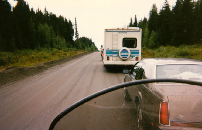
The rains had been so heavy the previous weeks in the Mojave Desert that the freeway was still flooded in Barstow (surprised that would ever happen). As I rode into town I noticed that the opposing lane was backed up for tens of miles and was thinking "poor bastards." It turned out that those cars were ultimately going the same direction that I was and all cars were being re-routed in Barstow back up the road and then over to the old highway. I wasn’t going to stand for that so I just went on into downtown Barstow and followed old Route 66. And surprisingly, that worked. I guess they didn’t want to clog up downtown Barstow with all the freeway traffic, so they routed it all miles out into the dessert.
I made it as far as Needles, and since I didn’t feel like continuing on to Kingman, I stopped for the night.
I keep thinking that someday I’ll follow old route 66 up to Oatman, but I haven’t done it yet, and I didn’t do it on this trip. I stayed on I-40 all the way.
 Arizona
Petrified Forest National Park.
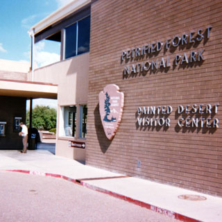
Even though I’ve been through here many times, this was the first time that I stopped at Petrified Forest National Park (well, once I stopped at night because my engine made a strange noise—but that's another story). This shot was taken from the visitor center looking south into the main part of the park.
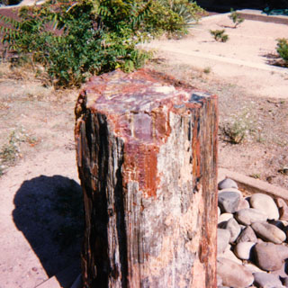
Petrified wood. Sad to say, I still haven’t gone though the park. I’m not sure that simply walking around the visitor center and watching the movie qualifies (it doesn't).
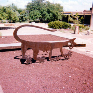
The cougar was made from drawings made many hundreds of years ago.
 New Mexico
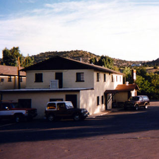
I stopped for the night in Grants, New Mexico. There is fierce competition for hotel customers in this town. Consequently, they’re all remarkably cheap.
From Grants I stayed on I-40 until Tucumcari, and then took 54 all the way into Wichita.
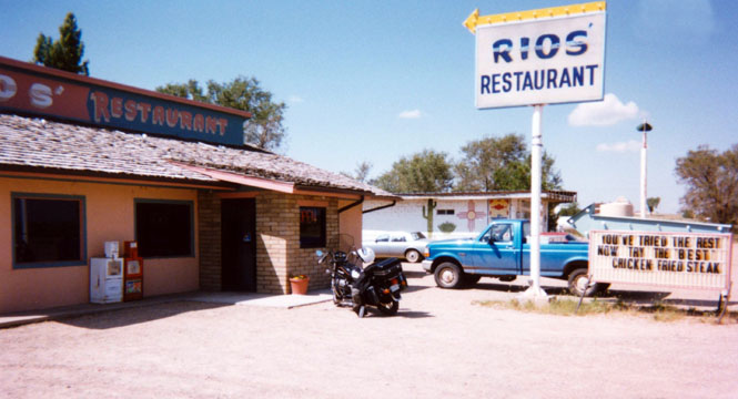
A wonderful restaurant in Logan, New Mexico.
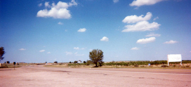
View looking toward Wichita from Logan. Now I’m back to the near 100-degree weather. But, that would change by this evening.
 Texas
Texas
Deep in the heart of (panhandle) Texas
 Oklahoma
Kansas
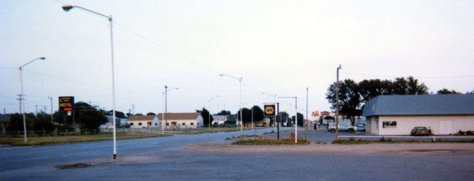
Meade, Kansas. It was getting dark pretty quick, and I still had 150 miles to go. I made it just fine.
Good Trip. Great Trip. Bunches of miles, no breakdowns, vast temperature ranges. About 5,800 miles