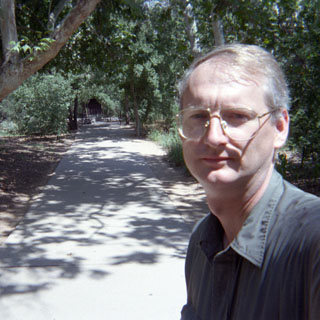
August, 1998

Sunday |
Monday |
Tuesday |
Wednesday |
Thursday |
Friday |
Saturday |
16 August |
17 |
18 |
19 |
20 |
21
|
22
|
23
|
24
|
25
|
26
|
27
|
28 |
29
|
30 |
31
|
1 September
|
2
|
3
|
4
|
5 |
The only real goal that I had for this trip was to attend at least one day of the GRIN (Guzzi Riders in New Mexico) rally in Datil, New Mexico. I also had some vague notions of riding north to Vancouver Island before sweeping across the northern states.

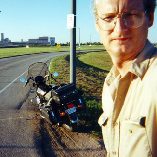
 Kansas
Since the Guzzi rally was on Saturday, I had to leave Kansas on Friday.
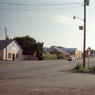
 Oklahoma
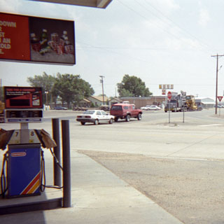
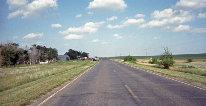
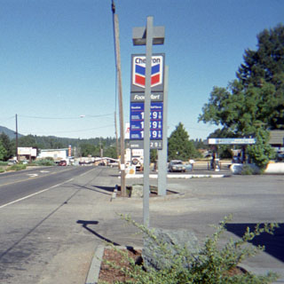
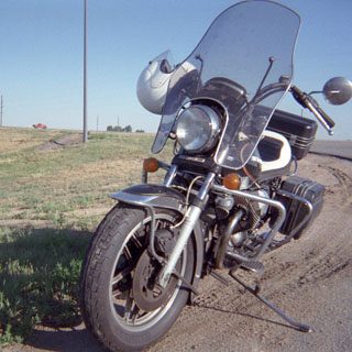
 Texas
Texas
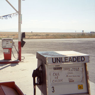
Fueling in a small town in Texas (they all look just like this).
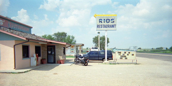
 New Mexico
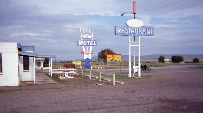
I've stopped several times at this small restaurant in Logan, New Mexico. I'd recommend it, but you can't always trust these places over the years.
Highway 54 to Santa Rosa, New Mexico is very familiar to me, but from then on I was on all new highways.
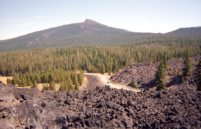
Highway 60 from Vaughn west is part of the National Old Trails road that predates the numbered highways, and was one of the earlier routes across the southern Rocky Mountains. Route 66 (and later Interstate 40) bypassed this area long ago; so things haven’t changed too much in seventy years.
Taken somewhere west of Vaughn. There was very little traffic.
This route generally follows the railroad across the mountains. Several of the smaller towns still had some impressive railroad stations although it was clear that they hadn’t been used for a very long time. At I-25 I turned south to Socorro, New Mexico.
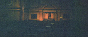
I had made fairly good time this first day and I probably could have made it all the way to Datil. But, since I wasn’t too sure what sort of motels (if any) would be available there, I spent the night here. Socorro is on the old Spanish Trail that ran from Mexico north to Sante Fe and the other Spanish outposts in what is now the U.S. As such it has some very old and historic buildings. Even so, it’s a rather ugly place.
 Early the next morning I climbed west out of the Rio Grande valley towards Magdalena.
This is an old mining town whose downtown section has
far more buildings than people.
Just east of the town though, were several new large houses and art galleries. The region
is apparently starting to attract the art crowd from Santa Fe and Taos. It was here that I
first encountered what would become an annoyance throughout the trip. After gassing up,
when I pushed the starter button, nothing happened. I poked around a bit with the wires
and connections leading to the starter, but nothing seemed to help. So finally, I just
bump-started the thing and continued on.
Early the next morning I climbed west out of the Rio Grande valley towards Magdalena.
This is an old mining town whose downtown section has
far more buildings than people.
Just east of the town though, were several new large houses and art galleries. The region
is apparently starting to attract the art crowd from Santa Fe and Taos. It was here that I
first encountered what would become an annoyance throughout the trip. After gassing up,
when I pushed the starter button, nothing happened. I poked around a bit with the wires
and connections leading to the starter, but nothing seemed to help. So finally, I just
bump-started the thing and continued on.
If it weren’t for my little starter problem, I would have stopped at the visitor center for the VLA (Very Large Array) radio telescope. The telescope is made up of 27 huge antennae; each one on tracks. By positioning each antenna relative to the others, the telescope can be focused. The road to the main center was gravel, and since the terrain was dead-flat (that’s why they built it here after all), I wasn’t sure that I’d be able to easily bump start the bike if the starter again didn’t work.
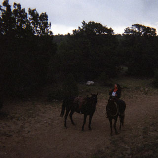
When I arrived at the town of Datil, I didn't know just where the rally was, exactly. Luckily, there were a dozen or so motorcycles parked at the local café, so I stopped in for breakfast. Shortly after I had sat down, a waitress came up and asked me if I wouldn’t like an egg, sausage, and hash-browns--uh, sure, ok. Immediately she produced a plate and set it in front of me. Apparently, she had just given a wrong order to the cook, and had to do something with it...
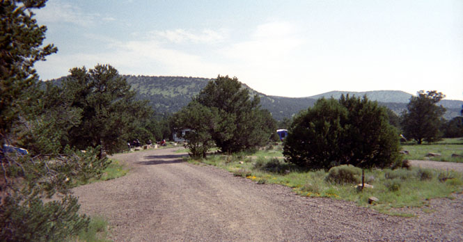
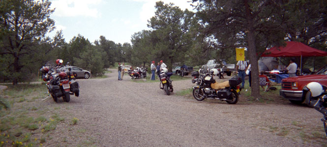
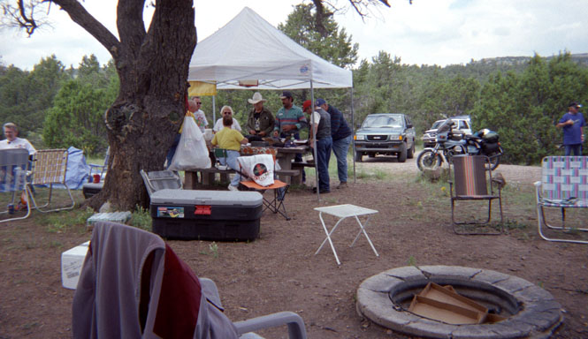
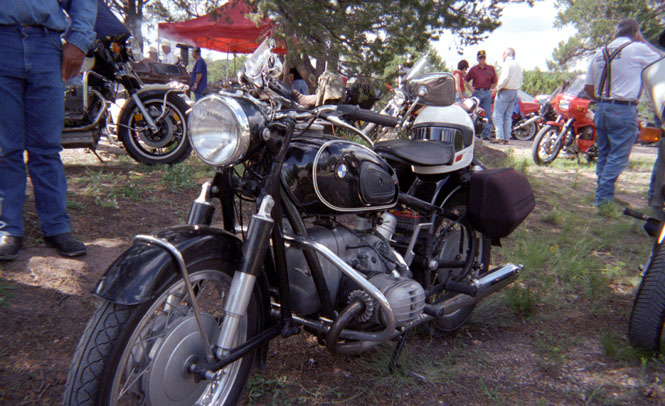
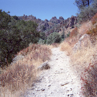
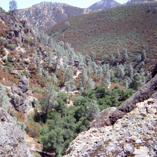
The rally site was at a national forest campground about 3 miles from Datil.
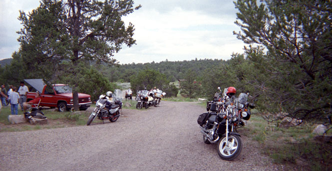
Although you really can’t tell from these pictures, there were about 100 folks who had registered, and about that many motorcycles. A very good turn-out for just a state rally.
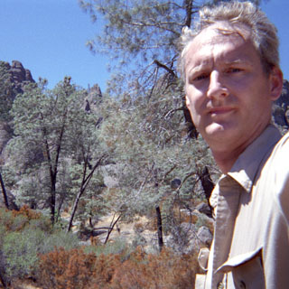
Mine is off to the right. While here, I took the opportunity to try to solve my starter problem.
All the symptoms pointed to the starter relay being at fault, so I removed the battery and a few other parts, and then removed the relay. The relay points did look a little pitted, so I filed them smooth and reassembled everything. It still didn’t start. I then borrowed a volt/ohm meter, and started tracing everything down. It just didn’t make any sense. I had power to the starter solenoid, but nothing happened even though I knew the solenoid was in perfect working order. Shorting out the starter spun the starter motor, so I knew that was ok. Finally, I gave up and pushed the starter button, and it worked! Grrr.
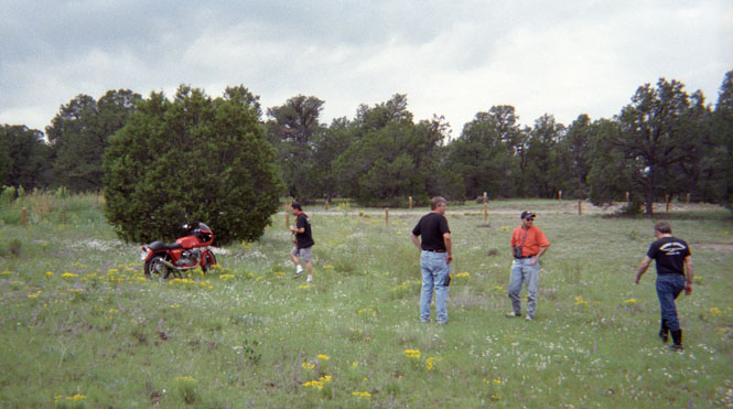
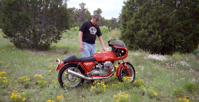
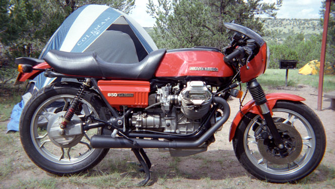
The man closest to the motorcycle was shooting pictures for a magazine. Proud father of a very nice Le Mans
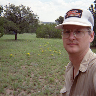
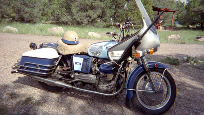
I wore a Harley-Davidson hat to the Moto Guzzi rally just to be contrary.
Some of the rally check-in crew.
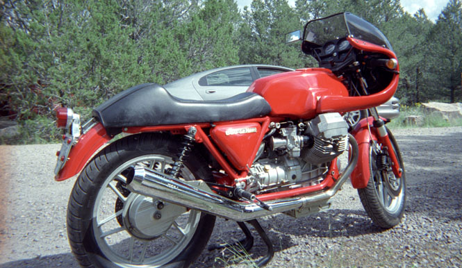
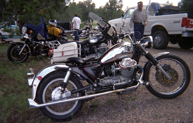
Another nice CX100 Le Mans.
They even allowed a BMW in. Actually, there were several other brands there--as there always are at Guzzi rallys.
This old Eldorado looked far goofier in person. Note the machine gun (!) mounted to the front crashbar. A strange duck, indeed.

A nice dinner of BBQ chicken was provided.
The winning peoples choice bike in the show competition. I can spot parts from at least four different models, so it’d be hard to say what exactly it is. The frame was painted to look like carbon fiber weave.
It was a good rally with a lot of nice people. I don’t normally attend these things, but they’re fun once in a while. One thing I’ve noticed though: Once you get past the Guzzi connection, you’ll find that these people have nothing in common. So it’s best to stick to the fairly narrow subject.
 I didn’t have a sleeping bag with me, so I left by 6:30 or so, and continued on
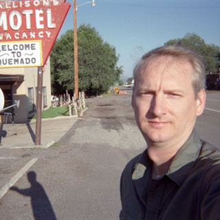
down the road to the town of Quemado. The bike started up just fine at the rally, and
started fine the next morning in Quemado. Hmmm.
I didn’t have a sleeping bag with me, so I left by 6:30 or so, and continued on
down the road to the town of Quemado. The bike started up just fine at the rally, and
started fine the next morning in Quemado. Hmmm.
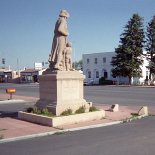
These "Madonna of the Trail" monuments are all over the western U.S. Sometime I need to track down the exact locations of all of them. They’re always on major trails and are dedicated to the spirit of the pioneer women who walked them.
 Arizona
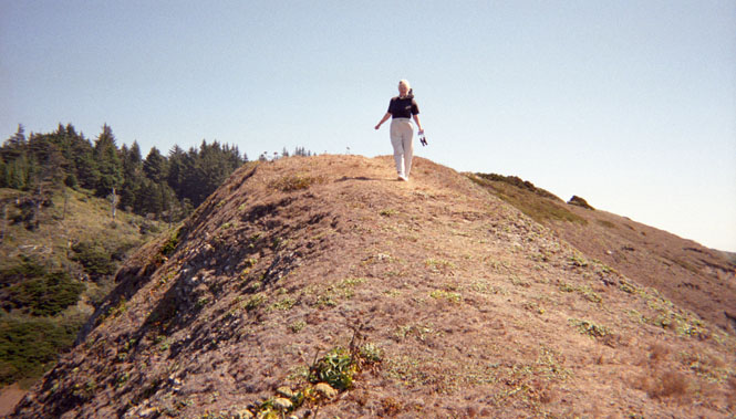
 Part of my intention of crossing Arizona here, was so that I could travel along the Magollon Rim. Northern Arizona is a high plateau that drops off suddenly at the Rim.
Unfortunately, it looks like I’ll need to return with a dirt bike or (rental) car,
since the rim road is unpaved throughout.
Part of my intention of crossing Arizona here, was so that I could travel along the Magollon Rim. Northern Arizona is a high plateau that drops off suddenly at the Rim.
Unfortunately, it looks like I’ll need to return with a dirt bike or (rental) car,
since the rim road is unpaved throughout.
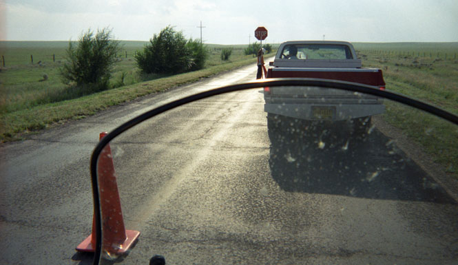
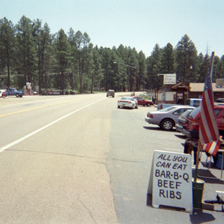
At Show Low, New Mexico I was finally coming to grips with the starter. After gassing up, it once again wouldn’t start. I had been careful to select a gas station on a hill, so that bump starting wouldn’t be a problem, but there had to be a better way. After thinking back on my previous steps, it occurred to me that after spinning the starter by shorting out the posts, the thing worked fine. So, I took a screwdriver and shorted the starter motor for just a second, and, hey-hey, it worked. From then on I learned that if the bike was warm, I had to first spin the starter by manually shorting the connections. If the bike was cold, it would start up without that step. Strange.
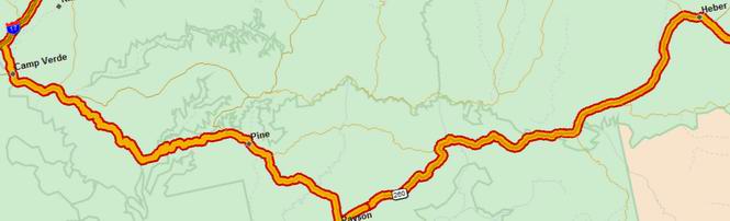
Pine, New Mexico. By this time the road had made several large elevation changes which meant large changes in temperature. Towards the middle of the day however, it was just plain hot everywhere. As in over 100 degrees.
 Descending out of the mountains to Camp Verde the road followed the top of a spine that
dropped off to the desert on both sides. An interesting road. When I reached Camp Verde, I
stopped for fuel and about half a gallon of liquids for me. This was to become a problem
of sorts for the entire trip. Even though I wore my riding suit (or perhaps because of
it), I just couldn’t keep enough fluids in me to last a tank of gas. My own
miles-per-gallon wasn’t much better than the motorcycle’s (A little
exaggerated. The bike returned about 45 mpg throughout the trip. I
probably did about 200 mpg).
Descending out of the mountains to Camp Verde the road followed the top of a spine that
dropped off to the desert on both sides. An interesting road. When I reached Camp Verde, I
stopped for fuel and about half a gallon of liquids for me. This was to become a problem
of sorts for the entire trip. Even though I wore my riding suit (or perhaps because of
it), I just couldn’t keep enough fluids in me to last a tank of gas. My own
miles-per-gallon wasn’t much better than the motorcycle’s (A little
exaggerated. The bike returned about 45 mpg throughout the trip. I
probably did about 200 mpg).
I was only vaguely aware of Montezuma’s Castle. But since I was so close, and because it was so blasted hot, I rode up to the visitor's center.
Montezuma Castle National Monument As you may know, the dwellings have nothing to do with Montezuma. It’s just that the earliest discoverers took a stab at their origins, and got it wrong.
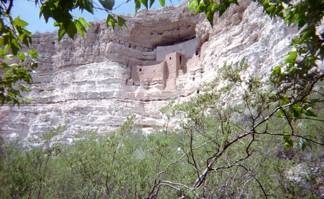
They haven’t been used for several hundred years. Over the past few years the monument has been greatly improved. Not long ago, the road into the park was dirt—now it’s paved. Also, the short trails leading to the base of the dwellings are all paved and are wheelchair accessible. Very nice place. As is typical for this area (and this time of year—after the start of school), most of the tourists were European. I hate to make this (unfair) observation, but… You can tell the Europeans from the Americans without even hearing them speak. When Europeans first get out of their car, one of them will be reading a guidebook, while the others are listening intently. When Americans get out of the car, they’re all whining about the heat, or each other.
 By this time, the heat was becoming just too much, and I went looking for rain. I could
see clouds off in the distance towards the north, so that’s where I headed. I stayed
on 60 from Camp Verde across to Cottonwood, and then north to Sedona, Arizona.
By this time, the heat was becoming just too much, and I went looking for rain. I could
see clouds off in the distance towards the north, so that’s where I headed. I stayed
on 60 from Camp Verde across to Cottonwood, and then north to Sedona, Arizona.
Sedona is a very upscale town much in the same vein as Aspen or Telluride. It’s really a lovely place set in the mouth of a steep canyon with bright red and orange rocks.
The road for Sedona to Flagstaff along Alternate 89 is one of the more famous motorcycle roads. The highway stays within the canyon walls and crosses from one side of the river to the next. At the higher altitudes the trees turn to pines, with lush, green vegetation on both sides of the road. It would be a perfect road if it weren’t for all the other cars enjoying the same thing. By the time I reached Flagstaff (Elevation 7,200 feet) it was actually raining quite heavily. Nice. Usually, I scout the weather reports to avoid any rain. But this time, rain was exactly what I needed.
About this time I was judging just where I might end up for the evening. I had wanted to travel on the old Route 66 through Peach Springs. This would put me in Kingman, Arizona well after sunset. If I stayed on the freeway (horrors) I could easily be in Kingman by nightfall. But then, what would be the point? I third option was to stop in Williams and take the train to the Grand Canyon and then catch route 66 in the early part the of the day before it got too hot. And, waiting to decide until I was at the exit ramp, that’s what I did.
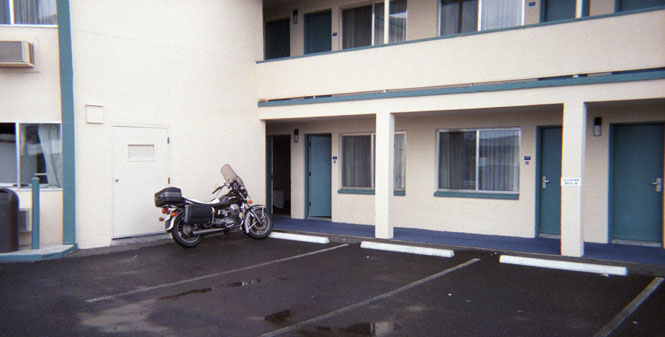
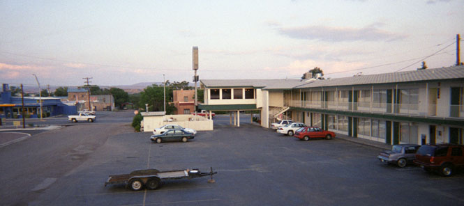
The Travelodge in Williams, Arizona. I had a very nice dinner at a restaurant just
off the tracks.
 Next door was an old saloon/hotel with several rooms upstairs. The next
time I stay in Williams, I’ll skip the chain hotels, and spend the night here, instead.
Next door was an old saloon/hotel with several rooms upstairs. The next
time I stay in Williams, I’ll skip the chain hotels, and spend the night here, instead.
Ah, rain! The rain cooled things off nicely so that it became bearable to ride again. Several people in the lobby of the hotel expressed concern for me being out in the water, and were surprised when I told them that I thought it was great. I had plenty of time that evening to walk the full length of Williams’ downtown district.
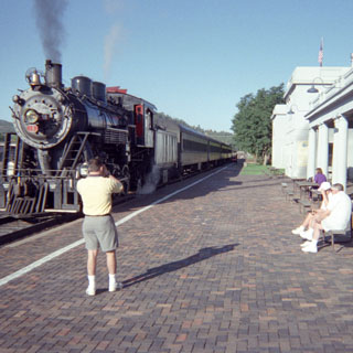
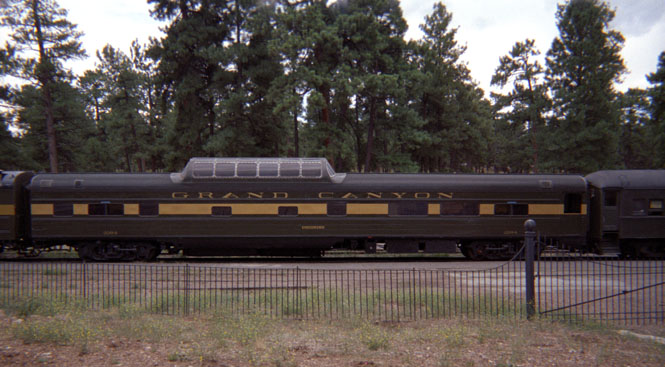
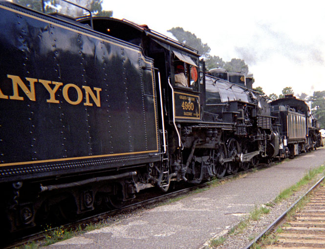
The next morning, I packed the bike and rode the short distance to the train
depot. Prior to the mid 1950’s or so, the train from Williams was, by far, the most
common way for tourists to get to the Grand Canyon. Several trains
 each day were operated
by the Santa Fe. As was the case everywhere though, cars replaced train travel and the
line wasn’t used and the right-of-way had been sold. The current owners (a couple
whose name I can’t recall) gained control of the line when it was put up as
collateral on a loan that had been defaulted. The salvage value would have erased the loan
amount, but the couple decided instead to go into the railroad business. So after spending
what must have been a tremendous amount of money, they bought rolling stock, had the rails
and bridges rebuilt, and here we are today. The line operates everyday year around using
steam engines in the summer and classic streamlined diesels in the winter. The prices
range from $45 to $180 (thereabouts) plus the cost of the National Park pass. The cheap
seats (that would be mine) include the basic passenger car, and cute (6 oz) bottles of
coke. The more expensive tickets include the dinning and lounge car and the observation
car.
each day were operated
by the Santa Fe. As was the case everywhere though, cars replaced train travel and the
line wasn’t used and the right-of-way had been sold. The current owners (a couple
whose name I can’t recall) gained control of the line when it was put up as
collateral on a loan that had been defaulted. The salvage value would have erased the loan
amount, but the couple decided instead to go into the railroad business. So after spending
what must have been a tremendous amount of money, they bought rolling stock, had the rails
and bridges rebuilt, and here we are today. The line operates everyday year around using
steam engines in the summer and classic streamlined diesels in the winter. The prices
range from $45 to $180 (thereabouts) plus the cost of the National Park pass. The cheap
seats (that would be mine) include the basic passenger car, and cute (6 oz) bottles of
coke. The more expensive tickets include the dinning and lounge car and the observation
car.
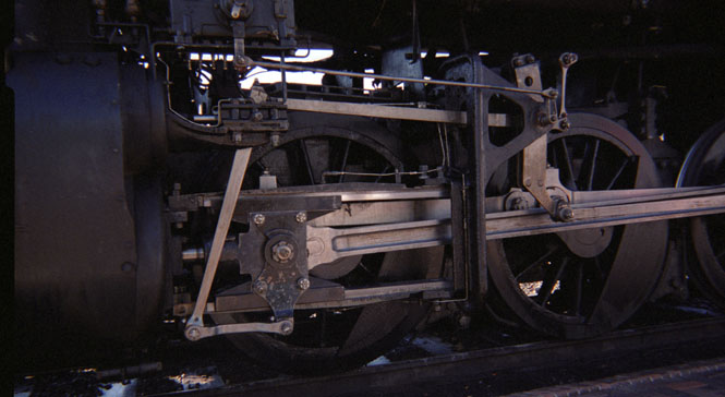
I’m always fascinated by the valve and reversing mechanisms on
 steam engines.
Such a clever system.
steam engines.
Such a clever system.
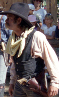
Before the train left the Williams station an "old west shootout" was staged.
Really corny, but it was fun. The actors were really great. The man in the black hat was the somewhat stupid bad guy who just wanted to have a little fun. His sidekick in the white hat was equally dim, but his heart was good—he was just misspending his youth. The hero was the Marshall who looked exactly like Buffalo Bill—long white hair and mustache included. Apparently, in fact, he was a retired policeman, and his grandfather had been a U.S. Marshall. The guns he wore had once been his grandfather’s.
The station at the Grand Canyon is an impressive log structure that’s been there since 1915 (or so). I saw photographs in the Williams station that showed rows, and rows of trains lined up at the Grand Canyon Station. These days, the rails are (mostly) still there, but there’s only one train at a time.
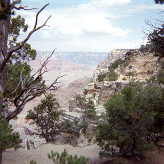
The Grand Canyon. Somehow, it seemed foolish to be taking pictures with my $5.00 camera. Disrespectful to the overwhelming view not to use the very best equipment. Perfect weather.
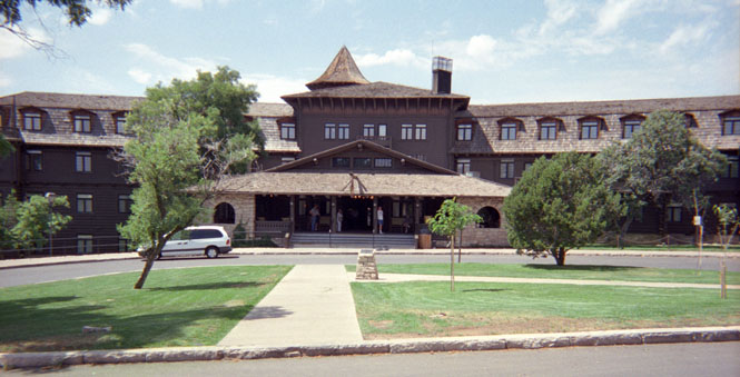
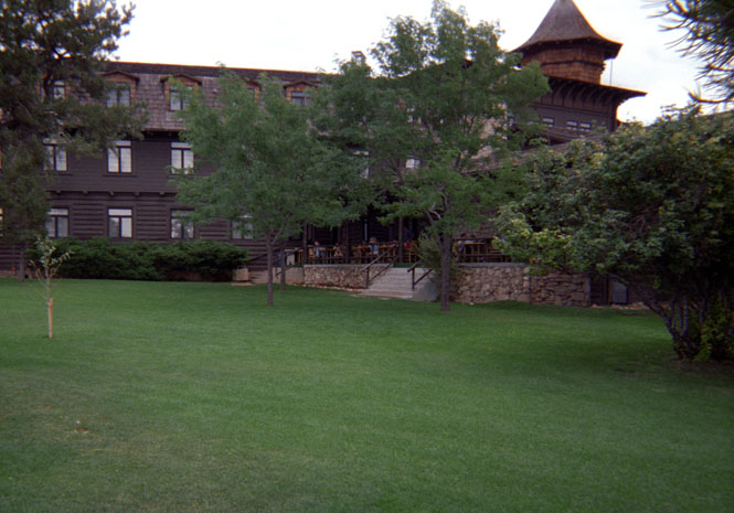
Front of the El Tovar Hotel. There are several hotels at the South Rim with prices ranging from the $50’s to $300. The El Tovar is the best. Hint: the best restrooms are in the basement level of the El Tovar. I was sitting in there just reading my map when several women rushed in and set up guards. Apparently, the women’s room was being cleaned, and these women just weren’t going to wait. So. Do I stay there quietly (they didn’t know I was there), to avoid causing them any embarrassment, or do I make myself known?
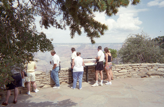
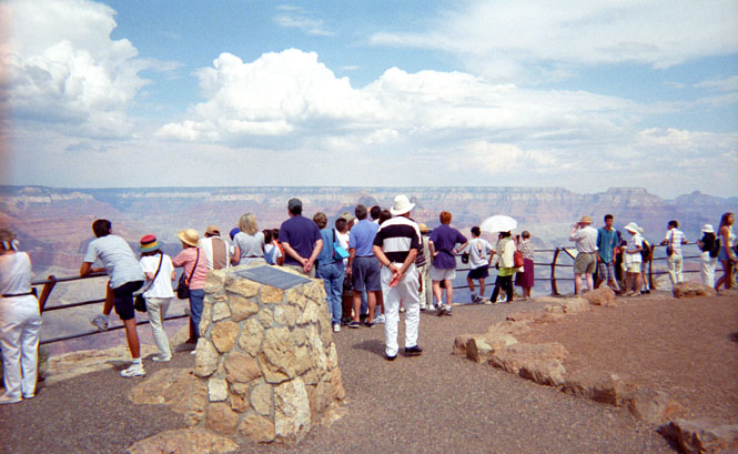
One of many overlooks within walking distance of the depot.
Near the entry of the Bright Angel Trail. I considered walking down just a little ways, but didn’t.
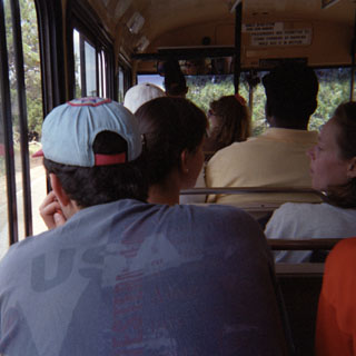
There’s really no need to have a car here. There are free shuttle busses than run continuously along the south rim roads. No matter where you are, a bus will come along within 10 minutes. It’s not a problem with a motorcycle (I've done it), but even if you did have a car here, it would be hard to find a place to park.
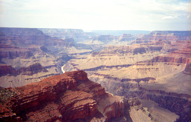
One of the few overlooks from which you could see the river.
The other side of the El Tovar. I took this picture to capture the folks sitting on the porch. One of them was our Marshall.
The observation car. My ticket didn’t allow me access.
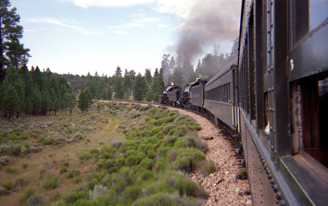
A treat for the "foamers." At first I didn’t understand the term. The train employees refer to the many train enthusiasts that hover about them as "foamers." Foaming at the mouth over trains. Earlier in the week, the engine that pulled the train up to the Grand Canyon had mechanical problems and was forced to stay for maintenance. It was now fixed and ready to head down to Williams. So, this would be a very rare steam engine double-header event.
In spite of being warned not to, I quickly stuck my arm out the window to shoot these photographs.
Knowing a (very) little of what’s involved in running a steam engine, running two at once must have required tremendous coordination. There was a great deal of whistle blowing from one engine to the next as the two engineers tried to balance the applied power and speed. At the crossings, both engines let loose with their whistles making for an impressive noise.
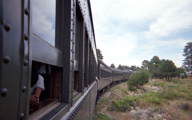
The car in front of mine was not occupied. I suspect that they use the first car as a buffer between the soot and grime and the occupied cars.
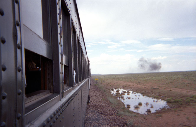
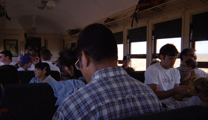
It’s a 2 ½ hour trip each way. Williams and the Grand Canyon are both within pine forests. In between, is a long stretch of desert.
 On the trip back, the train was "robbed." "Take me!, Take
me!" was the more common call from the victims when confronted with this particular
outlaw.
On the trip back, the train was "robbed." "Take me!, Take
me!" was the more common call from the victims when confronted with this particular
outlaw.
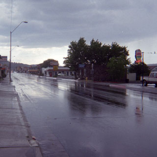
The weather was great during the trip, but when the train reached Williams it was raining fairly heavily. Oh well.
I rode the short distance from Williams to Seligman. Soon after I checked into the motel, a very heavy thunderstorm moved with buckets of rain.
I went into town with a Belgian couple who were touring the western United States. It was fun hearing of all the places that they had been, and helping them make plans for what they should see next. They thought our cars were huge and our trucks were enormous! On my own, I would have eaten at a famous route 66 diner in town, but it was their car, and they selected some tacky T-shirt selling restaurant. I told them all about route 66 and tried to explain just why it’s important (and no, James Dean didn’t crash on 66). When I explained that there was no road here at all just 70 years ago, they were somewhat surprised. There probably isn’t any major road in Belgium that didn’t also exist 1,000 years ago.
From Seligman I was finally able to ride on a long stretch of 66 that I’d been trying to get to for many years now.
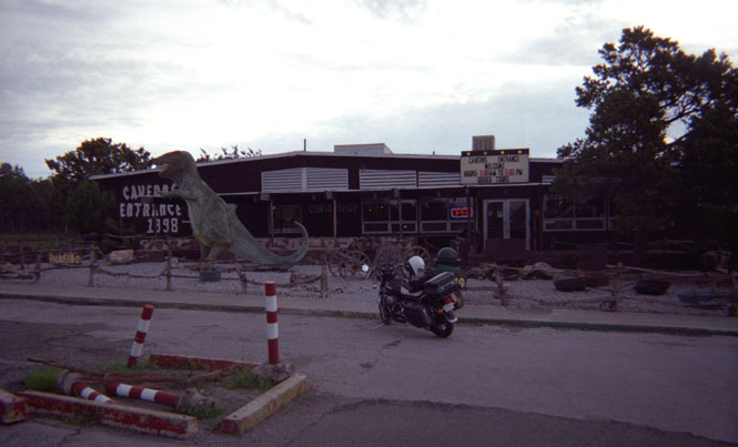
Since the Interstate went in some years ago, the Grand Canyon Caverns have probably had a large decrease in traffic. I was there first thing in the morning, and was the only tourist there. After having a large (and not very good) breakfast, I took the elevator down to the caverns accompanied by my guide. I let him know that he wasn’t obligated to give me the whole spiel. Remarkably, the air supply for the caverns is supplied from an entrance along the rim of the Grand Canyon itself, something that wasn’t discovered until fairly recently. I have no idea what that dinosaur is all about in front. Looks good though, doesn’t it?
I have no pictures to show you of 66 to Kingman. Certainly it’s a much more scenic route than the freeway takes. The canyon route near Valentine is well worth the diversion. However, don’t count on any services.
The road to Oatman, Arizona has been on my list of must-do roads from the very beginning. This was one of the high points of the trip. It’s a classic piece of road that all the travelers on route 66 had to take, and it must have been especially challenging with a Model-T Ford. From what I’ve read, many travelers would hire local high school kids to drive their cars for them over the pass. Even today, it’s not for the faint of heart. It’s a steep, winding road, with a poor surface and no guardrails.
Oatman. The town once was a thriving mining town. There is still some mining done in the surrounding hills, but these days, I think the tourist industry keeps things alive. Notice the burros in the road and along the sidewalk at the left.
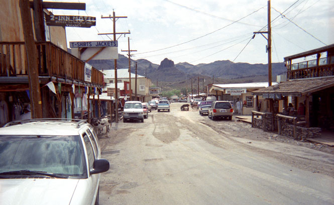
The burros are left over from the mining days. They apparently aren’t owned by anyone, and are free to roam. There were a number of signs posted saying that the burros were dangerous, and to not touch them.
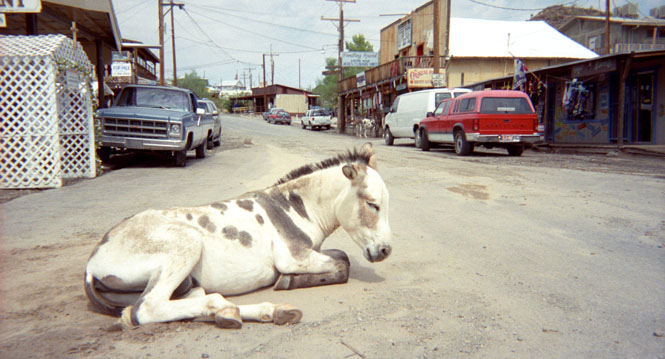
This one doesn’t look too fierce.
South of Oatman, the road dips and turns as it makes it’s way down to the river. Ordinarily this would be a fun road, except that my shocks were becoming a real problem. All this heat (it was over 100 degrees) and bouncing about had pretty well blown the shocks. I had to stand on the floorboards when the road dipped in order to keep from bottoming the suspension. I would have to do something soon.
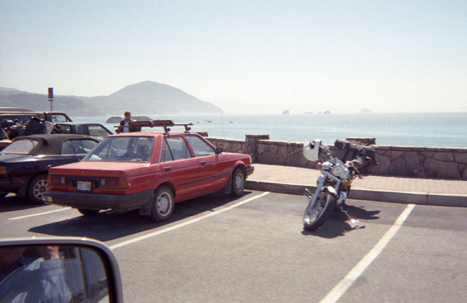
 California
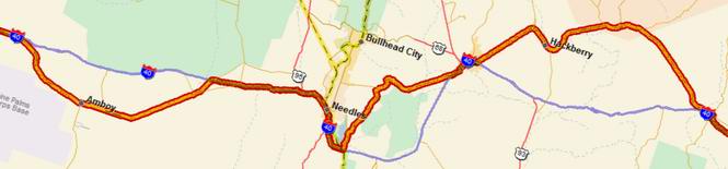
Past Needles, old 66 heads off south into the desert towards Amboy. If you look at a map, the Interstate is on the north side of a short range of mountains and 66 follows the flatter, southern route—along with the railroad. When I turned off on the highway it started to rain just a little bit. Unfortunately, that didn’t last long enough and it was soon blast-furnace hot again.
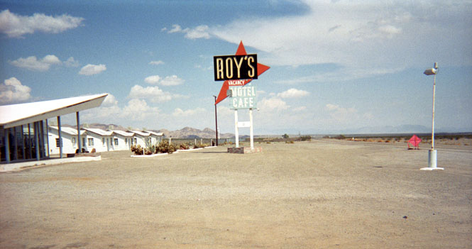
Roy’s in Amboy is perhaps the most famous business on the entire Route 66. It looked just like the pictures, I'd seen. At this point, I was so very hot that I parked the bike in the (107 degree) shade, and saddled up to the bar for a root-beer float. And then a glass of water--and then several more. I kept an eye on those clouds hoping that they might put out a little rain, but they never did. There was virtually no traffic on the highway. If I had been in an air-conditioned car, I would scarcely remember any of route 66, and Roy’s would be just another gas station along the highway. You’ve got to suffer for the proper desert experience.
There are two Ludlow’s now. There’s the old route-66 Ludlow, which is a virtual ghost town. And there’s the freeway Ludlow which looks like all the other "services available" towns along Interstates everywhere. I gulped down another half gallon of fluids and realized that even the travelers in their Model-T’s were able to drink water as they drove along. If I were to make a habit of daytime summer desert travel on a motorcycle, I’d rig up some sort of tubing system for water.
The crossroads of California 58 and 395 (Kramer Junction). I’ve eaten at this truck stop many times before. This time I only had a small salad with lots of water.
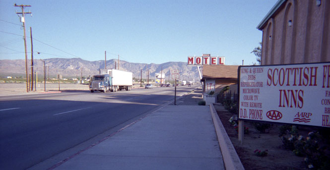
I spent the night (again) at the Scottish Inns in Mojave, California. The (Indian) folks who run this place are very nice, and will do your laundry (including folding) without charge. At least they do for me. They have a dual porch-swing set up in their living room hanging from the ceiling.
From Mojave it was up and over the Tehachapi mountains, through Bakersfield and Shafter, and on over to Coalinga. I’d been trying to figure out a way to get to the coast without using roads I’ve been on before, but finally decided to head up the coastal range to Pinnacles National Monument instead. I’d never been there either.
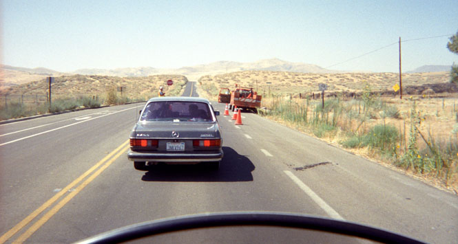
Just west of Coalinga. Typically on these motorcycle trips, I come across some sort of highway construction at least every other day, and often several times in one day.
The road up from Coalinga to Pinnacles was great. For the most part it follows creeks, but does have places where it climbs up and over parts of the Diablo Range. Wonderful stuff. Unfortunately, my shocks were only getting worse.
Visitor Center at Pinnacles National Monument.
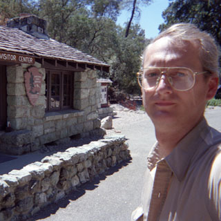
Actually, the monument has two centers—east and west. The two sides of the park can only be connected on foot—unless you want to drive well over 100 miles. Most of the buildings were built in the 1930’s as CCC construction. Very well built I might add.
Trail to some of the Pinnacles. An interesting place. The rock formations are directly on top of the San Andreas Fault. Consequently, over many thousands of years, half the formation has been left behind several hundred miles to the south as the western plate moves north.
I never made it to the top—and had no intention of doing so. It was too hot, and I didn’t have anything but a single 16oz bottle of water with me.
On the way back down.
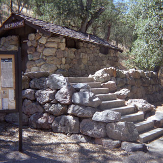
A CCC restroom--built to last.
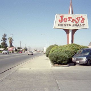
Hollister is one of the more confusing places to get through. This shot was taken from a service station. I didn’t eat at Jerry’s.
Eventually, by following likely semi-trucks I was able to find the main east-west highway and get out of town. That place should really invest in a few direction signs.
Anderson’s Split Pea Soup along I-5. I should have just ordered the endless bowl of soup.
By the time my Cobb salad arrived, I had already had two large bowls. Good stuff. After eating, I called the Guzzi shop in Seattle and made arrangements to have a new pair of rear shocks sent to Sacramento. Several years ago, I had similar shock problems, but let it go until I made it all the way back to Wichita. That was not pleasant, and I had no intention of repeating the experience this time.
From here it was a straight (albeit dull) shot up I-5 to Rio Linda.
What a nice oasis in the valley heat.
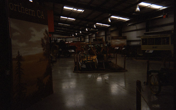
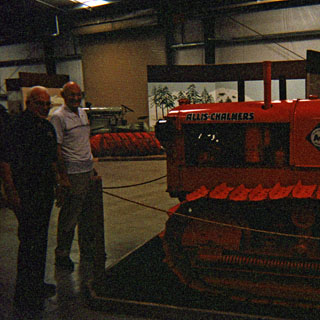
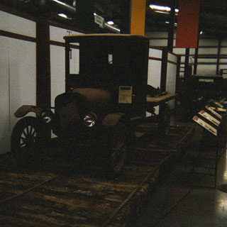
The Heidrick Ag History Center and the Hays Antique Truck Museum. One is on the right, and the other is on the left. I’m not exactly sure what the connection between the two is, but it’s not important.
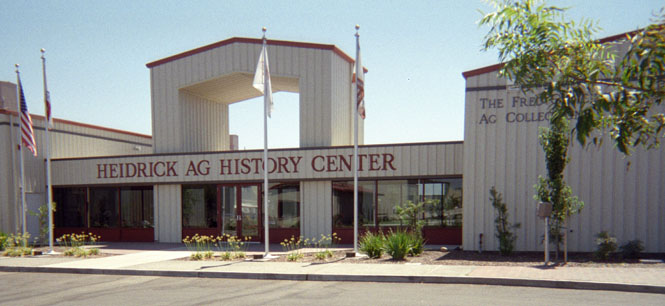
This is a terrific museum. They’ve assembled an enormous collection of farming equipment and old trucks. Woodland wouldn’t seem to be the ideal location, but here it is. An old Woodland street trolley is on the left.
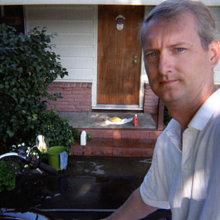
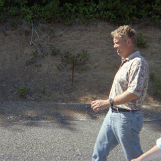
Dad, and our tour guide Ed.
This was the first time that I’d seen some of the early plank road that was used to cross the southern California desert. It wasn’t really very successful, as shifting sand would quickly ruin the road.
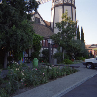
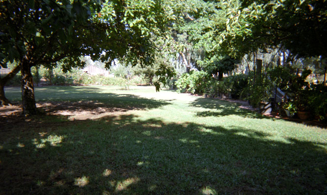
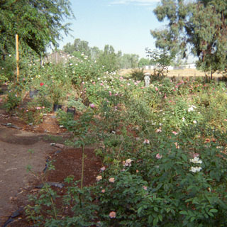
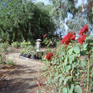
Back to Adena’s rose garden.
We met Sandi at Capitol (or is that Capital?) park over her lunch hour. This is the Trout pond.
After installing the new shocks (ahhhh), I was on the road again.
Yet another gas station shot—this one at Laytonville.
 Other than the fuel stop at Laytonville, this was my only stop on the way to
Eureka. It’s the demonstration forest not too far south of Rio Dell. Although full of
lots of lumber propaganda (forests need people to survive) it is a beautiful place.
Other than the fuel stop at Laytonville, this was my only stop on the way to
Eureka. It’s the demonstration forest not too far south of Rio Dell. Although full of
lots of lumber propaganda (forests need people to survive) it is a beautiful place.
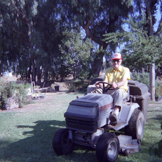
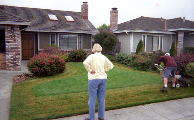
Mom and her yellow yard.
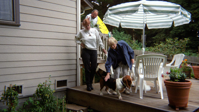
Good dog.
The Eureka Maritime Museum.
A worthwhile museum, with lots of historic and interesting photographs. But that woman who was running the place was just too much. She was desperate to enlist volunteers to help her, and was very persistent in asking every visitor. Gil made some comment about not having time to do it, and she answered (perhaps sarcastically) that he must be some sort of Doctor. I told her that, indeed, Gil was a Doctor, which only further set her off. Later Becky overheard her talking that the "Doctor" must not want to deal with people from her (apparently lower) social position.
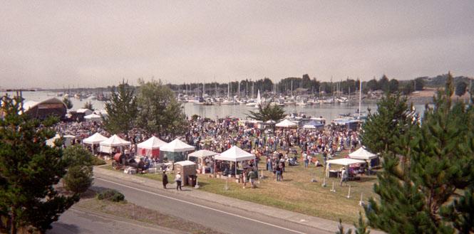
Blues on the Bay. Jazz by the Jetty. Rhythm on the rocks. Something like that anyway.
 Oregon
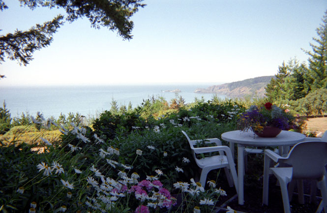
From Eureka it was north on highway 1 to Port Orford to See Aunt Ruth and Uncle Bill. This is the absolutely gorgeous view from their back patio.
By luck change Steven and Carmen were there visiting from Vancouver. I hadn’t seen them since the Vancouver Expo.
No, that’s not my bike. This lovely stone wall is at the center of a ridiculous controversy of the sort that seems to thrive in small towns. It is a very nice wall.
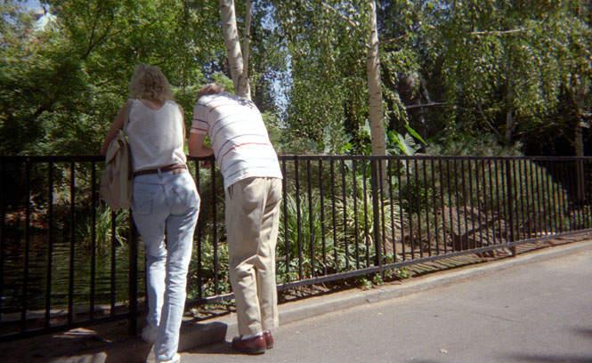
Ruth, Steven and Carmen and I drove to the point to try out one of the newer hiking trails.
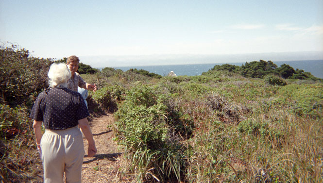
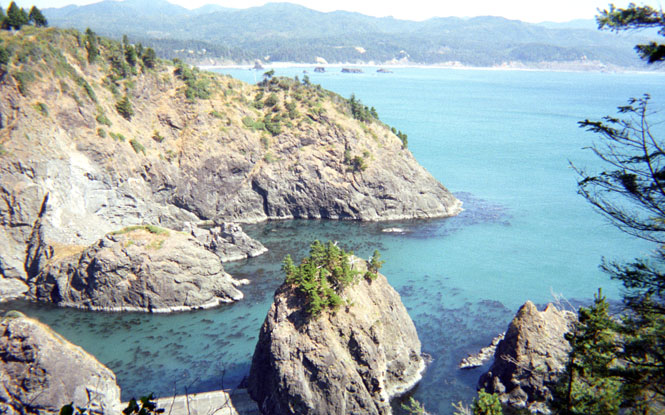
Cape Blanco – Port Orford
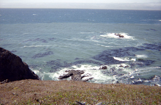
It was really quite windy out on the point. Beautiful place.
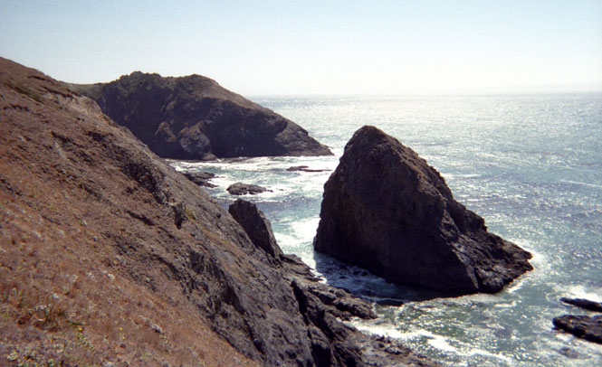
Looking over the old Coast Guard harbor towards Port Orford. Ruth said that at times you can watch whales from here.
 Before dinner, Steven, Carmen and I walked around the block—or what
passes for a block in Port Orford. Later we had a terrific lasagna meal that Carmen had
prepared.
Before dinner, Steven, Carmen and I walked around the block—or what
passes for a block in Port Orford. Later we had a terrific lasagna meal that Carmen had
prepared.
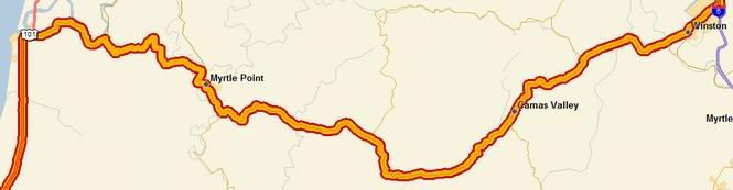
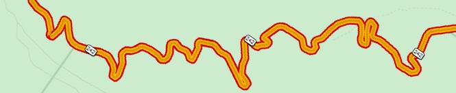
I had long given up making it to Vancouver Island. So I was trying to figure out some way to get across Oregon using roads that I hadn’t been on before. At least mostly. From Port Orford I stayed on highway 1 to Bandon, and the east across to Winston. At Eugene I turned east towards McKenzie Bride towards Sisters.
These days the main highway then turns north and then east again to avoid crossing the higher pass. I took the old road (now labeled "scenic highway"). It’s a great motorcycle road, but I understand why the new highway avoids the route. Near the summit the speeds slow down to an honest 15 mph as the road twists back and forth from one hairpin to the next.

Lava lands west of Sisters. The visitor’s center was undergoing renovation and was closed at the time.
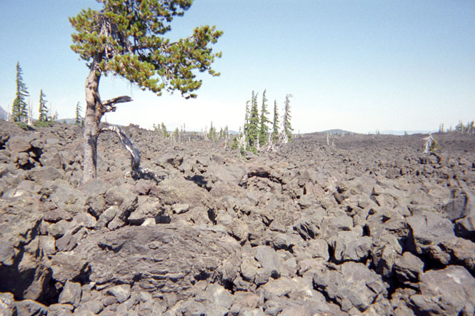
I cannot imagine crossing this area in a wagon, and yet this was on of the main routes across the Cascades at one time.
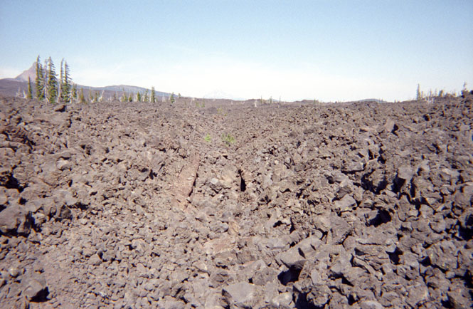
A lava stream bed.
Have I said yet how hot it was here? It was. HOT. This is a view looking east. The road that I’ll soon be on is down below. There was a paved trail that wound through the lava fields that I walked. An interesting place.
This trip gave me a chance to close a gap in my done-roads that has existed for many years. Some 15 years ago, on a different motorcycle, I had the rod bearings disintegrate just east of Mitchell. I managed to convince a local to take my bike and me in his pickup to Redmond. But since I haven’t ridden that stretch on a motorcycle, it doesn’t count and I’ve had that gap on my map ever since. So finally, I was able to ride to Mitchell.
Funny thing, though. When I got to Mitchell, the old highway had been abandoned, and the
new road sliced through a major road cut up the ridge on the east side of town. I could
see the old road
 clinging to the side of the hill, but I wouldn’t be riding it. Back
then, the engine failed when I was at the top of the hill. I ended up coasting with the
engine off all the way down (several miles) all the while hoping that there were no
up-grades before Mitchell. That was an interesting trip. This time it was uneventful.
clinging to the side of the hill, but I wouldn’t be riding it. Back
then, the engine failed when I was at the top of the hill. I ended up coasting with the
engine off all the way down (several miles) all the while hoping that there were no
up-grades before Mitchell. That was an interesting trip. This time it was uneventful.
I could easily have ridden further. But there isn’t too much between John Day and Ontario, so I stopped here for the night.
John Day the next morning. To the left is Nevada; I’m looking back towards west.
All in all, the route from Bend/Redmond through John Day to Ontario is much more interesting than the route through Burns. Both routes are about the same distance.
 Idaho
Idaho
Such an exciting picture. I stopped for an Egg-McMuffin® in Ontario.
From here on out, there were no new roads. It’s funny, but I almost felt that I was basically home since I’d been on these roads so many times in the past. From Ontario I stayed on the Interstate through Twin Falls, and then turned south on I-84 towards Ogden.
One of the most isolated service-stations anywhere I think. The stretch across southern Idaho is as empty as any in Nevada. Did I say how hot it was?
 Utah
Utah
 Wyoming
Evanston, Wyoming. I do wish that the Olympics would hurry up and be done with in Salt Lake. Construction there is making travel on the freeway system impossible. It’s been that way for several years now. I’m sure that it’ll be worth it, but…
I stayed at Evanston simply because I’d been on the road all day, and there aren’t too many more places in Wyoming after this. They’ve done a nice job fixing up their station, and their downtown area.
Downtown Evanston. I had dinner at a small Chinese restaurant near that hotel. It was surprisingly good.
The Ames Monument. I was actually trying to find the gravesite of one of the founders of the Lincoln Highway. Instead, I came across this thing:
The dirt road to get here is well off the freeway, and not particularly smooth.
Ames, Oakes, 1804-1873, American manufacturer, railroad promoter, and politician, b. Easton, Mass. With his brother Oliver he managed the family’s well-known shovel factory at Easton. The business grew under demands from the expanding Midwest frontier and the Western gold diggings. Active in founding the Republican party in Massachusetts, Ames served in the U.S. House of Representatives from 1863 to 1873. Interested in the construction of the Union Pacific RR, Ames secured control of the Credit Mobilier of America after ousting T. C. Durant, its founder. The financial scandals of the company brought upon Ames in 1872 public disgrace and the censure of Congress.
Credit Mobilier of America, ephemeral construction company, connected with the building of the Union Pacific RR and involved in one of the major financial scandals in American history. Oakes Ames, Thomas Durant, and a few other influential stockholders of the Union Pacific organized the Credit Mobilier under an existing Pennsylvania charter, which they took over. Acting for both the Union Pacific and for their newly created construction company, they made contracts with themselves. Oakes Ames, as head of the Credit Mobilier, in 18678 assigned contracts to seven trustees to build the remaining 667 miles of road for a total sum that brought profits variously estimated at from $7 million to $23 million. This process depleted generous congressional grants to the Union Pacific and left it under a heavy debt by the time of its completion in 1869. The scandal became political when Ames (a U.S. Representative), to forestall investigation or interference by Congress, sold or assigned shares of the Credit Mobilier stock to members of Congress at par, although the shares were worth twice as much at the time. He wrote to Henry S. McComb, an associate, that he had placed the stock, "where it will produce the most good to us" and subsequently forwarded a list of Congressmen who had received or were to receive shares. Later friction between Ames and McComb facilitated the publication of these letters in Charles A Dana’s New York Sun in the midst of the presidential election campaign of 1872. A subsequent investigation by Congress badly smirched the political reputations of Vice President Schuyler Colfac, Senator James W. Patterson of New Hampshire, Representative James Brooks of New York, and others—most of all, of course, Ames himself. Ames and Brooks were censured by Congress, but there were no prosecutions.
I feel fairly certain that the road I’m standing on is part of the original Lincoln Highway. There was once a small town here. I saw the cemetery for the town off in the distance, but I didn’t go have a look. Any other time I would have (but did I mention that it was really hot?).
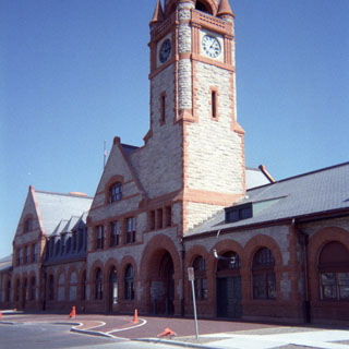
Cheyenne, Wyoming, the state capitol. At one time the Union Pacific had a Challenger Engine on display. But they’ve resurrected it for special occasions so it’s no longer here. The station, too, was closed.
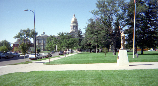
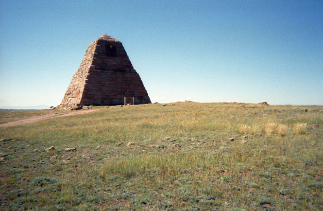
I hiked from the station to the capitol building passing yet another scale statue of liberty. Someday I need to research just how many of those were built. They were erected by the Boy Scouts of America many years ago and can be seen in small towns all across the country. Some are in better shape than others, and some have been painted weird colors. My favorite is here in Kansas. It’s on a wooded hill miles away from any town and off of a minor road. It has a certain charm looking over rolling Kansas prairie.
 Senate chambers. This turned out better than I expected considering that my
one-shot cameras don’t have flash. The desks were surprisingly ugly. When I asked
about them to an Information woman, I received far more information than I wanted.
She’d apparently been asked about the shabby furnishings before, and wasn’t
about to take it anymore. By God, Wyoming people expect their legislators to work at their
desks, and they aren’t about to pay for any east-coast foolishness! Well, fine. But
they’re still ugly.
Senate chambers. This turned out better than I expected considering that my
one-shot cameras don’t have flash. The desks were surprisingly ugly. When I asked
about them to an Information woman, I received far more information than I wanted.
She’d apparently been asked about the shabby furnishings before, and wasn’t
about to take it anymore. By God, Wyoming people expect their legislators to work at their
desks, and they aren’t about to pay for any east-coast foolishness! Well, fine. But
they’re still ugly.
 Colorado
 Oh dear... At the Colorado line I heard a noise that sounded like small
pebbles hitting my fender. The sound you might get when riding over a sandy road. I
didn’t think anything of it at first. Then after riding over 15 miles of two-way
traffic (due to construction) I heard it again, but louder this time. Suspecting that
something had come loose from my back-up electronic speedometer, I pulled over and checked
things out. The speedometer was indeed loose, so I tightened things up and got back on the
freeway.
Oh dear... At the Colorado line I heard a noise that sounded like small
pebbles hitting my fender. The sound you might get when riding over a sandy road. I
didn’t think anything of it at first. Then after riding over 15 miles of two-way
traffic (due to construction) I heard it again, but louder this time. Suspecting that
something had come loose from my back-up electronic speedometer, I pulled over and checked
things out. The speedometer was indeed loose, so I tightened things up and got back on the
freeway.
Then I heard it again, only much louder. When I pulled off the
 freeway and applied the
brakes, the whole front end twisted to one side and went clunk-clunk-clunk-scrape-clunk.
Hmmm. That doesn’t sound right.
freeway and applied the
brakes, the whole front end twisted to one side and went clunk-clunk-clunk-scrape-clunk.
Hmmm. That doesn’t sound right.
Looking at the front wheel again, I noticed that the left bearing was hanging out, with lots of twisted bits of metal. Saying out load: "now this is interesting".
It happened that I was within a mile of a major Busch brewery so I parked the bike on the shoulder and started walking. It wasn’t too hard to convince the guard to let me use his phone, and I started to make some phone calls.
Without going into all the details, I managed to track down a Guzzi owner in Ft Collins who had a trailer. Dick and Peggy came on out along with another Guzzi owner, and we loaded the bike into his trailer and went on to dinner. I spent that night in their basement bedroom (along with three Corgi dogs and four cats). The next morning Dick and I drove to a local bearing supply store where I bought a pair of 6004-2RS bearings. It didn’t take long at all to drive out what remained of the old ones and drive in the new ones. I was soon on my way again without really losing much time at all. Thinking back to all the places I’d been, it certainly could have been much more inconvenient (or interesting).
Kansas
I made it as far as Salina (just 100 miles from Wichita) before calling it quits. It had been a long day, and I just didn’t feel like riding that last 100 miles with the temperature over 100 degrees into a 40 mph south wind.
Early the next morning, things were so much better, and I rode on into Wichita.
Good Trip. About 4,500 miles