June, 2000

Sunday |
Monday |
Tuesday |
Wednesday |
Thursday |
Friday |
Saturday |
18 June |
19 |
20 |
21 |
22 |
23 |
24
|
25
|
26
|
27
|
28
|
29
|
30
|
1 July
|
2
|
3
|
4
|
5
|
6
|
7
|
8
|
9 |
10 |
11 |
12 |
13 |
14 |
15 |
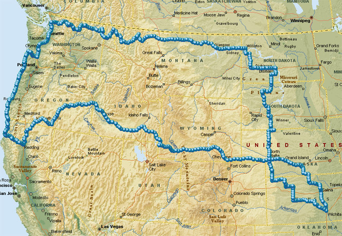
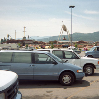
I headed out from Wichita with a vague notion of passing through the Black Hills and then riding northwest towards the Yellowstone River. I particularly intended to see Pompey's Pillar, which is about 30 miles downriver of Billings, Montana. As it happened, I didn't do any of this. Still, I did manage to pick up a few locations that had remained on my list of places to see: Roosevelt National Park (North Unit), Highway 2 between Havre and Shelby, Montana, and the stretch of road between Klamath Falls and Lakeview, Oregon.
This was one of the rare trips (perhaps the only one) in which I crossed my own path. For no logical reason, I try to arrange my route to avoid this (if the weather hadn't been quite so hot, I would have swung south into Colorado to avoid any crossings).
 Kansas
This trip didn't begin on an auspicious note. While only about two miles from my driveway the engine just stopped. Not a running-out-of-gas stop, but a turn-the-ignition-off stop. But, just as I pulled off the road, and let the clutch out to turn the engine over, it started right up again. At this point--essentially not even beginning yet--the sensible thing would have been to turn around and try to fix whatever problem I had. Well, I didn't. I hate turning around.
Not far after fueling in Rush Center, the engine quit again. Then it started. Then it quit. It did this a couple of more times going down the road until I pulled off into a rest area just west of the small town of Alexander. Here, as much as practical, I disconnected and reconnected all wires associated with the ignition system, and made sure that everything was clean. Nothing jumped out as being a problem, so I buttoned things up and continued on the way. At least I'd have plenty of time to think about it as I rode.
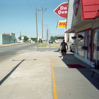
At Ness City, I turned north on 283 to Wakeeny, Kansas where I stopped at the Dairy Queen. Unfortunately, the weather was terribly hot.
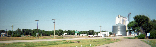
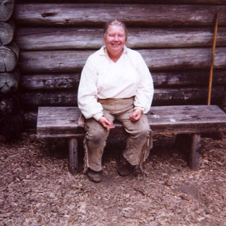
I managed to pick up a few stretches of Kansas road that I hadn't been on before, and ended up in Atwood where I stopped for the night. Atwood's a nice little town that probably peaked around 1917 (as did most towns in this part of Kansas). I had plenty of time before the sun went down to walk around most of the town.
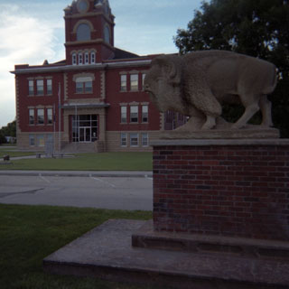
A nice Buffalo statue outside the Atwood high school.
 Nebraska
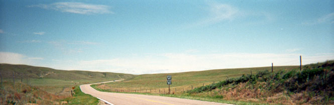
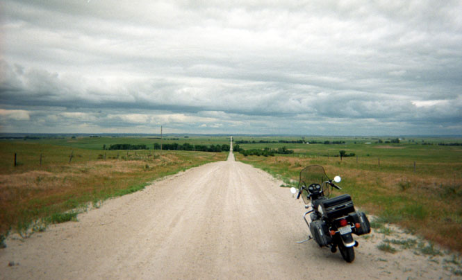
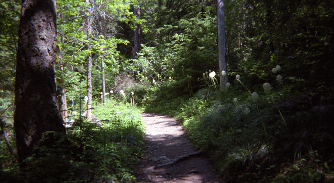
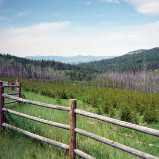
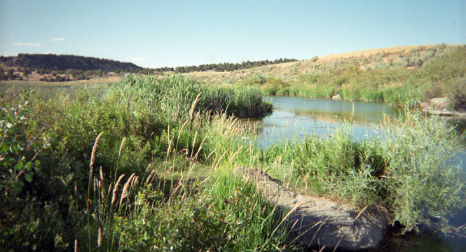
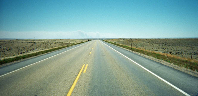
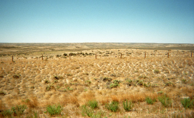
The next morning, I rode the few miles west to Bird City, and then headed north into Nebraska. First at Imperial, and then at Ogallala, I was tempted to turn west on any number of roads, but, in the end, I decided to stick to state highway 61 and take it all the way north across the state. This would give me the opportunity to see Arthur, Nebraska, the county seat (and only town) in Arthur county. Not even a gas station. I'd seen Arthur on maps before, and had always wondered what was there. Now I know. The photograph was taken between Arthur and Ogallala--well into the Sand Hills. Really beautiful country, and I enjoyed riding through it. No traffic to speak of, and the roads are still first generation (after dirt). The Sand Hills are a gently rolling region of grass lands that are apparently unable to support even the most meager cattle ranches. Consequently, this part of the country is hardly changed at all. The ride from Hyannis to Merriman (look at a map) was really incredible. Huge vistas, very few fences, and not one car.
After stopping for fuel in Merriman (and giving $10 to a couple who were trying to hitch a ride up to Martin) I intended to ride a short distance to the Bowring Ranch State Park, which shows on my map as being less than five miles away. I never did see a sign or any other evidence of a park so I just kept riding east. Riding east seemed altogether wrong since my goal was to go north and west. I kept expecting to come to some sort of cross road heading north into South Dakota, but didn't see anything promising.
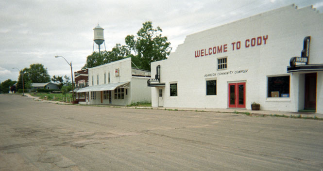
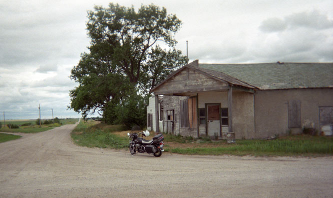
Finally,
at Cody, Nebraska I pulled into a nice little community park to look at a map,
and to eat a little something. Cody is a one-street town that
doesn't appear to have ever been very large. The building in the
photograph had been a gas-station / general store at one time. If I kept
on this route (east), I wouldn't be able to turn north until I reached Valentine.
 There was a road going north out of Cody, but it showed as unpaved above the
state line. But, there was a road north to Tuthill that was indicated as
being paved, so I doubled back (much as I hated doing it) and looked for the
road. I didn't ever see a sign for Tuthill, but I did see
a faded sign for the National Wildlife Refuge, so I figured that must be
the one.
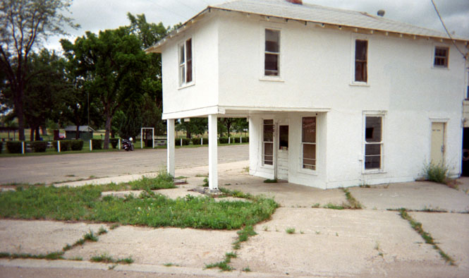
There was a road going north out of Cody, but it showed as unpaved above the
state line. But, there was a road north to Tuthill that was indicated as
being paved, so I doubled back (much as I hated doing it) and looked for the
road. I didn't ever see a sign for Tuthill, but I did see
a faded sign for the National Wildlife Refuge, so I figured that must be
the one.
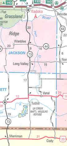
 South Dakota
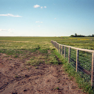
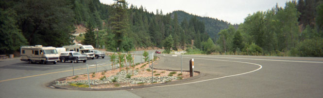
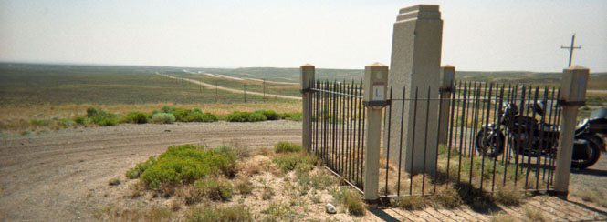
By now, I should really know not to trust maps when it comes to those thinnest little black lines (see the adjacent map). For the first five miles or so, the road really was paved although I had to wonder why it was getting so narrow. Clearly there had not been any maintenance done for thirty years or more. At the state line, however, any pretense of pavement ended, and I was on dirt from then on. The photograph was taken just inside South Dakota (and is possibly my favorite shot of the trip).
The shot below was taken from the same location--looking towards the east this time. All those clouds had done a nice job of dropping the temperature. Unfortunately, I did have to contend with a strong wind from the north. I was hoping that any rain would hold off while I was on the dirt. I don't mind so much riding off pavement, but I'd rather not have to ride through mud.
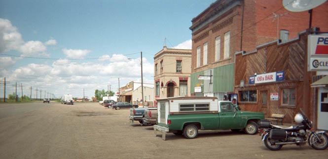
This is downtown Tuthill South Dakota. Just south (left) of this closed up gas station and garage was a working post office. There were a few houses around, but that's about it.
I'm always interested to find living towns of any size that are not accessible by paved roads--and Tuthill is one. From Tuthill north to the highway, the road got quite a bit worse. Some of the fiercest wash-boarding I've ever had to ride over. I wished more than once that I had taken the KTM instead of the Guzzi (other times I was glad to have the Guzzi and not the KTM).
I stopped at Kadoka to consider my next move and to eat lunch. If I were to head west across the Black Hills and into Montana I needed to make a move now. While I was sorting this out (in a booth at Bob's Big Boy), a 30ish couple from California (I checked the tags on their BMW) was asking the waiter a hundred questions about the food--what kind of cheese it was, what sort of lettuce, what type of wheat in the pasta (!). Poor kid. It's cheese, lettuce, and noodles. That's it. Don't eat at Bob's Big Boy if you care.
 Anyway,
I had made up my mind to go to Rapid City and then northwest to Belle Fourche
and then into Wyoming and Montana. I had only ridden about five miles on I-90
(my first freeway miles of the trip) when I changed my mind. The headwind
was too tiring, and I hate freeways. So, the first chance--state highway
73 it turned out--I turned north. From here on I was depending on my
memory of the road system since I hadn't even been looking at these roads back
there at the Big Boy (and was not going to stop just to read a map. But
ultimately I found my way to Faith, where I stopped for the night. I could
have ridden on for an hour or so, but, if you look at a map of this area you'll
see that there aren't too many places where you could expect to find a
motel. The photograph is nothing in particularly except open prairie north
of Faith.
Anyway,
I had made up my mind to go to Rapid City and then northwest to Belle Fourche
and then into Wyoming and Montana. I had only ridden about five miles on I-90
(my first freeway miles of the trip) when I changed my mind. The headwind
was too tiring, and I hate freeways. So, the first chance--state highway
73 it turned out--I turned north. From here on I was depending on my
memory of the road system since I hadn't even been looking at these roads back
there at the Big Boy (and was not going to stop just to read a map. But
ultimately I found my way to Faith, where I stopped for the night. I could
have ridden on for an hour or so, but, if you look at a map of this area you'll
see that there aren't too many places where you could expect to find a
motel. The photograph is nothing in particularly except open prairie north
of Faith.
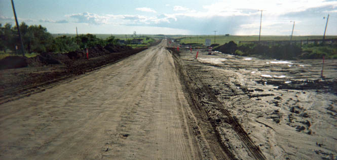
I made a mental note to avoid the road west out of Faith if it rained at all during the night. Even without rain the road looked rather slimy. This would change my plans a bit. I had intended to go west out of Faith and then north, but I wasn't looking forward to this stuff.
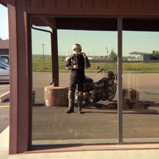
Shot taken the next morning at the hotel. It's a reflection of me holding the camera in my right hand.
 North Dakota
Since there was no sense in sloshing through the mud (wishing for the KTM again), I again found myself riding east when I really wanted to go west. This area is within the Cheyenne Reservation and I found it really interesting. You'd think that I'd at least take one picture. Zigging and zagging over a number of roads I crossed into North Dakota and found myself approaching the city of Mandan. Since the capitol of North Dakota (that would be Bismarck) was just across the river (that would be the Missouri) I made the side trip.
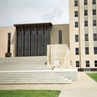
The capitol building. Not much to look at, really. The building is older than it looks, but while you have to admire them for not putting up yet another replica of the US capitol building (as most states do), it's not particularly interesting. Some interesting stuff inside though.
The state museum was down the mall about half way, and I ended up spending a number of hours in Bismarck. All the while I kept an eye on the weather, but it never did rain. You may be able to see my reflection in the center door of the museum entrance.
It turns out that North Dakota has been quite the revolutionary state. I had had no knowledge of the truly enormous collective farms that existed here in the late 1800's. It was the only way to make money from the land then, and a few people (who didn't always live in the state) made a great deal of money. The people working the land didn't fare so well which created some real socialistic tendencies in the state. Gave me a whole new perspective on the settling of the center part of this country--nothing like the history of Kansas and Nebraska. Interesting area.
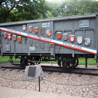
After the 2nd world war, the French sent over an entire train of rail cars and exhibits that toured the nation as thanks for the US participation in the war. I'm not sure but that North Dakota may be the only state that still has their car.
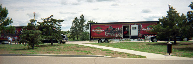
From Bismarck, it was back on the dreaded freeway (I-94). I stopped at a rest area near New Salem. The Budweiser Clydesdales were being transported in a number of luxurious semi-trucks. Each truck held maybe a dozen horses and one dog. I don't see him in the picture (I know he's there), but the dog-not-seen is "Gus."
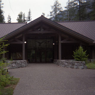
I followed a number of roads getting to Theodore Roosevelt National Park (North Unit), and somehow managed to avoid getting rained on too much. In one spot, I was especially lucky. There was road construction on a 4 mile stretch of road and the detour was bare dirt through the construction site. If there had been any rain at all in this area, it might have been impassible for me. Cars can cope in slippery mud, but motorcycles with street tires don't do so well.
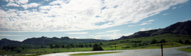
Shot taken from the Visitor's Center. It turns out that the small center was closed by the time I arrived. Oh well. At least the restrooms were open. There was a heavy downpour just before I arrived. I hit a little of it, but nothing too bad.
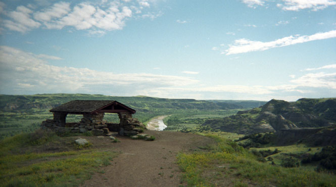
I took the winding scenic road through the park and parked at one of the overlooks of the Little Missouri River. I had been to the South Unit of this park several years ago, but this was my first time at the North Unit. It had always gnawed at me that I hadn't been here, so it was very nice to finally make it. The hut is a WPA structure and represents an enormous amount of work. The park is little visited even today, and must have been especially deserted during the 1930's. I'm sure more than one laborer complained that nobody would ever use these buildings.
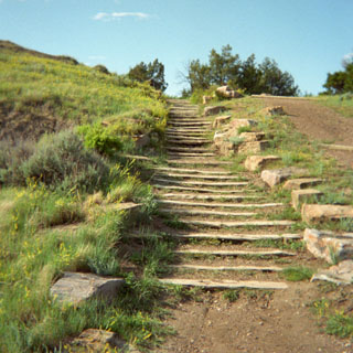
Stairs leading down from the overlook.
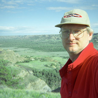
The Little Missouri River. I spent a couple of hours walking along the ridge and just sitting and watching the river. I really like this park. It's pretty similar to the South Unit except that there aren't any people here. This is not to say that the South Unit is at all crowded.
 I fully intended to ride north of the park
and spend the night in Watford City. Turns out, however, that Watford City
doesn't have very many motels, and the ones it did have were full. So, I
continued on towards Williston with the sun shining right into my eyes.
I fully intended to ride north of the park
and spend the night in Watford City. Turns out, however, that Watford City
doesn't have very many motels, and the ones it did have were full. So, I
continued on towards Williston with the sun shining right into my eyes.
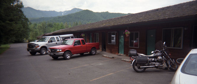
As it happened, I didn't need to go all the way to Williston, as the little town of Alexander had rooms available. Not particularly nice rooms, but sort of clean and certainly cheap. The two shots below are of the Motel complex and the main street through town. It would have been ideal if there had been a cafe in town or even a place to buy food. Nothing.
 Montana
The next morning I rode on up to Williston and sat in a truck stop cafe while I had breakfast and poured over the maps. I was trying to sort out if I should keep going north into Canada (I certainly had the momentum to go that way) or to turn west and take the highline (as US 2 is called) across Montana.
Eventually the highline won out. It wasn't so much that there was more to see in Montana than Canada, but that this stretch of road has been on my list for sometime now and as long as I was here...
 This is not particularly distinctive country,
but there sure is a lot of it. Miles, and miles of droning. I
stopped at a bar/cafe in Saco for lunch (photo). I've been here before,
but on that earlier trip, I headed south towards Lewistown. From Malta to
Shelby I'd be traveling all new highway.
This is not particularly distinctive country,
but there sure is a lot of it. Miles, and miles of droning. I
stopped at a bar/cafe in Saco for lunch (photo). I've been here before,
but on that earlier trip, I headed south towards Lewistown. From Malta to
Shelby I'd be traveling all new highway.
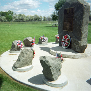
I stopped at Harlem for a break and noticed this memorial. It's in commemoration of a C-141 training flight out of McChord AFB that crashed near the small town killing all aboard. The town took in many of the families of the victims during the aftermath of the accident and subsequently erected the large stone monument along with the smaller ones for each crew member.
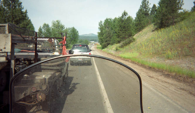
 I
believe the photograph below was taken outside the very small town of Lohman.
A grain train was moving in and out (and always across the road). Since it
was clear to me that the delay might be close to 30 minutes, I pulled over and
explored the local used car lot / flea market. Didn't see any bargains.
I
believe the photograph below was taken outside the very small town of Lohman.
A grain train was moving in and out (and always across the road). Since it
was clear to me that the delay might be close to 30 minutes, I pulled over and
explored the local used car lot / flea market. Didn't see any bargains.
At Havre, Montana I was all set to change the oil on the bike, and so started to look for a likely motorcycle shop. Sometimes it's easy, and sometimes not. This time I struck out. The ideal situation is where they will sell me the oil, and give me the funnel and pan to do the job myself. No fuss, and I can have the old oil out and the new oil in in less than five minutes (the biggest time consumer is the time it takes for the oil to pour out of the bottles). After an unpleasant exchange with a counter-man who never heard of Moto Guzzi (as if that mattered) which led to the owner going on about a $50 repair job to his parking lot the last time somebody changed their oil, I left.
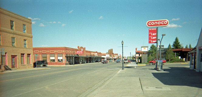
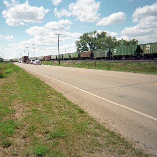
The road from Havre to Shelby is just stunning. I've never seen anything like it. While the map shows a number of little towns about 10 miles apart, in practice there's nothing. In any case, the towns have no services of any kind. This is an area of no fences and mile after mile of open prairie and wheat fields. It would be possible for a combine driver to run a straight line of 10 miles or more without having to turn. You could easily imagine taking off from the highway and coming across a heard of buffalo. The photograph is taken from a shady spot in Shelby. It was just too hot that day. I had stopped in Chester for fuel and water, but still ended up drinking both of my water bottles empty.
 When
I reached Cut Bank, I had the choice of going on, or stopping. But,
remembering the last time I was through here and how I didn't think I'd ever
find a vacancy near Glacier Park, I decided to call it quits at Cut Bank.
The photograph was taken the next morning. That's my motel off in the
distance on the right. If the resolution were higher, you'd be able to see
the Rocky Mountains rising up in the distance. Really spectacular.
When
I reached Cut Bank, I had the choice of going on, or stopping. But,
remembering the last time I was through here and how I didn't think I'd ever
find a vacancy near Glacier Park, I decided to call it quits at Cut Bank.
The photograph was taken the next morning. That's my motel off in the
distance on the right. If the resolution were higher, you'd be able to see
the Rocky Mountains rising up in the distance. Really spectacular.
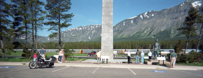
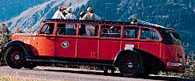
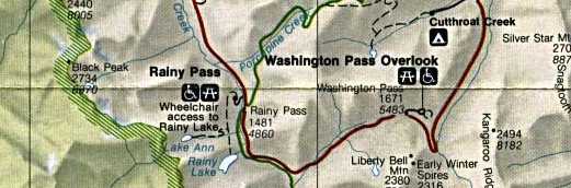
At Browning I debated whether to go to St Mary and take the Going-to-the-Sun Road through the park, or to take the southern route to West Glacier. In the end, I went with the southern route. I'd been on the Going-to-the-Sun twice already, and really hate to pass up a road I've not done before. And too, I planned to take the bus tour on one of the old roll-top 1934 White tourist busses that the park is famous for.
 As it turned out, I'm glad I
did. This was the route discovered by John F. Stevens of the Great Northern
Railroad in 1889 (that late!) and is the lowest pass through the Rocky Mountains
(Marias Pass 5,280 ft). Interestingly, the Lewis and Clark expedition was
within 20 or 30 miles of the pass, but didn't find it. It certainly is the
easiest way across the Rockies, and would have made their trip much
quicker. Really a beautiful road as it follows creeks on both sides of the
divide. The monument above is dedicated to Theodore Roosevelt, and the
statue is of John F. Stevens. There is a great deal of train traffic
across the pass, and it seemed as if there was always something on the
tracks. I noticed quite a few train spotters taking pictures at the
crossings.
As it turned out, I'm glad I
did. This was the route discovered by John F. Stevens of the Great Northern
Railroad in 1889 (that late!) and is the lowest pass through the Rocky Mountains
(Marias Pass 5,280 ft). Interestingly, the Lewis and Clark expedition was
within 20 or 30 miles of the pass, but didn't find it. It certainly is the
easiest way across the Rockies, and would have made their trip much
quicker. Really a beautiful road as it follows creeks on both sides of the
divide. The monument above is dedicated to Theodore Roosevelt, and the
statue is of John F. Stevens. There is a great deal of train traffic
across the pass, and it seemed as if there was always something on the
tracks. I noticed quite a few train spotters taking pictures at the
crossings.
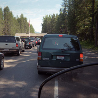 This picture has become something of a
tradition for me; the wait at the ranger station at the entrance to a
National Park. In this case it's Glacier National Park. I generally
shut the engine off in lines like this, and just paddle my way forward as each
car in turn pays its way.
This picture has become something of a
tradition for me; the wait at the ranger station at the entrance to a
National Park. In this case it's Glacier National Park. I generally
shut the engine off in lines like this, and just paddle my way forward as each
car in turn pays its way.
My first order of business was to ride to Fish Creek and have lunch at the restaurant there. As it happened I was a bit early for lunch and settled for an omelet. I wasn't entirely sure where the (red) White busses departed from, so I asked a couple of the wait-staff. I was disappointed to hear that they had been discontinued and were replaced by a fleet of Ford vans. Well, there was no way I was going to tour the park in a Ford van, but I thought I'd ride on up to Lake McDonald anyway.
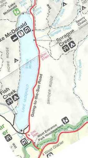 After
riding for several days in the prairie, this was my first real chance to ride
through dense forests. Very nice. Even though I wasn't planning on
taking the Going-to-the-Sun Road all the way to the top, even part in the valley
is worthwhile as it follows the shore of the lake. The Lake McDonald
lodge is a classic National Park Lodge, but before I checked all that out, my
first priority was to get off the motorcycle and do some walking. On the
map, the trail to Sperry Chalet didn't look all that long, and anyway, it
appeared to just follow a creek. How tough could that be? I even had
the idea that I would take the path up to the ranger fire-lookout tower. I
stepped out of my riding suit, changed my boots for walking shoes, put on
a red Polartec pull-over, packed two bottles of water and a handful of granola bars
and was off.
After
riding for several days in the prairie, this was my first real chance to ride
through dense forests. Very nice. Even though I wasn't planning on
taking the Going-to-the-Sun Road all the way to the top, even part in the valley
is worthwhile as it follows the shore of the lake. The Lake McDonald
lodge is a classic National Park Lodge, but before I checked all that out, my
first priority was to get off the motorcycle and do some walking. On the
map, the trail to Sperry Chalet didn't look all that long, and anyway, it
appeared to just follow a creek. How tough could that be? I even had
the idea that I would take the path up to the ranger fire-lookout tower. I
stepped out of my riding suit, changed my boots for walking shoes, put on
a red Polartec pull-over, packed two bottles of water and a handful of granola bars
and was off.
As it would turn out, there was no way I would make it to Sperry Chalet or the ranger tower. While the path did follow a creek, I had not expected that the creek would be nothing less than a long waterfall, and that the path would be more like climbing a continuous series of stairs than a leisurely stroll. At least that's how it seemed.
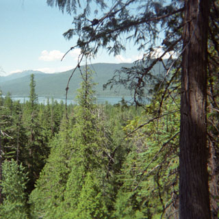 Photograph
taken at a look-out point after what seemed a pretty good distance. Up to
this time I thought I was making fine progress. Except for when I passed a
sign facing the down hill walkers. I turned around to read the sign and it
said "Lodge: 1.7 Miles." So the lake you see down there in the
distance isn't nearly as far as it appears. I had to reset my goals.
A beautiful place to hike, though.
Photograph
taken at a look-out point after what seemed a pretty good distance. Up to
this time I thought I was making fine progress. Except for when I passed a
sign facing the down hill walkers. I turned around to read the sign and it
said "Lodge: 1.7 Miles." So the lake you see down there in the
distance isn't nearly as far as it appears. I had to reset my goals.
A beautiful place to hike, though.
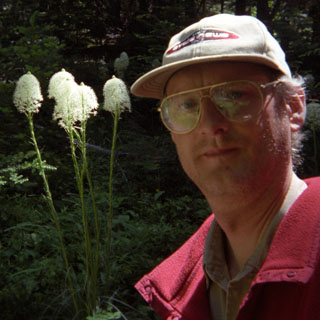
A more level section of the trail with interesting plants.
No doubt these are common plants, but I have no idea what they are (let me know, and I'll update this page). Quite striking looking, and lots of them.
When I reached the crossing with Snyder Creek, I drank the last of my water, and concluded that while I'd very much like to continue on to Sperry Chalet, the timing didn't look too good.
 Back
at the Lodge, I again made inquires about the White busses. This time I
think I got the
correct
story. Apparently they had found fatigue related
cracks in the frames of the busses and had taken the entire fleet down for maintenance. They were expected to be back next year, and in the interim
they were using Ford vans. I'm glad to hear that that they'll be back.
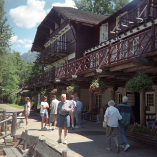
The interior of the lodge (see photo of exterior) was magnificent--full of
enormous log construction and massive woodworking that I expect to see in a
National Park lodge. Additionally, there was a grand piano in the rustic
lobby that was being played by an older man who was having a great time.
Back
at the Lodge, I again made inquires about the White busses. This time I
think I got the
correct
story. Apparently they had found fatigue related
cracks in the frames of the busses and had taken the entire fleet down for maintenance. They were expected to be back next year, and in the interim
they were using Ford vans. I'm glad to hear that that they'll be back.
The interior of the lodge (see photo of exterior) was magnificent--full of
enormous log construction and massive woodworking that I expect to see in a
National Park lodge. Additionally, there was a grand piano in the rustic
lobby that was being played by an older man who was having a great time.
I eyed that western unpaved road up to Flathead Canada for some time before admitting that while 100 miles of dirt road would be great on the KTM, it would not on the bike I had. Maybe next time... So, I returned to West Glacier and then continued west through Kalispell.
 I made another attempt to change the oil in
Kalispell, but while this time the owner of the quick-lube shop was very
willing, he didn't have any 20-50 on hand, and surprisingly neither did any of
the stations within close distance. I'll keep trying.
I made another attempt to change the oil in
Kalispell, but while this time the owner of the quick-lube shop was very
willing, he didn't have any 20-50 on hand, and surprisingly neither did any of
the stations within close distance. I'll keep trying.
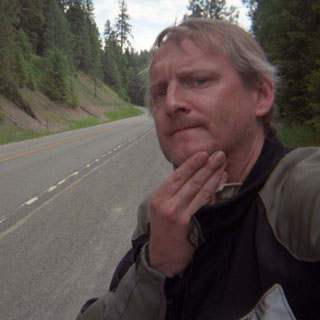
Somewhere
east of Libby, a stinging insect of indeterminate species decided to attack my
chin just forward of the helmet chin strap. I immediately knew that this
was going to hurt a lot in about 10 seconds, so I quickly pulled to the side of
the road, yanked my helmet off and and quickly applied some anesthetic
ointment. Even so, for the next 15 minutes it didn't feel at all
good. 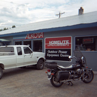 As a matter of fact, this particular sting would leave a
hard lump in my
chin for the next 6 weeks.
As a matter of fact, this particular sting would leave a
hard lump in my
chin for the next 6 weeks.
And, finally. Just outside Libby I stopped at a Polaris dealership thinking that snowmobilers can be depended on to be good folks. I was right. They had the right weight of oil, and were only too happy to give me the funnel and drain pan that I needed to do the job right there in the parking lot. Three quarts of Kawasaki 20-50 oil. And, for what it's worth, I also had a really good salmon steak for lunch in a nearby restaurant.
 Idaho
Idaho
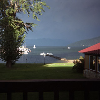 Staying
on US highway 2 (as I did all the way across Montana), I crossed into Idaho at
Bonners Ferry. From here on down to Sandpoint it was raining quite
heavily. It wasn't a cold rain and it wasn't blowing particularly hard, so
I didn't mind it too much. Even so, by the time I reached Sandpoint I
could see very dark clouds over the mountains to the west--the same mountains
that I was expecting to cross. It wasn't much of a decision, then, to stop
for the night. For some reason, whenever I ride for any distance in
solid rain I tend to want to check into the better hotels. Surprisingly
the price at the Edgewater Resort Hotel wasn't too bad, and the room was
terrific. The photo was taken off my back patio looking out over the grass
lawn to Lake Pend-Oreille. The rainstorm had just blown over, and
the sun was coming out. Feeling extravagant, I walked the short distance
to the downtown area and had dinner at an especially up-scale Mexican restaurant
and had probably the best food of the trip. Sandpoint is becoming very
much like Aspen Colorado and Sun Valley Idaho--a very wealthy resort town.
Sandpoint's not quite there yet, but it's getting closer.
Staying
on US highway 2 (as I did all the way across Montana), I crossed into Idaho at
Bonners Ferry. From here on down to Sandpoint it was raining quite
heavily. It wasn't a cold rain and it wasn't blowing particularly hard, so
I didn't mind it too much. Even so, by the time I reached Sandpoint I
could see very dark clouds over the mountains to the west--the same mountains
that I was expecting to cross. It wasn't much of a decision, then, to stop
for the night. For some reason, whenever I ride for any distance in
solid rain I tend to want to check into the better hotels. Surprisingly
the price at the Edgewater Resort Hotel wasn't too bad, and the room was
terrific. The photo was taken off my back patio looking out over the grass
lawn to Lake Pend-Oreille. The rainstorm had just blown over, and
the sun was coming out. Feeling extravagant, I walked the short distance
to the downtown area and had dinner at an especially up-scale Mexican restaurant
and had probably the best food of the trip. Sandpoint is becoming very
much like Aspen Colorado and Sun Valley Idaho--a very wealthy resort town.
Sandpoint's not quite there yet, but it's getting closer.
The next morning, the weather was clear and nice. This is just another road-construction site. At least it gives me a chance to get a camera out to take a picture. Unfortunately, this trip is like all the rest; the best parts are rarely seen in my photographs, because I'm busy riding the bike, and I don't want to stop. I really do need to sort out a way of securing a camera to the handlebars to allow me to take pictures on the move. Of course, a camera with a motorized winder would help, but a motorcycle is a terrible place for a camera worth more than $4.00.
Incidentally, by this time I had determined that my intermittent ignition problem was due to a short in the ignition switch. This is not an uncommon problem for older Guzzis (it is Italian, after all), but I'd never encountered it before. I think it may have started with a little ArmorAll that trickled into the key slot. In any event, I squirted a little key lubricant into the slot when I was in Eureka, and the problem never returned.
 Washington
 Since
way back in Shelby, Montana, I had been traveling on roads that I'd already been
on before, so I was anxious to find something new. First, though, I had to
get to them. At Newport, I turned north on 20 following the Pend-Oreille
River (always seems backwards to me when major rivers flow north) up to Tiger,
and then across the Selkirk Mountains to Colville which is where this picture
was taken. More precisely, I'm in a Wal-Mart parking lot. I don't
normally wear ear plugs when I ride (though I should), but there was
something about the rpms that I had to keep that made a particularly penetrating
noise. So, I stopped here to pick up some bright pink foam plugs that I
used for the remainder of the trip. Very effective. Initially,
I had to take them out when I was in particularly hilly country because I couldn't properly hear the sound of the engine which made it hard to tell my
shift points. Eventually, this wasn't a problem, and I kept them in all
the time.
Since
way back in Shelby, Montana, I had been traveling on roads that I'd already been
on before, so I was anxious to find something new. First, though, I had to
get to them. At Newport, I turned north on 20 following the Pend-Oreille
River (always seems backwards to me when major rivers flow north) up to Tiger,
and then across the Selkirk Mountains to Colville which is where this picture
was taken. More precisely, I'm in a Wal-Mart parking lot. I don't
normally wear ear plugs when I ride (though I should), but there was
something about the rpms that I had to keep that made a particularly penetrating
noise. So, I stopped here to pick up some bright pink foam plugs that I
used for the remainder of the trip. Very effective. Initially,
I had to take them out when I was in particularly hilly country because I couldn't properly hear the sound of the engine which made it hard to tell my
shift points. Eventually, this wasn't a problem, and I kept them in all
the time.
Another side note: For this entire trip I had occasional problems at some throttle settings. The result was that I was unable to consistently cruise at speeds much above 70 mph, and I was sometimes unable to maintain good speed going up steep grades. In general, it seemed to act like it was starved for fuel, or perhaps the coil was breaking down. And to make it more baffling, for the first 30 miles or so after filling up, I would generally not have any problems. I thought it might be a plugged vent in the gas cap, but that was easy to check, and it turned out not to be the problem. Jumping to the end, after the trip was done, I cleaned out the carburetor jets and the float bowls and that solved the whole thing. I'm guessing that some very small particles were being picked up out of the bowls and partially plugging the jets. But, sometimes after shutting the engine off, the particles would dislodge and things would clear up for a time. I relearned a lesson that I'd already known. Clean the carburetors before leaving on a long trip. On the plus side, I returned much better mileage than I otherwise would have--50 mpg on several occasions.
At Kettle Falls, I crossed the Columbia River and headed up Sherman creek over Sherman Pass. A new road finally. The photograph was taken near Wauconda Pass.
The descent into the Okanogan valley was awful. It just got hotter and hotter as I got closer to the river. What is this desert doing between two densely forested mountains? The photograph was taken at a rest stop along the river just south of Okanogan. I stayed here long enough to avoid the hottest part of the day as well as to finish off another Patrick O'Brien novel.
 I
cannot believe that I rode all the way from Omak through North Cascades National
Park without taking but one photograph. You'll have to trust me that this
is a spectacular road. Oddly, the best part is not actually in the park,
but from Mazama and on over Washington Pass and Rainy Pass. I'm not sure how the boundaries of
the park were chosen, but they managed to miss some of the best parts of the
Cascades (judged only by the view from the road--perhaps unfairly). This is wonderful country. My lone photograph is of the
newly built park headquarters. The last time I rode through this area I
was surprised that there was no central hub of the park. Every park should
have something that lets you know you're there. This new building
looks nice, and the next time I'm there, I'll arrive a bit earlier.
I
cannot believe that I rode all the way from Omak through North Cascades National
Park without taking but one photograph. You'll have to trust me that this
is a spectacular road. Oddly, the best part is not actually in the park,
but from Mazama and on over Washington Pass and Rainy Pass. I'm not sure how the boundaries of
the park were chosen, but they managed to miss some of the best parts of the
Cascades (judged only by the view from the road--perhaps unfairly). This is wonderful country. My lone photograph is of the
newly built park headquarters. The last time I rode through this area I
was surprised that there was no central hub of the park. Every park should
have something that lets you know you're there. This new building
looks nice, and the next time I'm there, I'll arrive a bit earlier.
The town of Concrete is just west of the park boundary, and is where I stopped for the night. For dinner I had a terrific pizza at a coffee and pizza restaurant within walking distance (not to be confused with a coffee shop. This place offered seemingly hundreds of varieties of coffee drinks and nearly that many types of pizzas; many downright peculiar).
Breakfast the next morning in Hamilton. A pretty good mushroom omelet.
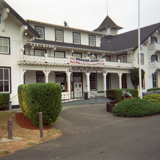
The ride south into Seattle was the normal routine of intermittent rain combined with increasingly heavy traffic as I neared the city. I have never enjoyed riding through this place. After stopping for half an hour at the local Guzzi shop in Seattle, I continued on down I-5 to Tacoma, where--for the very first time--I was able to tour the Ft. Lewis Museum. This was perhaps the sixth time I'd tried to see the place, and in all my previous attempts, either it was closed, or I was unable to fight the bureaucracy. I never gave up, but even so, I was quite surprised to find that it was not only open, but that I was able to drive onto the base without any catch-22 provisions.
Told by the guard: "Sir, you are not allowed to ride on the base roads without an approved reflecting vest." Me: "but, my riding suit has the same reflectors on it." Him: "It's not approved." Me: "How do I get an approved vest?" Him: "You need to go to the security office; they have some available for use." Me: "Great, I'll ride there now." Him: "You can't do that sir, because you aren't wearing an approved vest."
I didn't stop at all (except for fuel) from Tacoma down to Longview.
At Longview, instead of crossing the Columbia , I decided to stay on the north side of the river in order to record some new pavement. First, though, I had lunch at a Schlotsky's sandwich shop. I Didn't know those things were outside the Oklahoma/Kansas area.
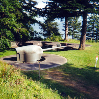
 The photographs below are of Fort
Columbia. The fort was established in order to protect the entrance to the
Columbia River. I found it to be a fascinating place. The
nearest that the gunners came to glory was when a Japanese submarine shelled
areas south of the mouth of the river (near Fort Stevens) and within range of
the guns. The officer in charge ordered his men not to fire in
order to avoid being detected by the submarine. Very disappointed
gunnery crew, I'm sure. There was an investigation of the incident,
where--no surprise here--the commanding officer was exonerated. The
consensus was that it was his call. In earlier competitions with other
coastal batteries, the gun crew had shown themselves to be some of the
best. So who knows, if they would have been able to hit the sub or
not. In the end, nothing came of it one way or the other.
The photographs below are of Fort
Columbia. The fort was established in order to protect the entrance to the
Columbia River. I found it to be a fascinating place. The
nearest that the gunners came to glory was when a Japanese submarine shelled
areas south of the mouth of the river (near Fort Stevens) and within range of
the guns. The officer in charge ordered his men not to fire in
order to avoid being detected by the submarine. Very disappointed
gunnery crew, I'm sure. There was an investigation of the incident,
where--no surprise here--the commanding officer was exonerated. The
consensus was that it was his call. In earlier competitions with other
coastal batteries, the gun crew had shown themselves to be some of the
best. So who knows, if they would have been able to hit the sub or
not. In the end, nothing came of it one way or the other.
The fort is nicely restored and benefited from its very isolated location. Vandalism over the years was minimal.

 Oregon
After crossing the river into Astoria, I rode the short distance to Fort Clatsop National Memorial--the winter quarters of the Lewis and Clark Expedition. I arrived a little too late to bother with the visitor's center, but I was able to walk through the outdoor exhibits and see the replicated buildings.

I spent the night at the resort town of Seaside, Oregon. It was nice to have enough time left in the evening to walk the beach and to walk up and down the town streets.
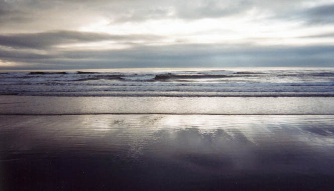
 A nice place, although the edge between nice and upscale and
not-so-nice and run down is pretty sharp.
A nice place, although the edge between nice and upscale and
not-so-nice and run down is pretty sharp.
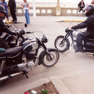
A "rowdy gang" of Montgomery Ward Riverside motorcyclists. This is a rather obscure motorcycle actually made by Puch (of Austria) and features two cylinders and one combustion chamber--a twingle. These guys had actually ridden these machines of questionable reliability all the way from Michigan. They seemed to be having a great time of it.
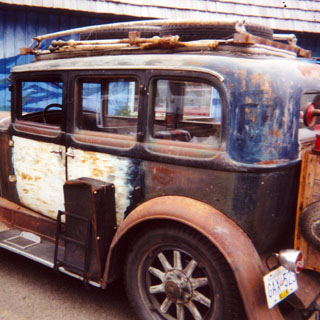
I ran across this interesting vehicle (1928ish Nash) near Manzanita. The internals of the car are in good working order, but the external parts have been left as-is to represent the car during the depression years. he was driving south from Vancouver towards California. I admired the owner for what he was doing and had a nice talk with him in the cafe.
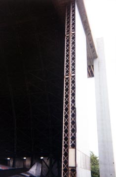
After passing by the enormous hangar on several previous trips, I finally stopped at the Tillamook Air Museum. Quite a few nicely restored airplanes of all types. But the building was quite a show piece unto itself. The photograph shows just the edge of one of the hangar doors. This is (or at least was) the largest building of its type in the world. The fact that "its type" refers to its wooden construction explains the destruction of its next-door twin several years ago.
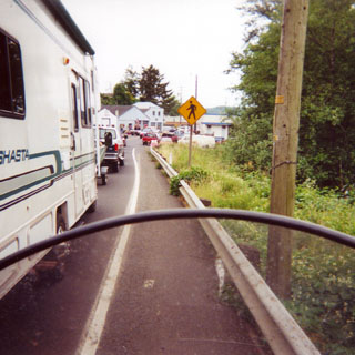
Photograph of traffic backed up in Lincoln, Oregon.
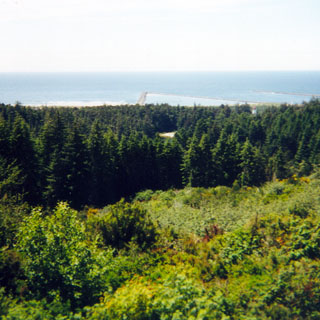
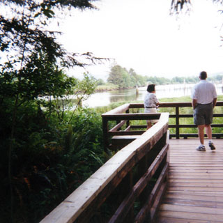
The view from a roadside stop in Oregon.
 California
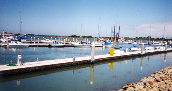
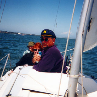
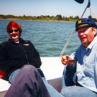
In Eureka, Dad came up from Sacramento, and we all had really good weather for sailing on the Bobbin'. Managed to clean and service the motorcycle, as well, for the trip home.
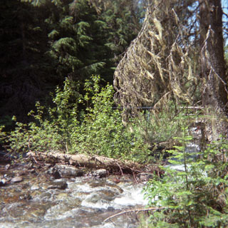
The route back started over some pretty familiar roads. I took 299 out of Arcata through Willow Creek and then down into Redding. The shot below was taken at a rest stop along 299.
Stopped to eat lunch at the Y-cafe in Weed, California. I'm afraid that the restaurant is not what it once was. The Safari Room is long gone, and the food isn't so good either.
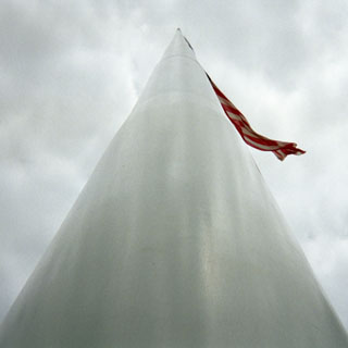 The
town of Dorris had been trying to erect the "world's
tallest flag pole" for several years now, taking donations from
travelers at their rest stop. Well, it seems that they have apparently
gathered enough money to put the thing up. I wouldn't guarantee that it is
really the world's tallest as there was no mention of the height of the second
tallest, but even so, it is a really tall pole.
The
town of Dorris had been trying to erect the "world's
tallest flag pole" for several years now, taking donations from
travelers at their rest stop. Well, it seems that they have apparently
gathered enough money to put the thing up. I wouldn't guarantee that it is
really the world's tallest as there was no mention of the height of the second
tallest, but even so, it is a really tall pole.
Oregon
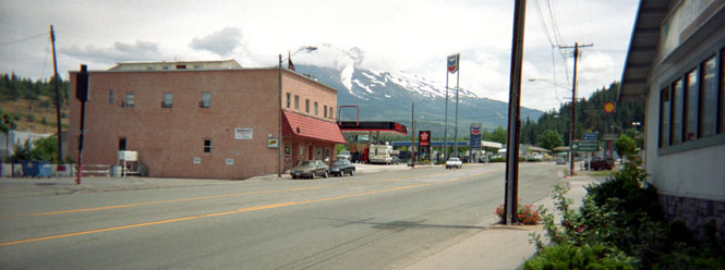
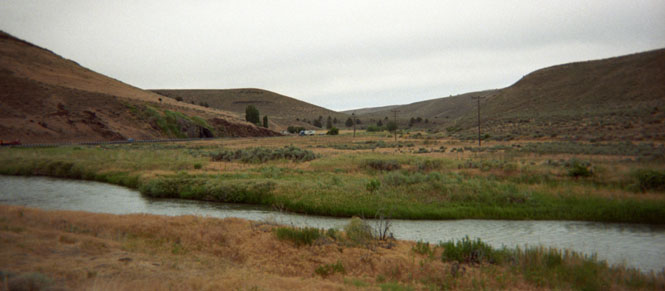
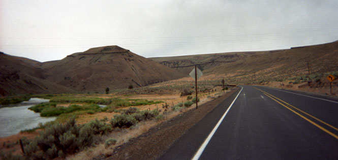
At Klamath Falls, I had to stop at a gas station to sort out just where I was headed. I had had some notion to head north to Lewiston and then across Idaho over the Lolo Pass, but I wasn't sure that I had the time anymore. So, ultimately, I decided to cut across southern Oregon on highway 140 to Lakeview--a new road for me. This part of Oregon is just empty, empty, empty.
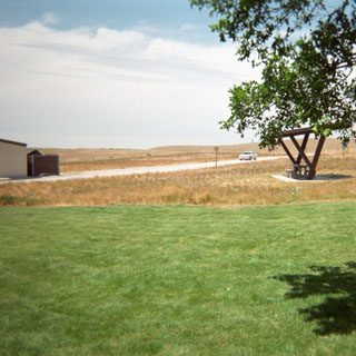
Stopped for the night in Burns. The photograph is of nothing in particular near the Best Western motel that I stayed at.
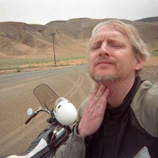
From Burns, it was east across highway 20 toward Ontario. Somewhere near Juntura, I was attacked by yet another stinging bug. I took it on the chin again.
Idaho
Stopped at Massacre Rocks along the Oregon Trail on the Snake River. It was getting quite hot, so I took a nap to wait out the worst of it. Riding through the Snake River Plains is one of my least favorite things. If I had had the time, I would kept off the freeway, and stayed on old highway 30. But, I didn't, so I didn't.
At Pocatello, I took I-15 south as far as Mc Cammon, and then picked up highway 30 towards Wyoming. This was much nicer. Years ago I had been on this same rode, and it was interesting to see how much of it I could remember even though I was traveling the opposite direction this time though. I stopped for the night at Lava Hot Springs. I should have taken my bathing suit.
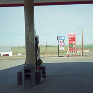
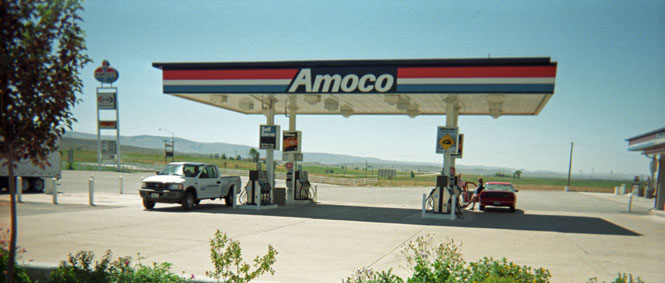
No trip report would be complete without several pictures of service stations, so here's a nice one near the Wyoming/Idaho line on highway 30.
 Wyoming
These photographs were taken south of Kemmerer, near Granger Wyoming. This is the route of the 1830's Oregon-California trail.
At Green River, I was just about beat. It was very windy, and very, very hot. So I pulled into the shade of this tree, and tried to cool off.
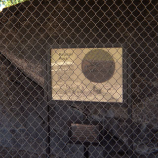
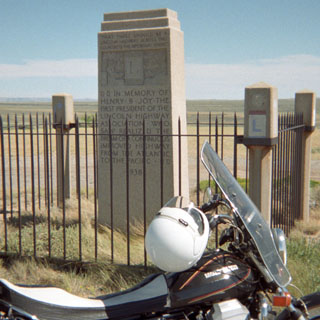
Henry Joy had as much to do with the creation of the Lincoln highway as any other man (next to Carl Fisher), so its is appropriate that there is a memorial to him next to that road. Several times while riding across the Wyoming desert, I had looked for the monument, but it wasn't until this trip that I spotted it.
The old, unpaved, Lincoln highway still runs along side the Interstate. The four corners of the memorial are defined by Lincoln Highway guide posts that once defined the entire route. A very isolated place.
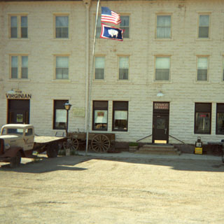
It's funny how much a road can define your attitude. I was motoring along I-80 in the heat and the wind not having an especially good time, when I turned off at Walcott to catch the Lincoln Highway route of old highway 30- through Medicine bow. Just as soon as I turned off the freeway everything seemed to change. The motorcycle ran better, and I felt much better. Medicine Bow is an old western town and is the setting for the book "The Virginian" by Owen Wister. The photograph below, is of the original Hotel Virginian and Bar. The hotel is still in operation, and the rooms are open for viewing. This is not a replica; but, the real thing. I felt compelled to at least order a beer in the bar. Between the flag pole and the old truck you may be able to see a short stump. It's an original Lincoln Highway marker--just like the ones at the monument above. The other photograph was taken from the same shot, looking east down the highway. Not much traffic along here. I left refreshed.
Nebraska
Photograph taken from a rest stop in Nebraska.
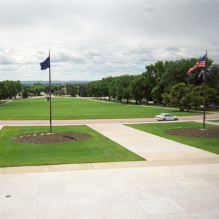
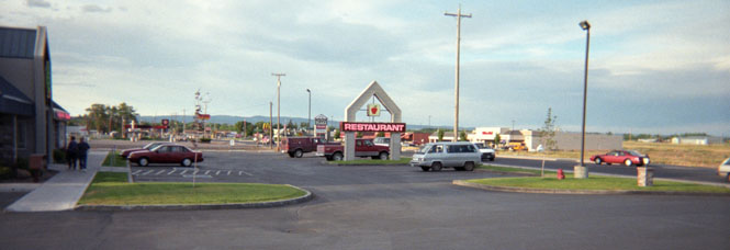
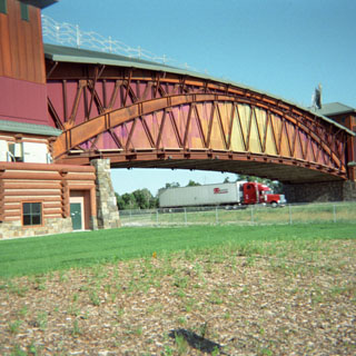
After much planning, a museum of the Platte River Road was just opened at Kearney, Nebraska. The museum stretches across the Interstate and forms a virtual gateway to the west. I wish that they had spent less on the gee-whiz displays and more on artifacts and information, but I give them credit for putting this impressive museum together. It covers the original trapper trails, through the Oregon Trail, and on into the railroads, the Lincoln Highway, and the Interstate system. In short, it's a museum that is exactly suited for my interests.
I spent the night in Kearney.
Kansas
The next morning I rode a variety of back roads to Wichita.
About 5,500 miles