November, 2001

Sunday |
Monday |
Tuesday |
Wednesday |
Thursday |
Friday |
Saturday |
4 |
5 |
6 |
7 |
8 |
9 |
10 |
11
|
12
|
13
|
14
|
15
|
16
|
17 |
18 |
19 |
20 |
21 |
22 |
23 |
24 |
This was a fairly short--5 1/2 day--trip to Carlsbad Caverns and Guadalupe National Parks in New Mexico as well as Big Bend National Park in Texas.
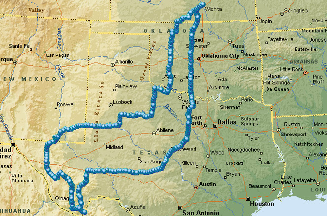
I'd been to both the Caverns and Guadalupe on a previous trip, but that was a rather rushed affair, and I wanted to spend a little more time on this trip. Big Bend was something new, and a place that I've wanted to ride to for some time now. It's usually pretty hot down there, so the timing of this late autumn trip worked out quite well.
 Kansas
I didn't get out of Wichita until around 11:00 Sunday, and considering the earlier sunsets this time of year, I didn't expect to get too far. K42/K2 took me to Kiowa where I entered Oklahoma just north of Alva.
 Oklahoma
From Alva I stayed on US-281 through Waynoka, and then south through Little Sahara. There was a surprising amount of activity at the off road vehicle park. After crossing the North Canadian River, I had lunch at Seiling and then picked up 183 all the way through the state.
At Clinton I thought about going through the Route 66 Museum--it's very good--but, since I'd been there once before, I just kept going.
 Texas
Texas
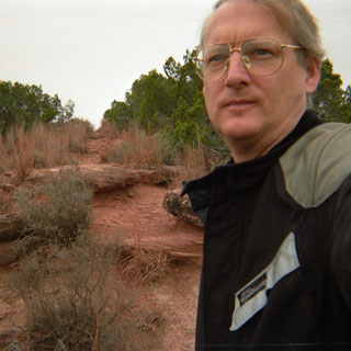
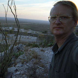
By the time I hit Vernon, Texas the sun was already nearing the horizon. Even so, it still seemed much to early to be checking into a motel. But, looking south, there didn't appear to be any towns big enough to support any lodging, so for illogical reasons I rode to Quanan.
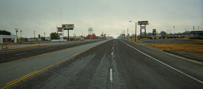
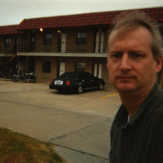
It wasn't any closer to my goal, but I was still able to get a few more miles in before shutting down. The photograph was taken after checking into the Quanan Hotel (you'd think I could smile just a little, at least).
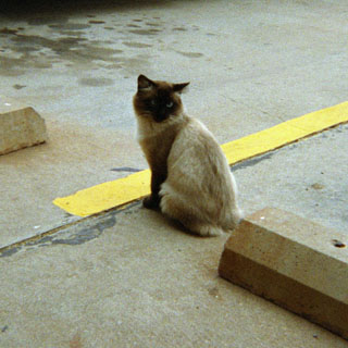
This cat was the apparent hotel greeter. She would have come into my room if I had left the door open. The next morning I walked to the restaurant across the four-lane highway that runs through town and had a larger-than-needed breakfast.
Copper Breaks is a Texas State Park about 15 miles south of Quanan. It had a boat ramp for a supposed lake, but the lake was little more than a pond--and long way from the boat ramp.
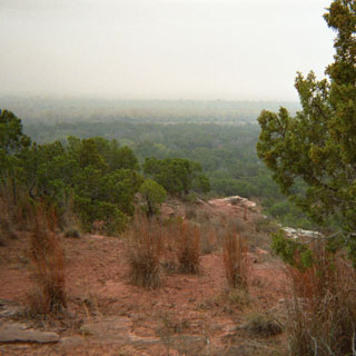
After the 'Breaks, I stayed on Texas 6 south to the village of Rule, and then picked up 380 to take me West. I was either going to stay on this highway, or I'd drop down if something else looked more interesting.
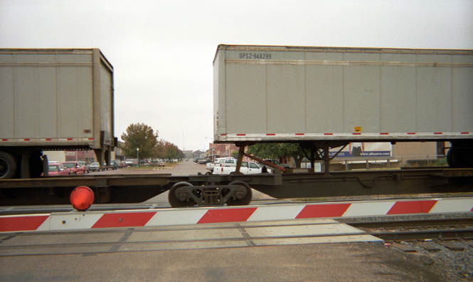
I stopped at the town of Post Texas only long enough to wait for the train to pass by, but the town really sounds like an interesting place. It was founded by C.W. Post (of cereal fame) as something of a utopian community. It remains a prosperous looking place--particularly in comparison with the other towns in this part of Texas.
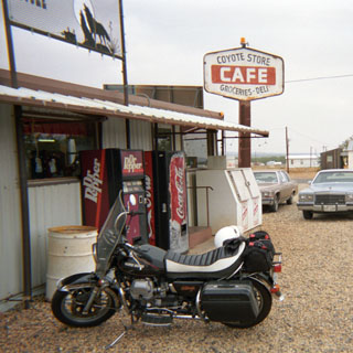
Just west of Post, I saw a road heading south that looked much more interesting--Texas 669--so I took it. When this small unused road hooked up with highway 180 at the town of Gail, I pulled into the Coyote Cafe for a cheese burger. Seemed a safe choice, and turned out to be really quite good. I wasn't that brave, though, and substituted a bag of chips for the fries. French fries are about the worst road food out there. I was now on a highway that would take me straight through Hobbs and then on into Carlsbad, New Mexico. This is serious cotton land, and the harvest was still progressing. Cotton was blowing everywhere.
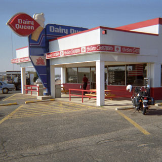
Looked like it was snowing sometimes. Just before crossing the border, I stopped at a Dairy Queen in Seminole, Texas. By this time, it was getting pretty warm, and I really did need a Sundae break.
 New Mexico
Between Hobbs and Carlsbad you can see enormous potash mines out in the desert. What a place to work...
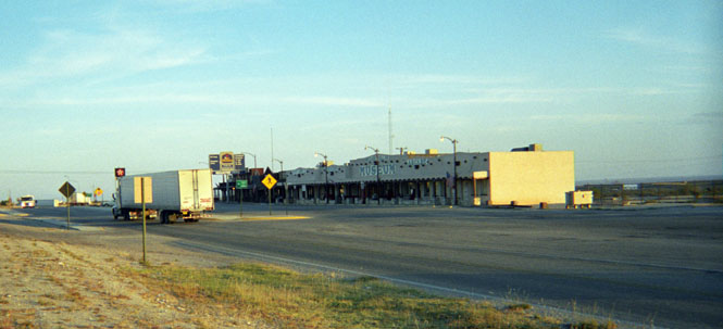
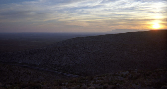
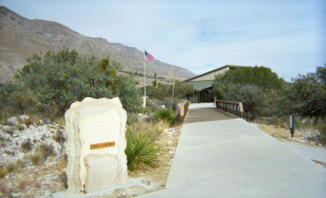
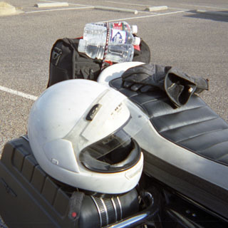
I didn't even stop in the city, but instead stayed on US-62 to White's City, which is about 20 miles south of Carlsbad. The last tour is allowed in the caverns at 3:30, so I didn't even bother to ride up the hill to the park. Instead, I checked into the Best Western Inn. Pretty much had my choice of rooms, as this is far from the peak tourist season for the park. White City is a company town at the entrance to the park. They must have 200 rooms available. Since there was plenty of time before night, I took the opportunity to climb up the hill behind the town and walked for a bit into the park over an unused jeep trail.
If I had had time, this would have been a great way to get to the visitor's center, about 7 miles up the hill. In any event, it was a beautiful sunset.
I ate dinner at a restaurant that was trying so hard to be upscale. I thought that spaghetti would be a safe choice, but that didn't turn out to be the case. Turned out to be a dozen noodles in the bottom of a banana split bowl (?) with a bucket of bland sauce and meatballs poured on top. Sad. All for the (not so) low price of $15.
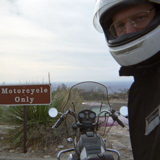
The next morning, I decided to forego the breakfast that came with the room and rode up the hill to the park headquarters. In the picture (with the "Motorcycle Only" sign) you can just see the lower desert floor at the horizon. The cavern entrance is at the top of this hill on the same level as the parking lot. The base of the large room is nearly at the same level as the desert floor. That should give you some idea of the amount of descending hiking that's required.
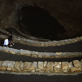
I didn't spend too much time looking at the displays. For one thing, I'd been here before, but also because the doors were soon opening for the first group to be able to enter the natural entrance to the caverns. There's also an elevator that descends from within the visitor's center, but that seemed to be cheating. Even so, the elevator is the only way out of the caverns as the rangers don't want people walking all the way up. Apparently, there were too many health problems when that was allowed. If you really want to make the walk, you need to get permission first.
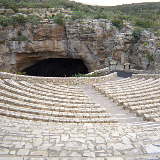
At the cave entrance is a large amphitheater, but this time of year, there weren't anywhere near enough people to justify using it. The ranger gave us a short talk on what to expect, and warned us against all the stupid things that people do in caves before releasing us to make the long trek down. This being the first group down, another ranger led the way, turning the lights on. So, even though this wasn't advertised as a ranger-led walk, it did turn out that way.
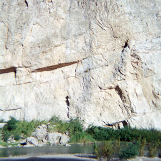
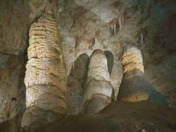 You can read and see much more
about the caverns elsewhere, but suffice it so say that it
is spectacular. Even though this was my second time in it, each room that
I entered was still stunning. And, they only got bigger. The Big
Room is astoundingly huge. Something like 25 football fields would fit in
it. I'm not sure how high the ceiling is, but it's way, way, up
there. I ended up doing all the self-guided tours, and spent perhaps 3 1/2
hours in the
caves. Incidentally, there's a cafeteria at the foot of the
elevator, but I didn't eat anything.
Seemed out of place, and after all the warnings about how human breath can stunt
the growth of the cave formations, to have an industrial cafeteria there didn't
look right. But, it's been there for 60 or so years.
You can read and see much more
about the caverns elsewhere, but suffice it so say that it
is spectacular. Even though this was my second time in it, each room that
I entered was still stunning. And, they only got bigger. The Big
Room is astoundingly huge. Something like 25 football fields would fit in
it. I'm not sure how high the ceiling is, but it's way, way, up
there. I ended up doing all the self-guided tours, and spent perhaps 3 1/2
hours in the
caves. Incidentally, there's a cafeteria at the foot of the
elevator, but I didn't eat anything.
Seemed out of place, and after all the warnings about how human breath can stunt
the growth of the cave formations, to have an industrial cafeteria there didn't
look right. But, it's been there for 60 or so years.
From Carlsbad I rode about30 miles south back into Texas and Guadalupe Mountain National Park.
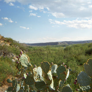
The mountains form an unexpectedly high ridge that runs north-south and rises up out of the surrounding flat desert. This is the highest point in Texas.
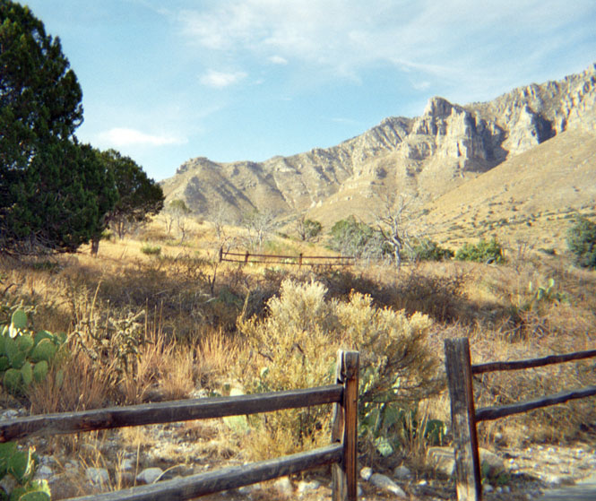
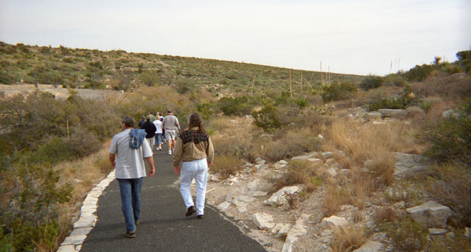
The park is clearly a hiking park, as there really isn't too much to see at the visitor's center and there aren't any scenic roads that lead to the "scenic spot" of the park. After talking with one of the rangers, I decided to take the Devil's Hall hike. It's about a 4 1/2 mile round-trip drive, although it seemed much longer than that.
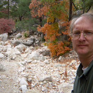
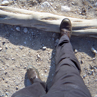
About 2/3 of the trail was along a dry, rocky stream bed. As such, there really wasn't any way to get lost on the trail, but it looked as if every boy scout troop that had been through was careful to mark the trail with additional small rock piles. I took a bottle of water with me, but had drained it before I was even halfway to the end. It was pretty warm at the beginning, but as the trail climbed in elevation, and the canyon tightened, the temperature cooled down nicely. The photograph is about 1/4 from the end. The "stairs" were actually a bit tougher to negotiate than it might appear. The tops slanted downward, so I ended up climbing these like a spider, using my hands to support myself.
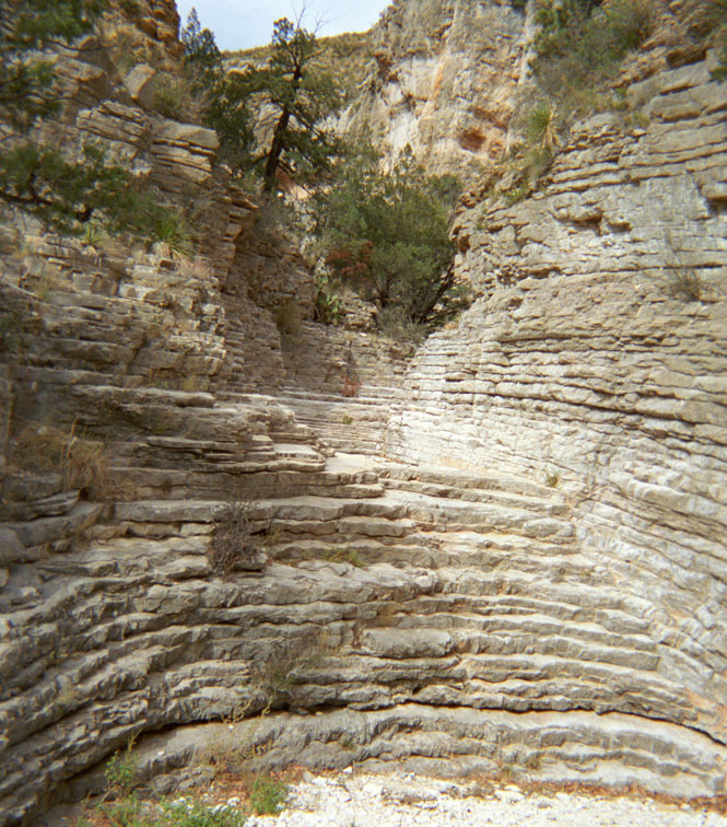
The end of the trail was the Devil's Hall--quite a remarkable thing. I spent about 20 minutes sitting on a rock, here, before heading back down the trail. During the walk, I met a few people going the opposite way, but really, there were not too many people in the park. One European woman asked me if I wasn't afraid to be hiking alone. She had a real concern about bears and mountain lions--much to the amusement of her companions.

Texas
Earlier in the day, I thought that I might be spending the night in Alpine, Texas. But, I spent more time in the two National Parks than I thought I would, and ended up riding south to Van Horn for the night. I had dinner at Chuy's Mexican Restaurant, which claims some notoriety for being on John Madden's All-Madden team. And it was very good food. And beer.
Next morning, I stayed on 54 through Van Horn and followed the desert valley to the junction with highway 505 and turned north into the Jefferson Davis Mountains.
I rode nearly all the way around the mountains on some really nice roads before stopping at Fort Davis, and the National Historic Site.
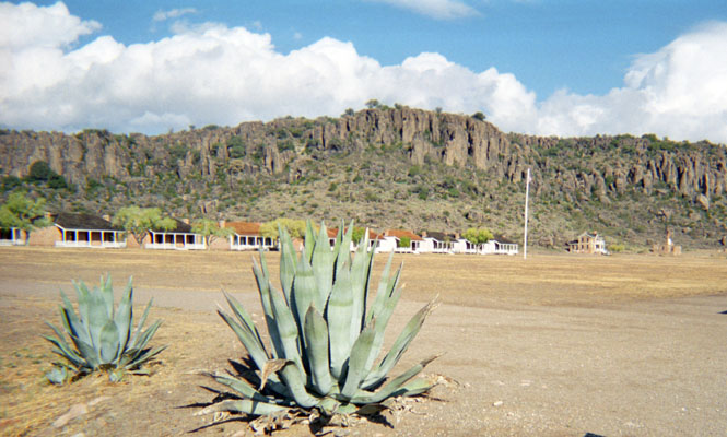
Incidentally, Fort Davis really is named for the president of the Confederacy, except that at the time he was the Secretary of War for the U.S. Curious, that the name was not changed, even during the Civil War when, for a time, the Union occupied the fort after displacing the Confederate troops.
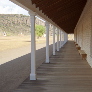
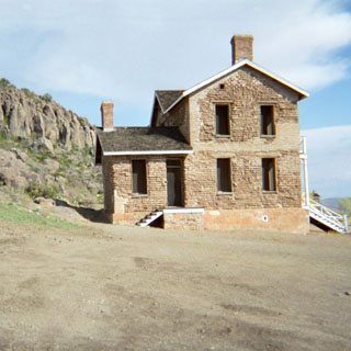
The fort has been ultra-restored, and is similar to many other 19th century outpost forts that I've been to--Fort Laramie comes to mind. I watched the film, and spent about an hour walking over the site. One touch that I appreciated was that throughout the day recorded bugle calls were heard that were appropriate to whatever activity would have been happening. It wouldn't take too long to learn them, and it's an effective way of communication.
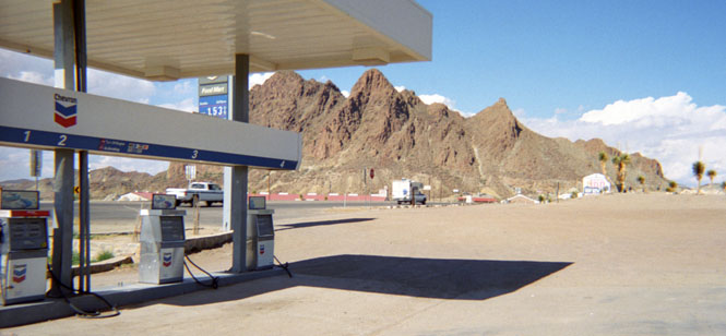
Leaving Fort Davis, I stopped at Alpine and ate a BBQ lunch. Not too bad, but nothing special. I did relearn a lesson that doesn't seem to take too well. I filled the tank before entering the restaurant, only to find that when I came out some 45 minutes later that fuel was dripping over the gas tank and down the engine to the ground. The high temperature was expanding the gas pumped from the cool ground and consequently overfilling the tank. I started the bike up, hoping that all the fuel wouldn't light off, and took off south towards Big Bend National Park. The photograph above is one of my trademark service station shots. This one at Study Butte, which is just west of the park entrance.
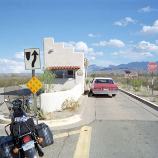
The park entrance. The visitor's center is about 25 miles farther down the road.
I spent just enough time in the visitor's center to sort out where I wanted to drive. I also realized that I didn't have nearly enough time to see this park. I had always thought of the park as being centered on the river. But really, the heart of the park may be in the mountains that form a basin in the middle of the park. In any event, it was to the river that I was heading, and the basin would have to wait for another trip.
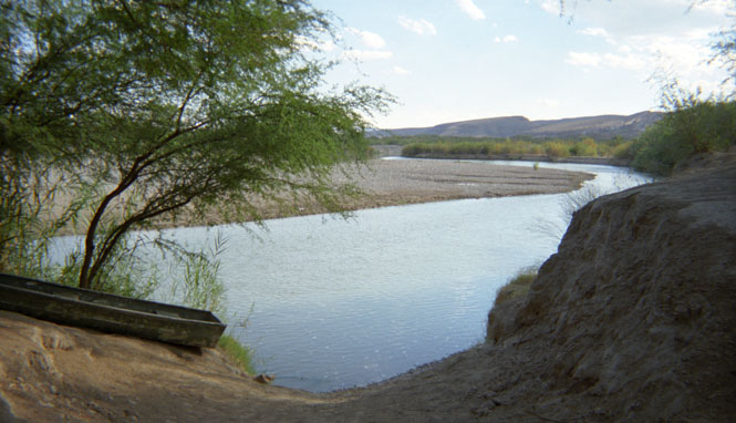
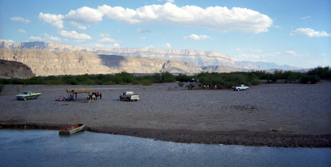
I saw the sign for Boquillas, Mexico, so I made the turnoff and rode down the gravel rode. After a short distance the rode ended at a turnaround spot, and you had to walk down a path to the water's edge. For some reason, I was expecting a town of some size, with perhaps a nice restaurant. Not so. At the river there was a small jon boat, and across the river were a few people under grass-roofed awning. A man called out to me asking if I wanted to cross, but I said no. Only later did I see the village which is to the left of the picture which could be reached using the burros and horses that you see in the photograph.
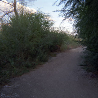
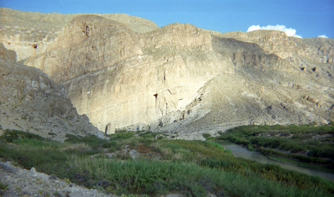
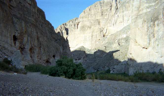
So instead of crossing over to Mexico, I continued downstream towards the entrance to Boquillas Canyon. There was an easy two mile hike to the water from the parking point.
The following photographs are of the trail to the river. This was a fairly short one mile trail that first crossed over a hill and then ran along side the Rio Grand for a short distance before ending at the canyon entrance. The canyon is so narrow that there is no way to walk along the water. An interesting feature was about 50 feet of tunnel under the river grasses. The trail had worn well into the sand, and the tall grasses had completely covered the trail--encouraged, no doubt, by the park rangers.

Leaving Big Bend, I took US-385 to Marathon, Texas which was about 100 miles to the north. About 1/2 way there, I nearly stopped at the side of the road to take a picture of a spectacular thunderstorm that was brewing to the east of me. In fact, I passed one car that had stopped, and they were setting up some impressive photo and video equipment to do that very thing. Still, they were traveling in a car, and I was fully exposed on a motorcycle, so it made more sense to me to keep moving lest I get trapped in that very storm. It was impressive.
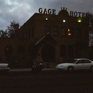 I
was hoping that Marathon would have a motel of some kind, since the next
town--Fort Stockton--was another 60 miles up the road. Turned out not to
be a problem, as I stayed at the most interesting hotel of the trip. The
Gage Hotel. I splurged a bit and took an en-suite room. But, I did
check out the community baths, and they were all very nice too. Nice plush
robes were provided in each room so everybody looked quite civilized as they
made their way to the bath. Quite a nice restaurant too. I had both
dinner and breakfast.
I
was hoping that Marathon would have a motel of some kind, since the next
town--Fort Stockton--was another 60 miles up the road. Turned out not to
be a problem, as I stayed at the most interesting hotel of the trip. The
Gage Hotel. I splurged a bit and took an en-suite room. But, I did
check out the community baths, and they were all very nice too. Nice plush
robes were provided in each room so everybody looked quite civilized as they
made their way to the bath. Quite a nice restaurant too. I had both
dinner and breakfast.
The next day was a rain day. It started out fair enough, but by the time I reached Fort Stockton it was raining fairly heavily. And it would continue doing so for most of the day. I had intended to take highway 67 towards San Angelo, but wasn't paying enough attention and missed the turnoff. So I ended up taking 190 instead. Just as well.
I stopped at Brady for lunch and had the best BBQ of the trip, although I still wouldn't call it the best I've had. By the time I reached Stephenville, I was good and tired about the rain, and pulled into the Holiday Inn for the night.
Oklahoma
Entered the state on the old Chisholm Trail, Highway 81, and stayed on this highway all the way across.
Kansas
At Caldwell, I took an inefficient series of back roads before finding my way back to Wichita.
Good trip. About 2,100 miles.