July, 2003

Sunday |
Monday |
Tuesday |
Wednesday |
Thursday |
Friday |
Saturday |
22 June |
23 |
24 |
25 |
26 |
27 |
28
|
29
|
30
|
1
July
|
2
|
3
|
4
|
5
|
6
|
7
|
8
|
9
|
10
|
11
|
12
|
13 |
14 |
15 |
16 |
17 |
18 |
19 |
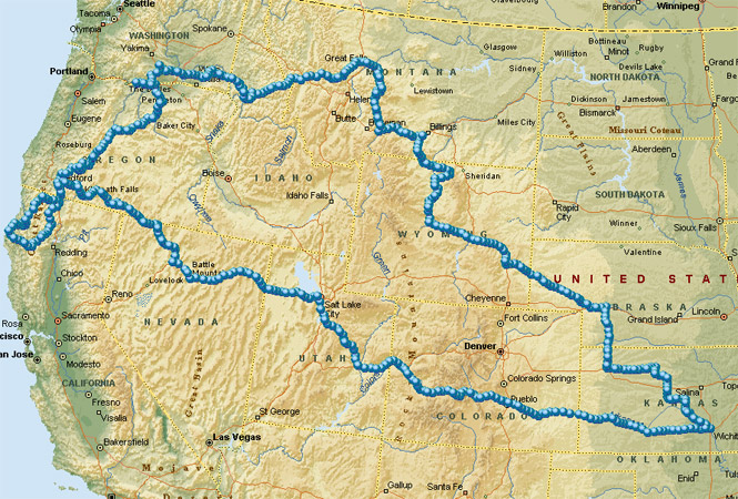
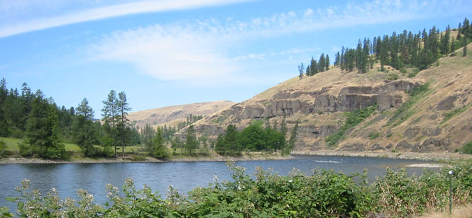
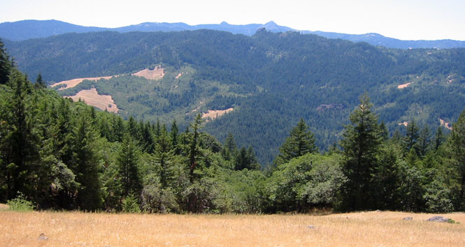
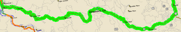
A couple of weeks off to ride into Wyoming and the Bighorn Mountains, then north into Montana to ride through the Little Belt Mountains, then across Lolo Pass into Idaho, into the Yakima Valley, then south across the Horse Heaven Hills to the Columbia River, down into the John Day river area, over to Crater Lake, down to Eureka and back up to Klamath Falls, then across Nevada, Utah and Colorado (at Monarch Pass), and finally back to Wichita along the Arkansas River. Just about 5,000 miles, even.
I was able to pick up a number of roads than I've been meaning to ride for quite some time. Principally among these was the road from Bickleton to Roosevelt, in Washington, as well as the road from Lake View Oregon to Denio Junction, Oregon. And, especially, I was finally able to ride the eastern rim of Crater Lake. I've ridden along the western rim several times, but for any number of reasons (mainly, snow) I had never yet been on the eastern rim. Now I have. Oh, and not to forget, I finally did highway 3 in California.
 Kansas
Even though most of the trip was under blue skies and sometimes (or perhaps I should say often) oppressive heat, it started out under a full overcast cloud cover with a heavy downpour. In fact, between Wichita and Hutchinson, I had to be careful to find the highest point in the road since water was running a couple of inches deep in the normal depressed tire grooves in the lanes. Very heavy rain.
 If only I could have arranged to
spread this rain out over the entire trip. As it was, once beyond
Hutchinson, the clouds vanished, and I had my first day of near-100 degree
temperatures. It would not be the last. It would get hotter.
If only I could have arranged to
spread this rain out over the entire trip. As it was, once beyond
Hutchinson, the clouds vanished, and I had my first day of near-100 degree
temperatures. It would not be the last. It would get hotter.
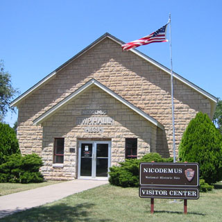
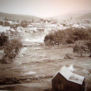
Keeping off the freeway, I cut north and west until I hit highway 24 and the small town of Nicodemus.
Nicodemus was founded shortly
after the civil war by ex-slaves who had come up from Oklahoma looking for
affordable land. What they were promised, and what they saw, were two
different things, but then, wasn't that pretty
 much the case with many of the
first settlers in Kansas? For a few years, now, the town has been a National
Historic Site, and therefore has a nice visitor's
center with a full-time ranger
to explain things.
much the case with many of the
first settlers in Kansas? For a few years, now, the town has been a National
Historic Site, and therefore has a nice visitor's
center with a full-time ranger
to explain things.
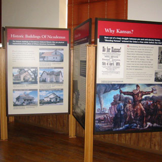
The center had been a WPA community Hall.
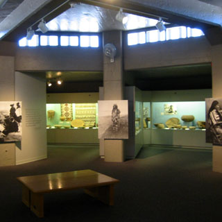
Not a particularly elaborate exhibit, but it did a good job explaining the importance of the town.
I ate lunch at Ernestine's, which is just adjacent
to the visitor's center. You wouldn't think that a BBQ restaurant would do
a booming business in such and out-of-the-way town, but it seems that they do
well enough. Perhaps,
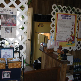 not booming, but they stay in business.
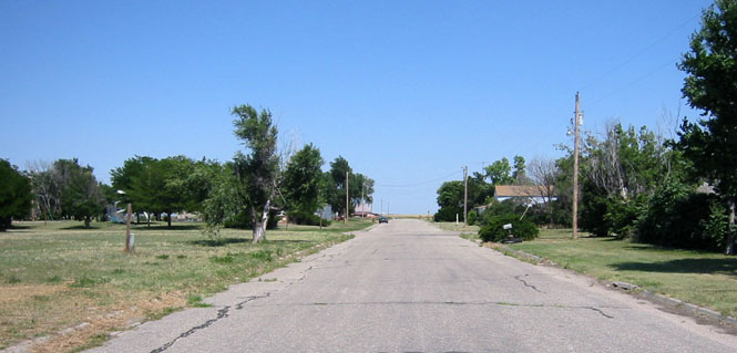
There is not much left of the town. I believe the population is now around 30 folks, and not one of them under 40 years old. There is a reunion held each year, and hundreds of people come from all over the country. It'd be nice if there were anything at all to keep young families here, but, clearly, there is not. Incidentally, to this day there are no white people living in the town. Never has been, it seems.
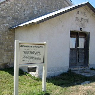
I can't say that I've ever even heard of the African Methodist Episcopal Church. This one closed sometime in the late 1950's.
The town had a nice, large park next to the highway. I really don't think anybody cared that I parked the motorcycle on their grass.
 Not far from Nicodemus (still on highway 24) at the
even smaller town of Studley is the Cottonwood Ranch Kansas State Historic Park.
Not far from Nicodemus (still on highway 24) at the
even smaller town of Studley is the Cottonwood Ranch Kansas State Historic Park.
This is a relatively large ranch house that is especially noteworthy for being in virtually the same condition as when it was first built in the late 1800's. It seems that the unmarried daughter of the builder stayed in the house all of her life, which accounts for everything remaining in the same condition for so long. The state of Kansas now owns the house and the outbuildings.
I stayed on highway 24 to Colby, and then turned north on 25 into Nebraska, where I crossed the Republican River at Trenton--getting warmer all the time.
 Nebraska
The bit of highway 25 between Trenton and
Sutherland was all new road for me. Nice bit of pavement. Hilly
(this being a relative
 term
in Nebraska) land and little sign of any changes to the land. Just open prairie,
and lots of it. I like it.
term
in Nebraska) land and little sign of any changes to the land. Just open prairie,
and lots of it. I like it.
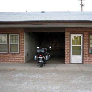
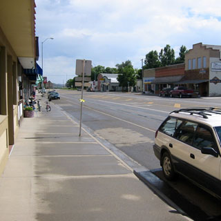
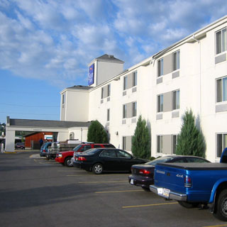
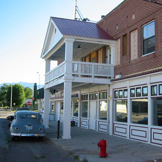
I crossed over I-80 (I would avoid all freeways unless there was no alternative) and hit old highway 30 (The Lincoln) in downtown Sutherland. A nice little town. I avoided the hotels along the freeway interchanges, and found just what I was looking for on the outskirts of town: an old courtyard-motel, complete with drive-in carports for each room. My room is just to the right of the motorcycle. The carports are generally unused as today's cars (especially today's SUVs) are far larger than the cars that were then expected. You'd be pressed to open both doors without hitting the walls. And, too, they had just dirt floors, which is why I only nosed the bike in. It looked too soft to support my center-stand.
 I
walked a couple of blocks to the downtown district (if I had walked a couple more
blocks, I'd have been on the other side of town) and had a root beer float.
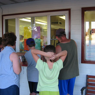
This was a Saturday night, so the place was actually quite busy (I just didn't
think to get anybody else in the photograph).
I
walked a couple of blocks to the downtown district (if I had walked a couple more
blocks, I'd have been on the other side of town) and had a root beer float.
This was a Saturday night, so the place was actually quite busy (I just didn't
think to get anybody else in the photograph).
Next morning I stayed on highway 30 through Ogallala and then turned northwest on 26 (you may have noticed that I've gone from highways 24 to 25 to 26--sometimes there's a perverse--but intentional--madness to the way I select my routes), which is the route of the Oregon Trail.
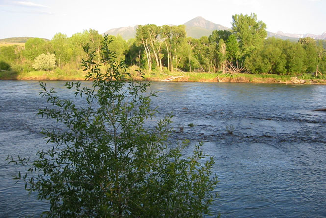
This shot taken from near Lisco, looking south towards the North Platte river.
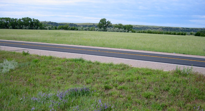
I've been on this road countless times and often think that the Oregon Trail pioneers must have thought at this point that their trip was going to be an easy one. Water, plenty of grass, and a gentle slope. How bad can it be?
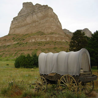
Scottsbluff is where things started to get serious for the wagons. The pass is now a national monument, and there's a very good Oregon Trail Museum and book store at the base of the bluff.
I really had not planned on walking any of the trails, as I've been over all of them already, but it was drizzling and the roads were looking slippery, so I took an hour off to walk along the trail.
The wagon, below, is pointed west (sure, there was a certain percentage of folks going the other way, but those were the "go-backs", and nobody celebrates them, today).
View looking back east. I've just walked over the crest of the pass.
Looking out towards Wyoming. The large ruts are the results of the tens of thousands of wagons and oxen that once took this route. Over the years erosion has turned the roads into gullies. It's still easy to visualize the wagons spreading out as they roll through the narrow pass and move down into the valley. Neat place. Nice picture.
 Wyoming
The rain let up enough that I continued up the road to Torrington, Wyoming, where I stopped for lunch and let everything dry out just a bit. This would be the last rain of the trip (sigh...).
 Up to this point, the trip was
generally along a route that I had expected to take--at least when I left
Wichita this is what I generally had in mind. From here on out, I would
decide on the route based on what looked interesting as I came
to an intersection. In fact, when I left Torrington, I had really intended to
turn north on 85 and head towards the Black Hills, except that when I came to
the turn, that road just didn't look as interesting as staying on 26 and heading
towards Casper. Which, is what I did.
Up to this point, the trip was
generally along a route that I had expected to take--at least when I left
Wichita this is what I generally had in mind. From here on out, I would
decide on the route based on what looked interesting as I came
to an intersection. In fact, when I left Torrington, I had really intended to
turn north on 85 and head towards the Black Hills, except that when I came to
the turn, that road just didn't look as interesting as staying on 26 and heading
towards Casper. Which, is what I did.
I moved over to the old highway at Glenrock, and stopped for a sandwich and some frozen yogurt. You can see the freeway sign (I-25) pointing to the left. No thanks--I kept straight, and took the old road all the way into Casper.
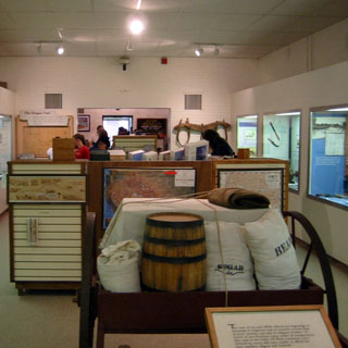
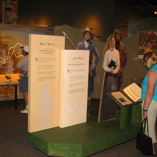
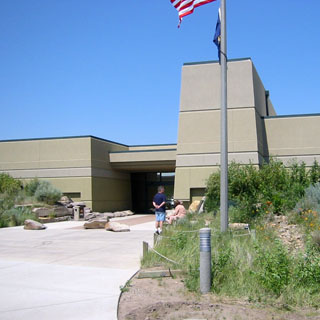
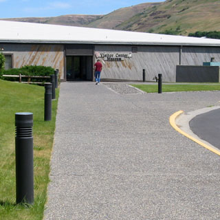
I knew that the National Trails Museum was in Casper, and I would occasionally see signs for it. But, it wasn't until I was right up to it that I actually noticed the building. One of the rangers (not their official title, but it will do) said that the architect wanted to have the building blend into the surroundings. Well, ok, I guess, but it's an odd thing to camouflage what you want people to find.
Parts of the museum were great. Parts were unnecessarily overdone. I really liked the many maps, though. Very detailed, and they covered all the many trails that the center was presenting. On the other hand, while the many full-sized cutouts of people and animals and some of the elaborate displays were eye-catching, they ultimately were without much use. I want lots of maps and lots of information along with lots of real stuff in my museums. I want to be overloaded with information. I do not expect to be entertained.
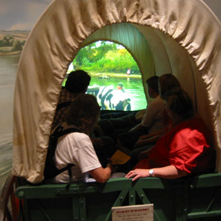
...you sit in the covered wagon as it crosses the Platte River. A large video screen shows you where you're at. There's even a bit of splashing water for the real pioneer experience.
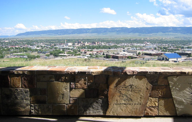
The view of Casper taken from the back porch of the museum. We're looking out over the North Platte river, which is the route of the Oregon Trail as it continues southwest. I'm going to head straight west from here across the high desert and towards the Wind River range.
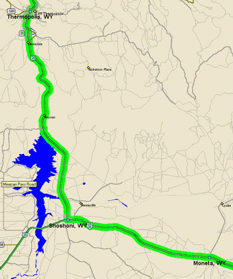
I don't know that this trip was any different than many others, but it sure seemed that I ran into more than my share of road construction on this one. Between Moneta and Shoshoni I had to ride many miles of dirt while the highway department rebuilt the road. Some states will rebuild just one side of a road at a time, giving you at least a one-way strip of pavement to ride on.
Other states (Wyoming, being one; South Dakota being another) simply prefer to tear up 15 miles of road and do the whole thing at one time. What this means is that you're riding across some pretty rough and rutted dirt, with the occasional slippery patch where they think themselves clever to spray water to keep the dust down. I do not like road construction.
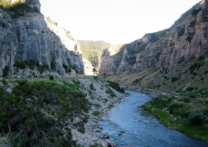
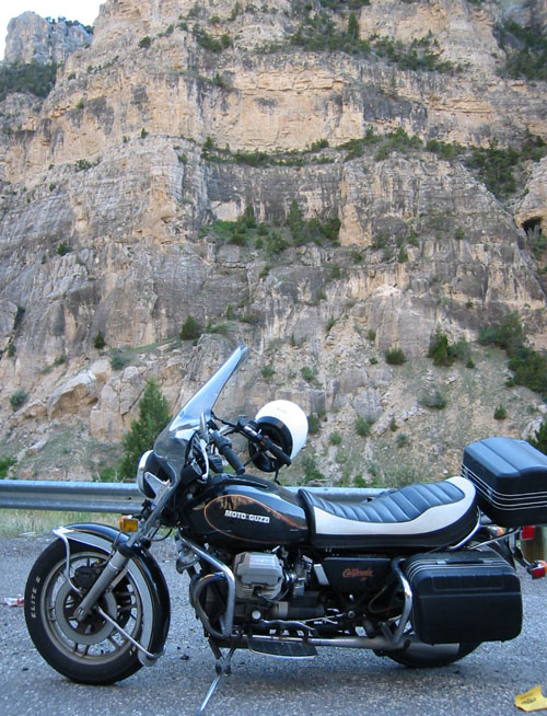 The route along the Wind River is one of my
favorites roads. It's not a particular challenging road (few river roads
ever are) but it's
so much fun to sweep along the curves as the canyon turns left and right and the
cliffs rise higher and higher. I've done this road several times; I'll
never tire of it.
The route along the Wind River is one of my
favorites roads. It's not a particular challenging road (few river roads
ever are) but it's
so much fun to sweep along the curves as the canyon turns left and right and the
cliffs rise higher and higher. I've done this road several times; I'll
never tire of it.
I parked at a picnic stop along the river to drink a couple of bottles of water. Even though I started out the day (back in Nebraska) in the rain, by this time it was quite hot.
I could have kept riding (plenty of daylight),
but I knew that there was a soon going to be a divide in the road where I'd have to decided to
either go to Cody (and Yellowstone?) or Worland (and Sheridan?) so I crossed the
river and stopped at Thermopolis Hot Springs State Park. More of a resort,
really. The place has developed over the ye ars into quite a nice
place. A couple of good hotels, and several natural hot springs swimming
pools. At one time there were several hospitals in the area (as always
seems to be the case when
there's a natural source of hot water), but one had been turned
into a nursing home, and the others were long gone. I stayed at the Holiday Inn
Resort Hotel--probably the most expensive night of the trip (and preceded
by the least expensive).
ars into quite a nice
place. A couple of good hotels, and several natural hot springs swimming
pools. At one time there were several hospitals in the area (as always
seems to be the case when
there's a natural source of hot water), but one had been turned
into a nursing home, and the others were long gone. I stayed at the Holiday Inn
Resort Hotel--probably the most expensive night of the trip (and preceded
by the least expensive).
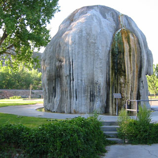
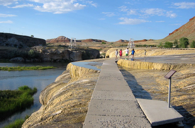
There were a few of these (see the photograph) mushroom formations throughout the town. Apparently, all it takes is to have some of the spring water slowly trickle out at the top of a tall standpipe; wait 50 years or so, and there you are: instant 'natural' formation.
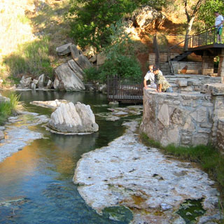
I walked across the park to the (real) formations, and then on up to the source of the springs. Even though the amount natural flowing water has been reduced (or diverted) over the years, it's still quite impressive.
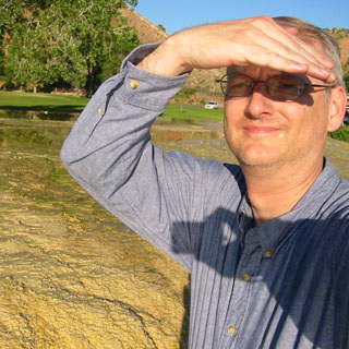
If you look closely at the photograph, below, you'll see an alert deer standing in the tall grass. And, if you look closely at the shadow in the photograph, above, you'll understand the secret of taking self-portraits.
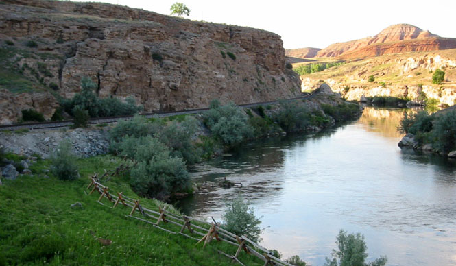
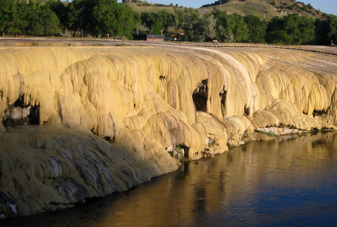
The springs bubble up from here, and then flow over the formations (depositing any number of noxious chemicals along the way) before dropping into the river.
I walked into downtown looking for some sort of restaurant. Not sure that this place qualified, but it was good enough. Seemed to be the popular meeting place for the locals. Out closer to the highway, there were any number of other, possibly better, restaurants, but I very rarely will start the bike up after I've shut her down for the day. It's always nice to walk some miles in the evening after riding all day.
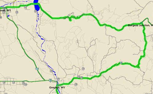
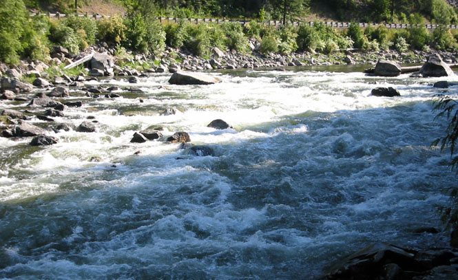
The next morning, I turned toward Worland (meaning away from Yellowstone). That was the first decision I needed to make. At Greybull, I turned west on highway 14 to head up the Bighorn Mountains--one of my favorite mountain ranges. I'd been on 14-Alternate before, but never 14, so it was nice to be able to pick up a new road. This road follows the Shell Creek Canyon. Spectacular place. (If you look at the map, below, you'll see that there's another rather direct route between Greybull and Lovell, but then that wasn't what I was looking for)
Just before the road entered the canyon, proper, I rode through the worst construction of the entire trip--about 5 miles of soft dirt and mud. The road was being realigned, and while the old road was being scooped up, only a minimal attempt was made to provide any kind of decent road in the mean time. I think I bottomed out my suspension half a dozen times as I rode across the rather deep holes hidden below the soft dirt (I bought a new pair of shocks as soon as I returned home--let's give Koni a try).
This shot was taken from an overlook; we're looking up the river (to the east).
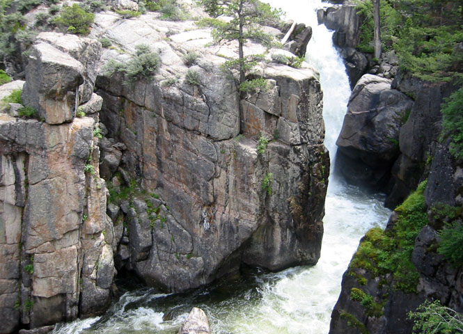
And, this shot (below) was taken from the same spot except I've now swung to the right, 90 degrees to follow the water going down the hill. Quite a tight canyon, which made for a surprisingly tight and winding road.
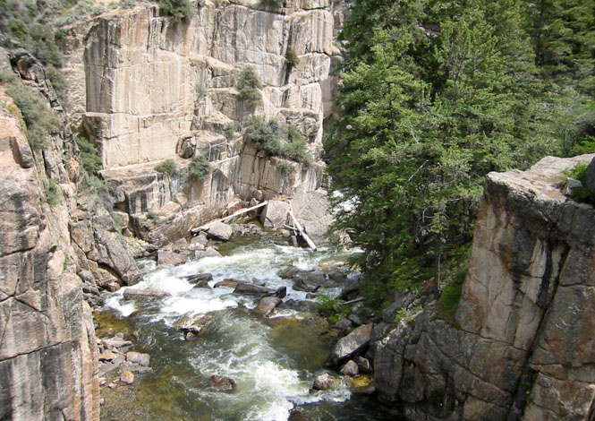
You can just see a curve of the highway, there between the trees. This shot was taken looking down the hill towards the Bighorn Basin.
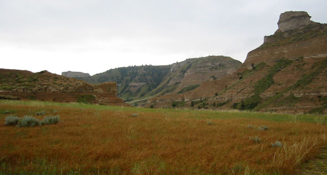
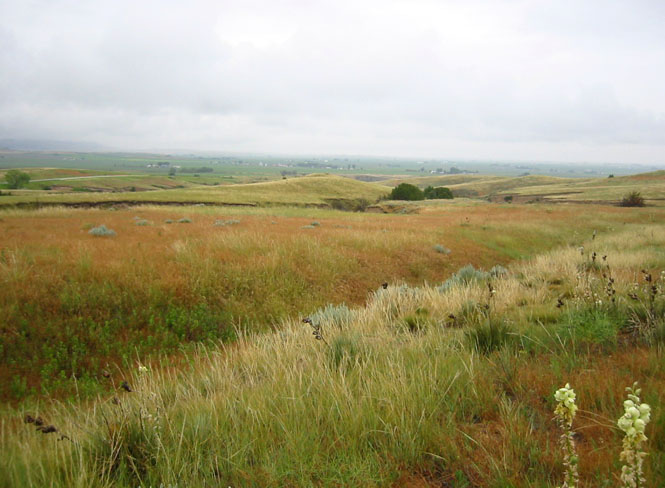
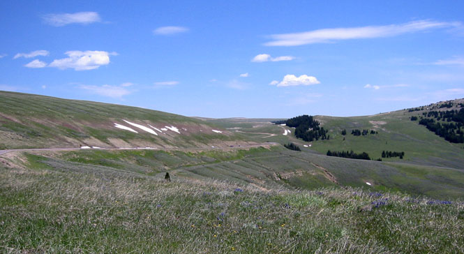
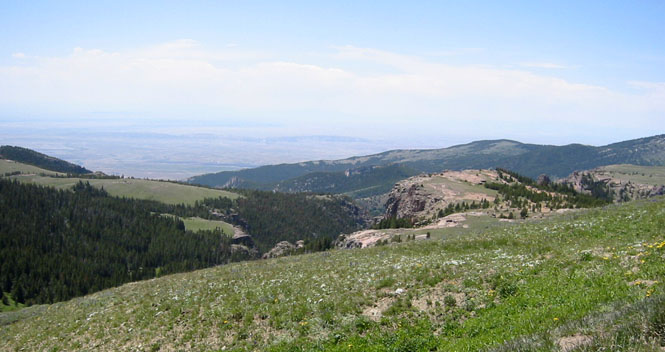
The Bighorn Mountains are quite high (over 13,000 feet) and yet, the top of the range is almost like a very large plateau. The road is mostly above the tree line and the surrounding meadows were covered with wildflowers and smooth, blue ponds. One of the highlights of the trip. A spectacularly beautiful place.
I stopped at Burgess Junction (still on top of
the mountain) for some lunch (and an excellent pie that was fresh out of the
oven) and to decide which way to go
next. I was half thinking that I still wanted to go to Little Big Horn
battlefield (which
 would mean dropping down the east side of the mountain) as a
new memorial to the Indians who had died during the battle had just
opened. On the other hand, since I was there just last year, I ended up
deciding to drop down the west side of the mountain, and pick up the road
between Lovell and Bridger Montana (more un-ridden road). The large yellow sign
that you see in the above photograph details the descending road and shows all
the various
runaway truck ramps as well as the speed limits in different
sections. This is one of the steeper roads to be given a national highway
number. I would not want to be pulling a large trailer on this road.
There was another earlier sign that ordered all trucks to stop and read this.
would mean dropping down the east side of the mountain) as a
new memorial to the Indians who had died during the battle had just
opened. On the other hand, since I was there just last year, I ended up
deciding to drop down the west side of the mountain, and pick up the road
between Lovell and Bridger Montana (more un-ridden road). The large yellow sign
that you see in the above photograph details the descending road and shows all
the various
runaway truck ramps as well as the speed limits in different
sections. This is one of the steeper roads to be given a national highway
number. I would not want to be pulling a large trailer on this road.
There was another earlier sign that ordered all trucks to stop and read this.
A view looking back up the highway. I've just started down the long hill to the basin. It was very tempting to park the bike and just walk out over the meadows to see what might be over the next ridge. Probably another ridge. There was virtually no traffic this day.
From the same spot, but looking westwards. It's a fairly hazy day, but out there on the horizon are the Yellowstone mountains (strictly speaking: the Absaroka Range). In just a relatively few miles, I'll be down on the valley floor. I wonder how many people have tried to coast all the way down? Some of the turns are of the hair-pin variety, so you'd better have really good brakes. Seemed a shame to have to go down the hill to all that heat that I knew would be waiting for me.
At Lovell, I had my last chance to ride into Yellowstone. I've been there so many times, and once you're there the options for going someplace else are restricted to the same options that I've seen many times over, so I turned north on 310. There would be no Yellowstone this trip.
 Montana
 The temperature at the top of the
Bighorn mountains was on the chilly
side, but once I was down in the valley
again, it was into the nineties. Odd thing, though: at Bridger it started
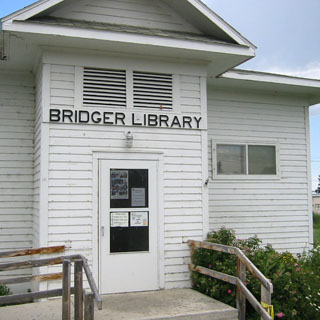
to rain pretty heavily. So I decided to park the bike in the city park and
take a breather in the public library.
The temperature at the top of the
Bighorn mountains was on the chilly
side, but once I was down in the valley
again, it was into the nineties. Odd thing, though: at Bridger it started
to rain pretty heavily. So I decided to park the bike in the city park and
take a breather in the public library.
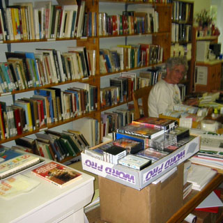
This trip could almost be considered to have a library theme. Without really trying, looking back, it seems that I visited quite a few. Since most any library these days has Internet access of some sort, they make a good stop to check up on things. I'm not sure if the Bridger library building had always been a library, or not, but it looks to have been here quite a long time
Librarians are a feisty lot. This one (I forget her name--sorry) had quite a bit to say about a recent law that said libraries should be active to protect our children from dangerous Internet sites. She said that the Marshalls could come and get her, but she wasn't going to do the job that parents should be doing, and not librarians.
Downtown Bridger after the rains had stopped. Several kids were hanging around the park (where the motorcycle was parked).
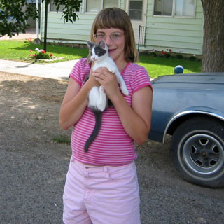
As I was walking back from my grand tour of Bridger (and before I could see the park) one boy came up to me and said 'Sir, somebody has taken your motorcycle and helmet!' I smiled, and said 'not likely'. These kids had a funny sense of humor. As any car (with out of state plates) drove by, they all stood at the side of the road and waved furiously at them as if they were in a parade. Then when the car passed by, they broke up into laughter at the faces of the people in the car. Small town humor--got to like it. I asked the girl if I could take a picture of her kitten. The others were standing behind me making faces at her, trying to get her to laugh. They succeeded.
At this point, there was no practical way to avoid the
freeway. I turned west on I-90 at Laurel. My general idea was to turn north
on 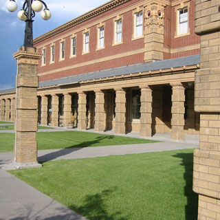 US 89 towards the Little Belt Mountains (a new road), but as I rode, and kept
an eye on the sun, it was becoming clear that I might be riding in the dark by
the time I reached the small town of White Sulphur Springs. I couldn't
remember from the last time I'd been through that town if there was a hotel or
not, and certainly there were no other towns in the direction I was
heading. In any event, it had been a long day, so I rode passed the
intersection and turned off into Livingston for the night.
US 89 towards the Little Belt Mountains (a new road), but as I rode, and kept
an eye on the sun, it was becoming clear that I might be riding in the dark by
the time I reached the small town of White Sulphur Springs. I couldn't
remember from the last time I'd been through that town if there was a hotel or
not, and certainly there were no other towns in the direction I was
heading. In any event, it had been a long day, so I rode passed the
intersection and turned off into Livingston for the night.
After checking into the motel, I had plenty of time to walk around town. The train station is quite impressive. Livingston used to be the gateway into Yellowstone, back when most of the tourists arrived by train. That's not the case anymore, so they're left with a beautiful station that no longer has a purpose except as a museum (closed for the evening).
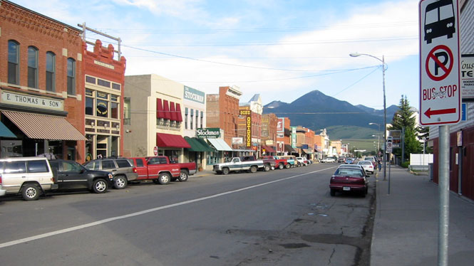
Downtown Livingston. A nice looking town. Seen better days, though.
Continuing my library theme, I stopped at the Carnegie Library. It's always nice to see a Carnegie Library building still used as a library.
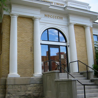
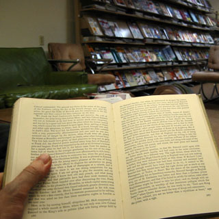
It is true that they always seem to be built to plans that are woefully unsuited to a library, what with all the stairs and floors, but, even so, they're always such impressive buildings (which was probably the original point).
The novel that I'd been reading on my PDA, up to this point was Thackery's Henry Esmond, so I tracked down a copy and found my place in this paper (paper!) book, and relaxed for awhile.
I walked south through town, through some very nice neighborhoods, then towards the Yellowstone river.

Along the banks of the Yellowstone.
As with all towns that have found themselves
attached to the Interstate system, most of the commercial activity of Livingston
has 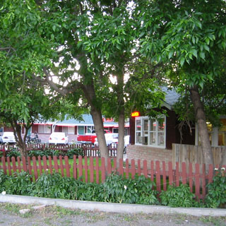 moved to the two interchanges along I-90. That's where you'll find the
Wal-Mart in addition to the major hotel chains. In
many cases, though, if
you stay on the old highway, you'll find any number of still-nice motels for a
remarkably cheap price. I don't doubt, however, that within 30 years,
these motels along the old highway will be gone (or at least no longer nice). If you look closely
(through the trees), you can see my motorcycle parked in between two white
cars.
moved to the two interchanges along I-90. That's where you'll find the
Wal-Mart in addition to the major hotel chains. In
many cases, though, if
you stay on the old highway, you'll find any number of still-nice motels for a
remarkably cheap price. I don't doubt, however, that within 30 years,
these motels along the old highway will be gone (or at least no longer nice). If you look closely
(through the trees), you can see my motorcycle parked in between two white
cars.
The next morning was just perfect. I'm glad that I didn't take highway 89 north to White Sulphur Springs the previous evening because the early morning ride up the valley between the Bridger Range and the Crazy Mountains was one of those mornings that I make these trips for. No traffic (I didn't see any cars for 50 miles), a slight chill in the air, no wind, and blue skies as the sun was coming up. Mountains on either side of me and rolling prairie in front and a gently rolling road. No fences, no towns--perfect. As is often the case, I didn't stop to take any pictures (photographs never capture these moments, anyway)
It turned out that there really were a couple of hotels in White Sulphur Springs. I'll make a mental note for the next time--although now that I've been on all four roads leading into town, it may be a very long time before I'm here, again.
The road takes a little right/left jog before it heads north into the Little Belt Mountains. These mountains are around 8,000 feet high--not especially rugged, but the road through them is just about ideal for motorcycles as it follows several winding creeks before coming out at the north end and the wide open prairie of the Missouri River plains.
I stayed in Great Falls last year, but never did make it to the Louis and Clark center, just outside of town. Since it was the hottest time of the day, it made good sense to kill a couple of hours going through the center. Turns out that of all the numerous L&C museums and visitor centers between St Louis and Astoria, this is the best. They've done a very good job of presenting the full extent of the journey, and have especially done a good job in presenting detailed maps. The center is on the south side of the Missouri river and just downstream from the Falls.
I was looking forward the next bit of
road. There are two small sections of highway 200 (between Great Falls and
Missoula) that I hadn't been on, and I was finally going to be able to grab them
both.
 Most
people trying to get from Great Falls to Missoula will stay on the freeway as it
runs south to Butte, and then back up north to Missoula. In fact, that's the
general path that Lewis and Clark took the first time through. But, there's a great shortcut
between the towns, that takes you right across the Rocky Mountains, and that's
state highway 200 across Roger's Pass. It's one of the all time great
motorcycle roads and has the advantage of not being very heavily
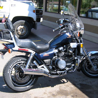
traveled. I stopped at the Subway in Lincoln for fuel and to cool down
(that's a photograph of an old V65 Honda, that was in pretty good shape).
The last time I was along this route, I turned north up the Swan River towards
Glacier National Park. I considered doing that again, but then that would
mean missing out on that last 33 miles stretch to Missoula, so I stayed the
course.
Most
people trying to get from Great Falls to Missoula will stay on the freeway as it
runs south to Butte, and then back up north to Missoula. In fact, that's the
general path that Lewis and Clark took the first time through. But, there's a great shortcut
between the towns, that takes you right across the Rocky Mountains, and that's
state highway 200 across Roger's Pass. It's one of the all time great
motorcycle roads and has the advantage of not being very heavily
traveled. I stopped at the Subway in Lincoln for fuel and to cool down
(that's a photograph of an old V65 Honda, that was in pretty good shape).
The last time I was along this route, I turned north up the Swan River towards
Glacier National Park. I considered doing that again, but then that would
mean missing out on that last 33 miles stretch to Missoula, so I stayed the
course.
 Missoula.
I have never had much good to say for this city. It seems that I'm always
trying to find my way across the town--following the state highway signs--at
rush hour. I am convinced that whoever laid out highway 12 across Missoula
did it with the intention of maximizing the number of lights and stop
signs. It took me a full 40 minutes to get from the east-side to the
west-side and by that time I was pretty well spent (and missed at least two
unexpected turns of the route). The temperature was
near 100 degrees, and I just was not in the mood to continue on. I needed
a break. So, I checked into a hotel and let the bike cool down while I
walked around west Missoula for a couple of hours. The day had started out
perfectly with the run north of Livingston, had been especially nice over
Roger's Pass and the Rocky Mountains, and I didn't want to spoil it by grinding
out the miles beyond Missoula after being cooked in the heat. Better to
have a fresh start with a fresh attitude.
Missoula.
I have never had much good to say for this city. It seems that I'm always
trying to find my way across the town--following the state highway signs--at
rush hour. I am convinced that whoever laid out highway 12 across Missoula
did it with the intention of maximizing the number of lights and stop
signs. It took me a full 40 minutes to get from the east-side to the
west-side and by that time I was pretty well spent (and missed at least two
unexpected turns of the route). The temperature was
near 100 degrees, and I just was not in the mood to continue on. I needed
a break. So, I checked into a hotel and let the bike cool down while I
walked around west Missoula for a couple of hours. The day had started out
perfectly with the run north of Livingston, had been especially nice over
Roger's Pass and the Rocky Mountains, and I didn't want to spoil it by grinding
out the miles beyond Missoula after being cooked in the heat. Better to
have a fresh start with a fresh attitude.
 Idaho
Idaho
Lots of choices this morning. As much as I dislike Missoula, there's not a better place to be in the morning with an open mind about which way to go. North up the panhandle of Idaho? West across Lolo Pass? South along the Bitterroot?
What clinched it was the opportunity of riding highway 13 into Grangeville as well as still heading towards the Yakima Valley, and the good chance to do the ever-elusive Bickleton-to-Roosevelt road. So, Lolo Pass it was to be.
In any event, this is not such a bad choice! Lolo is one of the nicer motorcycle roads, anywhere. It's not a particularly challenging road, being mostly a river road with gentle curves and good sight-lines (near the pass itself it tightens up a bit, but there are no particularly sharp turns).
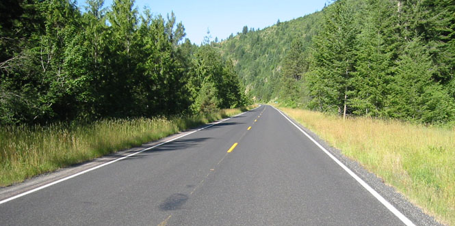
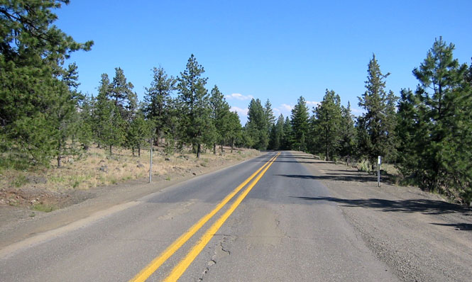
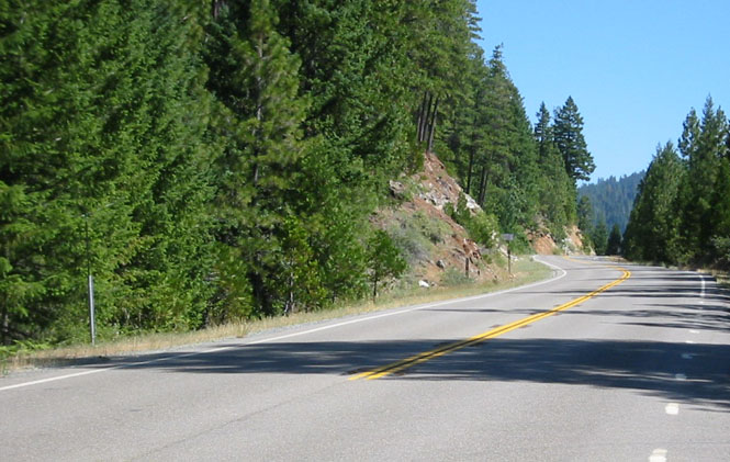
What makes it so nice is that fact that these gentle curves with their good sight-lines goes on for something close to 100 miles. [There's a sign at each end of the road warning of a winding road for the next 77 miles. Instead of indicating a stupendously winding road, I think it really just shows that Idaho didn't want to pay for more than two warning signs] The photograph, above, is perhaps a little straighter than most sections, but it gives a good sense of the road. Nice pavement, not much traffic, and the Clearwater Mountains. I think I've ridden this road 5 times, and I will never tire of it.
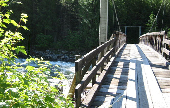
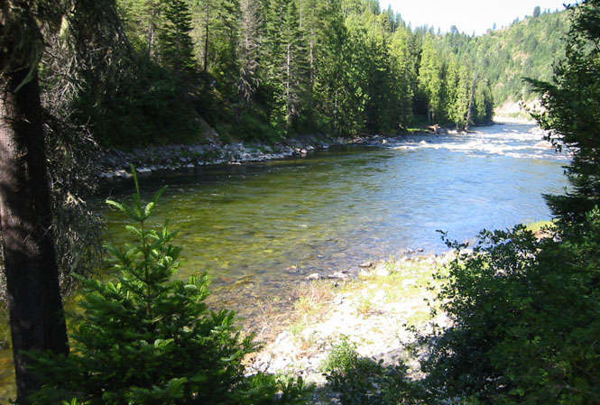
I stopped along the Clearwater for a snack break and also to do a little hiking along the trails that follow the river. There are quite a few trail heads along this river, and the Forest Service has erected a number of wooden foot bridges taking you from the parking areas along the highway to the trails that generally run south, into the mountains.
I stayed here--either reading or walking--for probably and hour and a half. It was a beautiful morning, and the temperature was perfect. I was glad that I stayed the night in Missoula, and didn't make the run over Lola in the hot temperature of that evening.
Of course, it wouldn't be a full day without a long stop for road construction. In this instance, the highway department was putting down a layer of chip-seal. Rather nasty stuff when it's fresh as it tends to stick rocks and goo on the tires. But, this was nothing compared to what I'd be seeing in Utah in a few days...
Usually, whenever I come to one of these construction sites, I'll immediately shut things off and get off the bike. You can tell by the length of the line of cars in front, as well as by how long it's been since you've seen any oncoming cars, about how long the stop will be, and it's much better to get off the bike and walk around than to just sit on the thing, cooking (as it were). The picture (below) was taken from the same construction stop.
Between the small town of Kooskia and the larger town of Grangeville is state highway 13, one of the state highways in Idaho that I had not yet ridden. Turned out to be quite a very nice road. Just a fairly narrow two lane road, it bounced up and down and swung left and right through the hills before dropping into the broad prairie valley of Grangeville. I stopped for fuel in Harpster, and while filling up the tank, I heard another Guzzi go by. I didn't see it, but the sound is so distinctive that I have no doubt but that it was a Guzzi. Counting this one, I would see (or at least hear) two Guzzis on the trip.
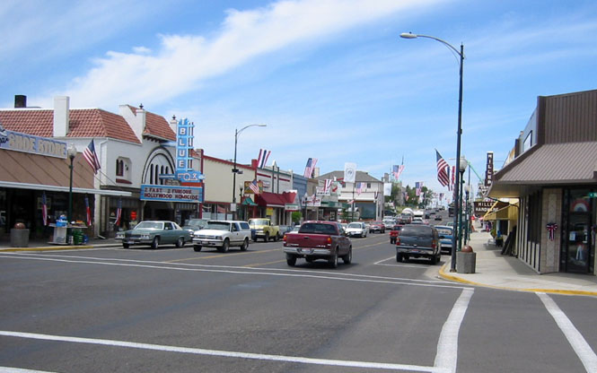
Grangeville
is a nice sort of town. Whenever I ride into it, it always seems bigger than I expect, and has
managed to keep its core downtown district as a vibrant place. Being just
two days before
 the 4th, there were flags hanging all up and down Main
Street. I swung around the corner on the right and parked the bike on a
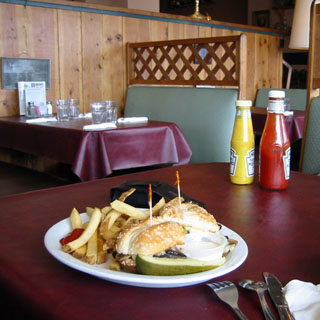
side street before walking back to the restaurant to have lunch. Turned
out to be a pretty good sandwich and the fries were just right, too. All
the best cafes have dark red plastic tablecloths and toothpicks with frilly
colored cellophane on the ends stuck through the sandwich.
the 4th, there were flags hanging all up and down Main
Street. I swung around the corner on the right and parked the bike on a
side street before walking back to the restaurant to have lunch. Turned
out to be a pretty good sandwich and the fries were just right, too. All
the best cafes have dark red plastic tablecloths and toothpicks with frilly
colored cellophane on the ends stuck through the sandwich.
The route north out of Grangeville is one of my favorite rides. It's a very hilly area, although what was once forest land has mostly been converted to farmland. You can see mountains off in the distance in every direction, while the road is a series of gentle, sweeping turns that winds around the lower hills, sometimes popping over the top when the turns of the creek it had been following become too sharp for a road.
At Spalding, I stopped at the Nez Perce National Heritage Park.
This was my last stop in Idaho, and I was reluctant to leave it so soon. The photograph, below, was taken from the park, looking north beyond the Clearwater River and highway 12. My little loop down to Grangeville hadn't really added much more distance than if I had stayed on 12 all the way, and that section of 12 isn't all that great, anyway.
 Washington
 After finding my way through
Lewiston, I crossed the Snake River into Washington (you'd think that by now
Lewiston would be large enough that they could afford to run a bypass of highway 12
without routing you through main
street). This was all well-trod territory through the Palouse
Hills. Even so, at Waitsburg I cut across on highway 124 to Pasco and was
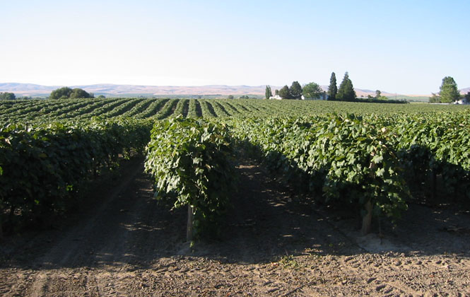
able to pick up another new road. This road runs mostly straight, and is mostly
surrounded by various crops that I was unable to identify. Oh, I could
figure out the grapes, just fine, but there were acres of any number of other
crops that I drew a blank.
After finding my way through
Lewiston, I crossed the Snake River into Washington (you'd think that by now
Lewiston would be large enough that they could afford to run a bypass of highway 12
without routing you through main
street). This was all well-trod territory through the Palouse
Hills. Even so, at Waitsburg I cut across on highway 124 to Pasco and was
able to pick up another new road. This road runs mostly straight, and is mostly
surrounded by various crops that I was unable to identify. Oh, I could
figure out the grapes, just fine, but there were acres of any number of other
crops that I drew a blank.
At Pasco, I had no choice but to pick up I-82 and follow the Yakima River into Sunnyside. Starting out in the morning in Missoula, I though that I'd be able to cross over the Horse Heaven Hills to the Columbia River, but again, I hadn't counted on the temperature being so high that I was forced to take an extended mid-day break at a rest stop. Running a couple of hundred miles without a break when the temperatures are near 100 will sap just about all your energy. So, I decided to stop for the night in Sunnyside and take the Horse Heaven Hills the next morning.
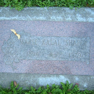
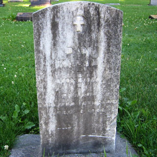
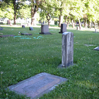
I managed to find the Sunnyside Cemetery without too much trouble, and took pictures of the markers for Marie Shafer and Dan Kalal. The third photograph (below) shows both markers (which may be of some help to anybody trying to find them).
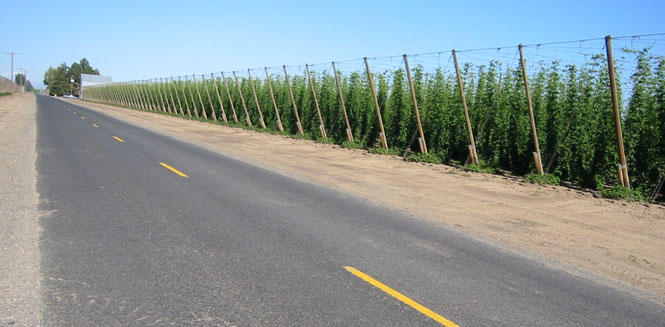
The next morning, after a bit of work avoiding bridge construction over the Yakima River, I rode between the hop fields to Mabton (not knowing that it was the home of a mad cow).
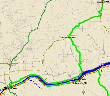
There has never been a rational reason why the Bickleton-to-Roosevelt road has held such a fascination with me for over 20 years. I think it has to do with the fact that this is such an undeveloped area, and that Bickleton is a small town that is about as isolated as you'd want a town to be and on a road that no one but people who live there would ever want to take. Years ago I rode from Mabton to Bickleton to Goldendale, which is really quite a good motorcycle road (if you allow for the less-than-perfect pavement).
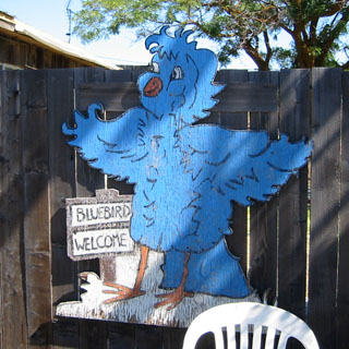
Now, I would be able to turn south at Bickleton and take the back road to Roosevelt. I guess I should point out, too, that Bickleton proclaims itself as the Bluebird Capital of the world. Or, perhaps they don't extend their claim quite so far as whole world. In any event, there are nicely painted bluebird houses erected all over town and for miles outside of town.
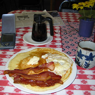
But first: breakfast. There's only once place to eat in Bickleton, and it was my luck that it's pretty good. They had the largest (and best) pancakes that I had on the entire trip. Bluebird (berry) syrup, of course.
For all my anticipation of this road, it really isn't anything special--just a narrow, mostly un-marked country road. As much as I expected. I do like this area, though. It has such a wide open feel, and the scenery is so distinctive to the region, that I'm convinced that I could be dropped here and would immediately know where I was. One of the nicer morning rides of the trip.
There's really quite a steep grade as the road drops down into the Columbia River and the small town of Roosevelt.
I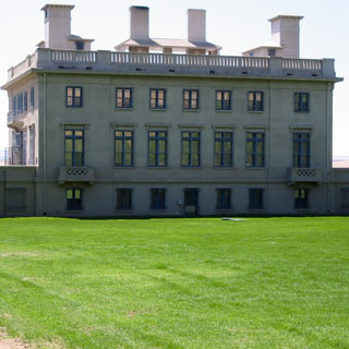 f the
old Columbia River ferry were still active it would have been an easy
thing to cross the river to Arlington and then to pick up the road south into
Oregon that I was planning on. In fact, I talked to an older man at the Bickleton Cafe who told me about how they used to do just that when their high school
basketball team played Arlington. Now they have to
drive all
the way west to Biggs Junction, and then drive back to Arlington--some 75 miles out
of their way. Well, that's exactly what I had to do, too.
f the
old Columbia River ferry were still active it would have been an easy
thing to cross the river to Arlington and then to pick up the road south into
Oregon that I was planning on. In fact, I talked to an older man at the Bickleton Cafe who told me about how they used to do just that when their high school
basketball team played Arlington. Now they have to
drive all
the way west to Biggs Junction, and then drive back to Arlington--some 75 miles out
of their way. Well, that's exactly what I had to do, too.
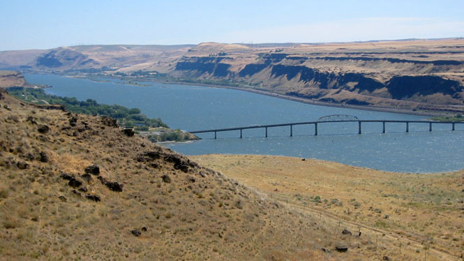
The photograph (of the bridge over the Columbia looking upstream of the Columbia River--Biggs Junction just across the bridge, and Arlington far up the river, over the horizon) was taken from the Maryhill Museum; probably the same shot taken by every visitor to the place (including me, every time I've been here).
Maryhill museum was really looking pretty good, this trip. It seems that fairly recently they had hired a new museum director who had made significant changes to the displays with the result that the museum is now accredited. Certainly, it all looked more professional than I recall from earlier visits.
This was to be an especially good day for picking up new roads.
 Oregon
 First I backtracked up the Columbia and had
lunch at the same Arlington restaurant that I've stopped at numerous times (it's
just across the street from the river park that you see in the photograph). While there,
I talked with a girl who was riding down from Canada to see friends in
Bend. She was around 19, and this was her first motorcycle trip of any
real distance. She didn't have the right motorcycle for the trip (a Suzuki
250), and certainly didn't have the clothing
First I backtracked up the Columbia and had
lunch at the same Arlington restaurant that I've stopped at numerous times (it's
just across the street from the river park that you see in the photograph). While there,
I talked with a girl who was riding down from Canada to see friends in
Bend. She was around 19, and this was her first motorcycle trip of any
real distance. She didn't have the right motorcycle for the trip (a Suzuki
250), and certainly didn't have the clothing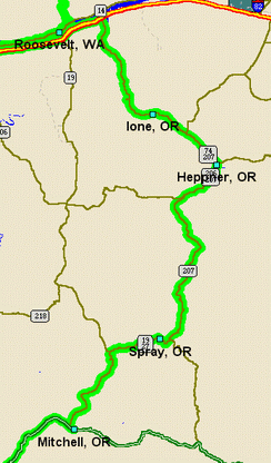 for it, and she had packed way more
stuff than she should have (and even that wasn't packed right), but she was on the 'trip of her lifetime', and was so
excited about it. Occasionally I'll meet people who are out on their first
long trip, and it's fun to hear them talk about it and share their adventures.
Anyway, I told her about several nice (but easy) roads that she should try on
her way back (she'd been keeping to freeways more than I'd have advised) and
gave her a couple of earplugs to see her on her way.
for it, and she had packed way more
stuff than she should have (and even that wasn't packed right), but she was on the 'trip of her lifetime', and was so
excited about it. Occasionally I'll meet people who are out on their first
long trip, and it's fun to hear them talk about it and share their adventures.
Anyway, I told her about several nice (but easy) roads that she should try on
her way back (she'd been keeping to freeways more than I'd have advised) and
gave her a couple of earplugs to see her on her way.
From Arlington, I only had a few miles left on
I-84, before turning south on highway 74 (new road!). This is a really
interesting part of Oregon. It reminds me of some parts of central
Wyoming--that is, if central Wyoming had more trees. Steep, rolling hills with
taller forest-covered mountains all around. It's not likely that any of
the few towns in this region
are larger, now,
 than they were in 1920, but on the other hand, they have not
blown away, either. For the most part, the downtowns still have stores open, and the old garages on the outskirts of town still pump gas and
service
cars.
than they were in 1920, but on the other hand, they have not
blown away, either. For the most part, the downtowns still have stores open, and the old garages on the outskirts of town still pump gas and
service
cars.
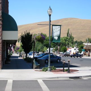
By the time I reached Heppner, it was the hottest part of the day, so I parked the bike and did a lot of walking and (typical for this trip) reading in the library. And, what a nice library they have in Heppner. Clearly there's some enthusiasm here. The library had several brand new PCs available--all of them with Internet access, of course. It matched the apparent pride in the town, itself, which had hanging flower baskets from all the street lights.
Next door to the library was the city museum, which had quite a good display on the devastating flash flood of 1903 that killed at least 250 people and nearly destroyed the town. The photographs of the flood were incredible.
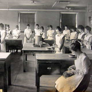
Home Economics class at Heppner High school.
This was a fun place for a motorcycle. The roads aren't particularly well maintained (it's a fuzzy line between gravel on the shoulders and pavement where you want it), but they're not really too bad, and the scenery is spectacular. I head south out of Heppner towards Ruggs, and then stayed on highway 207 to Spray and over the very winding summit road to Mitchell. These roads show on most maps as thin, little gray lines, but I think they rate as some of the best motorcycle roads, anywhere. Worth going out of your way to ride.
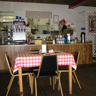
Downtown Spray, and the best cafe in town.
Or perhaps I should say the best grocery store and cafe in town... Oh, and, gas station, too. Just don't expect quick service. "What's the hurry, son?" No hurry at all. I'll have a milkshake.
When I reached Mitchell (on highway 26) I was
in familiar territory, again.
Highway 26 is comparatively a superhighway, what with centerline stripes, and
mile-markers and even guard rails where somebody thought they were needed.
I could either stop in Prineville, or carry on towards Bend, but either way, I
wasn't going to try to go any farther than that. It was still pretty hot,
and since I've never been too thrilled with highway 97, anyway, I decided to
stop in Prineville for the night. This gave me plenty of time to do the
laundry (for the first time on the trip), and to walk to a good restaurant for the evening.
It was still pretty hot,
and since I've never been too thrilled with highway 97, anyway, I decided to
stop in Prineville for the night. This gave me plenty of time to do the
laundry (for the first time on the trip), and to walk to a good restaurant for the evening.
Like I said; highway 97 through Bend is not much fun. But, these days, it's even less interesting. It's not yet altogether a freeway, but it's close enough to give you the same numb feeling. I was astonished at the build-up around Bend. The highway no longer runs through downtown, but instead bypasses around the east side of the city. I was considering stepping over to the Cascades highway, which is a favorite road, but since I was now somewhat 'on the clock' what with wanting to hit the east rim of Crater Lake in the afternoon, and to still reach Yreka that evening, I didn't do it. Stopped for breakfast in La Pine at a small cafe on the side of the road. My food didn't arrive until 45 minutes after I ordered it (some sort of 'difficulty' in the kitchen), but it was enjoyable to sit on the counter stool listening to all the stories being told. Turned out to be quite the place for the locals to have their breakfast. The locals without jobs, I would presume.
Highway 138 is a peculiar road. From the intersection with highway 97, near Beaver Marsh, to the intersection with the entrance road to Crater Lake is 15 miles of dead straight road. At least dead straight as far as turns are considered. It does climb up the hill at a fairly good rate.
 The
shot was taken at the entrance to the park. As I think I've explained in other reports, I generally ride past all the cars lined up
and park the bike
near the pay booth so that I can strip off my helmet and gloves, and sort out
where I want to go once I'm in the park. I also am careful
to allow several cars to run by me so that they don't think that I'm cutting
in front of them in the line. I've found that car drivers can be quite irritable
at the entrances to national parks--perhaps it's the tension of the trip, or
perhaps it's the kids in the back asking when they'll be there.
The
shot was taken at the entrance to the park. As I think I've explained in other reports, I generally ride past all the cars lined up
and park the bike
near the pay booth so that I can strip off my helmet and gloves, and sort out
where I want to go once I'm in the park. I also am careful
to allow several cars to run by me so that they don't think that I'm cutting
in front of them in the line. I've found that car drivers can be quite irritable
at the entrances to national parks--perhaps it's the tension of the trip, or
perhaps it's the kids in the back asking when they'll be there.
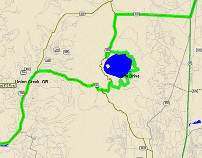
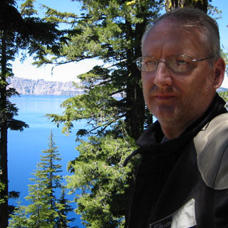
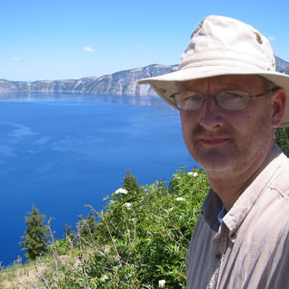
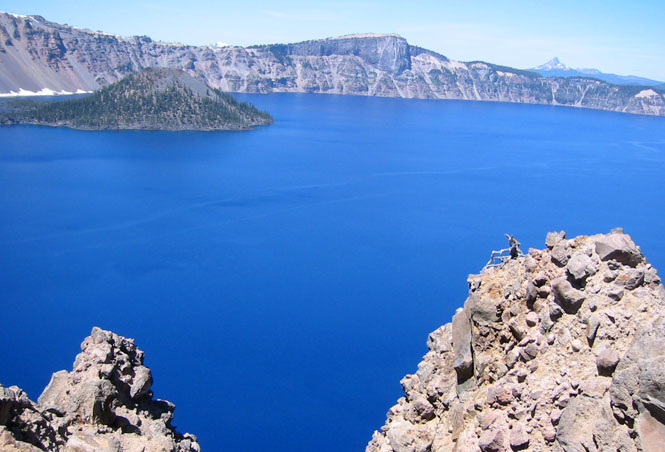
The rim drive elevation is probably around 6,500 feet, so it is a good long climb to get there. Finally; the east rim. It felt good making the sharp left turn to pick up the clockwise direction of the rim road around the long-sought eastern rim. And indescribable place. Perfect weather. As you might guess by the map, the east rim drive is a much better motorcycle road than the west rim drive. Doesn't really matter, though, as this is a National Park with a National Park speed limit and all sorts of drivers with no mountain driving experience doing some pretty amazing things. Best to just relax and enjoy the scenery.
 After parking in the visitors center I changed
into my civilian outfit
(remove the riding suit and boots--I just bungee the
suit to my seat and toss the boots under the bike. I do generally hide the
gloves as they'd be an attractive souvenir for an uncontrolled park visitor) and walked over to the
National Park Inn and then continued farther up the rim trail. My riding
boots are perfectly comfortable for hiking, but I've found that it's much
better--in the long run--to change into proper walking shoes when I have the
chance. I think the change of environment does my feet good, and it makes
it all the more comfortable when I again put the riding boots on.
After parking in the visitors center I changed
into my civilian outfit
(remove the riding suit and boots--I just bungee the
suit to my seat and toss the boots under the bike. I do generally hide the
gloves as they'd be an attractive souvenir for an uncontrolled park visitor) and walked over to the
National Park Inn and then continued farther up the rim trail. My riding
boots are perfectly comfortable for hiking, but I've found that it's much
better--in the long run--to change into proper walking shoes when I have the
chance. I think the change of environment does my feet good, and it makes
it all the more comfortable when I again put the riding boots on.
 The Inn has recently undergone an extensive rebuilding
program, and is now looking good. It seems that the original
building was never all that well-built to begin with, so there was some serious talk
about just tearing the whole thing down. But, the historic side won out,
so now the place looks about the same as it always has, except that it now is
insulated, and is actually livable
year-round.
The Inn has recently undergone an extensive rebuilding
program, and is now looking good. It seems that the original
building was never all that well-built to begin with, so there was some serious talk
about just tearing the whole thing down. But, the historic side won out,
so now the place looks about the same as it always has, except that it now is
insulated, and is actually livable
year-round.
I only walked about 1 1/2 miles up the trail. It might have been nice to go farther, but it was getting pretty hot, and I didn't have that much water with me.
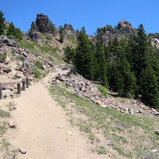
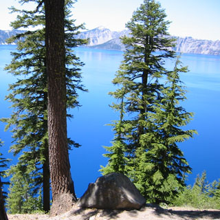
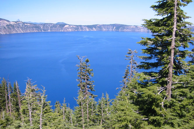
No matter. The view doesn't really change that much of the lake--it is round, after all. I was going to write that the photographs don't do justice to the deep blue color of the water; but, on looking at them, I'm thinking that they do (at least on my monitor). If you watch the water for at least 10 minutes, you'll notice that the color is not constant. Instead it changes ever so slightly as the sun moves or wind blows the surface or, perhaps, with the convection currents from within the lake. Crater Lake is like the Grand Canyon: even if you've been there several times (as I have for both) the first sighting of the lake (or the canyon) is always unexpected.
Not too many options for leaving the Park. The immediate road south of the lake is fairly winding as it descends down the mountain, but once you hit Union Creek, it's a fairly straight shot all the way to Medford as the road follows the Rogue River.

Of course, I had to stop at Beckie's (yes, the spelling is correct) for a slice of pie and ice cream. I don't know if it was the best of the trip (as I had a few others that were equally good) but on the other hand, I don't know how it could have been better. A recommended stop.
At Medford I had little choice but to turn south on good old I-5. Even though it was nearing 100 degrees back when I was on Oregon 62, I didn't really feel the heat until I hit the freeway. This really isn't such a bad stretch of freeway, as freeways go, but a freeway is a freeway, no matter what the scenery.
 California
 I
pulled into Yreka late in the afternoon (probably could
have done the Cascade Highway, after all), where I expected to connect with
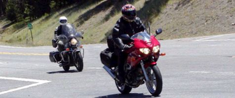
Becky and Gil at the Best Western Inn. One black Triumph, and one red
Suzuki in the parking lot (everybody has a swoopier bike than I have). Yep, they were here.
I
pulled into Yreka late in the afternoon (probably could
have done the Cascade Highway, after all), where I expected to connect with
Becky and Gil at the Best Western Inn. One black Triumph, and one red
Suzuki in the parking lot (everybody has a swoopier bike than I have). Yep, they were here.
We walked across the street to a cafe for
dinner (not so good as to make us want to return there for breakfast), and then relaxed
with a Glenfarclas on
 the
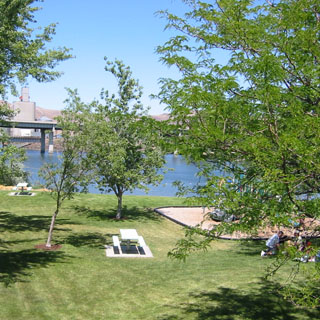
back porch of their room (looking over the grassy lawn to the river).
the
back porch of their room (looking over the grassy lawn to the river).
The next morning Gil had turned their bikes around (for a smooth departure?) and was making me ashamed of my accumulated seven days of road grime by wiping off his Triumph. I think Becky's was pretty well spotless already. I didn't embarrass them by parking next to them. We still had plenty of time to walk downtown and have some breakfast at Denny's.
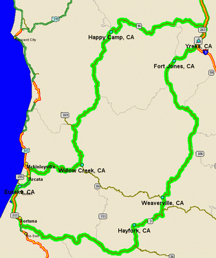
The original plan was simply to ride back to Eureka by some route, and the route that made the most sense was to take highway 3 to Weaverville (jog left on 299 for a short distance) and then to continue on 3 to highway 36 and then on to Eureka. I'd been on each of the other highways in the region (36, 96, 199, 299) several times, but I'd somehow never been on 3, before. All four of these highways are well known for being some of the best motorcycle roads in the country--for good reason.
We all three fueled up at a Chevron station at the south end of town, but then I think Becky and Gil had a plan to get a head start on me. As I came out of the store after buying a couple of water bottles, they were already moving down the road. So, after packing the water in the rear trunk, and putting on my gloves and helmet, I had a bit of catching-up to do...
The Scott Mountain summit has some of the tightest curves you could want. Probably actually a little tighter than I would want for too long. A terrific road.
At one point I stayed a little too long behind a car that Becky and Gil had passed earlier, so I finally decided to just pass it instead of waiting for a straighter section. Shortly after that, as I was hustling to catch up to Becky again (who was taking the curves with a great deal of confidence) I looked down at my Tach and noticed that I was heading upwards past 6,000 RPM. Not a nice thing to do to a motor that was just shy of 250,000 miles. By way of apology, I slowed down and shifted up a gear. The last thing I should be doing 2,000 miles from home is running 10/10th on a mountain road--back to 6/10th. We stopped for a water break along Trinity Lake, which is where the above shot was taken.
After waiting, seemingly forever, for a break in traffic we turned left on 299 and escaped from Weaverville (where'd all these cars come from?). Seven miles down the road we turned right and were by ourselves on highway 3, again.
The curves
through this section are wider than the Scott Mountain section, and go on for
much longer. Much easier to set up a rhythm, and, for me, a more enjoyable
section. The Guzzi is most happy to maintain a more steady speed, and to just
hold it through
 the curves and straights,
alike, with a minimal amount of shifting on either side of 3rd gear (which alone
gives me plenty of useful range between 35 and 65 mph). You won't win any
races with that technique, but you can ride all day on some pretty curvy roads
without getting tired and still move at a good clip.
the curves and straights,
alike, with a minimal amount of shifting on either side of 3rd gear (which alone
gives me plenty of useful range between 35 and 65 mph). You won't win any
races with that technique, but you can ride all day on some pretty curvy roads
without getting tired and still move at a good clip.
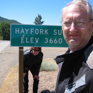
We stopped at the Hayfork Summit for a water break (and to admire each other's motorcycles--of course), before dropping down the hill into the once bustling town of Hayfork. Logging and mills used to sustain quite a good-sized town. No more. We rode through town looking for a good place to eat, and then found ourselves on the other side. OK. Turn around and go back to the only place to eat. Turned out to be good place to eat, too. The poor waitress was dreadfully overworked, but, she was doing a fine job, and we didn't have anyplace to be at the moment. Besides, it was hot outside, and it felt good to be in a cool dining room.
 From Hayfork we passed the town of Peanut (I
blinked and missed it) and connected with good old highway 36. This road
offers everything
you might want out of a motorcycle road. It starts in Red Bluff (if that's
where you start) and bounds up and around the
short, stumpy foothills and winding creeks before getting serious and climbing
up the Coast Mountains. The eastern, lower, half of the road is in Tehama,
Shasta and Trinity counties, and is now quite well maintained. Things change in Humboldt county, but
we'll get to that. Some years back (25 years?), when I rode this highway for the first
time, the pavement wasn't anywhere nearly as good as it is now.
From Hayfork we passed the town of Peanut (I
blinked and missed it) and connected with good old highway 36. This road
offers everything
you might want out of a motorcycle road. It starts in Red Bluff (if that's
where you start) and bounds up and around the
short, stumpy foothills and winding creeks before getting serious and climbing
up the Coast Mountains. The eastern, lower, half of the road is in Tehama,
Shasta and Trinity counties, and is now quite well maintained. Things change in Humboldt county, but
we'll get to that. Some years back (25 years?), when I rode this highway for the first
time, the pavement wasn't anywhere nearly as good as it is now.
In fact, at that time the summit section of the road was still not paved. It's all paved now. Highway 36 is often listed in magazines as being the best road in northern California. It's impossible to make a comparison between highway 1, along the coast, or any number of other especially nice roads, but, I would never argue that highway 36 is not the best. Before we crossed the last hill to the coast, we stopped to zip up the vents and otherwise prepare for the coming cold weather. It's always a surprising thing how it can be so very dreadfully hot in one spot, and then so chilly just 50 miles inland. Considering the many days that I had of riding in 100 degree heat (and knowing that there were more of those to come) it was a welcome relief for me.
As mentioned, highway 36 is considerably different in Humboldt County. It was originally just a dirt road for forest access, but when it was paved, there was only a minimal attempt at making grade improvements. What you have, then, is a marginally prepared paved surface of a roadway that was expected to take traffic moving along at whatever speed you might be tempted to drive on a dirt road. In several places, the road is not wide enough for two trucks to pass. Of course, this is not a problem on a motorcycle, but you do have to be wary for car drivers who like to hug the mountain side of a narrow road regardless of what side that happens to be. This is most definitely not a road to be ridden at 10/10th. At least, not by me. Not now.
Becky looking much more sporting (and possibly less comfortable) than me--but then, she's on the faster bike.
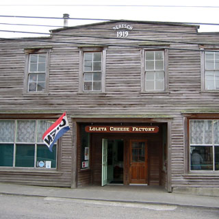
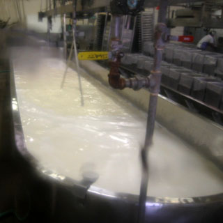
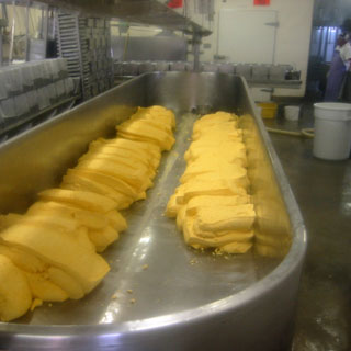
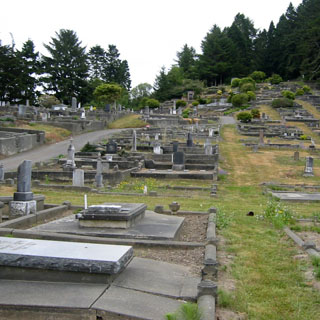
I only had one full day in Eureka, but did manage to visit the Ferndale Cemetery (recommended) as well as touch the Pacific Ocean. The vats you see in the photographs are at the Loleta Cheese Factory in (you guessed it) Loleta.
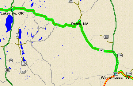
One of my goals for the trip was to try to take the road between Lakeview, Oregon and Winnemucca, Nevada. I will have to say that I never expected anything noteworthy about this road--it's just that I had never been on it, and since the route between Lakeview, Oregon and Winnemucca, Nevada isn't one that normally falls in with any other trip, I would have to make a special trip to ride this road. I was looking forward to it.
I left Eureka and took 299 to Willow Creek, and then 96 up the river to Yreka (following the same route that Becky and Gil took on their way to Yreka). River roads (such as 96) can be quite pleasant things. Unlike mountain roads, you'll rarely be surprised by an unexpected twist or turn in the road. If you keep an eye on where the river is going, you'll be able to tell what the road will be doing for miles ahead. Consequently, river roads are much more relaxing. Sometimes on a mountain road there's no telling which way the road will turn when you reach the crest (see 36), but a river road will never be cruel and will rarely trick you.
By the time I hit Yreka, the heat was back. Sigh... And, then I spent 20 minutes hunting for my wallet (it somehow fell under the booth in the restaurant).
Much as I hate to do it, I found myself backtracking on exactly the same stretch of freeway that I was on a couple of days before--I needed to get to Lakeview.
Oregon
There were any number of possible routes to take, but since I'd never been on highway 140 between Medford and Klamath Falls this would give me a great chance to pick up the entire route of 140. It's a curious thing, there are two roads between Medford and Klamath Falls--the southern route (66) is probably the better motorcycle road (and certainly the most direct route for this trip), but the northern route (140) is awfully good, too. Anyway, now I've done them both.
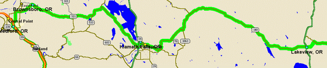
I camped out at a Dairy Queen in Klamath Falls. Hot, hot, hot. The highway between Klamath Falls and Lakeview is a pleasant thing. A bit of forest, and a bit of desert. Some winding bits and some straight shots. No towns and next to no traffic. When I reached Lakeview, I still had plenty of daylight left. However, I knew full well that the next hotel wouldn't be until Winnemucca, and I wasn't all that sure about gas, so I decided to stop for the night and pick up the desert road early the early morning.
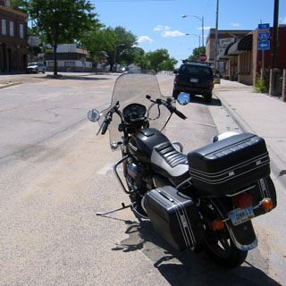
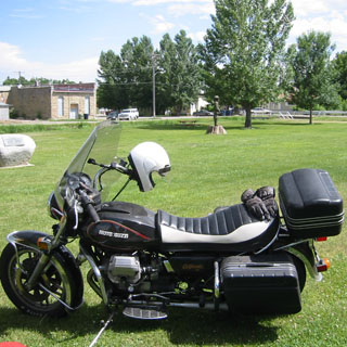
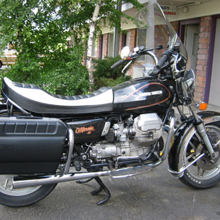
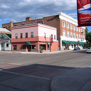
I know I include way too many pictures of this motorcycle (it never changes, so you'd think one picture would be enough), but it had just hit 250,000 miles, and I thought the old thing was looking pretty good. I had a lot of time to kill so I walked through town to a small cafe that I knew from other trips, and then took the full walking tour of Lakeview. Just missed catching another library as I saw the librarian locking up.
Highway 140, between Lakeview, Oregon and the intersection with US 95 just north of Winnemucca is as isolated a road as I have ever been on. Highway 50 in Nevada is often called the 'loneliest road in America', but that's more of a marketing ploy than reality. The reality is that you will occasionally see a car on that highway. Highway 140 is really a lonely road; you could safely eat your lunch on the pavement with not much fear. But, more to the point, the landscape that 140 runs through is remarkable for its openness and emptiness. The four-corners region of California, Oregon, Idaho, and Nevada is more remote than any other place in the country (yes, I know it's not exactly a 'corner').
Interestingly, there's actually a small ski region just east of Lakeview, and the road climbs through some rolling hills before diving into the wide valley below. No skiing today. The photograph was taken while waiting for some road construction.
 Nevada
There's a view just after Blizzard Gap (6,100 ft) looking across a valley towards Antelope Butte Pass (6,200 ft) that is just stunning. This valley runs north and south and you can see mountains far off to either side with little sign that any human being was ever here. Straight ahead (but, many miles away) you can see the highway climbing what appears to be a very steep bluff that stands in the way. It looks as if the roadway had been cut right into the side of a cliff as it climbs at a steep and unwavering angle from left to right. However, as soon as you reach what is now clearly the side of a mountain, it becomes apparent that this is no smooth cliff, but instead has been long eroded into something that has the appearance of hanging drapery. The road, instead of climbing in a straight line up the side, instead curves left and right and left and right within the folds of this 'curtain', all the while keeping to the same, unchanging steep grade. Must be a lot of fun to be coming down the grade at night.
I stopped for fuel at Denio. It's always the case that I stop for fuel much more often when I'm in a part of the country with the least amount of gas stations. You never know how far you'll have to go, so it's best to top-off when you have the chance. I'm pretty sure that this was the most expensive fuel of the entire trip--somewhere beyond $3.00 as I recall. On the other hand, there is so little traffic, that I can't blame the owners for charging whatever it takes to make a living wage--better to have expensive gasoline than no gasoline. There was an attached cafe, so I ducked in out of the heat and had a good slice of pie.
The remainder of the road to US 95 is flat, long, flat and straight. You can ride at 55 mph or 155 mph. It all feels the same. Well, you can ride 155 mph; I can't.
 By the time I reached Winnemucca, it was well
above 100 degrees. Winnemucca is just 100 miles from Denio, so I plunged
ahead on I-80 without stopping. At Battle Mountain, another 50 miles, I
had had quite enough of the heat, so I pulled off the freeway, rode past the
normal interchange establishments, and parked along the curb on the old Front
Street that parallels the railroad tracks. I ate lunch in a casino that
had seen better days--good food, though. It certainly wasn't any cooler
when I came out (closer to 110 degrees by now) so I rode a short distance to the city park,
spread my riding suit out (it makes a ground cover) and took a nap and did a
little reading under a shading tree. And, of course, I walked over to the
public library, which was air conditioned...
By the time I reached Winnemucca, it was well
above 100 degrees. Winnemucca is just 100 miles from Denio, so I plunged
ahead on I-80 without stopping. At Battle Mountain, another 50 miles, I
had had quite enough of the heat, so I pulled off the freeway, rode past the
normal interchange establishments, and parked along the curb on the old Front
Street that parallels the railroad tracks. I ate lunch in a casino that
had seen better days--good food, though. It certainly wasn't any cooler
when I came out (closer to 110 degrees by now) so I rode a short distance to the city park,
spread my riding suit out (it makes a ground cover) and took a nap and did a
little reading under a shading tree. And, of course, I walked over to the
public library, which was air conditioned...
 Eventually, I had to get out on the road,
again. I went as far as Elko, when I saw a sign for a California Trail Museum.
I didn't need much of an excuse to park the bike again, so
after riding through the newest part of town next to the freeway, then through
the rundown part of the 1960's part of town, I came to the original old downtown
Elko. I really had no idea that this was here.
As many times as I've been through
Elko, I never once took the trouble to go down to the tracks to see if the old
building were still there. Well, they are. After walking through the
museum (they're doing their best, but don't expect much) I talked to the owners
of a restored restaurant/saloon (one photograph of the outside--with the old
Dodge in front, and the other photograph of the interior). They were
certainly enthusiastic about the prospects for the renewal of the old town, but,
frankly, I have
my doubts. Hard to see why anybody would ever make their way here.
There apparently has been talk about promoting the historic old highway 40 (Fabulous
40) as something of a parallel to Route-66, but since highway 40 never
had a TV show about it, and I'm not aware of any song, this may not lead to
much.
Eventually, I had to get out on the road,
again. I went as far as Elko, when I saw a sign for a California Trail Museum.
I didn't need much of an excuse to park the bike again, so
after riding through the newest part of town next to the freeway, then through
the rundown part of the 1960's part of town, I came to the original old downtown
Elko. I really had no idea that this was here.
As many times as I've been through
Elko, I never once took the trouble to go down to the tracks to see if the old
building were still there. Well, they are. After walking through the
museum (they're doing their best, but don't expect much) I talked to the owners
of a restored restaurant/saloon (one photograph of the outside--with the old
Dodge in front, and the other photograph of the interior). They were
certainly enthusiastic about the prospects for the renewal of the old town, but,
frankly, I have
my doubts. Hard to see why anybody would ever make their way here.
There apparently has been talk about promoting the historic old highway 40 (Fabulous
40) as something of a parallel to Route-66, but since highway 40 never
had a TV show about it, and I'm not aware of any song, this may not lead to
much.
They might want to promote the Victory Highway (as it once was) or even the Lincoln Highway (after that highway was rerouted from what is now US 50), but I'm not so sure that enough people care about those old names to want to come. One (forlorn) plus is that since the area has been forgotten for so long, the old front street has not changed much over the years.
If it were not for the heat, I would have
seriously considered striking north on 93, back into Idaho to pick up a stretch
of the California Trail that I've not been on. Either that, or I could
have easily run across to Salt Lake City and beyond. Instead, I rode past
Wells and pulled into a fairly large Casino Hotel in West Wendover. West
Wendover has become quite a bustling little city on the border with Utah.
Naturally, the Nevada side is prosperous and has some surprisingly large casinos
and hotels lining the main street
 through town. On the other hand, Wendover proper is a shabby looking place. No casinos, and dependant
on Utah for help.
through town. On the other hand, Wendover proper is a shabby looking place. No casinos, and dependant
on Utah for help.
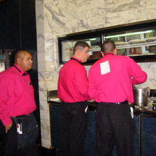
I had dinner at the coffee shop counter (which, per casino standards, required running the gauntlet of gaming tables and slot machines and mirrored walls). The server (above) was the unknowing victim of his coworkers who had posted the Spanish equivalent of 'kick me, I'm an idiot!' on his back. Hilarity ensues when he finally notices all his fellow employees smirking behind his back.
Let's hope for cooler weather tomorrow.
 Utah
Utah
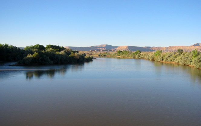
I could tell, immediately that it was not going to be a cool day. The ride across the salt flats was what it always is. I considered dropping south along Skull Valley to Dugway, and then to cross over Johnson Pass, and return back to Salt Lake through Rush Valley. Both of these routes were once part of the Lincoln Highway--the Johnson Pass route being one of the later improvements to the road. This section of the Lincoln is noteworthy as it is the one section that did not become part of any subsequent highway system. Back in the days of the Lincoln, the nation's cross-country highway went from Salt Lake City to Ely, Nevada. If you look at a map, today, you'll not see any (paved) road that follows this route. But, both the Skull Valley and Johnson Pass routes mentioned are paved, and I'll have to do them someday. Not this day, though.
Just beyond Spanish Fork, on highway 6, I ran into the worst road construction of the trip. From that description you might expect it to have been sandy and muddy and un-rideable. No. It was fresh chip-seal being put down when the temperature was well above 100. It did not cool down. After waiting an interminable amount of time to be allowed by the flagman to proceed, I slowly entered the fresh chip-seal. Immediately, I felt that both tires were flat! I quickly looked down at the front and at the rear, and they were both fine. It seems that the chip-seal was still a gooey mess of tar and gravel and that my tires were just squirming through it. Considering that the outside temperature was around 105 degrees, and that I was riding on a fresh black surface, I wouldn't be surprised to know that the air temperature was closer to 120 degrees. And, this went on for miles. I tried to keep a long distance behind the vehicles in front of me, but, even so, occasionally a sticky rock would fly at me. And, oddly enough, these same sticky rocks were coming off my own tires. Not sure how that worked, considering that the Guzzi has full fenders, but my windshield was becoming marked with black rocks slowly drifting down like black snails. Meanwhile, I got used to the feeling that I had flat tires and just kept on listening to the rocks strike (and presumably, stick to) the underside of my fenders.
At Thistle, I intended to run south to cross the Wasatch Plateau on highway 31. Somehow I missed the turn and so kept on riding on highway 6. In an attempt to wait out the worst of the heat, I pulled into a town park and spread out my suit to read and take a nap. The motorcycle was a sticky mess.
The ride from Price to Green River was noteworthy for the number of cars that had pulled over with obvious heat related problems. Nobody was being left in the sun, though, so there was no need to stop (I'm not sure that an offer of a lift into Green River would have been accepted by any of them, anyway). Went by one truck, pulling a boat, on the side of the road that had (I learned later) thrown a rod through the case. Bad vacation, for somebody. I pulled into the Green River City Park and put the bike in the shade of a tree. I thought it best to let it cool down before proceeding. I needed cooling, too. I hung around for about 1 1/2 hours, and then decided to just hang it up for the day and checked into a hotel.
There's a new museum in Green River dedicated to the old river runners that first went down the Colorado. This was the launching point for most of those parties. Quite a well-done place; worth a second visit.
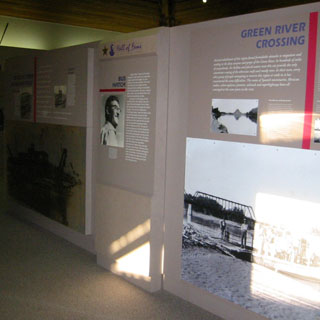
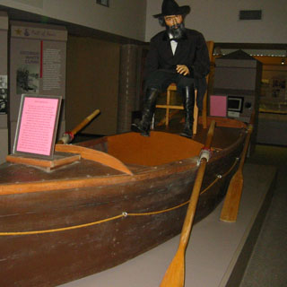
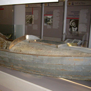
Much nicer in the early morning.
 Colorado
Next up was to be the north side of the Gunnison River. Riding through Grand Junction, I was surprised to see a Moto Guzzi sign, as well as several other European motorcycles out front. I looked over the new bikes (pictures are of a Triumph and a Ducati) before continuing on.
Highway 50 runs along the south side of the Black Canyon of the Gunnison National Park (but not so near that you are close enough to see anything), and state highway runs 92 along the north side. This one is near enough. I consider this road to be one of the best roads in Colorado, and it has more hairpin curves than California 3. It's a road to wear you out if you push things.
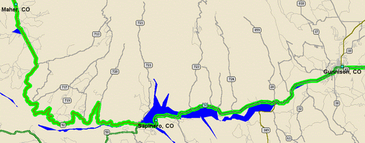
I stopped at a trail-head that led a few miles south to an overlook of the canyon. I only wish that I had more water with me. I took a full 28 oz water bottle with me, but it didn't last long. Quite a spectacular place, and any number of good hiking trails to warrant a return.
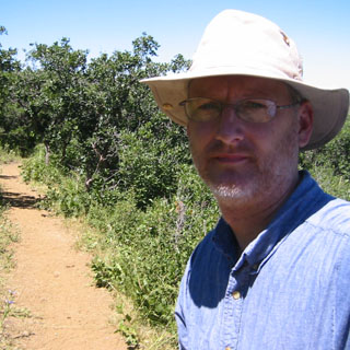
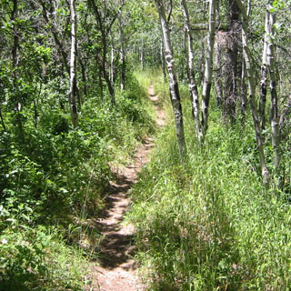
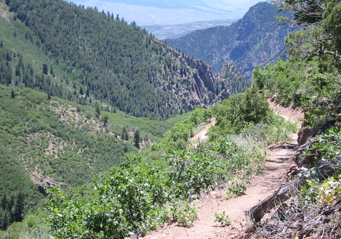
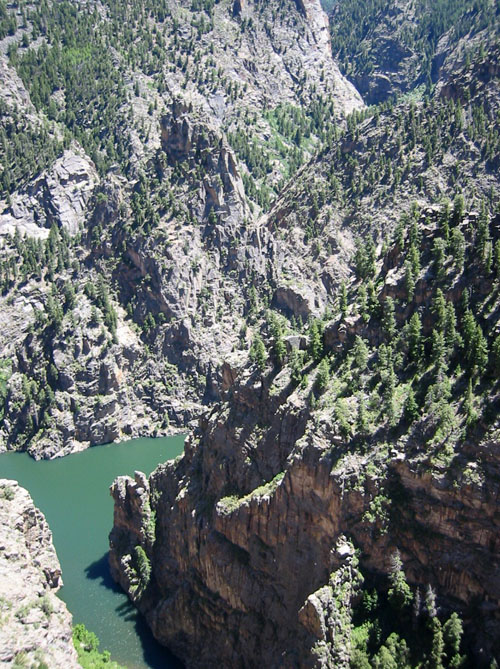 Until
as recently as 1949 there was narrow-gauge traffic down the Gunnison
River. Passenger service continued until 1940. Now, the old rail bed
is under the water of Morrow Reservoir. The Curecanti Needle was a famous
landmark on the route, and that's what you see (if you can pick it out) in the
photograph on the right.
Until
as recently as 1949 there was narrow-gauge traffic down the Gunnison
River. Passenger service continued until 1940. Now, the old rail bed
is under the water of Morrow Reservoir. The Curecanti Needle was a famous
landmark on the route, and that's what you see (if you can pick it out) in the
photograph on the right.
And this is what it used to look like, from the bottom, looking up (below). It's probably safe to say that if the dam hadn't been constructed then, that it would not be constructed today. Damming up the Black Canyon of the Gunnison, indeed...
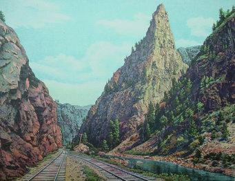 Not to belabor that it was hot, but it was sweltering
at Monarch Pass, and that's at 11,300 feet. Monarch has always been a nice
pass to ride. The road is very sweeping, and it's possible to keep your
speed up quite easily--of course, above 11,000 feet you loose a fair amount of
horsepower. A beautiful ride.
Not to belabor that it was hot, but it was sweltering
at Monarch Pass, and that's at 11,300 feet. Monarch has always been a nice
pass to ride. The road is very sweeping, and it's possible to keep your
speed up quite easily--of course, above 11,000 feet you loose a fair amount of
horsepower. A beautiful ride.
Stopped for the night in Salida. It seemed better to keep in the mountains, for now, and it's not that far to ride to Wichita from here--something I've done numerous times as I have often done Monarch on weekend trips.
I love the ride down the Arkansas River between Salida and Canon City. One of the best river roads in the country. Not so much fun when there are too many cars, but on this morning, I was the only one there.
Once I hit Pueblo, the trip--for most purposes--was over. There's nothing special about where the Kansas-Colorado state line falls (it happens to be 25º west of the zero meridian--back when we didn't recognize Greenwich as the zero meridian, and our zero meridian was Washington DC) and eastern Colorado might as well be Kansas.
I stopped in Lamar (for the usual reason) and after walking through downtown, I spent time in the (cool) visitor's center finishing up the book I was reading.
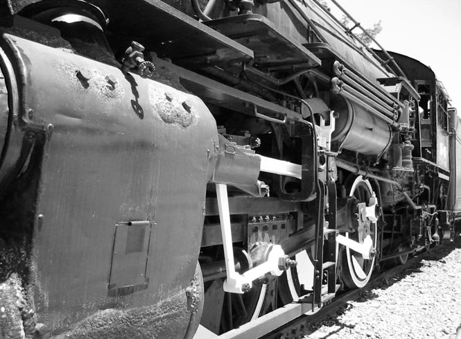
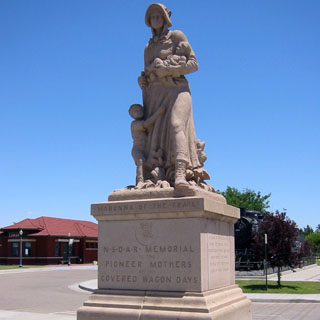
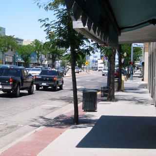
Kansas
When I reached Dodge City, the temperature was above 110 degrees. Good Grief! Dodge is only 150 miles from Wichita, and it's a trip that I'll often make just to eat lunch on a nice Saturday ride. However, while waiting at one of the numerous stop lights on Wyatt Earp (sigh...) boulevard so much sweat dripped into my eyes that when the light turned green I was nearly blind from the salt as I immediately turned into the nearest parking lot. Sheesh. Enough. I Pulled into a hotel and dedicated myself to leaving very early the next day.
Morning. Ah. The heat has broken. The ride back to Wichita was really quite pleasant. I arrived in Wichita in time for breakfast.
Concluding notes
An excellent trip. Things that stick out are:
-
riding over the prairie to Sutherland Nebraska
-
the Wind River Canyon in Wyoming
-
the Big Horn mountains in Wyoming
-
the morning ride up the valley towards the Little Belt Mountains in Montana
-
riding along the Clear Water River in Idaho
-
the morning ride from Bickleton to Roosevelt in Washington
-
the ride south of Heppner in Oregon
-
the east rim of Crater Lake in Oregon
-
Highway 3 in California
-
the ride toward Denio Junction in Nevada
-
north of the Gunnison in Colorado
read (on PDA) two books: Henry Esmond (Thackeray), and Mistress Wilding (Sabatini)
the digital camera worked well. Not nearly as handy (or forgiving) as the single-shot disposables, but better quality.
I wore my (Aerostich) one-piece riding suit for the entire trip, including those sections when it was so very hot. It may not be obvious, but wearing the suit is actually cooler than not wearing the suit. With the vents open, there's enough air-flow that it really is more comfortable wearing it than not. The problem is when you're not riding, but are sitting at a stop light (or at traffic construction). For those times, the suit can be extraordinarily hot. But then, so is a helmet.
The motorcycle ran fine the whole way. I don't know how long it will continue to do so, and most people would probably balk at heading out alone on a 5,000 mile trip through some of the most remote sections of the country on a motorcycle that will pass 250,000 miles on that trip. The only problem I had was electrical, which was solved by re-cleaning and connecting the connections to the alternator. I was picking out tar-covered rocks for days after the trip. That stuff was everywhere. The rear shocks didn't exactly fail, but it was clear by the end that it was time for a new pair. But then, shocks never fail in the garage...