September, 2004

Sunday |
Monday |
Tuesday |
Wednesday |
Thursday |
Friday |
Saturday |
29 |
30 |
31 |
1 September |
2 |
3 |
4
|
5
|
6
|
7
|
8
|
9
|
10
|
11
|
12 |
13 |
14 |
15 |
16 |
17 |
18 |
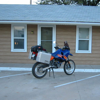
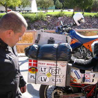
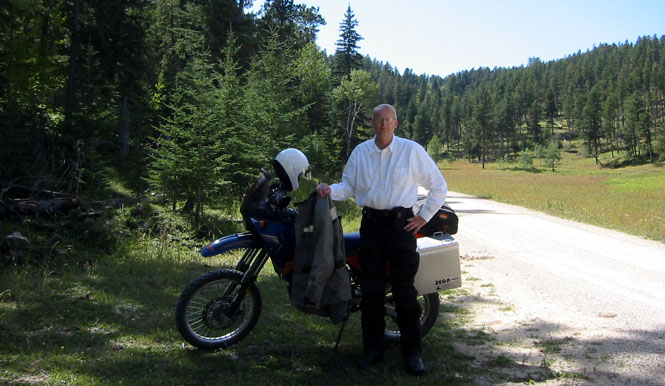
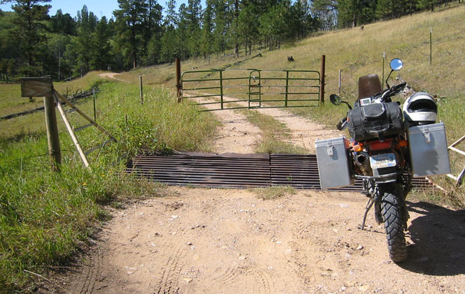
An altogether different sort of trip. Or, in any event, not the same old thing. For the first time in over 25 years, this would be a trip of some length not done on a Moto Guzzi.
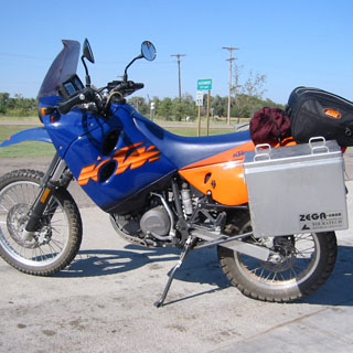
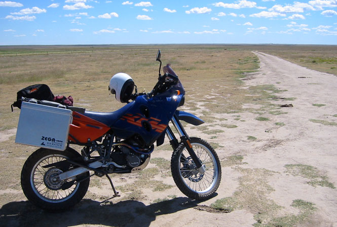
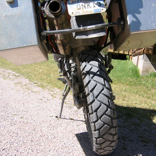
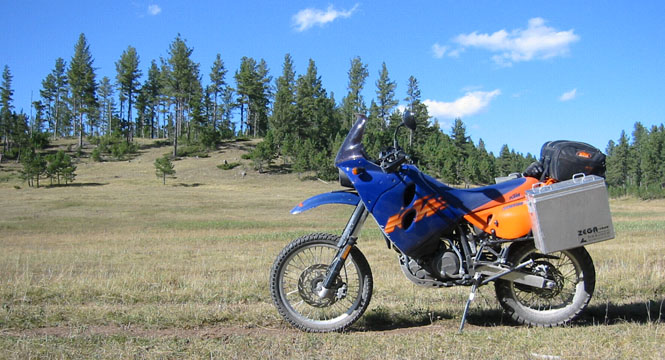
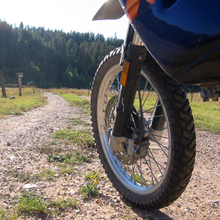
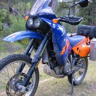
For reasons related in no small part to the obscurity of Guzzi (and associated parts availability), I would be on a KTM (Kronreif Trunkenpolz Mattighofen) Adventure R, which is quite a bit different (though even more obscure than the Guzzi, if that's possible).
The Guzzi is a 90-degree twin-cylinder motorcycle meant for long distance travel. At highway speeds it is very smooth (the mirrors are dead still) and the wide seat will allow me to ride all day without any discomfort. It's an easy-going loping long-legged sort of motorcycle. The KTM, on the other hand, is a large displacement single cylinder bike built for high-speed off-road running. It is not smooth, it does not have a comfortable seat, and it most certainly does not lope. It begs to be ridden hard. In short, it would not be the first choice of most riders for any sort of long distance road trip.
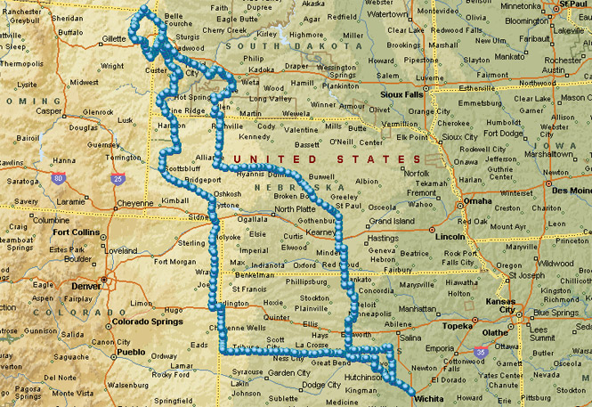
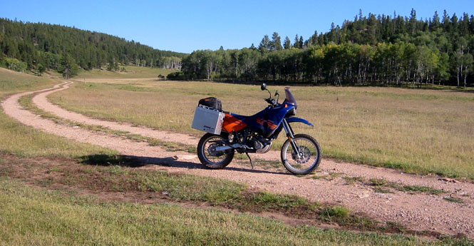
What we have here is a one-week trip from Wichita towards the Black Hills of South Dakota, over to the Bad Lands, and then back south to Wichita. At only just over 2,000 miles this would be a rather short trip.
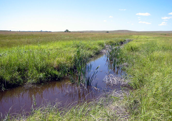
 Kansas
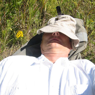
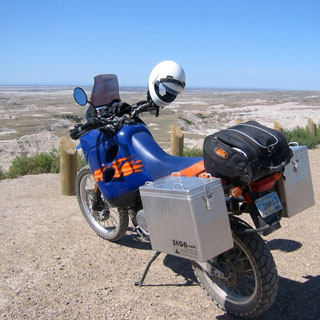
It'd been awhile since I'd packed a tent and sleeping bag. But, considering the places I thought I might be, it seemed sensible to prepare for anything. The tent and sleeping bag were packed in the right saddle-bag, and whatever clothes I might have were packed in the left. I had water, tools, chain lube, spare tube, and tire changing equipment in the tail pack, along with maps and miscellaneous other stuff (food). I had a hand-held Garmin GPS on the belt along with my camera. And, lastly, instead of the single-piece riding suit I normally use, I would wear a two-piece riding suit more designed for this sort of travel (the extra mobility was important). The maroon bag tied to the seat (in the photograph) contains my walking shoes--I thought it would be handy to have them ready. After the first day, I put them in the saddle bag, too (I had plenty of room). Turns out, I never even used them; the heavy boots I wore worked fine for hiking.
The only route I had in mind was to head west towards Colorado, with a preference for turning north into Wyoming (weather depending). Just in case, I had maps for all the western states except the ocean ones. I really didn't know.
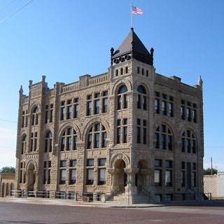
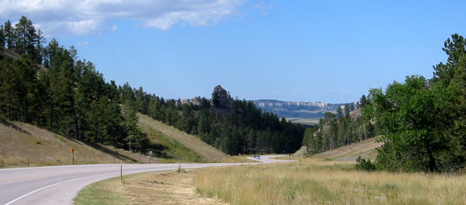
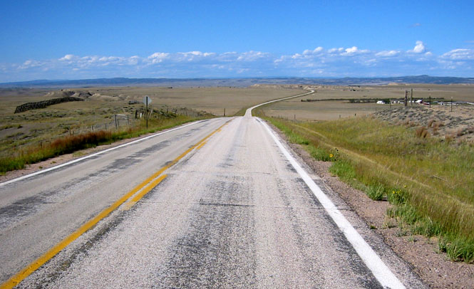
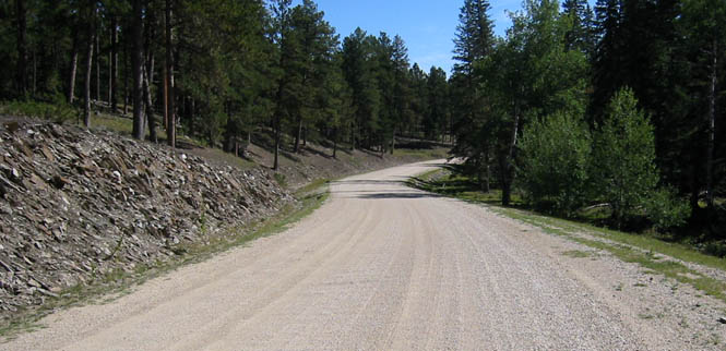
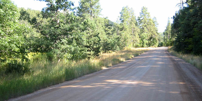
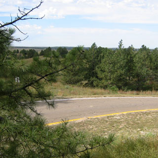
Kansas 96 is one of the better routes to run across the state. It goes through several small towns, and has very little traffic. At first, I made only 50 miles, or so, before stopping (eventually, I'd get used to the seat and the vibrations, but, that would come later). The above building in Ness City was once a bank. Obviously they had big plans (that didn't work out).
The small town of Beeler is not noted for much, although George Washington Carver once homesteaded there before going off to college. This trip will contain many more pictures of things along the way, simply because I stopped more.
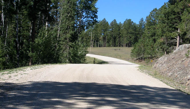
Considering that I didn't start until around 2:00 in the afternoon, and that I stopped more than usual, I didn't make it farther than Scott City before calling it quits. Even so, I was getting used to the bike at steady highway speeds, and was sure it would work out. I might point out that while I'd already put many thousands of miles on this motorcycle, they were all shorter runs, much of it on local dirt roads. I had never ridden the bike longer distances. On this first day, I did run the gas tank to empty (before switching to reserve) just to see what sort of mileage I could expect from cruising at ~70 mph. Turns out that 275 miles was about the limit before needing to stop for fuel and generally I'd get fuel before the 250 mile mark. Reserve would be good for at least another 40 miles if I needed it--plenty of range on this motorcycle.
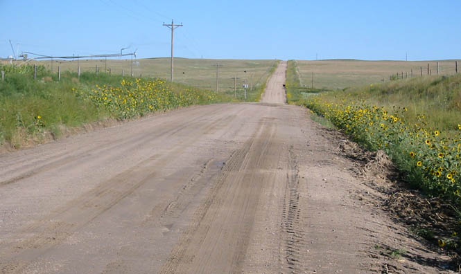
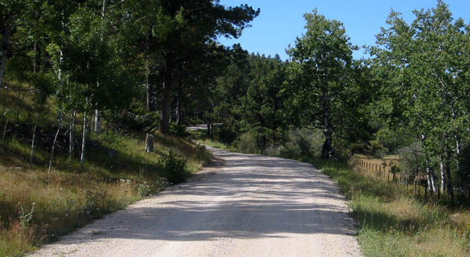
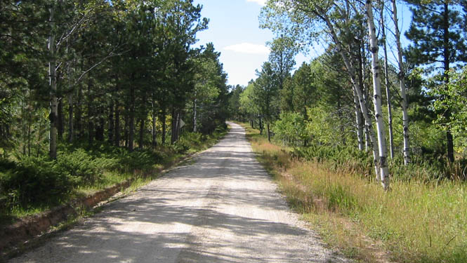
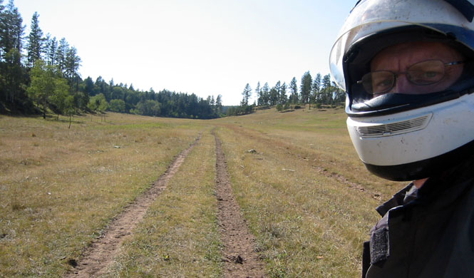
The next morning I decided to head west, and then hit some dirt roads. Western Kansas is lined with any number of dirt roads, although they don't all carry you from county to county without ending. Just past Tribune I turned north towards Weskan. This was a good place to use the GPS as the roads are not marked and it was not obvious which way I needed to turn whenever the road ended at a T-junction. At this point it was possible to run upwards of 65 mph.
There's not a great deal to see out here, but I thought horizon-to-horizon furrows had some interest.
The fast riding came to an end as I entered an area that had seen quite a bit of rain the night before. The dirt looked dry enough, but it seemed to be quite wet underneath. Made for rather spooky riding. I didn't care for it. A couple of times my front wheel tried to turn under me, and at other times the back end decided it wanted to swing out. This wet sand had the consistency of quick-sand, and it was impossible to use the side-stand as it would sink into the dirt. Give me hard dirt or gravel, but I don't like deep wet soft sand.
Halfway between Weskan and Kanorado (still on dirt roads) is Mount Sunflower--the highest point in Kansas at 4,039 feet. OK, it's not really a mountain, but it is the best we can do. The owners of this private land have a nice sense of humor. Anyway, I conquered.
The view from the summit, looking down the south face. It may look quite flat in the photographs (because you don't see the edge), but it really is a distinct hill. Note the block of wood under the side stand. Kick your heel in the dirt and it would sink three inches deep and come up wet. I dropped the pressure of the tires by 10 psi and that helped considerably.
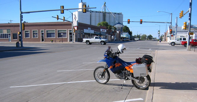
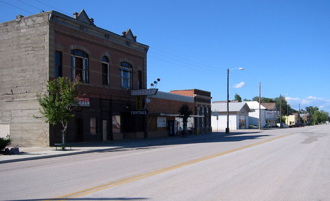
Kanorado, Kansas was once a major player on old highway 24 (and the old Golden Belt Route before highways had numbers). But, once I-70 was built, the town pretty well died. A common story. I had a fair amount of pavement ahead of me so I pumped the tire pressure back to a street riding level.
 Colorado
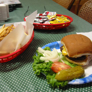
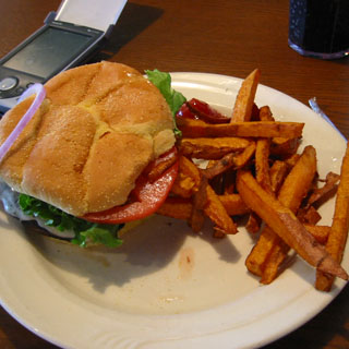 After stopping at Burlington for lunch, I turned north on US 385
to head towards the Platte River. Those happen to be sweet potato French
fries. I commend them for trying something different, but can't say that I
prefer them to ordinary potatoes.
After stopping at Burlington for lunch, I turned north on US 385
to head towards the Platte River. Those happen to be sweet potato French
fries. I commend them for trying something different, but can't say that I
prefer them to ordinary potatoes.
There really isn't a great deal to mention along this road. While it is fine example of an endless road across open prairie and farm land, there are only so many pictures a person need of that sort. I stopped in Holyoke for a water break.
When I reached Julesburg--just at the Nebraska border--I had to make some decision as to which way to go next. That was a good enough reason to call it quits for the day and check in for the night. It's interesting that while Julesburg is within a couple of miles of two intersecting freeways (I-80 and I76) it remains rather cut off from most travelers by the double rail tracks and only a single bridge over those tracks into downtown. Not much traffic makes the effort.
Julesburg, Colorado.
 Nebraska
The next morning I had in mind that I would ride north to Oshkosh, and then continue up the dirt road that runs through the Crescent Lake National Wildlife Refuge for some 50 miles. That's Oshkosh (below) as I descend down into the Platte River valley. The town sits next to the river.
Oshkosh, Nebraska
I only rode about 6 miles before I started hitting more and more sections of the same soft and wet sand that I was so annoyed with the day before.
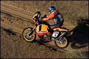
The frustrating part was that it looked so hard and fast that it seemed impossible that I was having such a hard time of it. I couldn't even use the block of wood under the side-stand to keep everything from sinking. The problem was that the road bed was about 2 feet thick of nothing but sand, and that it was almost completely saturated with water. I suppose I could have lowered the tire pressure to around 20 psi and carried on, but in the end I decided to just return to the pavement and wait until I was through with all this sand (these are the Sand Hills, after all) before running off-road anymore. Someday I'll go back to this area, as it does look quite interesting. That picture looks as if I should be able to run 70 mph. Nani Roma* could probably do a good 130 mph on this road and not think twice about it. Sigh...
*Winner of the 2004 Paris-Dakar race on the same model as my bike (albeit one that is built for the factory race team and makes mine look flabby and tame by comparison).
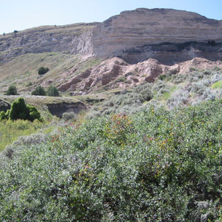
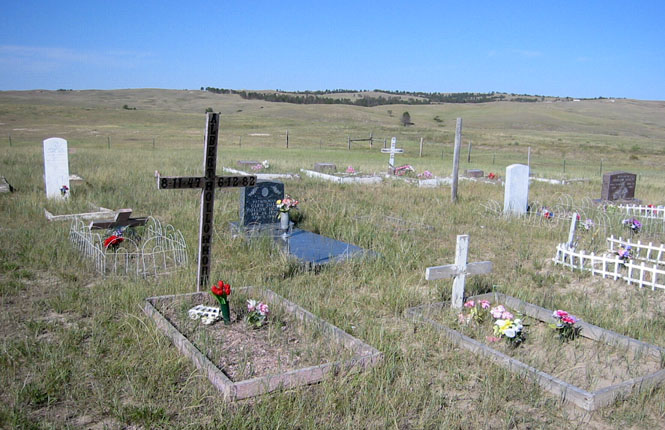
The photo (below) is of the cemetery at the foot of the hill. I don't know how many of the people buried here date from the days of the 1840's but it does look like several date from at least the time when the land first began to be settled. It's certainly a quiet place to be.
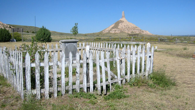
The cemetery is at the end of a dirt road, which itself is about 8 miles from the highway. From here, the monument is probably less than a mile away--it was hard to judge distances with so little to set a scale to.
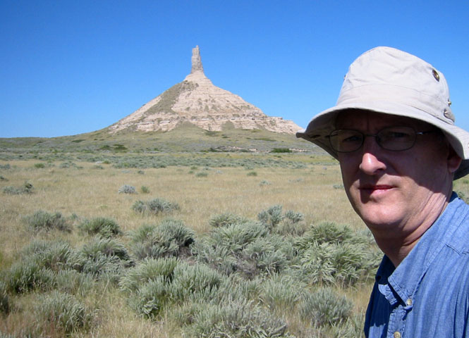
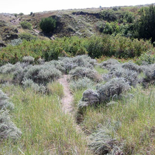
I climbed over the barbed wire fence and started walking straight towards the monument. After dropping down into a couple of surprisingly deep gullies, I reached the base.
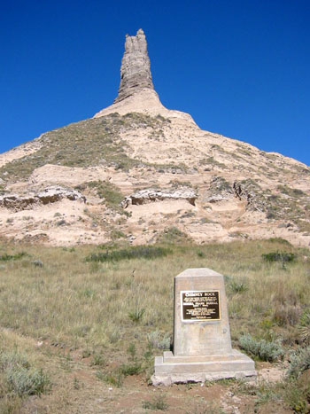
There's not much else to see except a plaque mentioning the Oregon Trail (and the person who donated the land). The return trip was a bit easier as I could now see the more traveled path back.
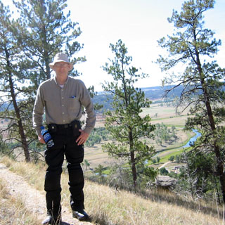
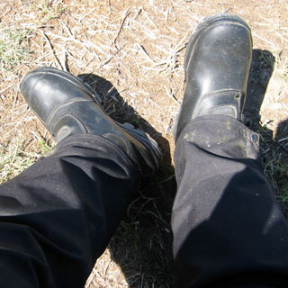 I was
not expecting these boots (Vendramini
Capetown) to be as good for walking as they turned out
to be. I bought them specifically for riding on the KTM as they are ideal
for that sort of thing. They're not quite motocross boots, but they are
made from exceptionally thick leather and have thick rubber soles to isolate my
feet from the vibration of the foot pegs (which can be considerable). The black pants you see are
actually ballistic nylon riding over-pants and have armor for the knees built in. I figured I
was well-guarded against any snakes who might be in the area. It'd take
one tough snake to get through all that.
I was
not expecting these boots (Vendramini
Capetown) to be as good for walking as they turned out
to be. I bought them specifically for riding on the KTM as they are ideal
for that sort of thing. They're not quite motocross boots, but they are
made from exceptionally thick leather and have thick rubber soles to isolate my
feet from the vibration of the foot pegs (which can be considerable). The black pants you see are
actually ballistic nylon riding over-pants and have armor for the knees built in. I figured I
was well-guarded against any snakes who might be in the area. It'd take
one tough snake to get through all that.
I considered riding over to the Scottsbluff monument, but I'd been there a number of times already, and there wasn't anything in particular I needed to see again. By this time the Black Hills were looking to be a good point to head towards. I had been considering the Big Horn Mountains, but the Black Hills now made more sense.
Highway 71, north out of Scottsbluff was a road that I hadn't been on before, so that made the final decision easy.
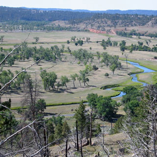
I believe that the Niobrara River may actually begin someplace in Wyoming, but if it does, it couldn't be much more than a dry bed. Here's what it looks like where highway 71 crosses it. I walked along the river for a bit, much of the time in water that was about 6" deep (those boots are completely water proof, too). It was clear that after heavy rains the entire valley would become flooded, but on this day, the river was small, and the grasses extended well out from the water. If I'd had the notion, I could have walked 30 miles up this river and would have ended up at Agate Fossil Beds National Monument without seeing another road, or (probably) any fences, either. An interesting area.
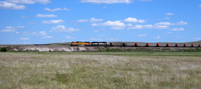
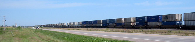
There are several rail routes through Nebraska that all seem to be heading towards the coal fields of either Wyoming or Montana. The only trains I saw were either hauling coal towards the east, or returning empty. The photo (below) shows one of the return trains. I believe these trains are standardized at 100 cars. That's plenty. If you look off to the horizon you can just see the last car of the train as it makes a giant loop through the hills.
North of the Niobrara, the road climbs into the Pine Ridge mountains (which are always something of a surprise to find in Nebraska). The photo, below, is of the descent down towards Crawford.
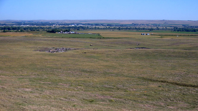
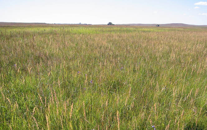
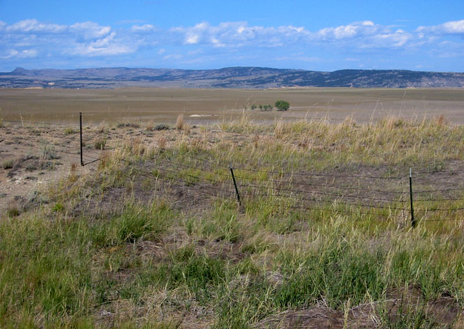
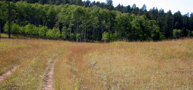
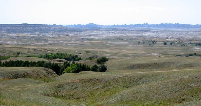
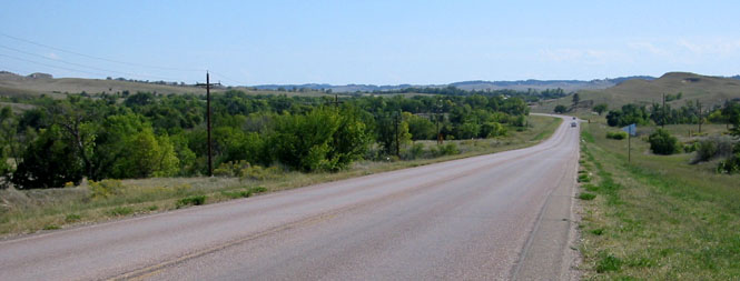
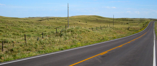
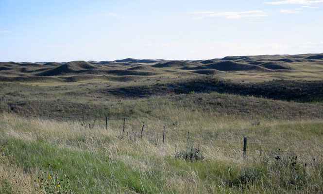
Crossing the Oglala Grassland, there's not much between you and the horizon. I like this area.
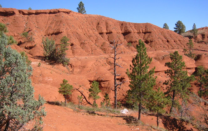
 South Dakota
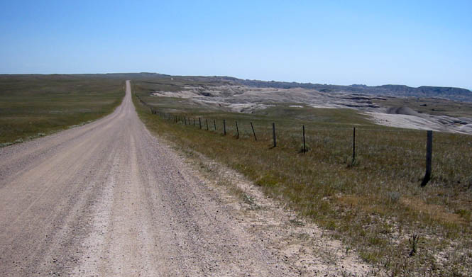
Just north of Ardmore (now in the Buffalo Gap Grassland), highway 71 splits with a route to Hot Springs and another route to Edgemont. Neither road is paved. I took the west road to Edgemont.
About 10 miles before Edgemont the pavement starts again. You can just see the foothills of the Black Hills in the distance.
Edgemont, South Dakota
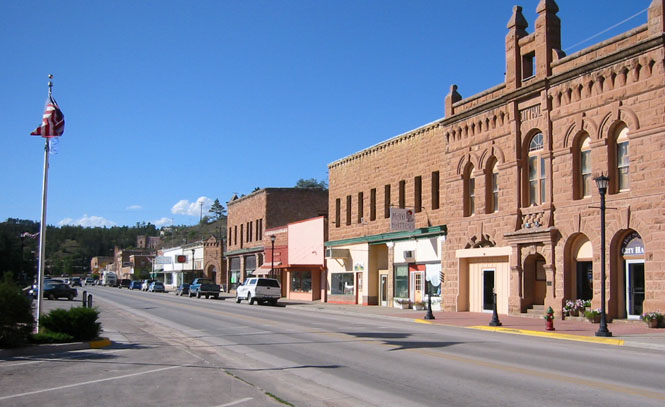
Hot Springs is a surprisingly large town just at the edge of the mountains.
 While I was sitting an a park bench overlooking the
river a rider on a Yamaha TT pulled up to say hello. Turns out that Gary
had taken a year off to see the world, and was on his way to Revelstoke B.C. for
a get together of the Horizon's
Unlimited motorcycle group. He had just come down from the Yukon
Territories and was circling back up towards Montana. This model of Yamaha
is one of the more popular selections for people doing this sort of thing; it's
air-cooled and has a reputation for being bullet-proof. I gave Gary all of
my maps of the states west of here and we both looked at the best route north
through the hills. Highway 87--The Needles Highway--looked to be the best
bet.
While I was sitting an a park bench overlooking the
river a rider on a Yamaha TT pulled up to say hello. Turns out that Gary
had taken a year off to see the world, and was on his way to Revelstoke B.C. for
a get together of the Horizon's
Unlimited motorcycle group. He had just come down from the Yukon
Territories and was circling back up towards Montana. This model of Yamaha
is one of the more popular selections for people doing this sort of thing; it's
air-cooled and has a reputation for being bullet-proof. I gave Gary all of
my maps of the states west of here and we both looked at the best route north
through the hills. Highway 87--The Needles Highway--looked to be the best
bet.
Up to this point, the pavement I'd ridden had been mostly straight and mostly I would just stick the KTM in either 4th or 5th and just drone out the miles. That's not what it's best at, but it was better at that sort of thing than I would have thought.
The Needles Highway showed what this bike could do
on pavement. You wouldn't think so to look at it, but the KTM Adventure is
extraordinarily good on twisty tight roads--and this highway is practically a
go-cart track. I haven't had this much fun on a really tight road in
years. While keeping the RPMs up high with lots of shifting, I was close to
power-lifting the front wheel when coming
 out of the turns. I guess it's not
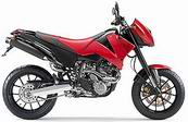
that surprising when you consider that the KTM Duke (photo) and the Adventure are not all
that much different (of course the Duke has sport street tires and doesn't need
a step-ladder to reach the seat).
out of the turns. I guess it's not
that surprising when you consider that the KTM Duke (photo) and the Adventure are not all
that much different (of course the Duke has sport street tires and doesn't need
a step-ladder to reach the seat).
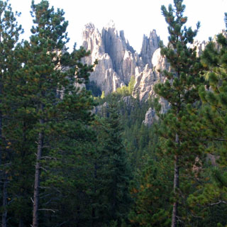 This is the best shot I took of The Needles that
name the highway. At one time, there was a proposal to actually carve
important characters of the West into these formations. I'm glad that
somebody had sense enough not to go ahead with that plan.
This is the best shot I took of The Needles that
name the highway. At one time, there was a proposal to actually carve
important characters of the West into these formations. I'm glad that
somebody had sense enough not to go ahead with that plan.
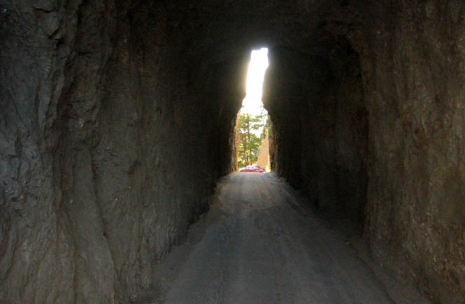
The highway exists solely for the sake of itself. It isn't as if there were two points that needed to be connected by pavement. In fact, that's what US-385 is for. No, this highway was built as a tourist attraction in its own right. The tunnel (below) is only there because the road builders thought it'd be a fun thing to drive beneath the needle formations. It looks narrow (it is), but it's wide enough for one full-size SUV to get through.
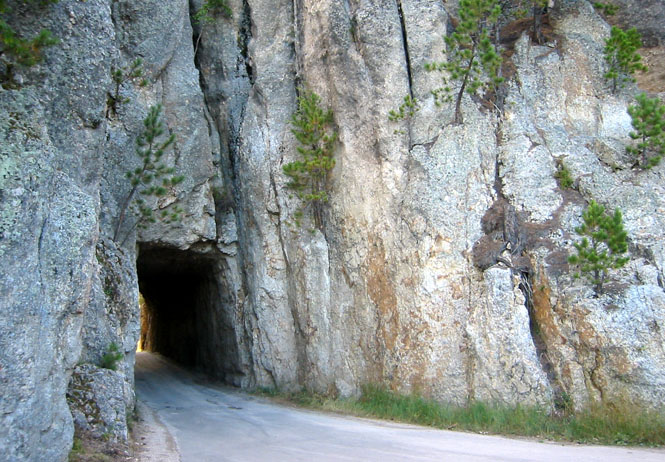
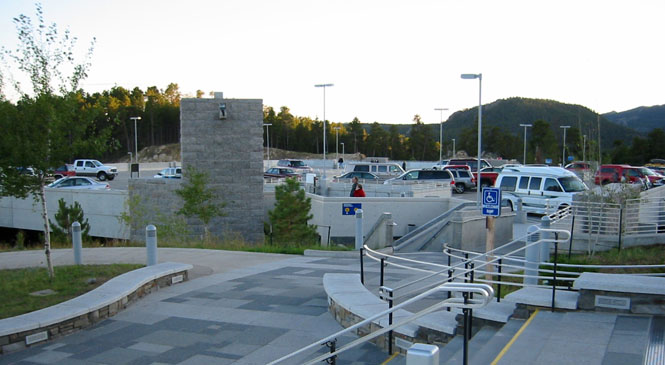
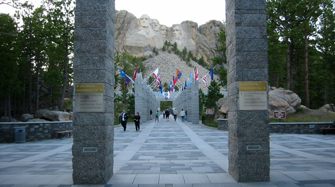
The entrance is far more impressive than the simple walkway lined with state flags that I saw 26 years ago.
The walk of flags is still here, but now the flag poles are granite pillars, and the path is a grand promenade of stone.
Here we have a few students from the University of Nebraska, who through the magic of photo-composition are trying to put a Nebraska Cornhusker ball cap on George's head.
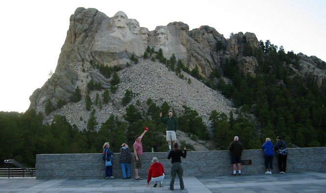
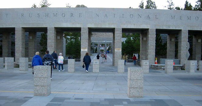
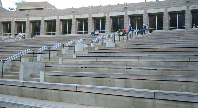
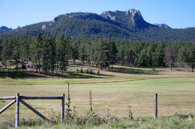
Mount Rushmore was planned and built to be a tourist attraction for the Black Hills. That's it. The plans were at one time much bigger before money came to be a problem, but at its heart, tourism was the goal. Fair enough. They succeeded wildly. That being the case, I'm not sure it's quite as appropriate to call it a National Memorial (to what? for whom?) or to refer to it (over and over) as a "Shrine to Democracy." Even that phrase seems to run counter to its own idea. The buildings (and especially the amphitheater) have the uncomfortable look of something that Albert Speer might have designed. Perhaps I'm too critical. The actual sculpture of the president's heads is a remarkable thing, and their creation was really amazing. It's worth visiting.
When I reached Keystone, there didn't seem to be any point in going farther, so I checked in.
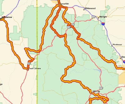 Now I could have some fun. There's a rail
connection between Keystone and Hill City that's paralleled by a paved road.
After that, the road heads across the center of the Black Hills--much of it
unpaved--coming out, eventually, near Lead.
Now I could have some fun. There's a rail
connection between Keystone and Hill City that's paralleled by a paved road.
After that, the road heads across the center of the Black Hills--much of it
unpaved--coming out, eventually, near Lead.
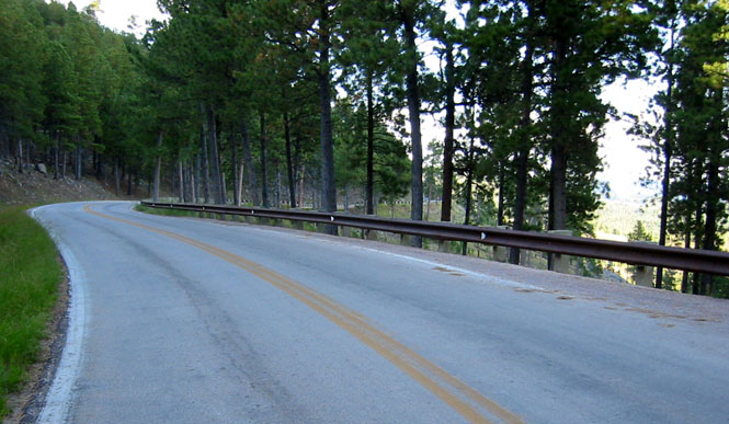
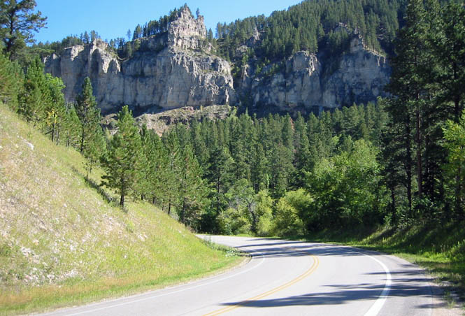
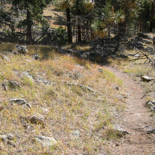
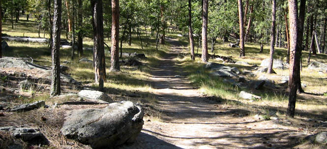
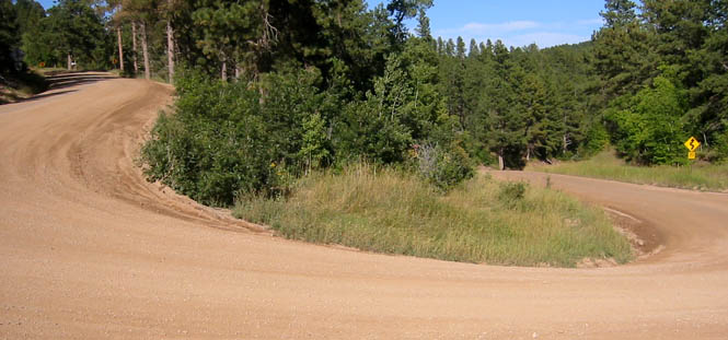
True; the Needles highway is exceptionally twisty, but that's because the road makes no attempt to follow the natural curves of the terrain. For the most part, the roads through the Black Hills are much more gentle, and have moderate curves combined with high-speed sweepers.
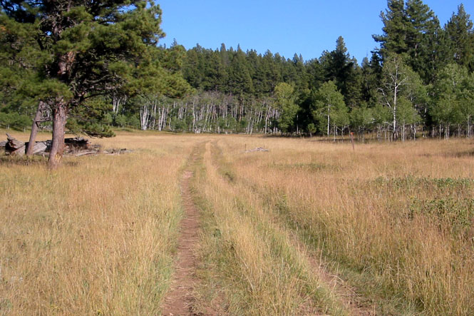
The photographs (above and below) were taken mid-way between Keystone and Hill City: open meadows surrounded by higher ridge lines. It was a perfect day.
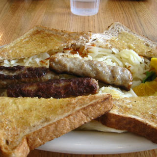 I stopped at a cafe in Hill
City for breakfast. Somehow it doesn't look
nearly as appetizing in the photograph as it really was.
I stopped at a cafe in Hill
City for breakfast. Somehow it doesn't look
nearly as appetizing in the photograph as it really was.
From Hill City, I used the GPS to sort out exactly where the road launched off from. On the tourist maps that are available everywhere (matched exactly by the AAA map) the roads are identified by the county or state highway number. The problem is that in practice none of these numbers are used. And to make it a bit more challenging, the maps are not very accurate. All this made the GPS invaluable to save wasting too much time looking for roads.
Just when I thought that the map was wrong to show that the road was unpaved--wham, the pavement disappeared. Trouble is, they ended it around a blind turn. Oh well, I could easily run just as fast on this road whether paved or not.
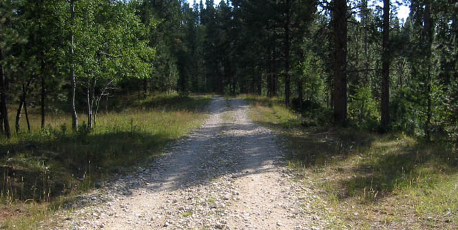
Eventually, the gravel disappeared to be replaced by sand and dirt. Of course, it was all easy stuff.
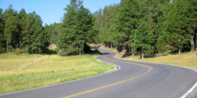
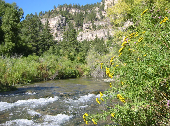
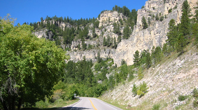
At highway US14A I turned back towards Cheyenne Crossing, and then turned down US14 and the Spearfish Canyon road. This was a terrific road to be riding. Miles and miles of perfect pavement and scenery.
I stopped along the river for a granola bar and water break, and ended up taking a short nap. Dead quiet except for the sound of the river. There was very little traffic on the road.
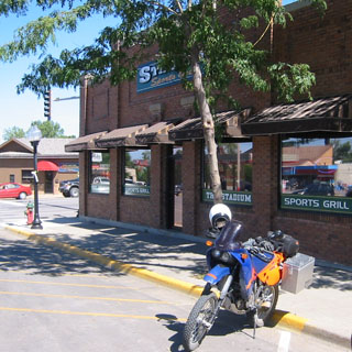
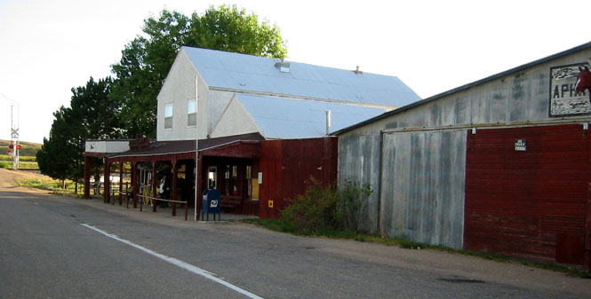
In Spearfish I stopped at the Stadium Sports Grill for lunch (patty melt) and caught part of the Grand Prix motorcycle races on the television.
There's a smaller (unpaved) road leading out of Spearfish into the hills--highway 134 on the maps. It took a bit of sorting out with the GPS to figure out the real name of the road, and even then I had to rely on the GPS instructions to take me through the residential streets to find where it began. A wonderful road.
On all the maps there is shown a connecting road between Sundance and Moskee Wyoming and US85 at O'Neil Pass in the Black Hills. I can say right now that there is no such road and all the maps are just plain wrong.
 Wyoming
No matter. I turned off on a one-lane dirt road in search of Moskee.
After about 9 miles (and I knew by the GPS that I was fairly close to Moskee) I ran into a locked gate.
There didn't seem anyway to get around this, so I turned around and turned off on another road that seemed, at least, to lead in the right direction. The GPS was very helpful as all of these roads were shown (if not the locked gates).
It was pretty clear that the road had not been used very much. That was fine by me. Gravel and sand isn't nearly as nice to ride on as just ordinary dirt and turf.
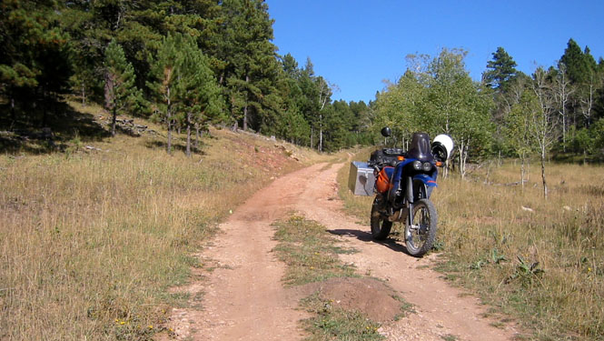
I found that it worked best to ride for awhile and then to check the GPS to be sure that I was still on the right road to get to Moskee. I found that not all the little trails I crossed were shown, but all the roads and trails you see here were covered.
By this time, it was looking as if there were far more cattle that had used the road in the past years than driven vehicles. This is a beautiful area. I gave some thought to turning into the hills and setting up camp.
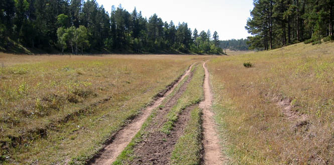
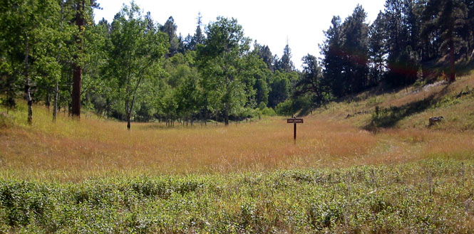
The road I was on was identified as the Lost Canyon road on the GPS, and this is Lost Canyon. Not much here. It wasn't clear that there ever was anything here. Just to the right of the sign (photograph below) you can see the road that I'm following. It was not always clear that I was even on a road, but the GPS reassured me that all was well.
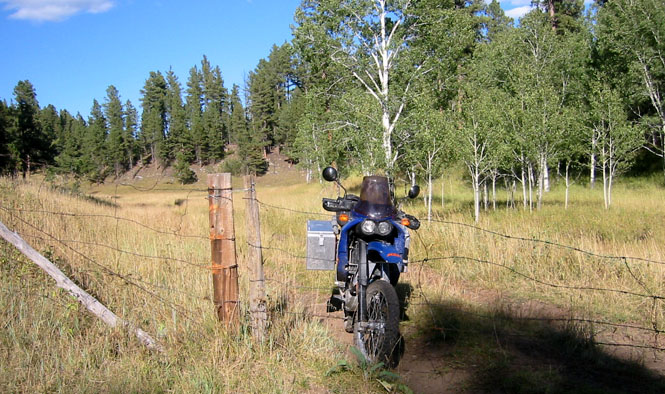
This was the sort of gate I could live with. These wire gates just needed to be unhooked and rolled back.
 Eventually, my little Lost Canyon trail intersected
a road that, by comparison, was a freeway.
Eventually, my little Lost Canyon trail intersected
a road that, by comparison, was a freeway.
I found I could run easily up to ~60 mph along here just flying across the occasional pothole or mud patch. The suspension on the KTM is just amazing. 13" of suspension travel will take care of most roads. This was a nice valley to run through.
After hitting a couple of more locked gates, I found myself in Wyoming at the town of Buckhorn. Pavement, again. Down to Four Corners, and back north along Wyoming 585 towards Sundance. By now, I was flying; everything felt smooth as glass.
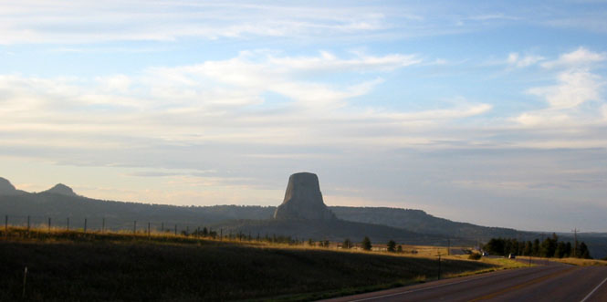
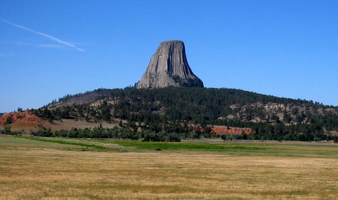
I stopped for a picture of Devil's Tower, and then continued riding into the town of Hulett.
I'd been here a couple of times before, and knew both of the cafes in town. Not a lot of choices on the menu, but it was good. Not sure I would recommend the fries, though.
Was that the best day, ever, for riding? I don't know, but it was a very good one. Some of the best paved roads I've ever ridden and all the off-road work made it just about perfect.
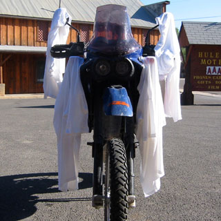
That evening I did the laundry, and finished the drying of the t-shirts (always the slowest to dry) the next sunny morning. Figuring that it's easier to carry only a single product, I've always done my on-the-road laundry with hair shampoo. I held back on the cream rinse, though...
I've been by Devil's Tower a few times before, and even camped here once. But, I never took the time to literally walk around the thing and to spend some time in the park. The photograph, below, was taken between Hulett and the Tower. Take note of the red bluffs at the base of the hill. You'll see those same bluffs later during my hike around the tower.
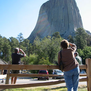 There were a number of people visiting, but as this
was after the start of school, the only children here were the ones that
couldn't walk too well (or talk that well, for that matter). The folks in
the photograph are watching the several climbers on the tower. One of them
told me that he had counted 13 climbers. I could easily see two groups.
About half way up, one of the groups suddenly started repelling down the side.
It didn't take them long to get to the bottom. Beats me how they
deal with leaving all the hardware behind. After all these years, it must
be getting pretty cluttered with steel pins all up and down the side.
There were a number of people visiting, but as this
was after the start of school, the only children here were the ones that
couldn't walk too well (or talk that well, for that matter). The folks in
the photograph are watching the several climbers on the tower. One of them
told me that he had counted 13 climbers. I could easily see two groups.
About half way up, one of the groups suddenly started repelling down the side.
It didn't take them long to get to the bottom. Beats me how they
deal with leaving all the hardware behind. After all these years, it must
be getting pretty cluttered with steel pins all up and down the side.
There are two paths around the tower. The first one is about a mile long, and hugs the base of the tower and therefore is always near the trees. The second one is about three miles long and stretches away from the trees. I took the second path.
In the photograph you can just see the GPS on my left hip and the camera on the right hip. I'm using a Wal-Mart carrying device for the water bottle. That quart bottle would just last for this little walk. It was getting hot.
Remember those red bluffs? Here they are, again...
There were plenty of nice views of the tower.
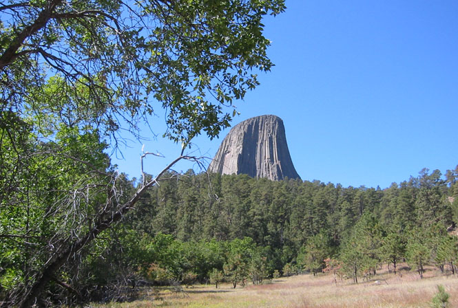
Funny how much wider and worn the trail was closer to the visitor center. I only saw two other people on this trail.
 Montana
By any sensible measure, the best route back to the Black Hills would have been on highway 24 through Aladdin and into Belle Fourche. It's a fun and scenic road. But, I'd already been on that road, and I had never been on the short bit north of Hulett to Alzada. So, that's what I did.
It did give me a small bit of Montana to hit, however. Just where the road turns left is the state line. I'm always amused how states are not able to coordinate where their smaller state roads cross the border. This sort of realignment is common, everywhere.
South Dakota
On practically all my other trips, once I ride through a place, I never turn back. No matter how nice the riding is, I never turn back.
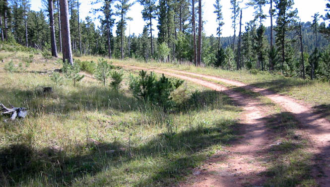
This trip was different. I was heading back into the Black Hills. This time I turned south along False Bottom Creek (after I figured out the name of the road) and followed this well-groomed dirt road to Lead.
I was expecting something more rustic, but this was a pretty major road even if it was unpaved. Still, a 10 mph 180 degree turn keeps the speeds down. A clapped-out Dodge Neon full of high school aged boys went sliding by me at a good clip. This would be a fun road for that sort of behavior. Please keep away from me, though.
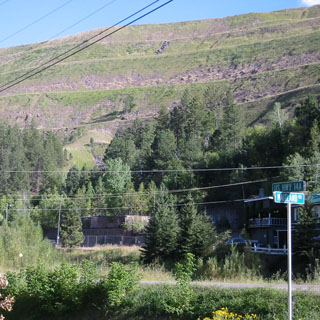
These days, mining is not so active in the Black Hills. This "mountain" looked suspiciously artificial. The Homestake mining company once moved an enormous amount of earth around here.
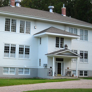
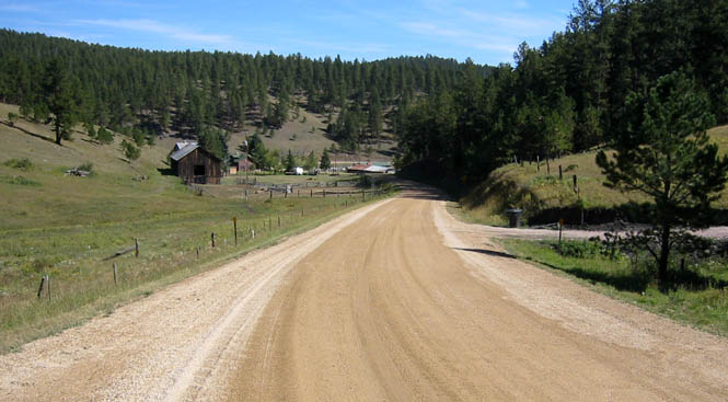
I did my best to avoid the high-traffic town of Deadwood, and turned off on US-385 and then the Nemo road. That's the Nemo school (above). It wasn't clear, but it may currently be some sort of residence.
Big sweepers and no traffic as the narrow road followed Boxelder creek towards Rapid city. There was a huge thunderstorm building south of me, over the mountains, but except for a few sprinkles it didn't bother me.
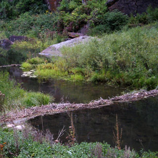
There were a whole series of beaver dams along the creek. Although I stayed at this spot for some time (another granola and water break) I didn't see any animals. Pretty spot, though.
The big city of Rapid City. I stopped at a Comfort Suites and then looked for a good restaurant--something other than the mom-and-pops I'd been eating at. It was a good dinner (although a little dark for the picture--I wasn't about to use flash).
This was a rather nice hotel and they had a well-equipped breakfast bar. This being the beginning of the off-season, the prices were not bad at all.
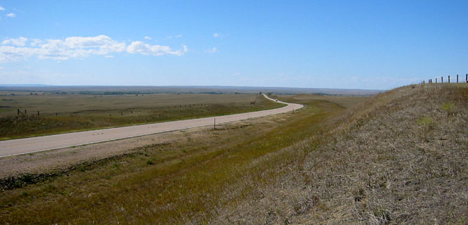
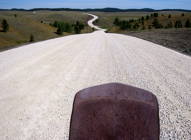
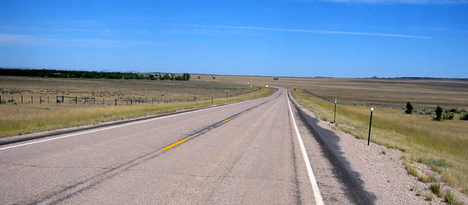
Scenic South Dakota doesn't get much traffic. I bought some water and gas.
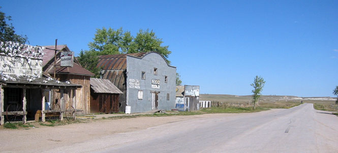
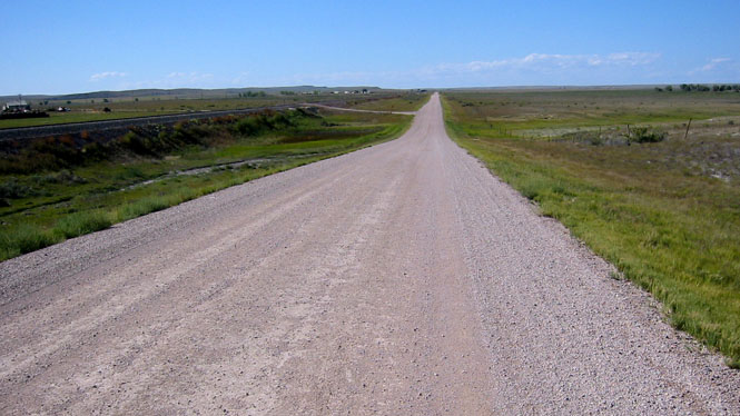
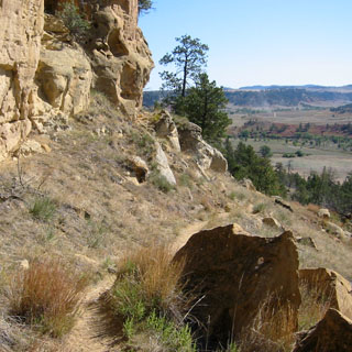
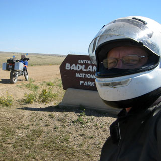
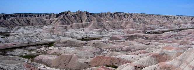
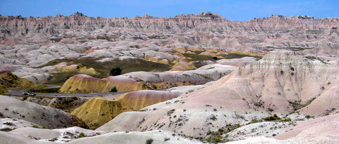
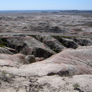
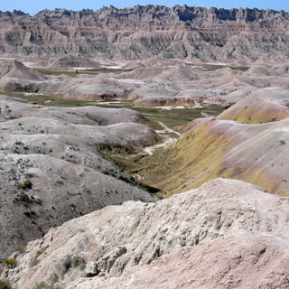
This is the unpaved entrance to Badlands National Park. In the photograph we're looking down the hill towards Scenic, which is out of the picture, far to the right.
This was a great time of year to visit the park. I'd hate to be here when it was terribly hot. As it was, it was just right. It's quite a remarkable place. Equally amazing is that people tried to make a living by farming here. Well, I guess they didn't know. Some places worked out, and some didn't. Something of a crap shoot to take up a homestead on un-broken land.
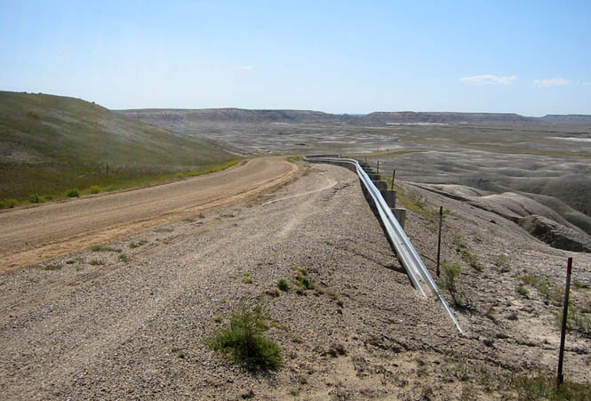
The unpaved road was nice enough in the beginning. The closer I got to pavement, the worse the wash-boarding became. This surface effect is caused by cars and truck breaking (err, braking) and their suspension causing the rippling effect. Therefore, it's much more severe just before turns.
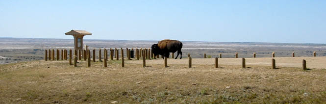
This inconsiderate animal was just standing in the overlook parking area, keeping all the cars out. He made for a good picture, though.
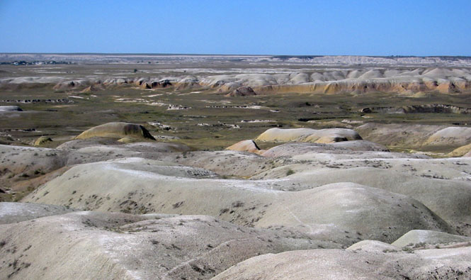
Can you believe that people even attempted to harvest the grasses that you see in the picture? These were tough (or stupid) people. I doubt that they lasted much over a generation, though. There are easier places to live.
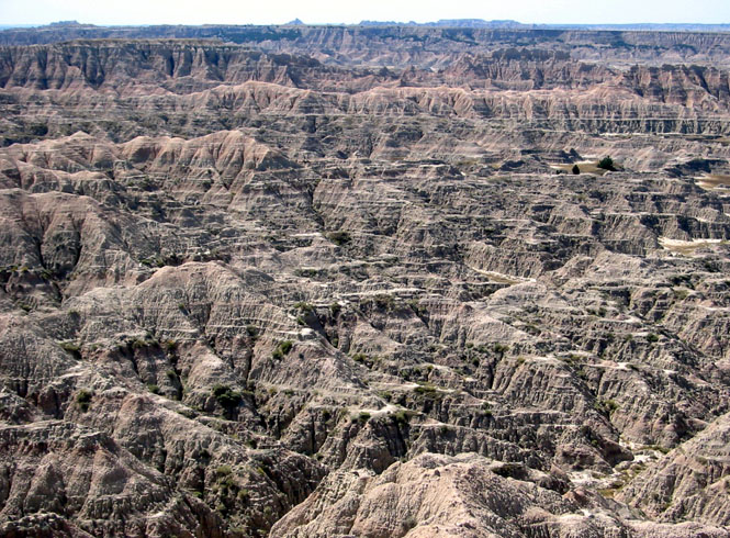
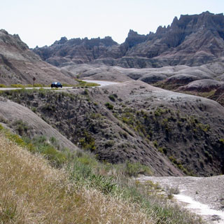
They did a very good job with the paved roads. They aren't so intrusive that they destroy the feeling of the place, but even so, you do get to see much of the interesting areas. I'd like to say that the 25 miles or so of unpaved roads gave me a better insight to the place. Maybe. But, the paved roads are sufficient to see the good stuff if that's what you want.
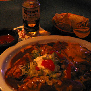
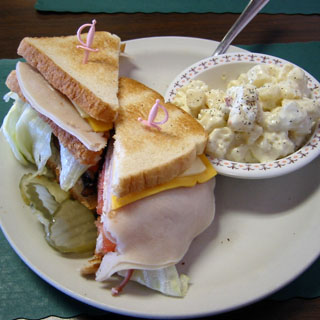 The lady behind the counter back in Scenic recommended that I eat at this
small cafe in Interior. So I did. It was a good club sandwich, and
it's always a good sign when they use little plastic swords... I bought
more water before heading out.
The lady behind the counter back in Scenic recommended that I eat at this
small cafe in Interior. So I did. It was a good club sandwich, and
it's always a good sign when they use little plastic swords... I bought
more water before heading out.
From Interior I rode south to Potato Creek and Kyle and through the Pine Ridge Indian reservation. These are all BIA roads, and they are not in especially good shape. The photograph, below, is along the route into Wounded Knee.
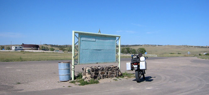
Wounded Knee Massacre Historic Site. Some years back the word "battle" would have been used in preference to the word "massacre" (note the edited message board, below). Not now. Massacre is the official name. Nothing about any of the events that took place here had anything to do with a battle. It's not even debatable.
Nebraska
From Wounded Knee it was south on highway 27 to Gordon, for more water.
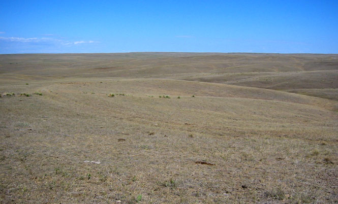
I may not like riding in deep sand, but I do like the Sand Hills of Nebraska. It seemed like I was riding across the open swells of the ocean except that the swells were grass and not water.
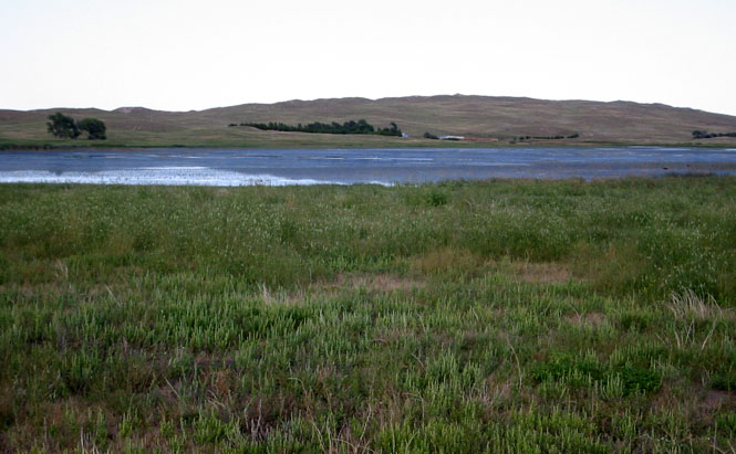
There are many smaller lakes, such as this, all through the Sand Hills. I would imagine that, depending on the time of year, you'd see any number of different migratory birds along this route.
Ellsworth, Nebraska.
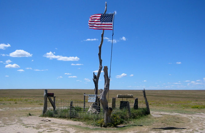
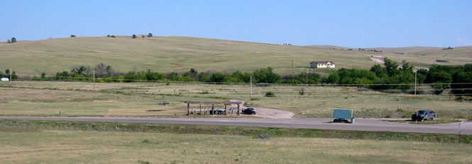
It may be obvious, but there are not many towns in this part of Nebraska, and there are even fewer towns with hotels. Before the sun dropped down, I had to find a place to spend the night--I did not want to have to set up my tent in the dark. The little town of Whitman look promising, so I crossed north over the tracks and checked it out.
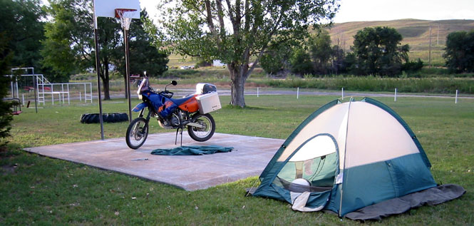
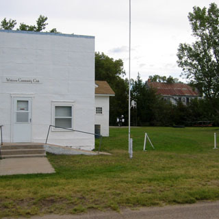 They had a very nice Community Center with a lawn.
What cinched the deal was seeing that basketball court (out in the grass) to
park the bike on. Perfect. You can see the motorcycle just to the
left of the flag pole.
They had a very nice Community Center with a lawn.
What cinched the deal was seeing that basketball court (out in the grass) to
park the bike on. Perfect. You can see the motorcycle just to the
left of the flag pole.
The shot, below, was taken the next morning as I was breaking camp and packing things up. The green cloth next to the bike is the tent fly. It did not rain at night. In fact, it was extraordinarily clear at night and the sky was thick with stars. Nothing unusual about that, I suppose, except that living in a city you don't see stars the same way.
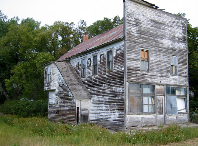
I am afraid that Whitman, Nebraska has seen better days. This was the old IOOF hall.
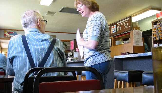
Breakfast, the next morning, was in Mullen. Nice place. Good food.
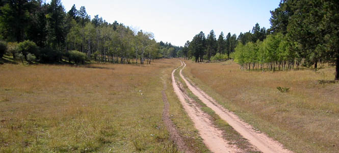
 The Nebraska National Forest near Halsey is a
curious thing. The entire forest has been planted, and was started during the
1930s. From what I've read, though, while the trees are reaching the end
of their cycle, they are not propagating themselves. It would seem that
the place will always depend on repeated planting.
The Nebraska National Forest near Halsey is a
curious thing. The entire forest has been planted, and was started during the
1930s. From what I've read, though, while the trees are reaching the end
of their cycle, they are not propagating themselves. It would seem that
the place will always depend on repeated planting.
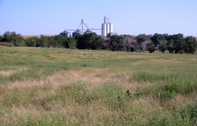
Dropping down on various roads towards Minden, Nebraska. This train is running along old highway 30.
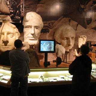
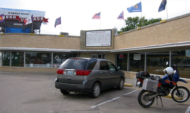
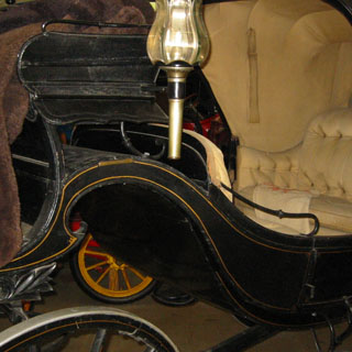
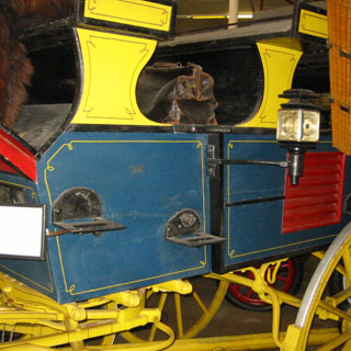
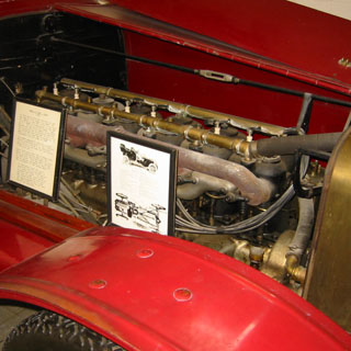
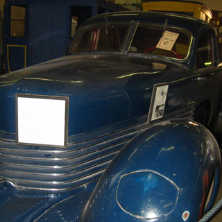
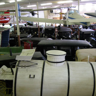
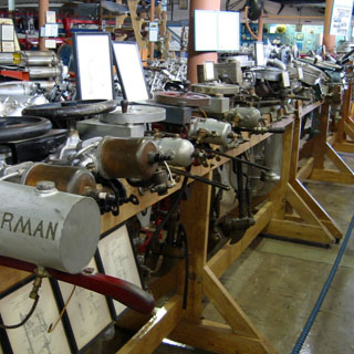
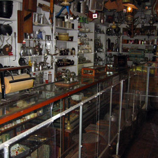
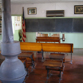
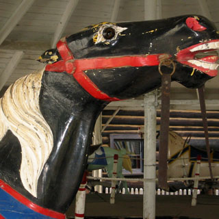
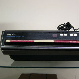
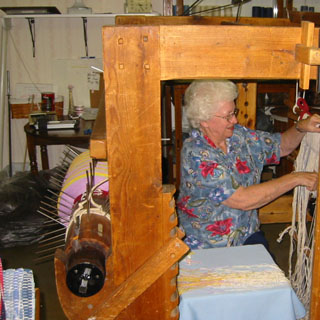
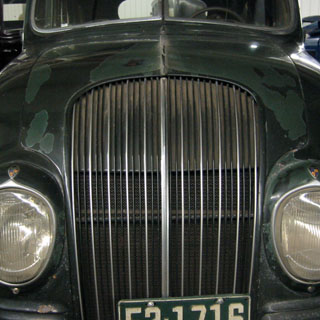
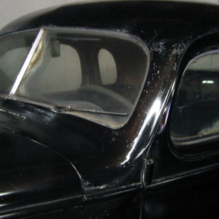
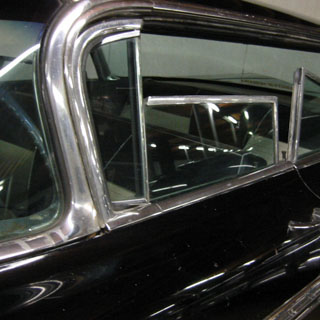
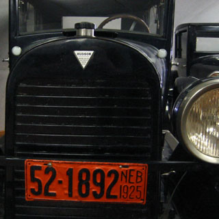
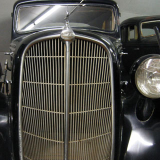
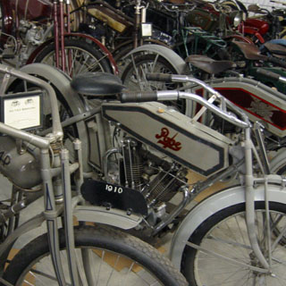
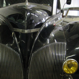
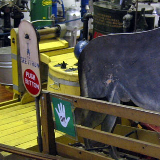
I have no idea just how many times I have been through the Warp museum in Minden Nebraska. A dozen? Anyway, it remains my favorite museum, and I never miss a chance to go through at least part of it. This is a collection of everything imaginable and in unbelievable proportions.


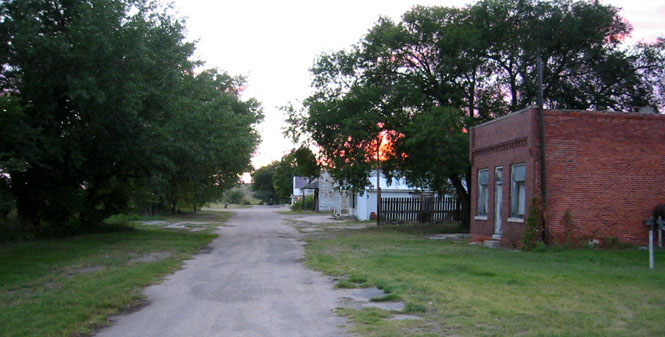
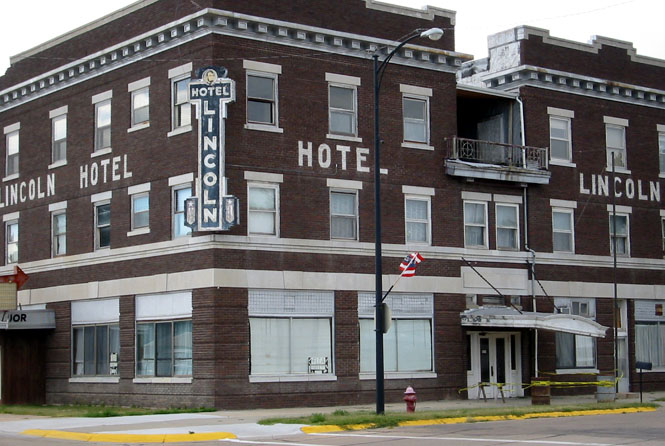
Just south of Minden, in Franklin, Nebraska, I stopped to take this picture of the old Lincoln Hotel. It has not been used in years.
Kansas
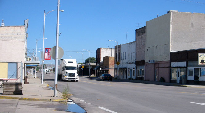
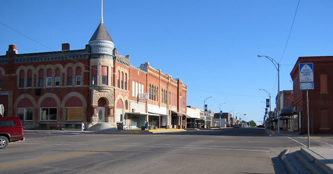
Smith Center, Kansas. I've been on all of these roads, so it was only a matter of picking and choosing a route that looked interesting.
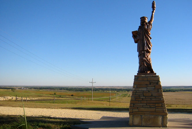
One of the Boy Scouts of America replicas that you'll find all over the country. You will find most of them next to city hall. I've always liked that this one is out in a field away from any town.
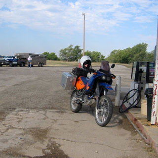
The last fill-up in Bushton.
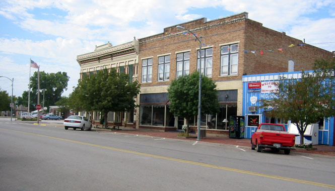
Marquett, Kansas.
- No rain.
- No flats.
- No cold weather (so I didn't need the electric vest I took).
- No problems with the motorcycle
- Average of just under 300 miles per day. That's lower than any of my other trips, but it's about right for this sort of traveling.
- in future: carry more water.
- in future: carry the spare tube strapped to the front fender.
- in future: be quicker about reducing tire pressure for soft dirt.
- in future: carry a larger disk to support the side-stand in the above soft dirt.
Quite a good trip. I didn't go very far, but I saw a lot of things and roads that I never would have seen if I had not been on a dual-sport motorcycle.