December, 2016


A winter trip by Awanna and Daniel. The forecast predicted rain (and perhaps even snow). Driving south was the only option, and it didn't look likely that there could be any chance to cross the Sierras if we wanted to loop back up on the Nevada side.
The Haggin Museum in Stockton remained a goal (as it had been for previous trips), but it has such limited opening times that we'd need to plan for it and not simply being able to count on dropping in.
 California
After seemingly years in the making, the freeway bypass around Willits is now open. No matter; we took the off-ramp into town and stopped at the park for lunch.

Clear Lake sometimes looks more green than blue, and isn't always even close to being clear (this natural lake isn't especially deep). But, today, it looks great.

 We stopped at the
Foster's Freeze (only seen in
California) in Lucerne for an Orange Crush Foster's Freeze.
We stopped at the
Foster's Freeze (only seen in
California) in Lucerne for an Orange Crush Foster's Freeze.
Highway 20 follows a narrow valley through the final ridge of the Coast Range before dropping into the flat Sacramento Valley and Colusa County.

Standing on this last hill to take the (above) photograph. I was next to a scientific instrument installation with the sign that said it was part of the EarthScope program.
EarthScope is a program of the National Science
Foundation (NSF) that deploys thousands of seismic, GPS, and other
geophysical instruments to study the structure and evolution of the North
American continent and the processes that cause earthquakes and volcanic
eruptions.
--http://www.earthscope.org/about


Andrus Island, Sacramento County. The original river delta where the Sacramento and San Joaquin Rivers flow into the San Francisco Bay looked nothing like it does, today. Numerous levies (some built in the 19th century) have created large tracts of rich farm land, which are actually lower than the surrounding rivers and sloughs.

Isleton was once directly on the banks of the Sacramento River, but is now (mostly and usually) protected from that river by a high levy. It still has something of the look of the old river port that it once was.

The charming town of Isleton, California (population 840), is located
along the Sacramento River in the California Delta. The Delta is a land of
rivers, agriculture, boating, fishing, and rich history.
Isleton's
Old Town offers a look at bygone days. The many façade front buildings
still remain intact. The town was once referred to as "the Little Paris of
the Delta." Stroll down Old Town and find antiques, arts & crafts,
restaurants, and the Isleton Museum.
The community of Isleton is
host to several popular celebrations of the history and spirit of the
California Delta. The best known is the Crawdad Festival held every year on
Father's Day weekend. This festival increases Isleton's population to about
200,000 during its three day run.
--Isleton Chamber of Commerce


Ida Island and the Sacramento River.

Rio Vista

Rio Vista soon became a prosperous town providing
services and agricultural supplies to travelers on one of the many
Sacramento River steamships running between Sacramento and San Francisco.
Despite that, Gold Rush fever was waning around the 1860’s; miners,
machinery and necessities still filled northbound steamships towards
Sacramento.
Although no gold was discovered in Rio Vista, the town
provided one of the largest supplies of fresh fish and canned salmon to San
Francisco and beyond. Today, Rio Vista is home to the largest American
producer of Belgian Endive in the USA.
--Rio Vista Chamber of
Commerce
The Rio Vista Bridge (Highway 12) was designed by Joseph Strauss who is better known for the Golden Gate Bridge.

Sandy Beach Park. We saw several people fishing, but didn't see anybody catch anything. No matter; it's a nice crisp morning to watch the Sacramento River flow by while eating Lorraine's Christmas cookies.


Soon after the Gold Rush, reclaimed farm land was created throughout the Delta through the use of clamshell dredges. It isn't likely that any standards-of-construction were followed. In 1928, one of these levies broke--The Big Break--creating the large, permanently flooded area that you see today, which is now the Big Break Regional Shoreline.
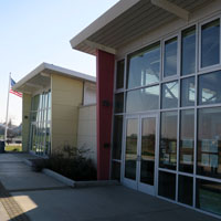
The visitor center was built in 2012 and includes a pretty comprehensive story of the history of the area as well as the wildlife that it is meant to help preserve.
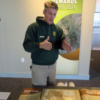
Mike Moran, Naturalist, was quite helpful explaining the long history of the California Water Projects. There have been many ideas and many plans that were only partially completed over the decades. There's nothing about the large-scale movement of water that is without controversy.

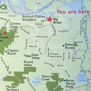
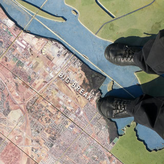
This walk-on map of the delta was quite helpful to explain how the water flows through the Sacramento and San Joaquin Rivers and then out the San Francisco Bay. We tend to think in terms of highways and cities, but this helps recast the map to rivers and landforms.

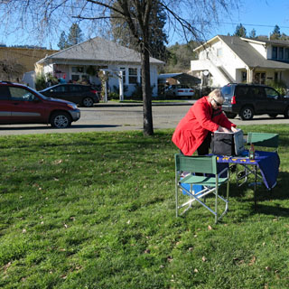
We didn't often have the luxury of a sturdy table (unless it was one we brought). The park has a nice picnic area.


One reason for our diversion to the California Delta was to ensure that we arrived at the Haggin Museum in Stockton not too early for the afternoon opening. The city of Stockton has been prominent in the news for being on the brink of financial collapse. It's no wonder that their museum has limited hours.
The Haggin Museum, Stockton
In 1928, the San Joaquin Pioneer and Historical
Society was looking to build a history museum but had been unable to raise
enough funds. Stockton native Robert T. McKee offered the group $30,000 on
behalf of his wife, Eila Haggin McKee, who had only two requirements: name
the museum in honor of her late father, Louis Terah Haggin; and add an art
wing to fill with paintings from her father’s collection.
The history
galleries focus on the San Joaquin Valley’s past and the accomplishments of
its residents, such as Charles Weber, Stockton’s founder; Benjamin Holt,
inventor of the Caterpillar track-type tractor; Tillie Lewis, the "Tomato
Queen" and the Stephens Bros. Boat Builders.
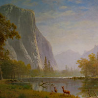
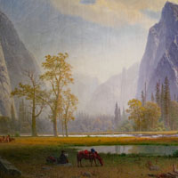
The Haggin has the
largest museum collection of major Bierstadt works.
--excerpts from
Haggin museum website


Their more famous paintings by Bierstadt are on display in the center lobby.


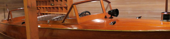
Stockton once had a large ship-building industry, including a company that made these teak run-a-bouts. This particular boat was once used on Lake Tahoe until its return to Stockton for preservation and display at the museum.
Stockton is hometown to Caterpillar Tractors (now located in Peoria, Illinois).


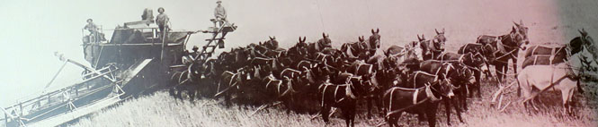
Thirty-two mules and one horse.
An unexpected collection of the Haggin Museum is of the works of Joseph Leyendecker. Leyendecker produced art for Collier's and the Saturday Evening Post. He did magazine covers and he did advertising. These were all done for Kellogg's Corn Flakes.


In the lobby is a computer screen that you can use to find your way around the museum. You can also take a photograph of yourself and have the image sent to any email address. If you do that, this is what you'll get:

Delano was at the center of the Delano Grape Strike (and boycott) that began in 1965 and lasted for five years. I thought there might be a history center or museum of some sort, but the closest thing was a mural of Cesar Chavez.

Caliente, California was something of a boomtown during the construction of the Tehachapi Pass railroad by the Southern Pacific Railroad (now Union Pacific). That's all long passed, of course, but we took the side road to see what might still be there.
The road to Caliente.

There's not a lot. This is one of the more heavily used tracks in the country, so it's something of a mystery why no trains were seen while we were there.

Not far up the highway turnoff to Caliente is the small town of Keene and the Cesar Chavez National Monument.
 Cesar E. Chavez National Monument
César E. Chávez National Monument is managed
collaboratively by the National Park Service and the National Chavez Center,
with initial operations funded in part by the America Latino Heritage Fund
of the National Park Foundation, the official fundraising partner of the
National Park Service.
Under the leadership of César E. Chávez and
others such as Dolores Huerta and Larry Itliong, along with support from
millions of Americans, the farm worker movement joined forces with other
reform movements to achieve unprecedented successes that greatly improved
working and living conditions and wages for farm workers. Learn about their
struggles.
--NPS website


Dolores died less than a year ago, and is now buried next to her husband.


We were lucky and then not so lucky with traffic on CA-58 over the mountain an towards Barstow. Just over the summit traffic going in the opposite direction (that's our lucky part) was stopped due to a wreck of a semi-truck. The backed-up traffic went on for many miles. However, at Boron--and, all the way to Kramer Junction--we were in stop-and-go-traffic seemingly for the simple reason of a single traffic light at Kramer.
Barstow would have looked pretty good to any traveler on Route-66. It's the biggest town after crossing the Colorado River at Needles.

The two major routes that used to dump traffic into Barstow are now freeways that skirt around the town. There's now no need to stop if you don't want to stop.


The Barstow Harvey House is one of the nicer ones built for the Santa Fe Railroad. Through good fortune, it was never demolished. Today it (and the associated rail station) contains a couple of museums. Unfortunately, nothing was open today.


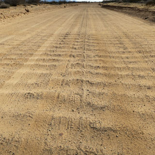
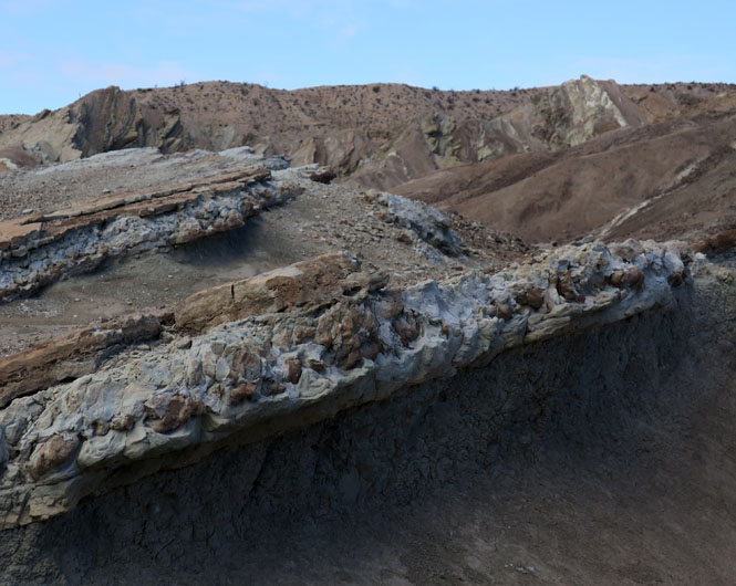
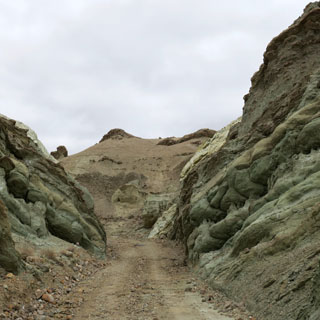
Not far from Barstow is the Rainbow Basin. The first turnoff puts you on dirt, and then another takes you along an even lower-quality one-way road through the basin.

 Rainbow Basin Natural
Area National Natural Landmark
Rainbow Basin Natural
Area National Natural Landmark

Drive slowly and the road isn't too bad. But, understandably, larger RVs and trailers should not even try.

Geologists must be amazed by this place. The folds, uplifts and different layers are really quite apparent. If it were raining, or had been raining recently, I might not recommend the road.


The Barstow Syncline (so it is called).


It's a good place for lunch.
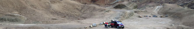

Our little Toyota is plenty agile enough.

 Nevada
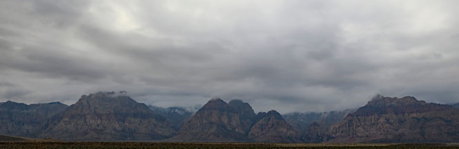
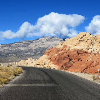
Red Rock Canyon
National Conservation Area
Our goal for the afternoon had been Red Rock Canyon, just west of Las Vegas. However, we didn't get there until just an hour before closing, so it made more sense to use this time to go through the visitor center, watch the video, look at the gift shop, and plan to return the next morning.


In any event, this evening is pretty cold and wet and tomorrow is forecast to be much better.

The next morning at Albertson's Super Market picking up a few supplies for along the way.


We're back to Red Rock Canyon and ready for the loop drive (it's one-way). Today's weather is vastly better. It's New Year's Day.

The unique geologic features, plants and animals of
Red Rock represent some of the best examples of the Mojave Desert. In 1990,
special legislation supported by the Nevada congressional delegation,
changed the status of the Red Rock Recreation Lands to a National
Conservation Area, the seventh to be designated nationally. This legislation
provides the funding to protect and improve the area
Red Rock Canyon
National Conservation Area is enjoyed by the local population as well as
visitors from the United States and many foreign countries. Two million
visitors each year enjoy the spectacular desert landscape, climbing and
hiking opportunities, and interpretive programs sponsored by the BLM.
--BLM website


It's hard to believe that this is all less than ten miles from the sprawl of Las Vegas.

There might have been a tortoise or two on the road, but we saw none. Nor did we see any mountain goats, even though they do live in these hills.


Every canyon that drops into the basin will have a hiking trail that will take you into the mountains.


You can sit on the bench and watch the clouds roll by. It's quite an amazing place.


California
South from Las Vegas on US-95 and just across the California state line was a terrible two-car accident that apparently happened just minutes before we arrived. We waited for over an hour until two helicopters arrived and departed and the road was made clear.

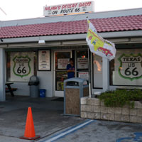
There's a bit of old Route-66 that I hadn't been on. This is a stretch of original highway--back when the route was entirely determined by the tracks that had been there years before any cars made the attempt. Goffs was once important, but that all stopped by 1930 when Route-66 was re-routed south.

A Service Station has been here for as long as Route-66 came through. These days, if you stay on I-40, you'll probably not even notice it. But, they're still in business, and you can still buy fuel (but, not at a bargain price).


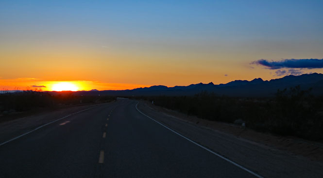
Along Route-66 near Essex. How many travelers have seen this same view as they push on to Amboy?
The next morning the right rear tire was down to a bit over 10 psi. It seems we'll be needing a new tire (the tread was marginal in any case, so it works out). As it happened, we had an air-pump, so were able to inflate things back to normal before driving to the nearest Discount Tire Center in Yucca Valley. Two hours later, we were on the way to Joshua Tree.


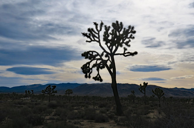
Evidently, lots and lots of people wanted to visit Joshua Tree National Park over the New Year's break.

We've been here before, but it's a park worth visiting again.


Two deserts, two large ecosystems primarily
determined by elevation, come together in the park. Few areas more vividly
illustrate the contrast between “high” and “low” desert. Below 3,000 feet
(910 m), the Colorado Desert (part of the Sonoran Desert), occupying the
eastern half of the park, is dominated by the abundant creosote bush. Adding
interest to this arid land are small stands of spidery ocotillo and cholla
cactus.
The park encompasses some of the most interesting geologic
displays found in California’s deserts. Rugged mountains of twisted rock and
exposed granite monoliths testify to the tremendous earth forces that shaped
and formed this land. Arroyos, playas, alluvial fans, bajadas, pediments,
desert varnish, granites, aplite, and gneiss interact to form a giant mosaic
of immense beauty and complexity.
--NPS website

It's pretty cold and rather windy. We're after a sheltered spot for lunch.


This will work.


What a strange tree is a Joshua Tree.
The solid rock was invaded by water and broken into smaller pieces, all while buried deep under the surface. Eventually, all was exposed to what we see today.


Cholla Gardens. Look, but perhaps you shouldn't get too close. And, definitely don't touch.


The view south, and lower in elevation. The Cholla likes to be right here.


We came in from the north; we'll exit the park through the south visitor center ranger station.

We'd be driving across the Los Angeles basin towards the ocean, but would be stopping at one place along the way: The Museum of Tolerance.


There are two levels of parking under the building. As might be expected, security is always present, but the security people we met were exceptionally considerate.


In the late 1980’s, Simon Wiesenthal Center
leadership and representatives from the world’s top museums began discussing
how to promote tolerance and understanding. Adding to the impetus for such a
museum was the troubling discovery that a new generation of young people was
beginning to question whether or not the Holocaust ever happened.
The
decision was made to create a museum - but not an ordinary museum of
artifacts and documents. As Simon Wiesenthal expressed, it must not only
remind us of the past, but remind us to act. This Museum should serve to
prevent hatred and genocide from occurring to any group now and in the
future. The daunting task was to create an experience that would challenge
people of all backgrounds to confront their most closely-held assumptions
and assume responsibility for change.
--Museum of Tolerance website


The museum has four main exhibit areas: 1) The Holocaust, 2)Tolerance Center, 3) Anne Frank, 4) Family Heritage.
Simon Wiesenthal's office.
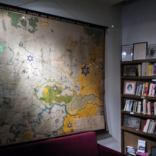

The Holocaust exhibit has a focus on the beginnings and explores how it is that something like this could happen. How did it start?


Information is presented through several set-pieces where videos and narration are given as we are guided through the exhibit (seats are provided). This is not something you'll just wander through. The approach works very well.
They have originals of German paperwork that documented--in a typical bland, bureaucratic way--the design and implementation of all of it. Nothing was haphazard; it was all planned in detail as with any large-scale civil engineering project. It was immense.


The Anne Frank exhibit presents her life in a similar way (narration that guides you from one station to the next). The goal is to fill out her life, beyond what is in the diary.


Survivors regularly give talks at the center. This is Rolf Gompertz. His survival came through chance events that brought his immediate family out of Germany before it was too late--as it was for most of his extended family.


The Intolerance Exhibit is a combination of current events and recent history. None of the beginning events that you've just seen presented in the main Holocaust exhibit have disappeared from the world. Similarities are striking. The video monitors are showing today's world news, but after seeing the words and voices and photographs and film from the 1920s and 1930s, the parallels are really remarkable. This, of course, is the entire point of why the Museum of Tolerance was created.


It's evening and we're driving north on Highway 1 towards Malibu and beyond. It takes more miles than you might think to escape the heavier traffic of Los Angeles.

Stopping at the Lookout Park in Summerland (county park Santa Barbara). It seems like an attractive place, at first. But, take note of that rainbow sheen on the water.

According to the historic plaque (put there by the "Petroleum Production Pioneers") this was the site of the first offshore oil well in the western hemisphere. So, who--exactly--is responsible to maintain the abandoned well-heads dating from as far back as 1896?
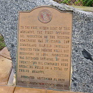

We had never seen a self-service dog wash. This one looks quite nice. I cannot imagine many humans wanting to be on this beach (it smells of oil), but perhaps dogs are happy enough.


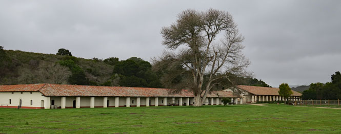
 La
Purisima Mission State Park
La
Purisima Mission State Park
There are twenty-one missions in Alta California. The first mission was San Diego (1769) and the last was San Francisco (1823). Mission La Purisima Concepción was founded in 1787.
Only two of the twenty-one original missions are not now connected to the Catholic church: this one and Mission Solano. This one is alone in being fully restored and complete.
The visitor center does quite a good job explaining the whole mission system as well as the details of La Purisima. We watched two videos, one of which was a documentary on the CCC project to restore the mission buildings and grounds in the 1930s. I would have assumed that the CCC restoration was done without much thought of the historical aspects, but that was wrong; In fact, they paid close attention to doing it right, including making original tools to use with the original building materials.
The CCC working on the restoration in 1935 and one of the original mission bells.


Artifacts found during archeological digs.


Views of the ruins between the time the mission was abandoned and its restoration.


The layout of this mission is not in the standard square-and-plaza of all the others (it is unique, that way).


There are two chapels. This is the larger.

A Gloria Bell Wheel with twelve Sanctus bells. The idea is to help you keep track of the progress of the Mass if you don't know Latin.


A hundred Indians worked in the weaving shops.


Solid wood wheels for the cart. If you don't have access to strap-steel and a blacksmith (for a tire), it's all you can do.


The CCC deliberately left some walls unfinished to show the technique that was used.


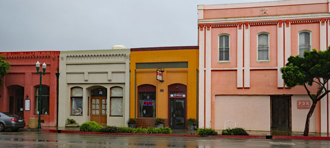
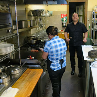
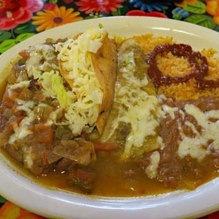
Guadalupe and it is time for lunch.

You can still drive El Camino Real along the route of the missions. Most of the entire way is marked by these mission bells.

Crossing the Salinas River. This is the route you'd drive before the construction of the Interstate-101 freeway changed everything.

Salinas.

While John Steinbeck might not have been much admired by the leading citizens of Salinas during his lifetime; today, you'll find that's all changed.
 The
The


You'll find a dedicated exhibit for each of his novels.


Driving north along Highway 1, up the peninsula towards the Golden Gate. That's the Pigeon Point Lighthouse (still in use by the U.S. Coast Guard).

Half Moon Bay and it's again time for lunch. It's a beautiful day.


As always, we saw a lot, and saw a lot more that we didn't expect to see.