February 28, 2017


Near the Colorado border, where Wyoming and Nebraska come together, is the Pawnee National Grassland. It's a large area, close to two-hundred thousand acres. Any attempts to farm this land came to an end with the dustbowl. It is now as close to the original short-grass prairie as is probably possible.
This would be a pretty cold walk; the temperature was only a couple degrees above freezing and the wind was strong.
 Colorado
Sterling, Colorado is the nearest town of any size. The grasslands are due west out of town on CO-14.


Turning north off CO-14 onto County Road 390. I expected this road to be paved, since there are two towns (Keota and Grover) that show on the map as being on this road. I cannot speak to Grover, but Keota has an old water tower and a few abandoned buildings, but not much else that you could call it a town.
I expected pavement; I found dirt.

And then... The road is paved. That's odd.

And then... The pavement ends. That's odd, too. There are several miles of pretty good paved road that can only be found after several miles of dirt. Not surprisingly, you won't see much traffic.

County Road 112 takes you east towards the buttes...

...and then NF-807 turns north to take you the rest of the way.

There are three trail-heads off NF-807, but they all come together quickly enough, so it doesn't matter where you start.
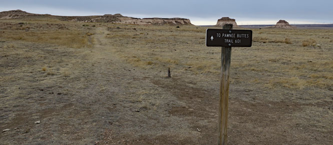
To protect nesting birds some areas are closed to foot traffic starting March 1. I was here the day before, so was good to go. In any event, I did not see but one (flying) bird, and no other wildlife. Perhaps, though, they saw me.


The trail runs east of some cliffs and circles around to the north before running east towards the buttes.

It is a well-marked trail, but there are a number of cut stairs and rock ledges along the way.


These cliffs include the areas that are off limits (starting tomorrow). Right now, I'm walking towards the buttes. On my return I'll take this trail to the top of the bluff.
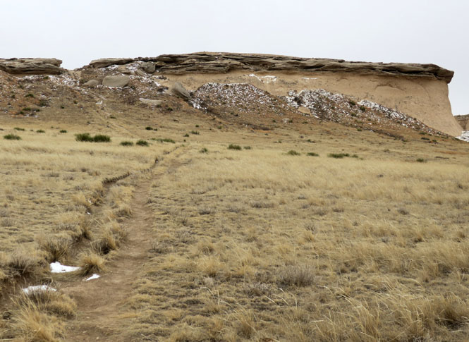
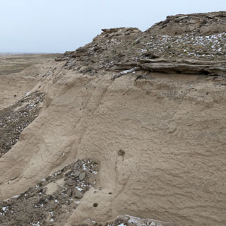
The west butte. The cap rock protects the underlying formation from rapid erosion. I suppose a person could get to the top, but you'd be doing a fair amount of damage on the way up.

And there flies the only bird I saw.

Looking south. The bluffs I first walked by are in the distance to the right.

The east butte.

Returning from the buttes, I took the trail to the top of those bluffs we saw earlier. That's the west butte, closest, and the east butte, farther away.


There's not really a trail to speak of at the top. You'll need to walk along that ridge; don't slip on either side as it's a long way down.

The prairie that runs the entire length of the Rocky Mountains along the eastern slopes is one of my favorite areas of the country. It's an area that seemingly has not changed for hundreds of years.