February, 2019


Castlewood Canyon State Park is between Denver and Pueblo, covering a stretch of Cherry Creek, which flows north, eventually reaching Denver before joining the South Platte River. As such, it is part of the broad Missouri River watershed. The park was created in 1964.
In 1933, the Castlewood Canyon dam (built 1890) failed catastrophically, which caused severe flooding all the way to Denver. The dam was not rebuilt.
 Colorado
From the south rim, looking over the canyon.

Cherry Creek is still running--you can hear it--but it's mostly under the snow and ice.

Walking the rim trail. There's quite a bit of snow and hard ice on the trail; where there isn't, there's mud.

Between 1890 and 1933, this would have been a view of an impounded lake. That's gone, of course.

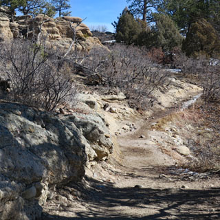
Where the trail sees more sun than shade, there's dirt and mud. Elsewhere, it's snow and ice.

Be careful where you stand; there might be water under you.


The remains of the dam and the narrow canyon below it--leading to Denver.

The view back up Cherry Creek. There is a trail that follows the creek and then climbs back up the rim, but that part of the trail would have been entirely in the shade (and therefore still covered in ice).
