February 3-4, 2020


There are two National Park installations in the Chiricahua Mountains of Arizona that have a connected history and are only about fifteen miles from each other: 1) Fort Bowie National Historic Site and 2) Chiricahua National Monument.
 Arizona
While they are near each other, it will take you two hours to drive from one to the other (nearly a hundred miles), giving a good idea of the ruggedness of these mountains and the lack of roads that cross them.
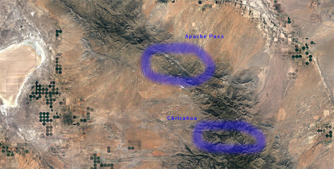
For thousands of years, Apache Pass defined the best walking route across the mountains. That name is recent as even the Chiricahua Apache tribe is somewhat new to the area (within a few hundred years). The Spanish would use this route and the stage line would use it, as would emigrants through what would become the southern United States.
The key is Apache Springs, which provided (and still provides) a dependable year-round source of water in an area where water can be rare.
 Fort Bowie National Historic Site
Fort Bowie was established in 1864 and remained in use until 1894. During that time it was the focal for the armed conflict that the U.S. Army waged against the Apache Indians until the surrender of Geronimo.
Interestingly, the visitor center is not next to a parking lot as is the usual case. You'll park at a trailhead (on an unpaved road) and walk 1.5 miles to the visitor center (located at the old fort).

People who would prefer to avoid the trail can still take the alternate dirt road to the visitor center (identified as handicap access). The trail is easy enough, and is well-marked with signage explaining the history of the area.


There are a few creek crossings, but it's evident that rushing water is rarely a problem. Even the water from Apache Springs doesn't stay above ground for very far.


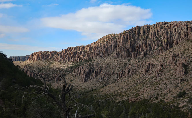
We're on the edge of the mountains; getting over them would not be easy.

There are ruins of the Butterfield Stage Station in an open field, downhill from the springs. This would have been the easiest part of that old stage road. At times it would have been very steep and barely wide enough for a wagon to get through. If you want to hike over the pass, the trail is still there. The railroad (and therefore the eventual Interstate Highway) are about twenty-five miles to the north.

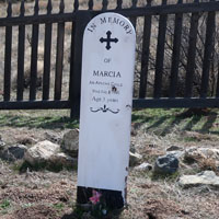
The post cemetery. When the fort closed, the graves of nearly all soldiers were removed.

In the box is a helpful pamphlet that gives what is known about the graves that remain. Somebody did an excellent job doing this research.


The trail continues across a dry bed.


Apache Spring is still flowing, but you are recommended not to drink from it. Incidentally, there are signs at the trailhead warning all walkers to carry water.

A view of the ruins of the old fort from a hill just to the north.

Vintage photographs of the fort during its operation.


The Butterfield Overland Mail Trail came through here, and protecting it was one reason for the fort to be established.


The visitor center has a good number of displays and some very helpful staff and volunteers.


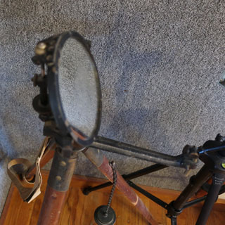
The surprisingly sophisticated heliograph system used reflected sunlight to relay messages all across the territory of southern Arizona and New Mexico. Being able to rapidly send information of when and where the tribes were moving gave a tremendous advantage to the army.


The view looking north from the mountains, at the entrance to Apache Pass.


Walking back to the trailhead, but on a different trail.

This monument was established in 1924. The nearest town is Willcox, Arizona, which makes a nice home base.

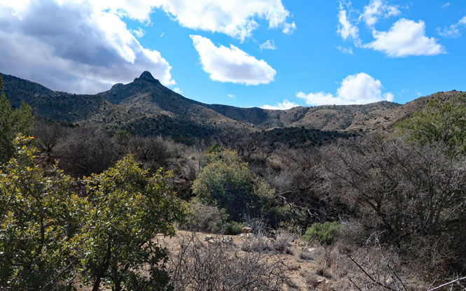
While here, the temperature only briefly hit the low-forties; much of the time it was in the high-thirties, and pretty chilly. I'll be taking the Lower Rhyolite Trail to reach the Heart-of-Rocks Loop.


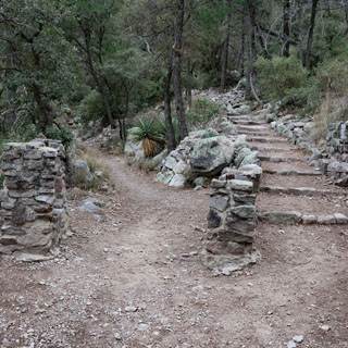
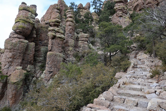
The trail is easy to follow and has been remarkably planned. The C.C.C. of the nineteen-thirties did a tremendous job.


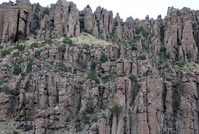
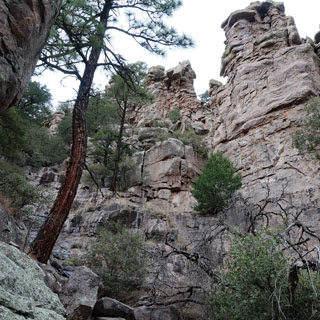
Whichever way you look, it's all spectacular.


I've turned around to look back towards my starting point. Out on the horizon will be the town of Willcox (which cannot be seen).

The trail looks quite natural, but somebody had to cut this ledge and then shore it up on the lower side to keep it from sliding down. it has been expertly done.

I've come to a split in the trail. I'll be taking the right-hand route and will now start to climb more aggressively


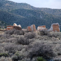
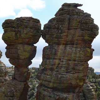
There are quite a few balancing rocks as well as quite a few examples of balancing rocks that have lost their balance.


The loop trail takes you through all this. wow.


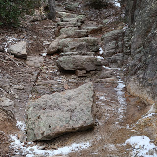
Two examples of large stones that have been moved to the trail to provide stairs in places where it can be quite steep (and slippery with ice).

Returning by the same trail. At least the clouds have cleared, letting just a bit of warming sun reach me.


What a remarkable place. Neither park site is ever very busy; you have to want to come here, and not many seem to make the effort. It's worth it.